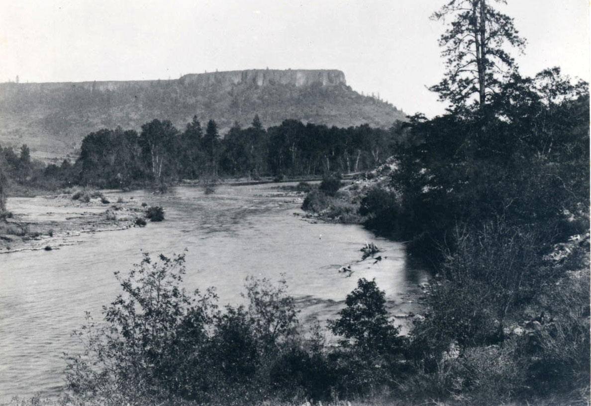
The Council of Table Rock brought a temporary peace between Indigenous residents of the Rogue River Valley and the American settlers that had swarmed into the region after 1850. The site of the Council’s negotiations was on the north side of the Rogue River, near the southwestern base of the main portion of Lower Table Rock, within a small valley formed by the horseshoe-shaped Table Rock.
The 1853 Council of Table Rock negotiated two treaties. First was the peace treaty, on September 8 (which was never ratified), between representatives of Oregon Territory and the Takelma, Shasta, Dakubetede, and other Indigenous groups of the Rogue Valley, bringing a temporary respite to the conflict in southwestern Oregon between Native people and the ever-growing number of white settlers and miners. A second treaty, dated September 10, was a land-cession treaty (subsequently ratified by the federal government) that provided for a reservation and various services to the Native people in return for relinquishment of their title to much of southwestern Oregon. The treaty-making required translation back-and-forth from Takelman into Chinook Wawa (the Pacific Northwest’s trade jargon).
On September 10, 1853, Takelma leader Apserkahar (known as Chief Joe) and former Oregon Territorial Governor Joseph Lane faced each other. Lane's fellow negotiators included recently federally appointed Oregon Superintendent of Indian Affairs Joel Palmer; U.S. Army Captain A. J. Smith; leader of the local settler militia Colonel John Ross; Lafayette Grover (later governor of the state); as well as interpreters Robert Metcalf and James Nesmith (later a U.S. senator) as translators of Chinook Wawa. The group entered the Takelma camp unarmed, and the parlaying lasted for much of the day. Nesmith later wrote that the party came close to being ‘killed to a man" when news of the latest murder of an innocent Native angered the Takelma leaders.
The ratified Treaty of Table Rock established a reservation on the north side of the Rogue River, including important salmon-fishing sites on the river; the two Table Rocks; the extensive oak-and-pine-filled Sam's Valley (named for Apserkarhar’s brother, Chief Sam); and the mountainous, heavily forested Sardine Creek and Evans Creek watersheds. The location of an eventual permanent reservation was not determined. The treaty also promised various goods and services that would enable the Indians to farm and ranch and agreed that the U.S. Army’s Fort Lane (established in late 1853 on the south side of the Rogue) would protect the reservation's inhabitants from land-hungry whites.
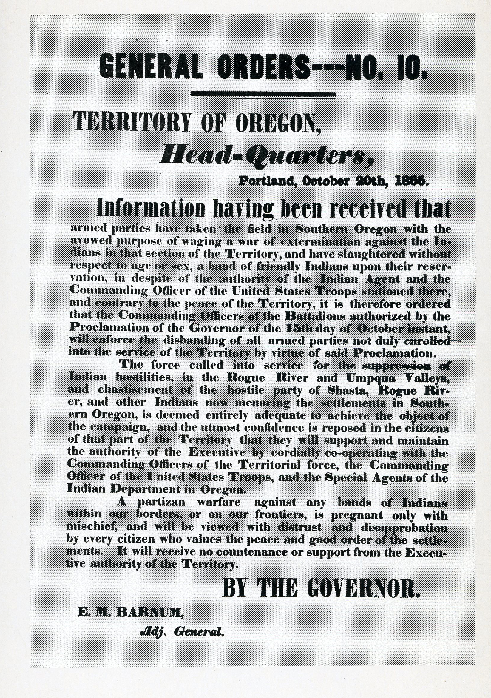
In October 1855, the Lupton Massacre, perpetrated by a group of white settlers and miners from Jacksonville on Takelmas camped near Upper Table Rock, ended the peace and precipitated the final Rogue River War. The Takelma (unlike the other Native groups gathered groups who fled downstream into the lower Rogue River’s rugged canyon) remained peacefully on the reservation. They were removed in 1856 from their Rogue Valley home to the Grand Ronde encampment, west of Salem, which became a formal reservation in 1857. Fort Lane was soon abandoned, and the former Table Rock Reservation was opened to settlement.
-
![]()
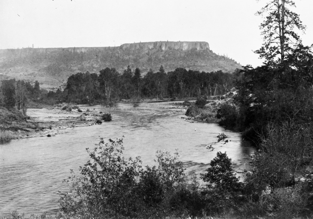
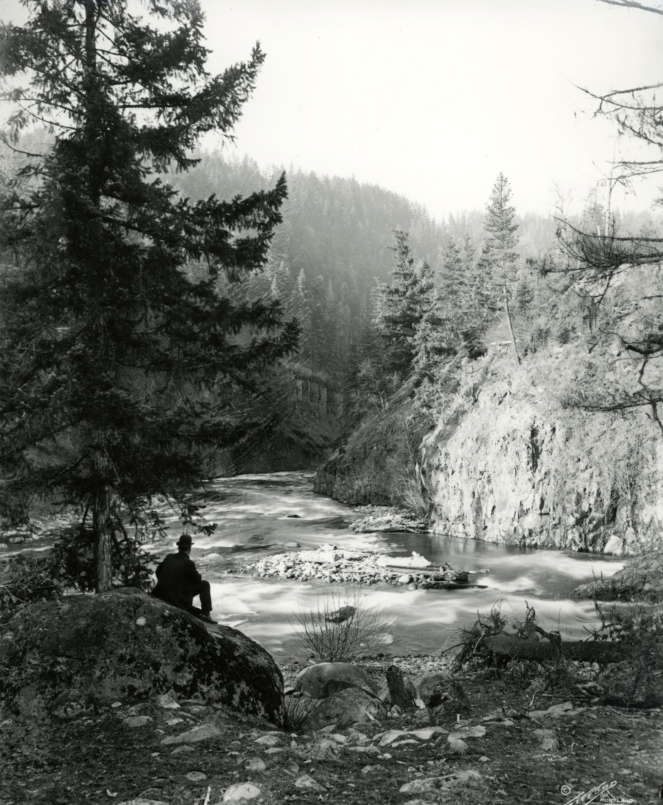
Table Rock rises above the Rogue River in Jackson County, 1887.
Photo by W. W. Bretherton, courtesy Oreg. Hist. Soc. Research Lib., bb006120
-
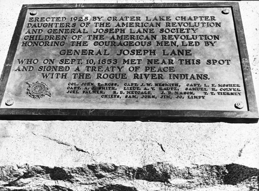
![Plaque commemorating treaty signing near Fort Lane, present day Camp White, Jackson County.]()
Rogue River Treaty plaque, August 1942.
Plaque commemorating treaty signing near Fort Lane, present day Camp White, Jackson County. Oreg. Hist. Soc. Research Lib., bb004075
Related Entries
-
![Apserkahar (Chief Joe)]()
Apserkahar (Chief Joe)
In the 1850s, Apserkahar, also known as Chief Joe, led one of the two p…
-
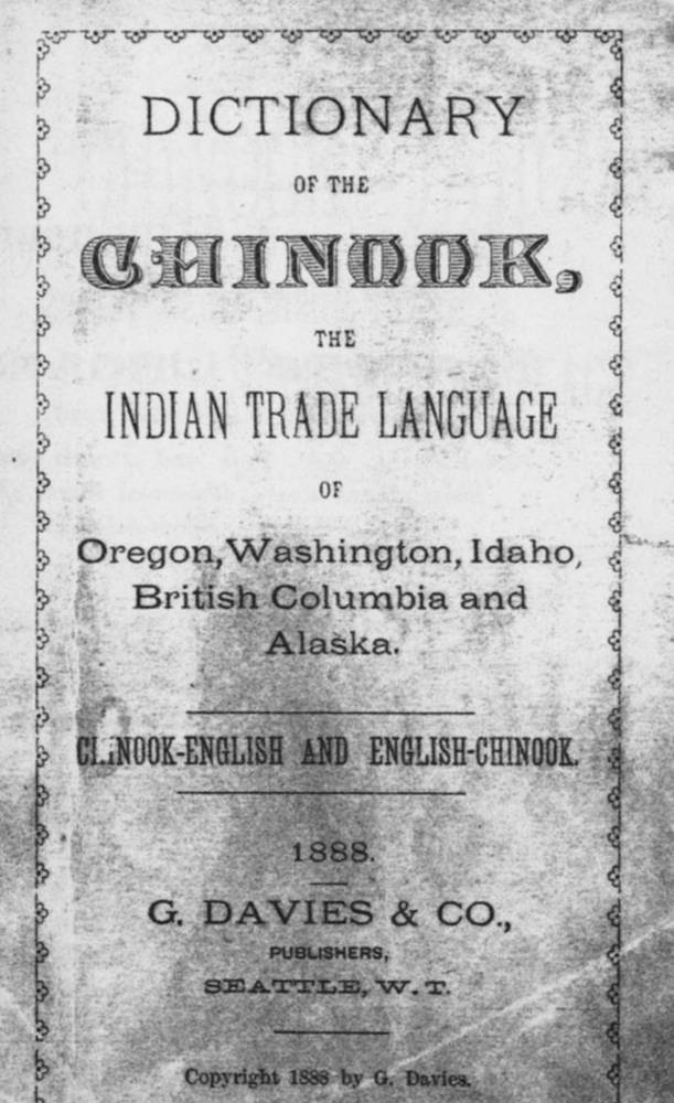
![Chinook Jargon (Chinuk Wawa)]()
Chinook Jargon (Chinuk Wawa)
According to our best information, the name "Chinook" (pronounced with …
-
![Fort Lane]()
Fort Lane
Fort Lane was a United States military fort constructed following the s…
-
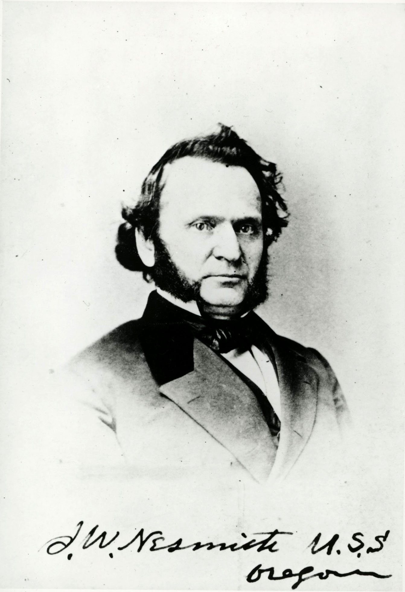
![James Willis Nesmith (1820–1885)]()
James Willis Nesmith (1820–1885)
James Nesmith was a prominent figure in the Oregon Territory and in Ore…
-
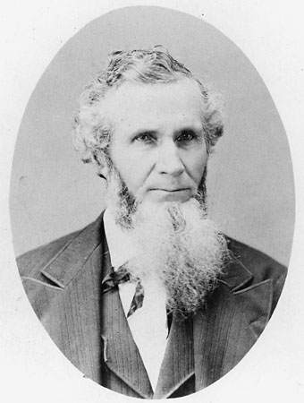
![Joel Palmer (1810–1881)]()
Joel Palmer (1810–1881)
Joel Palmer spent just over half of his life in Oregon. He first saw th…
-
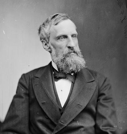
![Joseph Lane (1801-1881)]()
Joseph Lane (1801-1881)
Joseph Lane was the first governor of Oregon Territory. A leading Democ…
-
![LaFayette Grover (1823-1911)]()
LaFayette Grover (1823-1911)
LaFayette Grover was politically one of the most successful Democrats i…
-
![Rogue River]()
Rogue River
The Rogue River, Oregon’s third-longest river (after the Columbia and W…
-
![Rogue River War of 1855-1856]()
Rogue River War of 1855-1856
The final Rogue River War began early on the morning of October 8, 1855…
-
![Table Rocks]()
Table Rocks
The Table Rocks, two large mesas north of Medford, rise nearly 800 feet…


Related Historical Records
Map This on the Oregon History WayFinder
The Oregon History Wayfinder is an interactive map that identifies significant places, people, and events in Oregon history.
Further Reading
Beckham, Stephen Dow. Requiem for a People: The Rogue River Indians and the Frontiersmen. Norman: University of Oklahoma Press, 1971.
Nathan Douthit. "Joseph Lane and the Rogue River Indians: Personal Relations Across a Cultural Divide." Oregon Historical Quarterly, 95, no. 4, Winter 1994-95.
Schwartz, E. A. The Rogue River Indian War and Its Aftermath, 1850-1980. Norman: University of Oklahoma Press, 1997.