Bates State Park, located in Grant County, one mile north of Austin Junction on U.S. Highway 26, is on the site of the former Oregon Lumber Company mill and company town of Bates.
Bates was named for Paul Chapman Bates, a Portland businessman who assembled large tracts of timberland for the company. The Bates mill operated from 1917 until 1975. After lumber production ceased in 1975, the site was cleared and sold to the adjacent landowner. Except for Bates Pond, nothing remains of the Bates mill and town site.
Since 1979, former residents of Bates have gathered for biennial reunions. At the 1983 reunion, they began organizing and promoting the idea of developing a park at the town site. Over the next several years, efforts were made to purchase the site for a park. A nonprofit subsidiary of Grant County bought the land on January 30, 2007, with the idea of developing and operating a county park as a way of promoting tourism, but the idea proved economically infeasible due to a lack of county resources.
In May 2007, citizen advocates for a Bates park approached the Oregon Parks and Recreation Department (OPRD) to see whether it was interested in acquiring the site. OPRD agreed to the purchase, and ownership was transferred from Grant County to the state on April 30, 2008. After a period of research and planning, construction on Bates State Park began in 2011.
The 131-acre park is on the west end of the Austin meadows, bounded by Clear Creek on the east, Bridge Creek on the west, and the Middle Fork of the John Day River on the north. The site contains a 9-acre pond fed by Bridge Creek, where a large fish ladder facilitates the passage of steelhead and salmon from the Middle Fork up Bridge Creek to a prime spawning area. The site offers campsites, a picnic shelter and tables, interpretive panels, and 6,000 feet of trails, and there are opportunities for fishing, hiking, and exploring.
-
![Bates, view from the north, 1959.]()
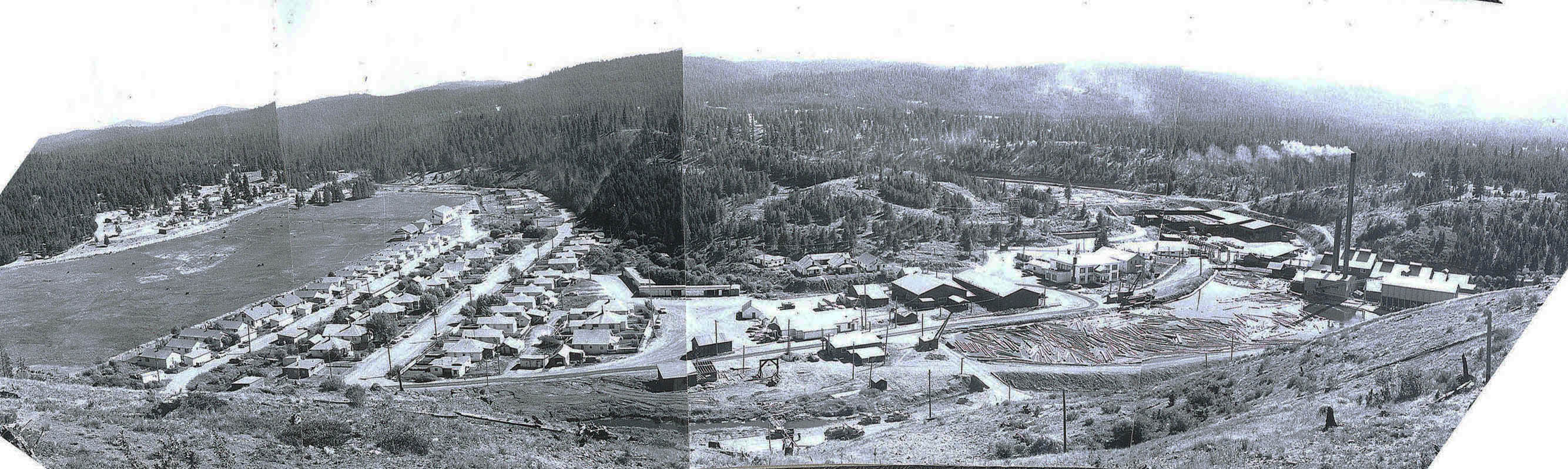
Bates, panorama, 1959.
Bates, view from the north, 1959. Photo Gregg Smith
-
![Bates Mill complex, view from the north, 1959.]()
Bates mill, 1959.
Bates Mill complex, view from the north, 1959. Photo Gregg Smith


Related Entries
Map This on the Oregon History WayFinder
The Oregon History Wayfinder is an interactive map that identifies significant places, people, and events in Oregon history.
Further Reading
“Pioneer Eastern Oregon Lumber Firm.” The Timberman (Sep. 1933), 48-49.
Ferrell, Mallory Hope. Rails, Sagebrush, and Pine: A Garland of Railroad and Logging Days in Oregon's Sumpter Valley. San Marino, Calif.: Golden West Books, 1967.
Terry, Richard. "New Oregon State Park Gets Friends Group." Oregonian, June 23, 2008. http://blog.oregonlive.com/terryrichard/2008/06/new_oregon_state_parks_gets_fr.html.