Boardman, located on the Columbia River in northeastern Oregon, is named for Samuel Boardman, the state’s first full-time superintendent of state parks. Boardman homesteaded the land in 1903, and he planted trees in the area along the highway. Eventually, that practice became the policy of the Oregon Highway Commission and helped lay the groundwork for Oregon’s park system.
The first permanent settler in Boardman was C.G. Blayden, who settled there in 1915. The town was laid out in 1916, a year after the articles of incorporation were drafted, and was incorporated in 1921.
Boardman was moved twice after it was originally built: first in 1952, when it was moved a half mile to accommodate U.S. Highway 30, and again in 1965 with the construction of the John Day Dam. The reservoir behind the dam was created in 1968, which required moving the town a quarter of a mile.
In 1964, the Boeing Company established a test site for rockets in Boardman, partly because of the work of Senator Mark O. Hatfield, who had lobbied for Boardman to become a NASA Control Center. Boeing helped develop Boardman, investing in irrigation projects to support area farms. Agriculture continues to be an important industry in Boardman.
Nature preserves, such as the Boardman Grasslands, are located close to Boardman, and there is a large U.S. Navy bombing range nearby, though only a few individuals are staffed there. The U.S. Army Umatilla Chemical Depot, located about eighteen miles east of Boardman, use to house 12 percent of the U.S. chemical weapons supply. The chemical weapons stocks were destroyed, and the facility closed in 2012.
In 2020, 3,828 people lived in Boardman.
-
![Union Pacific Railway Depot, Boardman, July, 1954.]()
Boardman, RR depot, 1954.
Union Pacific Railway Depot, Boardman, July, 1954. Photo Marion Dean Ross, Univ. of Oreg. Libr., pna_20401
-
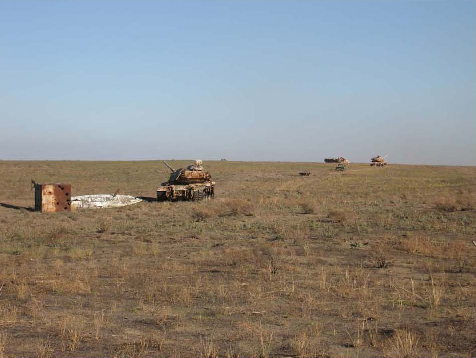
![Bombing range at Naval Weapons Systems Training Facility, Boardman, 2010.]()
Boardman NWSTF range.
Bombing range at Naval Weapons Systems Training Facility, Boardman, 2010. Hardlines Design Co., "Inventory and Evaluation of Naval Weapons Systems Training Facility Boardman," 2010, p. 54, Univ. of Oreg. Libr.
-
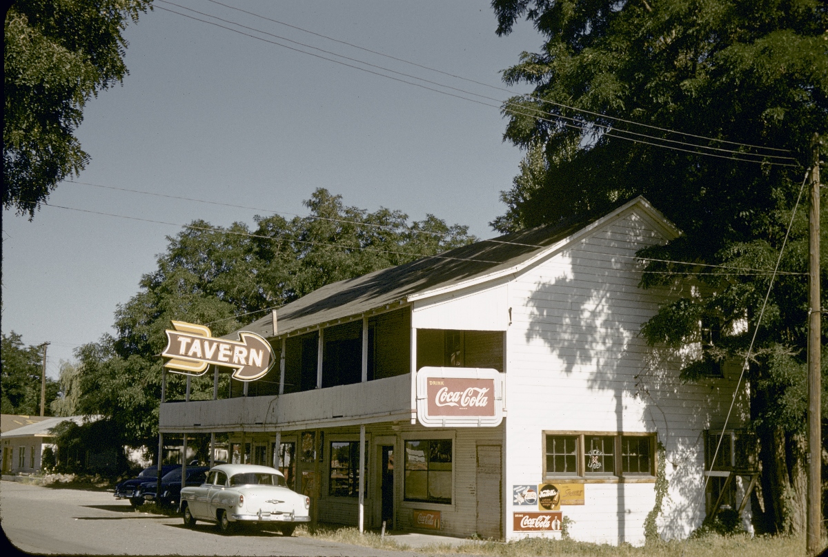
![Tavern in Boardman, about 1960.]()
Boardman, tavern at, ca 1960s.
Tavern in Boardman, about 1960. Photo Marion Dean Ross, Univ. of Oreg. Libr., Architecture & Allied Arts Libr., pna_08305
-
![]()
Aerial view of the new relocated town of Boardman, Oregon. Old location was flooded by John Day Dam, 1967.
Courtesy Yakima Valley Libraries -
![Aerial view of Boardman and Naval Weapons Systems Training Facility, 2003.]()
Boardman NWSTF aerial, 2003.
Aerial view of Boardman and Naval Weapons Systems Training Facility, 2003. Hardlines Design Co., "Inventory and Evaluation of Naval Weapons Systems Training Facility Boardman," 2010, p. 4, Univ. of Oreg. Libr.
-
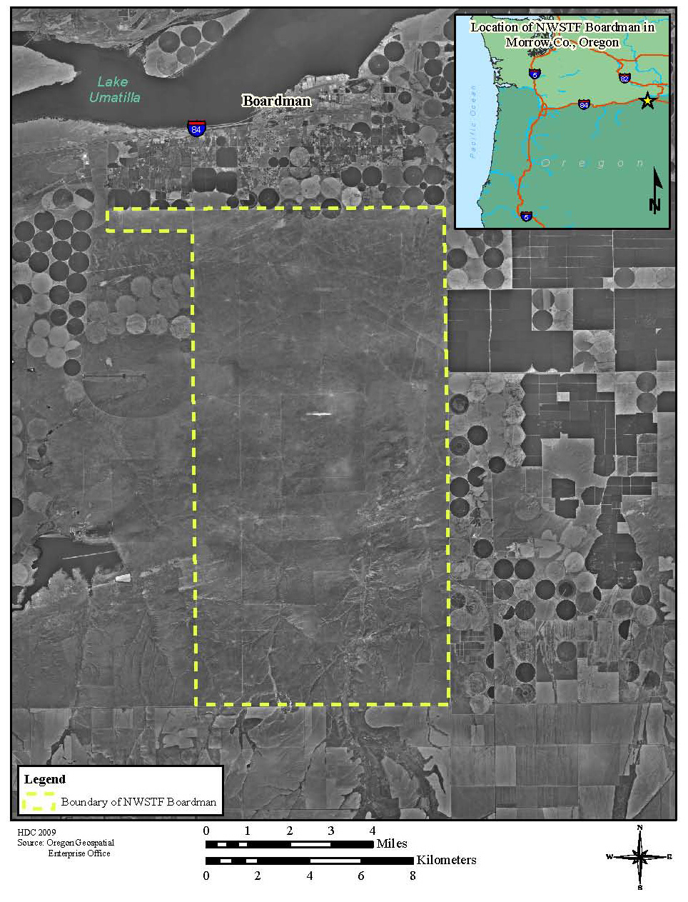
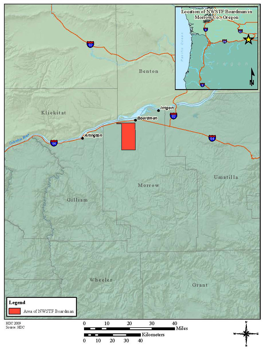
![Map showing Boardman and Naval Weapons Systems Training Facility, 2010.]()
Boardman NWSTF map, 2010.
Map showing Boardman and Naval Weapons Systems Training Facility, 2010. Hardlines Design Co., "Inventory and Evaluation of Naval Weapons Systems Training Facility Boardman," 2010, p. 2, Univ. of Oreg. Libr.


Related Entries


Map This on the Oregon History WayFinder
The Oregon History Wayfinder is an interactive map that identifies significant places, people, and events in Oregon history.
Further Reading
Cox, Thomas R. The Park Builders: A History of State Parks in the Pacific Northwest. Seattle: University of Washington Press, 1988.