The Columbia Region Association of Governments (CRAG) was the regional planning agency for Multnomah, Washington, Clackamas counties of Oregon and Clark County, Washington, from 1966 to 1978. As such, it was one of the predecessors of Metro, along with the Metropolitan Service District (MSD).
CRAG was a council of governments, or COG, an institutional form found in many U.S. metropolitan areas. Members of its governing board were appointed by the elected leadership of its constituent counties and municipalities and thus represented governmental units rather than citizens directly.
The organization succeeded the Metropolitan Planning Commission (MPC), which had been created in 1958 to use federal funds available for regional planning under Section 701 of the Housing Act of 1954. The four-member MPC board represented Portland and the three metropolitan counties in Oregon. Until CRAG replaced it in 1966, the MPC compiled demographic and land-use data and offered a venue where elected officials could discuss regional issues.
CRAG was a response to requirements of the Federal Highway Administration and the Department of Housing and Urban Development that 90 percent of the metropolitan area population be represented in a voluntary association of local officials. CRAG extended to include Columbia County, allowed participation of Clark County, and gave representation to suburban municipalities as well as counties. Local officials formally launched CRAG in October 1966.
The agency made two major contributions. First, it usefully continued and expanded the data gathering, analysis, and mapping work of MPC. Second, it served as the umbrella for the Portland-Vancouver Metropolitan Area Transportation Study (P-VMATS), fulfilling the federal requirement that there be a metropolitan planning organization to sign off on regional transportation plans.
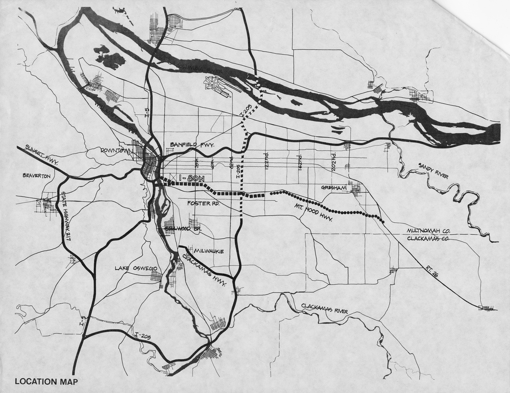
Nevertheless, there were problems and political tensions. The agency lacked an independent political base that would have allowed its staff to argue effectively against the desires of its constituent governments. The result was a regional land-use plan that essentially compiled local plans and accommodated local ambitions. In addition, the P-VMATS plan for 1990, issued in 1971, was gung-ho for highways in a decade when Portland was killing the Mount Hood Freeway and beginning to explore greater investment in public transit.
In 1973, the Oregon legislature transformed CRAG from a voluntary council of governments into a regional planning district with mandated membership from the three core metropolitan counties and their municipalities, giving the agency new authority to adopt and enforce regional plans. The City of Portland, and its new mayor Neil Goldschmidt, secured new operating rules that weighted the voting power of CRAG representatives by the population of their constituencies. Goldschmidt used that power, plus the technical expertise of Portland planning staff, to direct funds previously committed to the Mount Hood Freeway to projects that improved access to downtown Portland.
CRAG ended in 1978. The Tri-County Local Government Commission, a study group of civic leaders and academics, had developed a proposal to merge CRAG into MSD, and the legislature in 1977 agreed to refer that proposal to the voters. In May 1978 voters in Multnomah, Washington, and Clackamas counties indeed voted to merge the functions of CRAG into an enhanced Metropolitan Service District with a directly elected council. The ballot measure title read “Reorganize Metropolitan Service District, Abolish CRAG,” undoubtedly appealing to suburban voters who saw CRAG as a tool of Portland. Metro continues to provide the regional land use, transportation, data analysis, and mapping functions previously offered by CRAG.
-
![]()
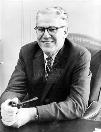
David Eccles, Multnomah County Commissioner and supporter of CRAG, 1962.
Oregon Historical Society Research Library, Oregon Journal Collection, 006303
-
Mount Hood Freeway map.
Image from publication "I-205 and Mount Hood Freeways: Facts and Alternatives." Proposed freeway is signified by dashed line running horizontally in center of image. Oreg. Hist. Soc. Research Lib., bb005623
Related Entries
-
![Metro Regional Government]()
Metro Regional Government
Metro is a regional agency that serves the urbanized portions of Multno…
-
Mount Hood Freeway
The Mount Hood Freeway, if constructed, would have passed through south…
-
![Neil Goldschmidt (1940-2024)]()
Neil Goldschmidt (1940-2024)
Neil Edward Goldschmidt, the thirty-third governor of Oregon (1986-1991…
-
![Portland]()
Portland
Portland, with a 2020 population of 652,503 within its city limits and …
Map This on the Oregon History WayFinder
The Oregon History Wayfinder is an interactive map that identifies significant places, people, and events in Oregon history.
Further Reading
Abbott, Carl and Margery Post Abbott. "A History of Metro." Portland, Ore.: Metro, 1991. http://library.oregonmetro.gov/files//abbott-a_history_of_metro_may_1991.pdf.


