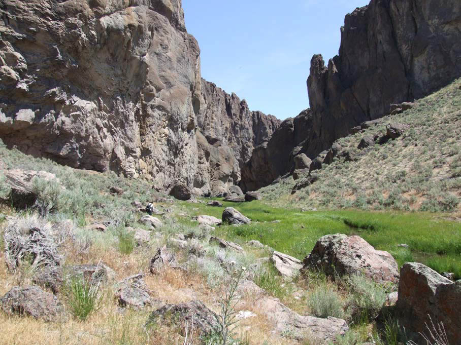
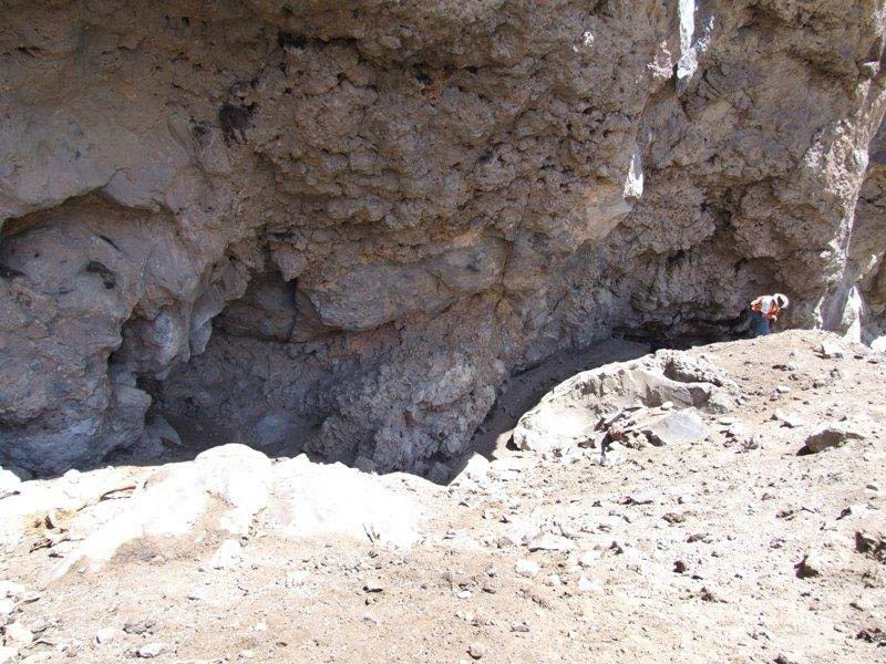
Dirty Shame Rockshelter, in the Owyhee Uplands of southeastern Oregon, was named for the fact that its exceptionally valuable prehistoric deposit was heavily pillaged by artifact collectors before the site was brought to the attention of University of Oregon archaeologists, who then undertook scientific excavation. The site nevertheless preserved, in a limited area, an exceptionally diverse and well-dated inventory of artifacts and food remains, which portray in rare detail the Desert Culture tradition lived by Natives across the Intermontane West, from the end of the Ice Age into historical times.
Archaeological sites in the open typically yield only imperishable stone artifacts, such as projectile points, knives, scrapers, and milling stones; but the protected Dirty Shame Rockshelter deposits remained very dry and thus preserved many artifacts made of wood, woven plant fiber, and animal hide, as well as identifiable seeds and other vegetal foods and the bones of food animals ranging from bison to small rodents. The site's C-14 dates span the period 9500-365 cal BP (that is, calendar years before the present). A complete lack of materials dating between 5850-2750 cal BP shows that the site was abandoned during the Middle Holocene Altithermal or Hypsithermal period, when a warmer global climate restricted human occupation in western North America.
In both its earlier and later occupation periods, hunting-gathering people came to Dirty Shame for the varied late summer-early fall harvest. Plant and animal remains found in dried human excrement, as well as those discarded in the shelter, show that its pre-Altithermal and post-Altithermal visitors ate a varied and healthy diet.
Antelope Creek, which flows past the shelter to empty into the Owyhee River several miles downstream, created a narrow but long and moist canyon bottom environment that provided sunflower and goosefoot seeds, prickly pear cactus pads, sego lily bulbs, wild onions, and fruits of the wild rose and cherry. The creek supplied freshwater crayfish, mussels, and chubs, while its bottoms and the adjacent basalt plateau uplands offered nutritious insects, including ants and termites; small game, including pocket gophers, field mice, cottontails, jackrabbits, and marmots; and large game, including antelope, mule deer, bighorn sheep, and bison. All these species were attested in the archaeological deposits.
The food resources available around the shelter were the same during both early and late occupation periods. This was also true of the raw materials that people used to make tools and equipment. Milling stones of local basalt for processing wild seed and a toolkit of flaked chert, basalt, and obsidian projectile points for hunting large and small game animals were well represented in all occupation levels, as were knives and scrapers for butchering. Researchers also found fragments of carrying and hunting nets made of twisted Indian hemp and milkweed fibers, sandals woven with shredded sagebrush bark, matting made of bulrushes, and basketry made of split willow splints and tough grasses.
Several notable differences between earlier and later cultural remains show that people had continued to live elsewhere in the region surrounding Dirty Shame even during the dry Altithermal interval, when the rock shelter vicinity dropped out of their annual cycle.
It also seems clear that people had made some important cultural changes during that time. Dirty Shame hunters of the early period used large flaked stone points to tip darts hurled with the atlatl or spear thrower, while those of later times used bows and arrows to cast smaller and lighter arrow points. In addition, sandals of the classic Fort Rock type, in use throughout the northern Great Basin during the early period of occupation, had dropped entirely out of the cultural inventory by the later period of site use, to be replaced by alternative designs.
Patterns of seasonal occupation at Dirty Shame apparently changed to a limited but significant degree over the millennia. During the early period, people came for the late summer-early fall harvest and may have wintered there, as suggested by sturdy Fort Rock sandals of shredded sagebrush bark with well-made toe covers, which would have made good winter shoes. But well-preserved house remains, representing at least five and probably six conical or domed wickiups, were found only in the levels dated after 2750 cal BP. Radiocarbon dates on individual houses were 2545 cal BP, 2005 cal BP, 1750 cal BP, 1480 cal BP, and 1175 cal BP. The uppermost structure, which was the most completely preserved, was identical in its construction details to winter dwellings being made in the late 19th century. In fact, Traditional Knowledge of the construction of such houses persists today in modern Northern Paiute communities of northern Nevada and south-central Oregon, keeping alive the ancient heritage.
-
![Dirty Shame Rockshelter]()
Dirty Shame Rockshelter.
Dirty Shame Rockshelter Courtesy U.S. Department of the Interior
-
![Dirty Shame Rockshelter, with evidence of looting and heavy equipment damage.]()
Dirty Shame Rockshelter.
Dirty Shame Rockshelter, with evidence of looting and heavy equipment damage. Courtesy U.S. Department of the Interior
Map This on the Oregon History WayFinder
The Oregon History Wayfinder is an interactive map that identifies significant places, people, and events in Oregon history.
Further Reading
Aikens, C. Melvin, Thomas J. Connolly, and Dennis L. Jenkins. Oregon Archaeology. Corvallis: Oregon State University Press, 2011.
Aikens, C. Melvin. Archaeology of Oregon. Washington, D.C.: USDA Bureau of Land Management, 1993.
Fowler, Catherine S., and Sven Liljeblad. "Northern Paiute." In Handbook of North American Indians, Vol. 11, Great Basin, 435-466. Washington, D.C.: Smithsonian Institution, 1986.


