Glaciers and permanent snowfields—found in many western states, including Washington, California, Colorado, Wyoming, Montana, and Nevada—are common in the high alpine environments of Oregon. There are about 463 glaciers or perennial snowfields in Oregon (35 of them named), covering an area of about 42.5 square kilometers. They can be found in the Wallowa Mountains of northeastern Oregon and along the crest of the Cascade Range from Mount Hood south to Mount Thielson. The fundamental requirement for a glacier is that more snow accumulates in winter than melts away in summer, so glaciers can exist in relatively warm environments where annual average air temperatures are above freezing as long as enough winter snow accumulates to survive the summer.
By definition, a glacier is composed of perennial snow or ice. It also moves. One indication of movement is the existence of crevasses, the gaping cracks that develop in the ice. Differential movement of the ice causes tension; if the tension exceeds the strength of the ice, then it cracks and forms crevasses. Another indication of movement is scratches on the bedrock that once covered the glacier. The scratches, known as striations, are caused by ice dragging rocks over the bedrock, much like sandpaper over wood.
Glaciers in the western United States were unknown to science until 1871, when a geological survey expedition, led by Clarence King, identified glaciers on California’s Mount Shasta. At nearly the same time, a field team from the King Survey, led by Arnold Hague, identified the Sandy Glacier on Mount Hood. Not long after, many glaciers in Oregon and other western states were identified. Until that time, early scientist/explorers did not realize that glaciers existed in the high peaks beneath the seasonal snow that covered the mountains. Their exploration in early summer would not reveal the glaciers because thick, seasonal snow-cover all but hides them and surrounding terrain.
That was particularly true in the mid- to late-1800s, when earth’s climate was in the last stages of what is known as the Little Ice Age and seasonal snows lasted late into the summer. Only by late summer, from August to September, would glacier ice be revealed. Early explorer/scientists such as John Newberry, who explored the eastern side of the Oregon Cascades in the 1850s, recognized the glacially carved landscape of the Cascades and correctly deduced that glaciers were once quite extensive. Had the explorer/scientists traveled later in the season and into higher elevations, they would have encountered the small remnants of those once titanic glaciers.
An ice cap covered Mount Hood during the Pleistocene (a stretch of time also known as the Ice Age, from about 1.8 million to about 10,000 years ago). Another ice cap covered the Oregon Cascades from Mount Jefferson south to Three Sisters, with glaciers descending on the east and west flanks of the range. Those glaciers retreated during the warmer Holocene, over the last 10,000 years, resulting in much smaller glaciers. Climate fluctuations during the Holocene caused glaciers to wax and wane.
The last major cooling period was the Little Ice Age, which lasted from 1300 to about 1900 AD in the western states, resulting in glaciers that were much larger than they are today. The earliest photographs of glaciers, which date to the early 1900s, clearly show the former glacial extent. Today, hikers and climbers traveling the high alpine regions walk over the rocky, sandy deposits left by the glaciers. Those deposits, called moraines, form along the glacier margin and outline the extent of the former glacier.
Over the past century, glaciers have advanced and retreated in response to climatic variations. Oregon glaciers retreated rapidly from 1900 through the 1950s. Then, during the 1960s and 1970s, the climate cooled a bit and the glaciers held their own, some of them even advancing a little. Their retreat resumed by the early 1980s, began to accelerate by the mid-1990s, and continues to the time of this writing in 2022.
The only glacier in Oregon that scientists know is responding to volcanic heat is the White River Glacier on Mount Hood. Steam vents appeared in the early 1900s near the top of this glacier, causing it to melt. Its dramatic retreat, compared to other glaciers on the mountain, must reflect this unusual situation. Overall, glaciers on Mount Hood, the best studied in the state, have lost about 34 percent of their glacier cover since about 1910. Collier Glacier on North Sister has lost about 60 percent.
Much of the research on glaciers in Oregon was conducted by the Mazamas, a hiking club in Portland. In the mid-1920s, the club’s research committee recognized that the glaciers on Mount Hood were shrinking and established a program of measurements to track the changes. The measurements included glacier length, thickness change, and melt rates. The Mazamas also contracted for aerial photographic surveys of the glaciers of Mount Hood and from Mount Jefferson south to Three Sisters and Broken Top. The Mazamas continued their studies for sixty years, a scientific effort by a hiking club that is unique in the annals of American glacier studies.
Other notable efforts include a forty-year photographic record of Collier Glacier on North Sister by Ruth Hopson Keen and a thirty-plus-year history of the area of Lathrop Glacier by Ralph Nafziger. Other glacier studies have been conducted by the U.S. Geological Survey, Oregon State University, Portland State University, and University of Oregon.
Two glaciers deserve special attention because of the wealth of information about them—Eliot Glacier on Mount Hood and Collier Glacier on North Sister.
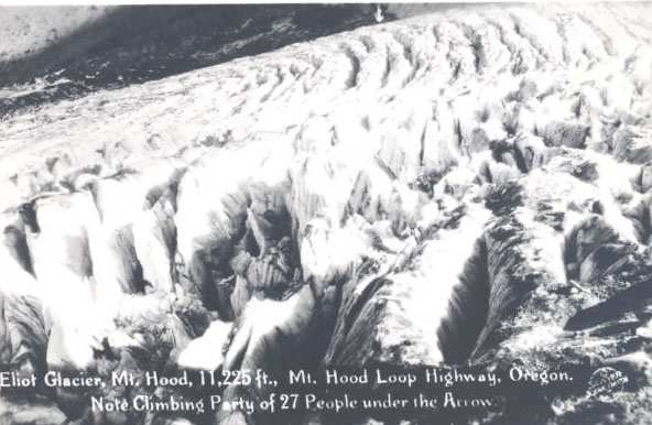
Eliot Glacier is Oregon’s largest glacier, covering about 1.6 square kilometers in 2004. It flows from near the summit of Mount Hood and down the north side. Meltwater from this glacier forms Eliot Creek, which provides water to apple and pear orchards below. In the late 1800s, a road was built to reach the glacier and to serve alpine recreation. Today, the glacier can be reached after a forty-five-minute drive from the town of Hood River and a fifteen-minute hike.
The glacier was named after Thomas L. Eliot, a mountaineer and pastor of the Unitarian Church in Portland during the late 1800s. Because of its size and ease of access, the glacier was selected for study by the Mazamas’ research committee. The glacier is unusual because the headwall of Mount Hood is fairly weak and avalanches occasionally throw rocks onto the glacier surface. Those rocks become buried with subsequent snowfalls and become part of the glacier. After flowing though the body of the glacier, they melt out near the foot of the glacier and blanket the ice. In some places, the rock blanket is over two meters thick. Consequently, the casual observer will mistake the lower rock-covered portion of the glacier as part of the ice-free landscape. The glacier is ninety meters thick in places and moves 2.3 to 6.9 meters each year. Because of climate warming since the early 1900s, the glacier had lost 19 percent of its area and had retreated about 600 meters by 2010.
One of the hazards posed by glacier retreat on volcanoes such as Mount Hood is the massive failure of the valley walls. The glacier erodes the volcanic edifice and deposits the material along the glacier margin (moraines). When the glacier retreats, it leaves behind an over-steepened wall of loosely packed sediment that is no longer buttressed by the glacier. Those walls are subject to failure, particularly during rainstorms that turn the streams into debris-choked flows. In November 2006, a heavy rainstorm caused numerous moraines to fail, creating debris flows that covered forests and roads. Part of the Eliot Glacier moraine failed, causing a debris flow that reached nearly five miles. A debris flow from the White River, which is fed by the White River Glacier, inundated a state highway on the east side of Mount Hood.
Collier Glacier, the largest glacier on the Three Sisters, is named after George H. Collier, a University of Oregon professor who climbed the Sisters in 1880. The glacier measured about 0.65 square kilometers in 1994, having lost 64 percent of its area and retreating 1,500 meters since 1910. The glacier can be reached by a ninety-minute hike from the trailhead near the McKenzie Pass Highway out of Eugene.
The earliest scientific study of Collier Glacier was by Edwin Hodge of the University of Oregon, who made the first known map of the glacier. In 1928, Ray Sims of the Obsidians, an outdoor club in Eugene, began annual August hikes to the glacier, a tradition that continued for thirty years. Starting in 1941, Ruth Hopsen Keen, a Eugene high school teacher, was asked by Francois Matthes of the U.S. Geological Survey to study the glacier. It was a good choice, not only because she completed her Ph.D. in geology in 1946, but also because she compiled a twenty-six-year photographic record (1936–1962) of its changes, the longest sustained research effort of the glacier.
From the photographic records of Collier Glacier and Eliot Glacier on Mt. Hood, updated with more recent photographs as well as aerial and satellite imagery, we know that Collier Glacier rapidly retreated during the early part of the twentieth century. It then slowed in the 1940s, retreated again in the 1950s and 1960s, stopped retreating in the 1970s, and slightly advanced in the 1980s before resuming its rapid retreat in the late 1980s and 1990s. This behavior is similar to other glaciers in the western United States. The overall driver of the observed glacial retreat is warming air temperatures. Decadal variations in the overall trend are caused by air temperatures and fluctuations in the amount of snowfall. Recent modeling predicts that, given the current trend of global warming, the glaciers of the Olympic Mountains in Washington State will disappear by 2070. The glaciers in Oregon will also shrink dramatically, and many will probably disappear. By 2100, Eliot Glacier is predicted to be about 10 percent of its current size.
Since the initial mapping of glaciers in Oregon by the U.S. Geological Survey (Mount Jefferson in 1949; Cascade Range in 1956–1957; Wallowa Mountains in 1981), an estimated twenty glaciers have "disappeared," which means they diminished below the threshold of 0.01 km2, showed no movement, or no snow or ice was present. Of the twenty, eight were named glaciers: Thayer on North Sister; Irving, Skinner, Carver, and Clark on South Sister; Palmer on Mount Hood; and Lathrop on Mount Thielsen; and Benson in the Wallowa Mountains. Lathrop Glacier has always been smaller than the minimum area threshold, but it is included here for completeness.
-
![Eliot Glacier]()
Eliot Glacier.
Eliot Glacier Courtesy Oregon Hist. Soc. Research Lib., OrHi65769
-
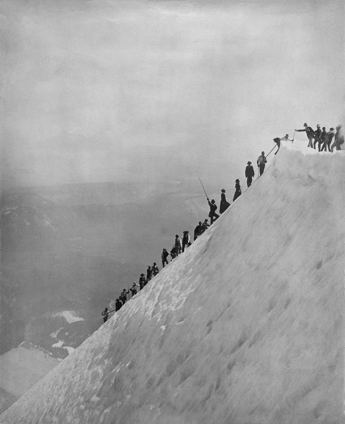
!["Eternal snows," Mt. Hood, 1926]()
"Eternal snows," Mt. Hood, 1926.
"Eternal snows," Mt. Hood, 1926 Courtesy Oregon Hist. Soc. Research Lib., neg. no.022304
-
![Mt. Hood, c. 1885]()
Mt. Hood, c. 1885.
Mt. Hood, c. 1885 Courtesy Oregon Hist. Soc. Research Lib., neg. no.016048
-
![Collier Glacier, c. 1940]()
Collier Glacier, c. 1940.
Collier Glacier, c. 1940 Courtesy Oregon Hist. Soc. Research Lib., neg. no.015331
-
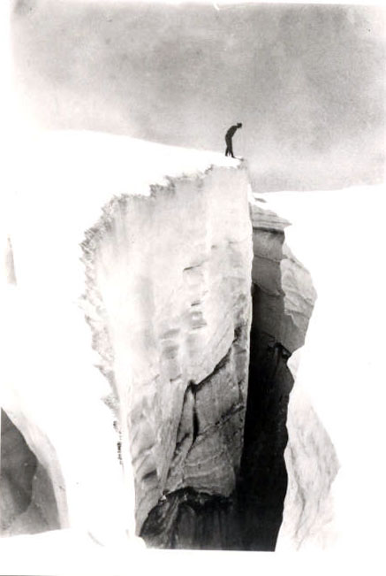
![]()
Eliot Glacier, crevasse.
Courtesy Oregon Hist. Soc. Research Lib., neg. no.003631
-
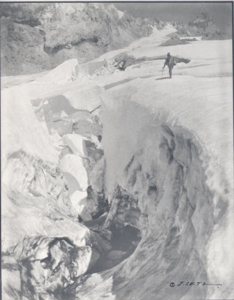
![]()
Eliot Glacier.
Courtesy Oregon Hist. Soc. Research Lib., neg. no.005087
-
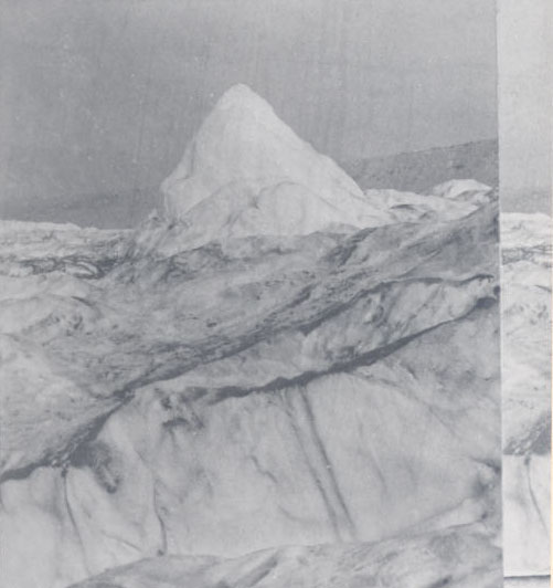
![]()
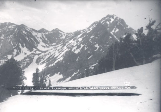
Rock Creek Glacier.
Courtesy Oregon Hist. Soc. Research Lib., OrHi13944
-
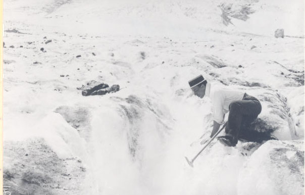
![]()
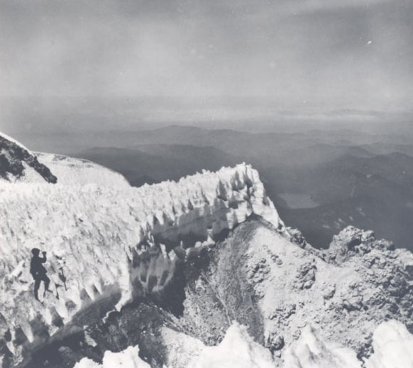
"Sun cups" ice on an unknown glacier in Oregon.
Courtesy Oregon Hist. Soc. Research Lib., neg. no.003799

Related Entries
-
![Cascade Mountain Range in Oregon]()
Cascade Mountain Range in Oregon
The Cascade mountain system extends from northern California to central…
-
![Climate Change in Oregon]()
Climate Change in Oregon
Within a few hundred miles in Oregon, you can see snowy volcanoes, parc…
-
![Mazamas]()
Mazamas
The history of the Mazamas began in early 1894 when William Gladstone S…
-
![Mount Hood]()
Mount Hood
Mount Hood is a stratovolcano in northwest Oregon located about fifty m…


Map This on the Oregon History WayFinder
The Oregon History Wayfinder is an interactive map that identifies significant places, people, and events in Oregon history.
Further Reading
Benn, D. I., and Evans, D. J. A. Glaciers and Glaciation. Oxford, U.K.: A Hodder Arnold Publication, 1998.
Fountain, A.G., and Glenn, B. (submitted). “Glacier Change in Oregon.” In Oregon Climate Update 2022. Oregon Climate Change Research Institute.
Fountain, A. G., C. Gray, B. Glenn, B. Menounos, J. Pflug, and J.L. Riedel. (2022). “Glaciers of the Olympic Mountains, Washington: The Past and Future 100 Years.” Journal of Geophysical Research: Earth Surface 127(4). https://doi.org/10.1029/2022JF006670
Frans, C., E. Istanbulluoglu, D.P. Lettenmaier, A.G. Fountain, and J.L. Riedel, (2018). “Glacier Recession and the Response of Summer Streamflow in the Pacific Northwest United States, 1960-2099.” Water Resources Research. https://doi.org/10.1029/2017WR021764
Hambrey, M., and Alean, J. Glaciers. Cambridge, U.K.: Cambridge University Press, 2004.
Paterson, W. S. B. The Physics of Glaciers. Oxford, U.K.: Pergamon Press, 1994.
Jackson, K. M., and A.G. Fountain. (2007). “Spatial and Morphological Change on Eliot Glacier, Mount Hood, Oregon, USA.” Annals of Glaciology 46, 222–226. https://doi.org/10.3189/172756407782871152
Lillquist, K., and K. Walker, K. (2006). “Historical Glacier and Climate Fluctuations at Mount Hood, Oregon.” Arctic, Antarctic, and Alpine Research 38(3), 399–412.
O’Connor, J. E. (2013). “Our Vanishing Glaciers” One Hundred Years of Glacier Retreat in Three Sisters Area, Oregon Cascade Range.” Oregon Historical Quarterly 114(4), 402–427.