Portlanders have long valued Macleay Park, in Portland’s northwest hills, as a wild oasis close to the city’s core. The nearly 140-acre park has deep ravines shaded by large Douglas-fir and western red cedar trees. Macleay Park also contains the lower portion of Balch Creek, which has a small population of native cutthroat trout. Park trails connect to Forest Park and the Bird Alliance of Oregon (formerly the Audubon Society) wildlife sanctuaries.
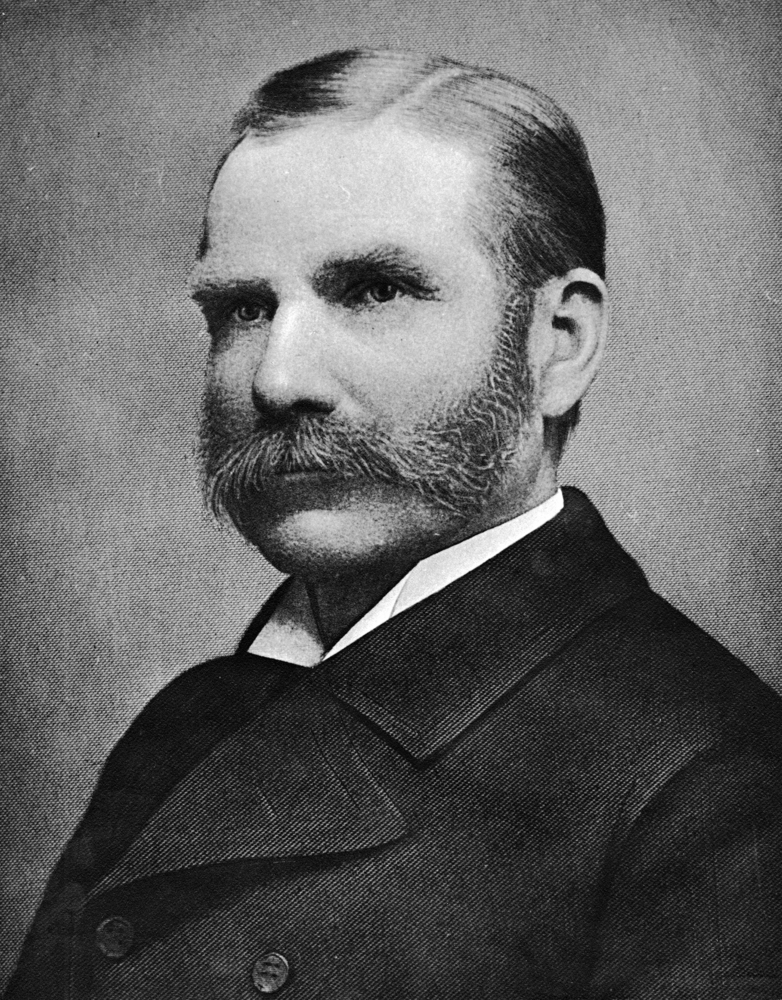
Macleay Park was one of Portland’s earliest city parks. Businessman Donald Macleay donated approximately 105 acres of land in 1897, shortly before his death. Over the years, the city has acquired additional land, including much of Balch Gulch, extending park boundaries to its current northern border underneath the Thurman Street Bridge.
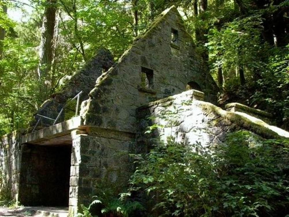
In the mid-1930s, workers with federal relief programs built a public restroom in the park. After being damaged by vandalism and a storm, park workers in the 1960s partially dismantled the structure. The ruins are now known as Stone House.
The plants, stream, and wildlife in Macleay Park have faced numerous threats over the years, from bird hunters and vandalism to soil erosion, pollution, invasive species, and off-leash dogs. Picnickers, bird lovers, and hikers continue to work with the city to protect this beloved city park.
-
![]()
Donald Macleay.
Oregon Historical Society bb004288
-
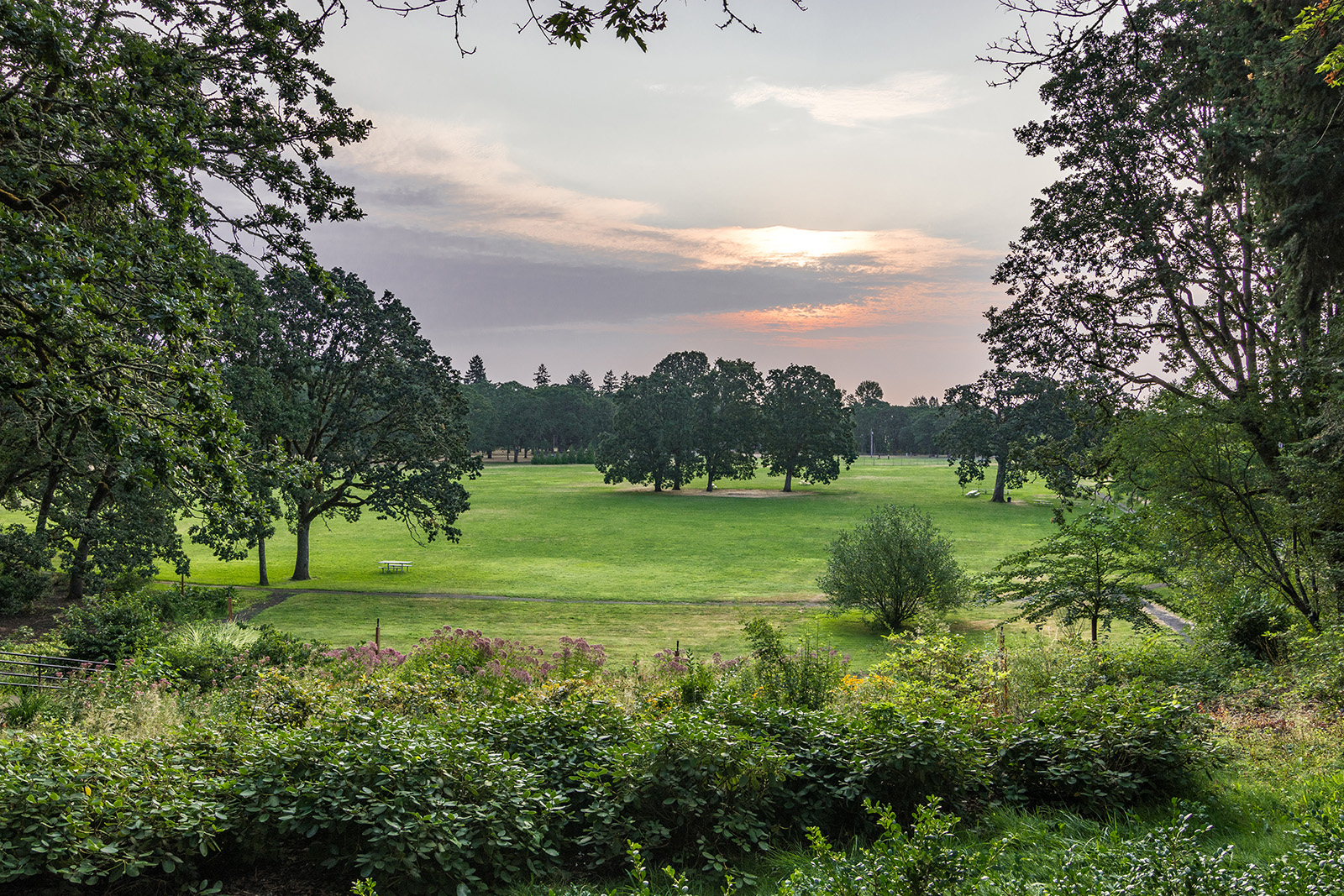
![Macleay Park]()
Macleay Park.
Macleay Park Courtesy National Recreational Trails
Related Entries

Map This on the Oregon History WayFinder
The Oregon History Wayfinder is an interactive map that identifies significant places, people, and events in Oregon history.
Further Reading
City of Portland, Bureau of Planning. Balch Creek Watershed Protection Plan. Adopted February 8, 1991. http://www.portlandonline.com/shared/cfm/image.cfm?id=103619.
Houle, Marcy Cottrell. One City’s Wilderness: Portland’s Forest Park. Portland: Oregon Historical Society Press, 1996.