Point Adams was given its name by Captain Robert Gray, who in his official log entry on May 19, 1792, named the spit of land Adam’s Point. Captain George Vancouver, later that year, referred to it as Point Adams, and the United States Exploring Expedition adopted that version in 1841. The original spit jutting into the Columbia River, forming the southern border of the river mouth, was much more extensive than it later became. Greatly altered by the building of the Columbia River South Jetty in 1895, Point Adams has become smaller and retreated farther inland; while Clatsop Spit, the area of accreted sand, has grown around the jetty to the west.
Since the beginning of European and American navigation on the Northwest coast, more than two thousand ships have been lost in the Columbia mouth region due to shifting sandbars, violent storms, treacherous currents, and turbulent waters. As a result, the United States had an early interest in both a lighthouse and a life-saving station for the Point Adams area. Though located near one another and serving similar needs, the two facilities had different fates.
Development of ports along the Oregon Coast in the mid-nineteenth century was greatly hampered by the lack of navigational aids. This became increasingly important after news spread of the gold strikes in California in 1848, which meant more and more people were traveling by ship between Portland and San Francisco. Both communication and commerce in the region depended almost exclusively on river and sea transportation, but navigators had to rely on hazarding a guess as to the location of prominent headlands and waiting for the calmest weather possible to enter the Columbia River.
When Congress created the Oregon Territory in 1848, it directed that a system of buoys be placed in the Columbia and Astoria Harbor, plus a lighthouse at Cape Disappointment on the north side of the river. Lit in 1856, it was the first lighthouse in the Columbia mouth region, which by then was situated in Washington Territory (created in 1853).
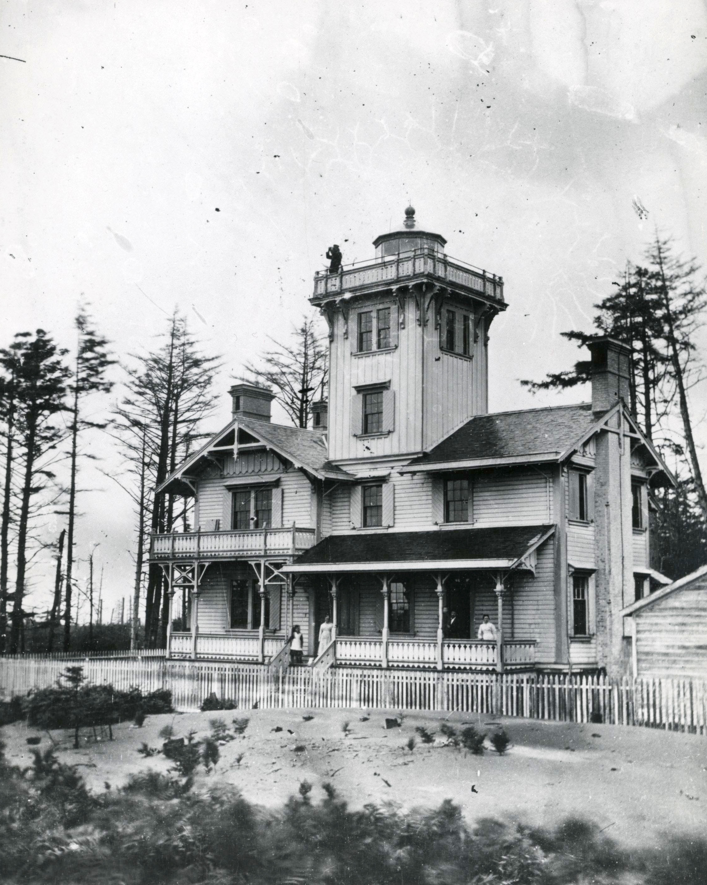
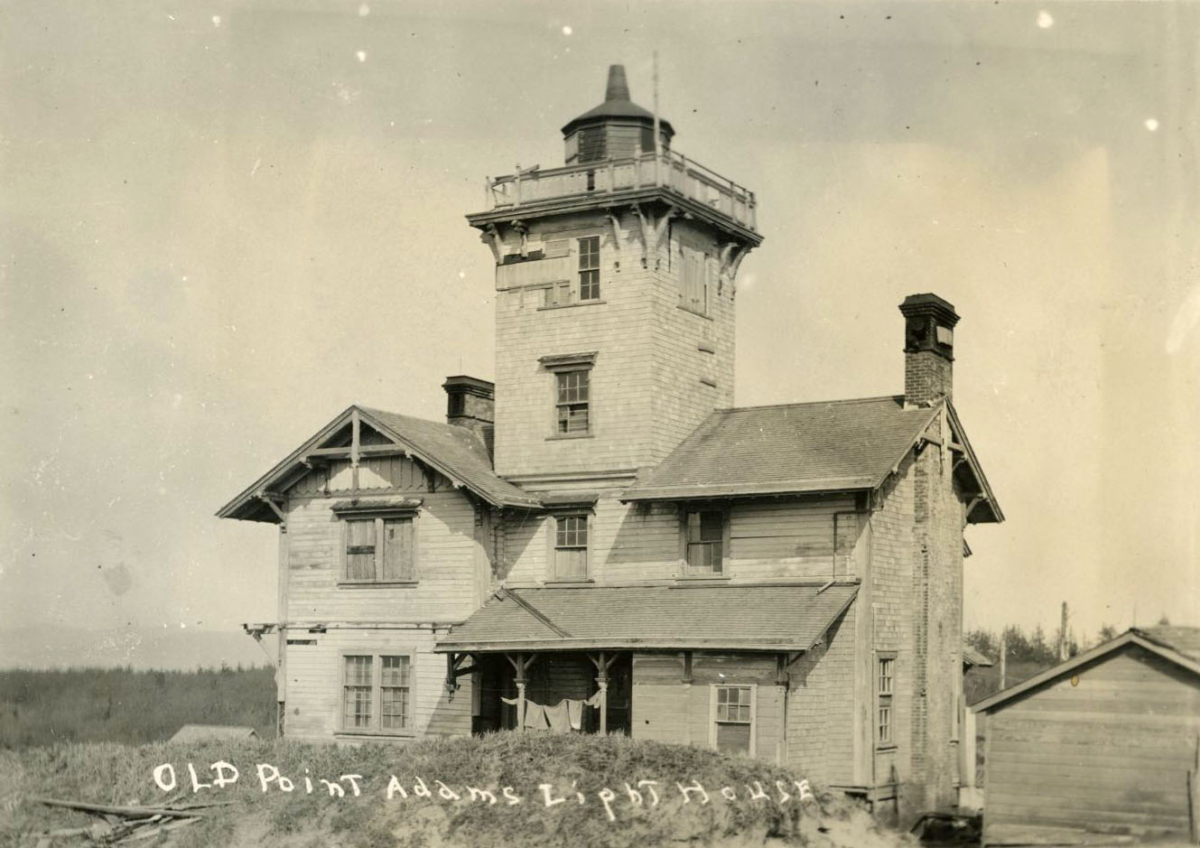
In 1875, recognizing the hazards to ships in the region, the U.S. Lighthouse Service built a lighthouse on a low sandy ridge about a mile south of Point Adams. Materials were landed at the Fort Stevens wharf on the Columbia and hauled over a road south to the site. The lighthouse consisted of a cottage combined with a square light tower with a fourth-order Fresnel lens rising from the roof, 99 feet above river level. Fresnel lenses are graded into six orders based on size and focal length, with the first-order lens being the most powerful.
Originally with a red and white flashing light, the Point Adams lighthouse changed to a fixed red beam in 1881. Point Adams was the first Oregon lighthouse with a steam fog signal and the only one designed in the Victorian-era Carpenters’ Gothic Revival style (sometimes referred to as the Stick Style). Paul Pelz, chief draftsman for the U.S. Lighthouse Board, was the designer. The light was first lit on February 15, 1875, and the first keeper was H.C. Tracy, who served from 1875 to 1881. The keepers fought a constant battle with drifting sands. The fog signal was inaudible to mariners due to pounding surf and was discontinued after five years’ service.
By 1899, the Point Adams Lighthouse had become obsolete. The completion of the South Jetty in 1895 had caused it to become distant from the sea due to sand accretion, and the U.S. lightship Columbia had been operating at the mouth of the river since 1892. Point Adams Lighthouse was decommissioned, and the station was abandoned. In 1912, the Lighthouse Service burned the buildings on orders of the Secretary of War to prevent vandalism and to make way for gun emplacements, especially Battery Russell at Fort Stevens.
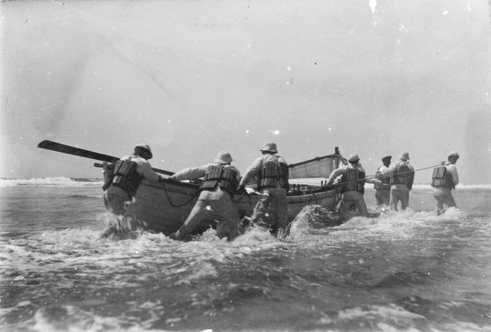
The nearby Point Adams Life-Saving Station had greater staying power. In 1886, in response to a request from Oregon Senator John Mitchell, Congress approved the construction of a life-saving station on the waterfront east of Fort Stevens, near the north edge of what became the town of Hammond. The Point Adams Life-Saving Station, funded by the U.S. Life-Saving Service (the predecessor to the U.S. Coast Guard), came into service in December 1889. Eight men were on duty year-round, the first such station in Oregon with a full crew. The station was essential during the fishing season, due to the high number of salmon gillnetting boats at the entrance to the Columbia. The gillnetters were crewed by two men, and their long, heavy nets frequently dragged the boats into the breakers, often with tragic results.
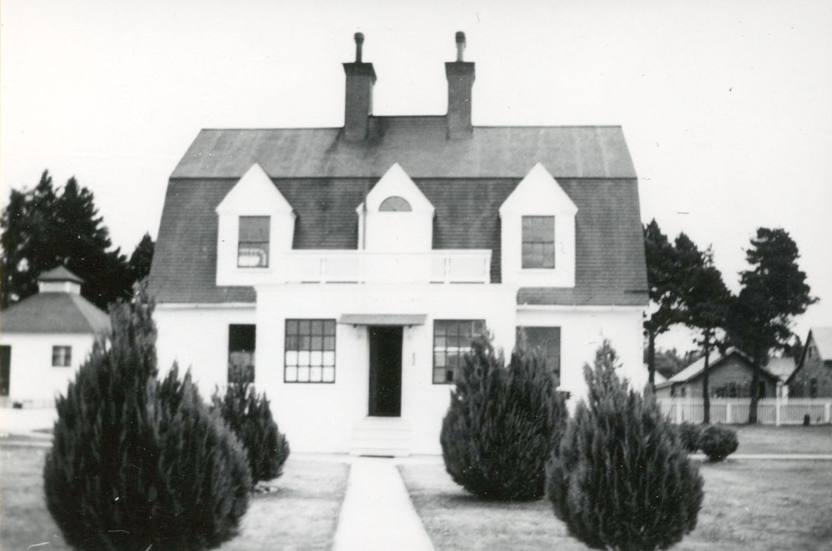
Albert Buruley Bibb of the Life-Saving Service designed the original life-saving station house at Point Adams. One of only three designed in the Fort Point-style, it was gambrel-roofed with three dormer windows in the Colonial Revival style. Its design featured a boathouse in a separate building for the first time, rather than as part of crew living quarters. The first keeper was Alexander McLean, who headed the life-saving station until 1891. After a succession of short-term keepers, Oscard Wicklund served as head keeper from 1898 to 1915. The lifesaving station’s boathouse had to be moved in 1913-1914 due to coastal erosion, and a second boathouse was added before 1923, built on piles in the Columbia River.
In 1938, the Public Works Administration began building a new Point Adams Lifeboat Station for the U.S. Coast Guard, also in a Colonial Revival style. The station was designed to sleep seventeen, but could handle more men if needed, and included a new boathouse. The cost for the complex, including the boathouse, was $44,000.
Decommissioned by the Coast Guard in 1967, the station complex was used by Clatsop Community College until purchased in 1969 by the National Marine Fisheries Service for use as a research station. The 1939 station house is the most intact building, but the rare 1889 boathouse still remains, as does a shop building from 1925. The boathouse is one of only two in Oregon from the Life-Saving Service period and the only one remaining of the era’s Fort Point-type boathouses.
-
![]()
Point Adams Lighthouse.
Courtesy Oregon Hist. Soc. Research Lib., Buchtel, 12292, pf654c
-
![]()
Point Adams Coastguard Station, 1938.
Courtesy Oregon Hist. Soc. Research Lib., Journal 000364
-
![]()
"Old Point Adams Lighthouse".
Courtesy Oregon Hist. Soc. Research Lib., Orhi76254, pf654c
Related Entries
-
![Columbia River]()
Columbia River
The River For more than ten millennia, the Columbia River has been the…
-
![Columbia River Bar Pilots]()
Columbia River Bar Pilots
The extensive, dangerous bar channel at the entrance to the Columbia Ri…
-
![Fort Stevens]()
Fort Stevens
One of the three major forts designed to protect the mouth of the Colum…
-
![Gillnet fishing]()
Gillnet fishing
A gillnet is used by fishermen throughout the world to catch various sp…
-
![Hammond]()
Hammond
Originally the site of a Clatsop village called Ne-ahk-stow, Hammond se…
-
![Point Adams]()
Point Adams
Located at the mouth of the Columbia River and marking the extreme nort…
-
![Port Orford Lifeboat Station]()
Port Orford Lifeboat Station
Built by Julius Yuhasz and Arvid Olson, a U.S. Coast Guard Lifeboat Sta…
-
![U.S. Life-Saving Service in Oregon]()
U.S. Life-Saving Service in Oregon
The mission of the U.S. Life-Saving Service was to rescue those in peri…
Related Historical Records
Map This on the Oregon History WayFinder
The Oregon History Wayfinder is an interactive map that identifies significant places, people, and events in Oregon history.
Further Reading
Deur, Douglas. Empires of the Turning Tide. U.S. Department of the Interior, National Park Service. Publication Number 2016-001, 2016.
Nelson, Sharlene, and Ted Nelson. Umbrella Guide to Oregon Lighthouses. San Luis Obispo, Calif.: EZ Nature Books, 1994.
Pinyerd, David. "The Preservation of Pre-World War Two Coast Guard Architecture in Oregon." Master of Science thesis, Interdisciplinary Studies Program in Historic Preservation. University of Oregon, Eugene, June 2000.

