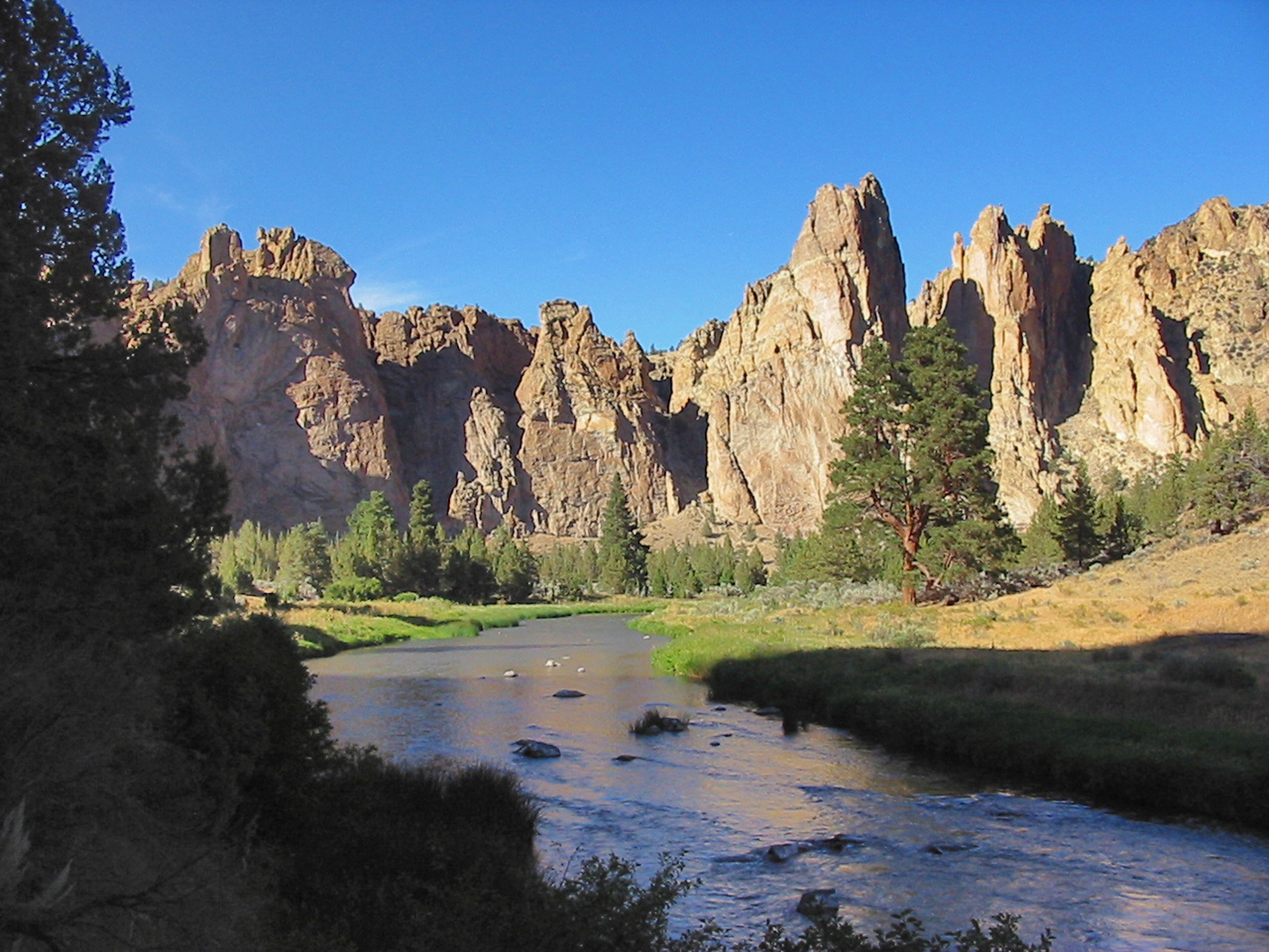
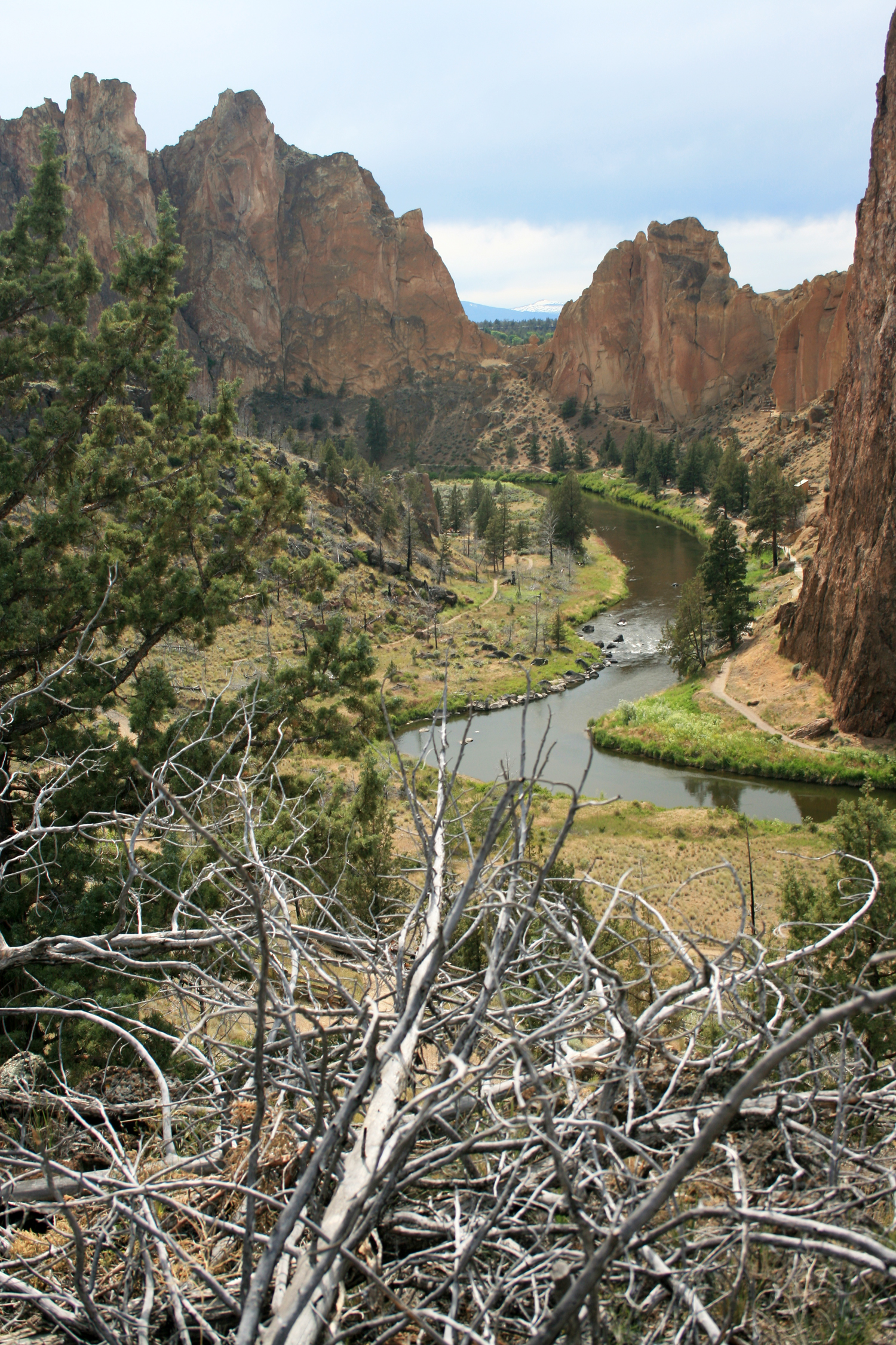
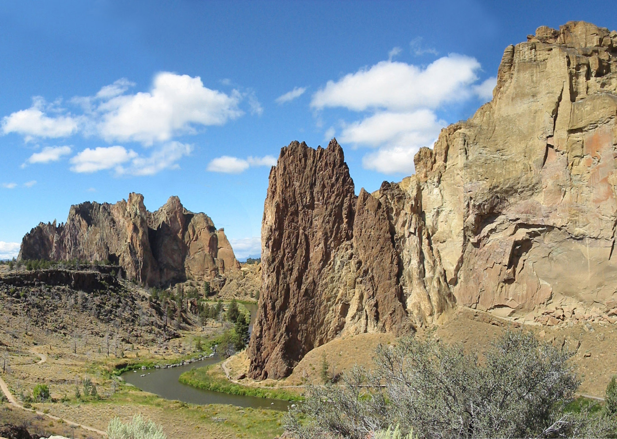
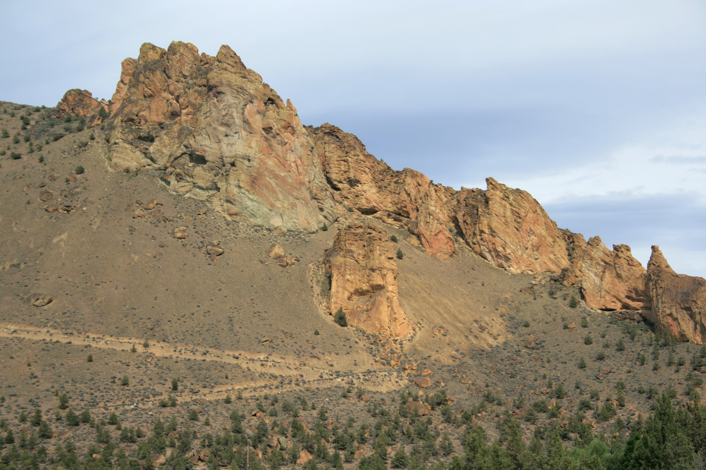
Smith Rock State Park encompasses 652 acres near Redmond and Terrebonne, in the semi-arid High Desert of central Oregon. This landscape of rock spires, cliffs, and canyonlands lies along the northern edge of the Crooked River caldera, a 26-mile long, 17-mile wide volcanic depression formed through a series of super-volcanic eruptions between 29.7 and 27.5 million years ago. Eruptions from the Crooked River caldera deposited massive volumes (>140 cubic miles) of tuff and rhyolitic lavas, dikes, and domes. All of these volcanic features are now well exposed in the rock walls of Smith Rock State Park.
Approximately 400,000 years ago, more recent lava flows erupted from Newberry Volcano, twenty-five miles south of present-day Bend, and flowed north, largely covering the caldera-filling tuff and diverting the Crooked River up against Smith Rock. Both older and younger rocks at Smith Rock State Park have been deeply eroded, sculpted, and incised by the modern-day Crooked River.
Some geologists have proposed that the Crooked River caldera records some of the oldest caldera-forming eruptions related to the passage of the Yellowstone volcanic hotspot from the coast of the Pacific Northwest to the modern Yellowstone caldera in Wyoming during the past 50 million years. The Crooked River caldera also contributed a significant amount of volcanic material to the Turtle Cove Member of the John Day Formation, which hosts one of the world’s most complete and well-preserved fossil records of Cenozoic terrestrial plants and animals.
Smith Rock is the traditional homeland of several Native American groups, including the Tenino (Warm Springs) and Northern Paiute people. The Northern Paiutes referred to the environs of Smith Rock as the Animal Village, a reference to the abundance and variety of plants and animals in the area. Emigrant nonindigenous settlers began to occupy the area in the late 1800s.
The namesake feature of the modern state park is Smith Rock, a 3,200-foot elevation ridge and 600-foot-tall cliff overlooking a major bend of the Crooked River. The naming of Smith Rock is the subject of debate. One popular interpretation suggests that it was named after Private Volk Smith, a U.S. Cavalry soldier who fell to his death there during a battle with the Northern Paiute in 1863. Alternatively, Smith Rock may have been named in honor of John Smith, Linn County sheriff (1855-1859), Oregon state legislator (1862), and Indian agent to the Warm Springs Indian Agency (1866-1886). An August 10, 1867, letter in the Albany States Rights Democrat, from members of an expedition over Santiam Pass to present-day Prineville, describes the conspicuous formation of Smith Rock and claims that the landmark was named for its discoverer, John Smith.
Smith Rock became part of the Oregon State Park system in 1960 through purchase and land donations, primarily because of its majestic landscape, unique geology, range of habitats, and variety of wildlife and plant communities. Park wildlife includes mule deer, river otter, beaver, and other small mammals. Notable birds of prey include prairie falcons and eagles, and rattlesnakes are found in some areas of the park. Native plant species include desert paintbrush, arrowleaf balsamroot, yellow desert daisy, and purple sage.
The park, which attracts approximately 747,000 visitors annually, has become an iconic image of central Oregon and the Oregon state park system. Visitors participate in an array of activities, including rock climbing, hiking, trail running, camping, horseback riding, mountain biking, wildlife viewing, and photography. The American Alpine Institute has singled out Smith Rock State Park as “famous for sport climbing” in America, and the park attracts climbers from all over the world who challenge themselves on more than 2,000 climbing routes of all degrees of difficulty.
-
![Tuff of Smith Rock along the Crooked River along the Wolf Tree Trail near the Horse Ford in Smith Rock State Park.]()
Smith Rock State Park, August 23, 2010.
Tuff of Smith Rock along the Crooked River along the Wolf Tree Trail near the Horse Ford in Smith Rock State Park. Courtesy Jason McClaughry, Ore. Dept of Geology and Mineral Ind.
-
![Tuff of Smith Rock along the Crooked River. View is looking west from the main park overlook at Smith Rock State Park.]()
Smith Rock State Park, June 23, 2008.
Tuff of Smith Rock along the Crooked River. View is looking west from the main park overlook at Smith Rock State Park. Courtesy Jason McClaughry, Ore. Dept of Geology and Mineral Ind.
-
![Rhyolite dike intruding the tuff of Smith Rock along the Crooked River. View is looking south from the footbridge.]()
Smith Rock State Park, April 13 2007.
Rhyolite dike intruding the tuff of Smith Rock along the Crooked River. View is looking south from the footbridge. Courtesy Jason McClaughry, Ore. Dept of Geology and Mineral Ind.
-
![Rhyolite dike intruding tuff of Smith Rock along Crooked River, looking west from main park overlook.]()
Smith Rock State Park, February 28, 2014.
Rhyolite dike intruding tuff of Smith Rock along Crooked River, looking west from main park overlook. Courtesy Jason McClaughry, Ore. Dept of Geology and Mineral Ind.
-
![]()
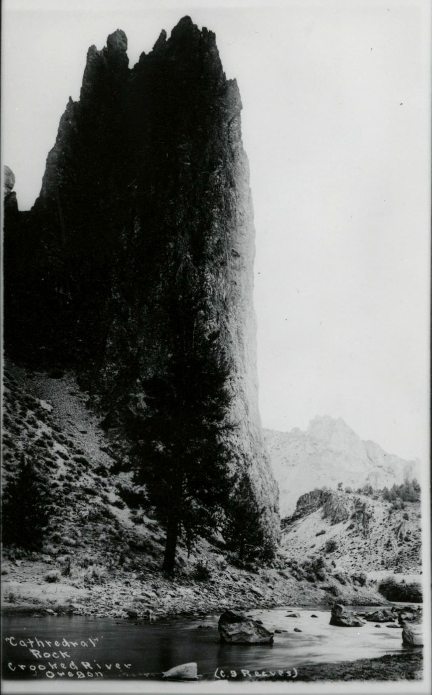
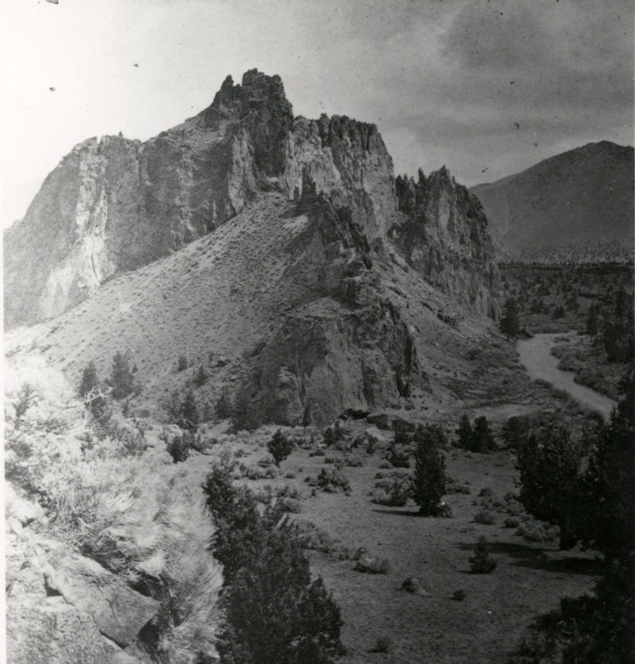
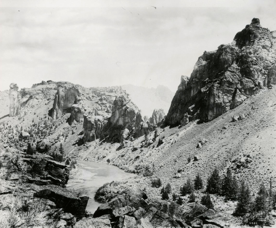
Cathedral Rock, part of Smith Rock State Park.
Courtesy Oreg. Hist. Soc. Research Library, 001425
-
![Spire forming exposures of tuff, north frm Misery Ridge. Gray Butte (in distance) is rhyolite dome, north edge of Crooked R. caldera.]()
Smith Rock State Park, April 13 2007.
Spire forming exposures of tuff, north frm Misery Ridge. Gray Butte (in distance) is rhyolite dome, north edge of Crooked R. caldera. Courtesy Jason McClaughry, Ore. Dept of Geology and Mineral Ind.
-
![Rhyolite dike intruding tuff of Smith Rock on Crooked River. Basalt flow from Newberry Volcano forming ledges on the east side.]()
Smith Rock State Park, April 13, 2007.
Rhyolite dike intruding tuff of Smith Rock on Crooked River. Basalt flow from Newberry Volcano forming ledges on the east side. Courtesy Jason McClaughry, Ore. Dept of Geology and Mineral Ind.
-
![Rhyolite dike intruding the tuff of Smith Rock along the Crooked River.]()
Smith Rock State Park, February 12, 2009.
Rhyolite dike intruding the tuff of Smith Rock along the Crooked River. Courtesy Jason McClaughry, Ore. Dept of Geology and Mineral Ind.
-
![Cliff and ridge-forming tuff of Smith Rock exposed along Staender Ridge in Smith Rock State Park.]()
Smith Rock State Park, June 23, 2008.
Cliff and ridge-forming tuff of Smith Rock exposed along Staender Ridge in Smith Rock State Park. Courtesy Jason McClaughry, Ore. Dept of Geology and Mineral Ind.
-
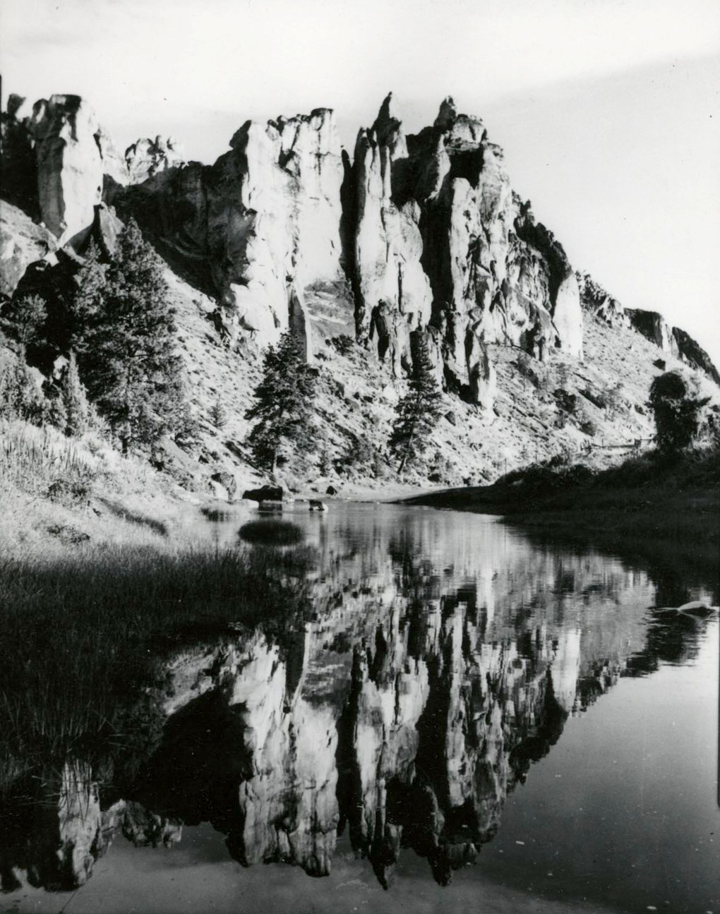
![]()
Smith Rock and the Crooked River, 1937.
Courtesy Oreg. Hist. Soc. Research Library, 001427
-
![]()
Smith Rock.
Courtesy Oreg. Hist. Soc. Research Library, 019059
-
![]()
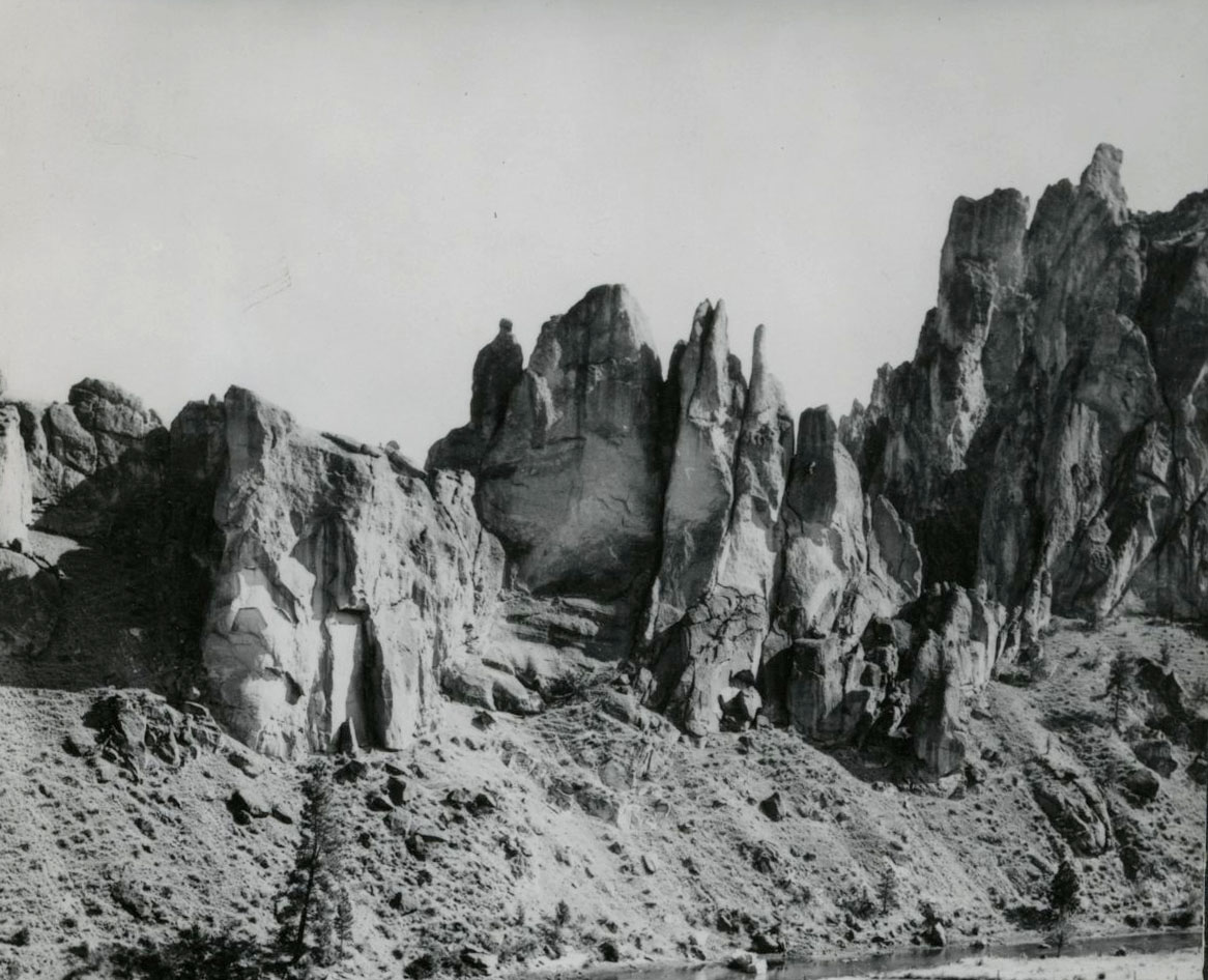
Smith Rock, 1937.
Courtesy Oreg. Hist. Soc. Research Library, 001426
-
![]()
Smith Rock.
Courtesy Oregon Hist. Soc. Research Lib., 018791


Related Entries

Map This on the Oregon History WayFinder
The Oregon History Wayfinder is an interactive map that identifies significant places, people, and events in Oregon history.
Further Reading
Fremd, T., 2010, Guidebook: Society for Vertebrate Paleontology Field Symposium 2010 John Day Basin Field Conference, NRPC Geologic Resources Division.
Graham, J.P., John Day Fossil Beds National Monument Geologic Resources Inventory Report: Natural Resource Report NPS/NRSS/GRD/NRR—2014/846.
Kirby, Tom. "Rock Climbing Terms: Styles and Techniques." American Alpine Institute.
McClaughry, J. D., Ferns, M. L., Gordon, C. L., and Patridge, K. A. "Field trip guide to the Oligocene Crooked River caldera: Central Oregon’s Supervolcano, Crook, Deschutes, and Jefferson Counties." Oregon Geology 69.1 (2009): 25–44.
McClaughry, J.D., Ferns, M.L., Streck, M.J., Patridge, K.A., and Gordon, C.L. "Paleogene calderas of central and eastern Oregon: Eruptive sources of widespread tuffs in the John Day and Clarno Formations." In O’Connor, J.E., Dorsey, R.J., and Madin, I.P., eds., Volcanoes to Vineyards: Geologic Field Trips through the Dynamic Landscape of the Pacific Northwest. Portland, Ore.: Geological Society of America Field Guide, 2009.
Oregon State Parks, 2016, http://oregonstateparks.org/index.cfm?do=parkPage.dsp_parkPage&parkId=36
Seligman, A.N., Bindeman, I.N., McClaughry, J.D., Stern, R., and Fisher, C. "The earliest low and high δ18O caldera-forming eruptions of the Yellowstone plume: Implications for the 30–40 Ma Oregon calderas and speculations on plume-triggered delaminations." Frontiers in Earth Science – Volcanology 2:34 (2104): 1-9. http://journal.frontiersin.org/Journal/10.3389/feart.2014.00034/abstract