Media Collection: Cascade Mountain Range in Oregon 1
-
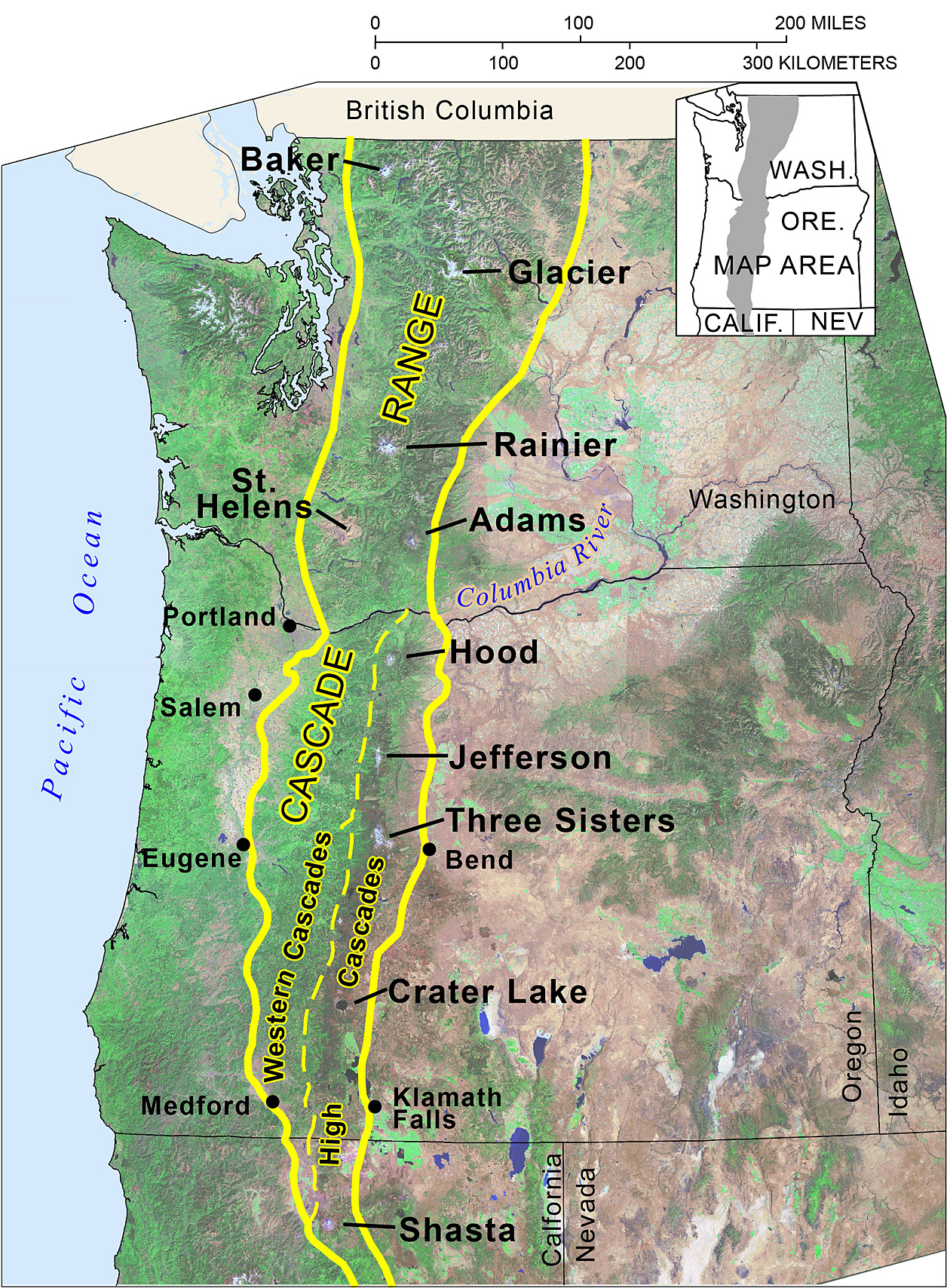
![Cascade Range in conterminous United States. Oregon segment customarily divided into the Western Cascades and High Cascades subprovinces. Labels near major volcanoes show, from north to south, Mount Baker, Glacier Peak, Mounts Rainier, St. Helens, and Adams (all in Washington); Mounts Hood and Jefferson, Three Sisters, and Crater Lake (Mount Mazama) (all in Oregon); and Mount Shasta (California). Image is clipped north of Lassen Peak in California (also a major Cascade Range volcano). Base map is composited Landsat image.]()
Fig. 1.
Cascade Range in conterminous United States. Oregon segment customarily divided into the Western Cascades and High Cascades subprovinces. Labels near major volcanoes show, from north to south, Mount Baker, Glacier Peak, Mounts Rainier, St. Helens, and Adams (all in Washington); Mounts Hood and Jefferson, Three Sisters, and Crater Lake (Mount Mazama) (all in Oregon); and Mount Shasta (California). Image is clipped north of Lassen Peak in California (also a major Cascade Range volcano). Base map is composited Landsat image.
-
![]()
Figure 2: Mt. Jefferson, view from the southeast, 1965.
Courtesy USGS, photo by G.W. Walker
-
![Map showing precipitation and characteristic vegetation zones for western Oregon forests. Gray dashed lines mark Cascade Range subprovince boundaries for Western Cascades and High Cascades, from figure 1. In Oregon, precipitation generally increases eastward into the Cascade Range, then diminishes abruptly east of the range crest. Vegetation zones after R. Frenkel and S Kolar as depicted in Atlas of Oregon (1st ed., 1970). A similar zone map published more recently as Ecoregions of Oregon by Thorson and others (2003). Precipitation base map, created July 10, 2012.]()
Figure 3.
Map showing precipitation and characteristic vegetation zones for western Oregon forests. Gray dashed lines mark Cascade Range subprovince boundaries for Western Cascades and High Cascades, from figure 1. In Oregon, precipitation generally increases eastward into the Cascade Range, then diminishes abruptly east of the range crest. Vegetation zones after R. Frenkel and S Kolar as depicted in Atlas of Oregon (1st ed., 1970). A similar zone map published more recently as Ecoregions of Oregon by Thorson and others (2003). Precipitation base map, created July 10, 2012. used with permission from PRISM Climate Group, Oregon State University, Copyright © 2012, http://prism.oregonstate.edu.
-
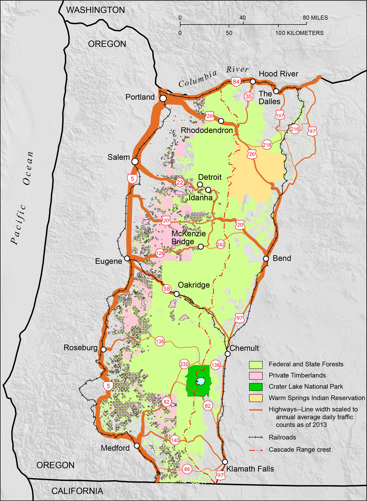
![Major roads and railroads that bound and cross the Cascade Range, Oregon. Also shown is ownership for federal and state holdings, tribal land, and large-corporation private lands. Crater Lake National Park is Oregon’s only national park. Road line widths are scaled for annual average daily traffic in 2013, when more than 75,000 vehicles traveled U.S. Interstate 5 between Portland and Salem, and fewer than 1,000 vehicles traveled on minor, paved Cascade crossings.]()
Fig. 4.
Major roads and railroads that bound and cross the Cascade Range, Oregon. Also shown is ownership for federal and state holdings, tribal land, and large-corporation private lands. Crater Lake National Park is Oregon’s only national park. Road line widths are scaled for annual average daily traffic in 2013, when more than 75,000 vehicles traveled U.S. Interstate 5 between Portland and Salem, and fewer than 1,000 vehicles traveled on minor, paved Cascade crossings. Data from Oregon Geospatial Enterprise Office website, http://www.oregon.gov/DAS/CIO/GEO/Pages/sdlibrary.aspx.
-
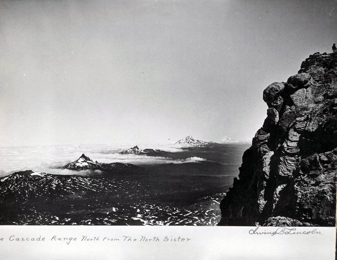
![]()
View from North Sister of Mt. Washington, Three-Fingered Jack, Mt. Jefferson, and Mt. Hood.
Courtesy Oregon Hist. Soc. Research Lib., 022265
-
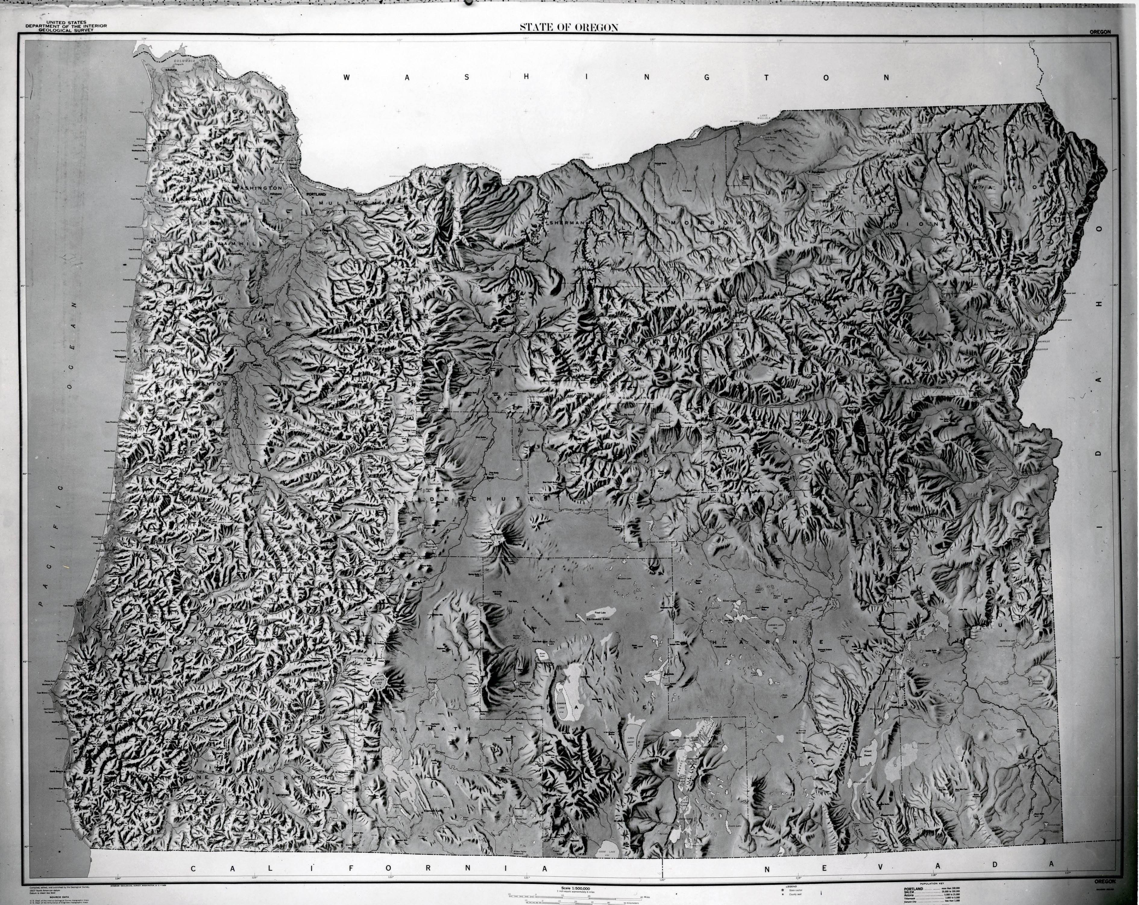
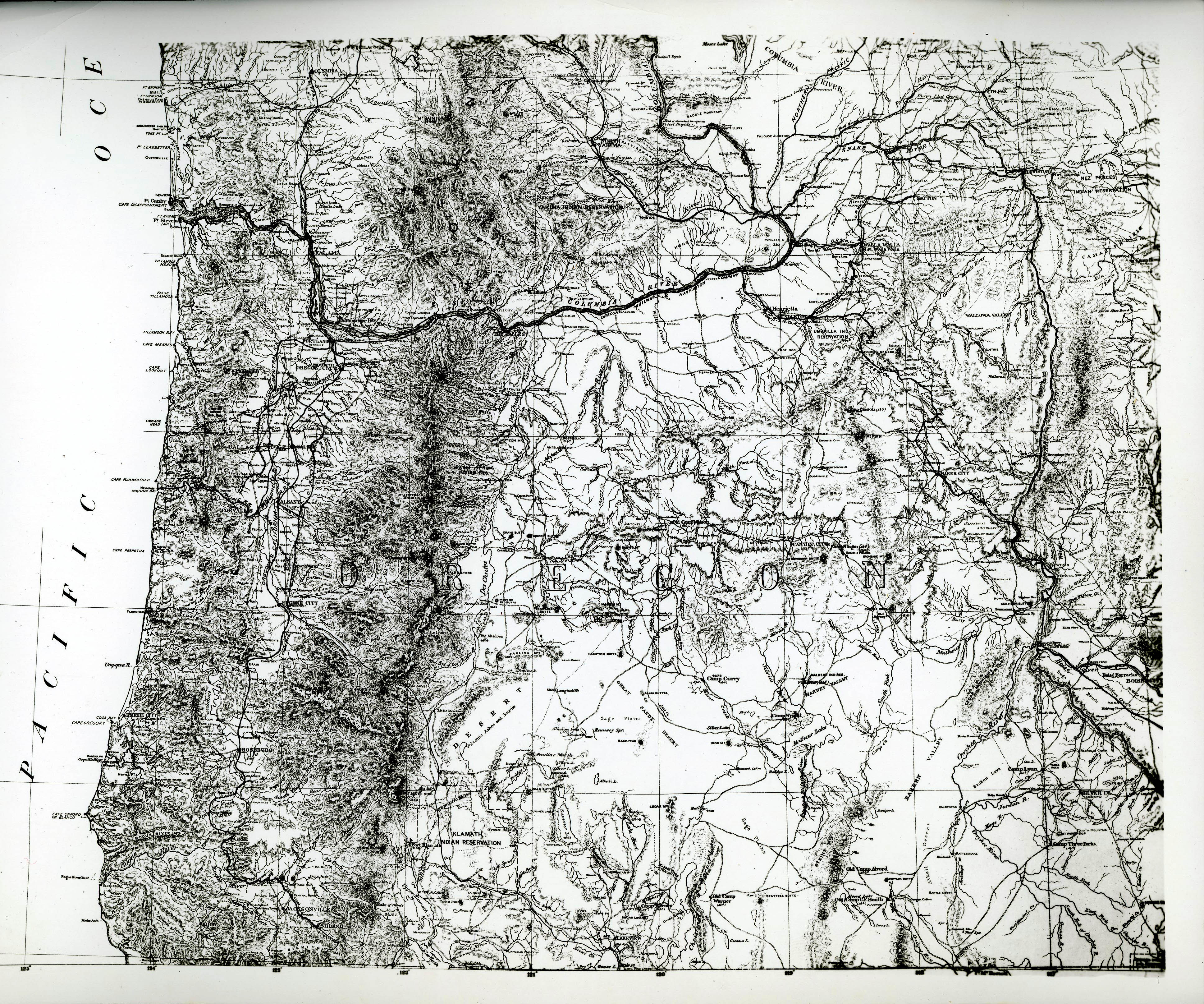
![]()
U.S.G.S. topographical map of Oregon, 1966.
Courtesy Oregon Hist. Soc. Research Lib., 67513B
-
![]()
Map of the Department of the Columbia, 1811, by J.W. MacMurry.
Courtesy Oregon Hist. Soc. Research Lib., 217406