Media Collection: Ice Age
-
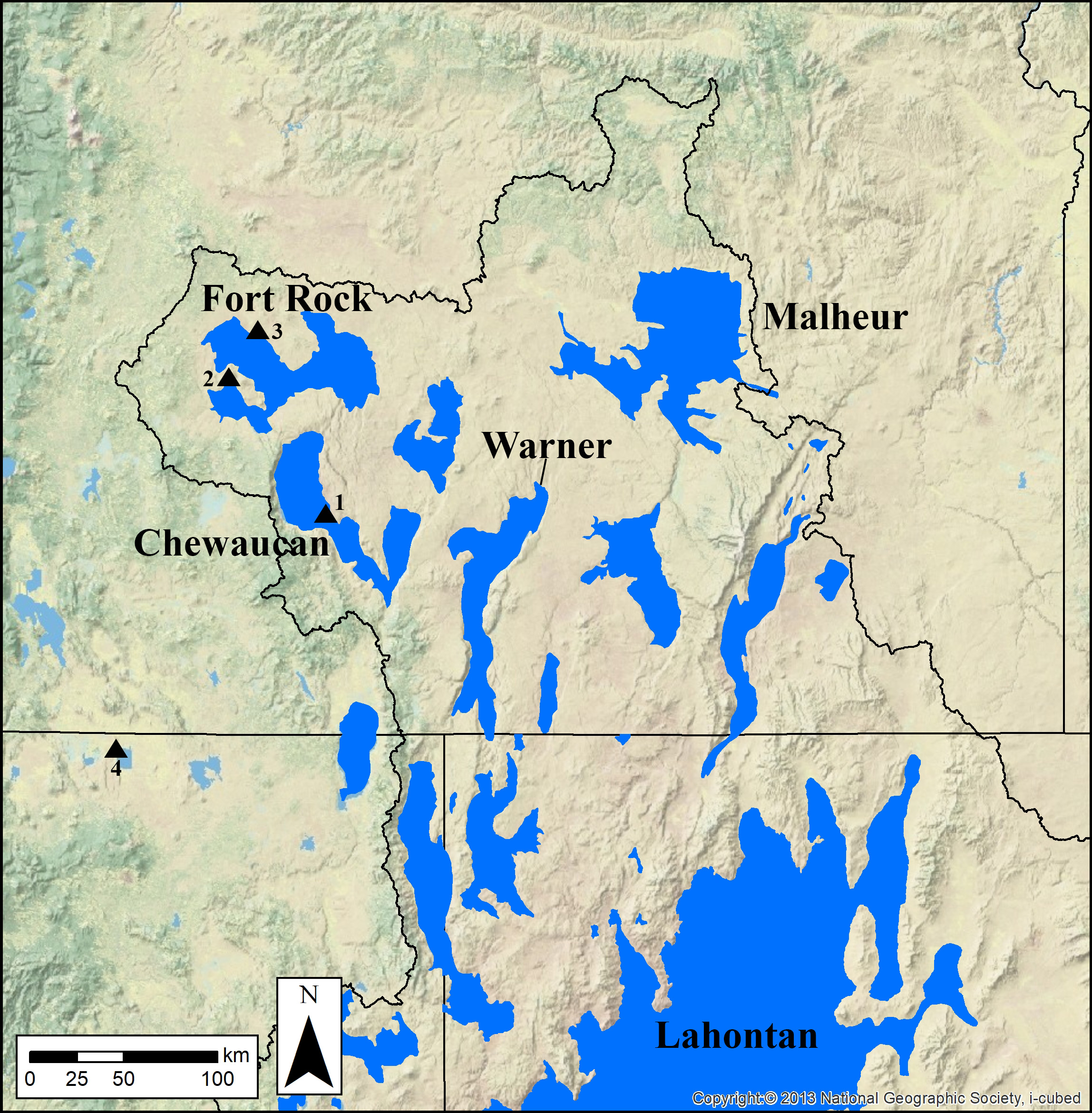
![Blue areas and labels show pluvial lake extents at their highstands. Triangles show archaeological sites: (1) Paisley Caves; (2) Connley Caves; (3) Cougar Mountain Cave; and (4) Tule Lake Rockshelter.]()
Fig. 1: Map of the Northern Great Basin at the Oregon-California-Nevada border.
Blue areas and labels show pluvial lake extents at their highstands. Triangles show archaeological sites: (1) Paisley Caves; (2) Connley Caves; (3) Cougar Mountain Cave; and (4) Tule Lake Rockshelter. Courtesy Richard Rosencrance
-
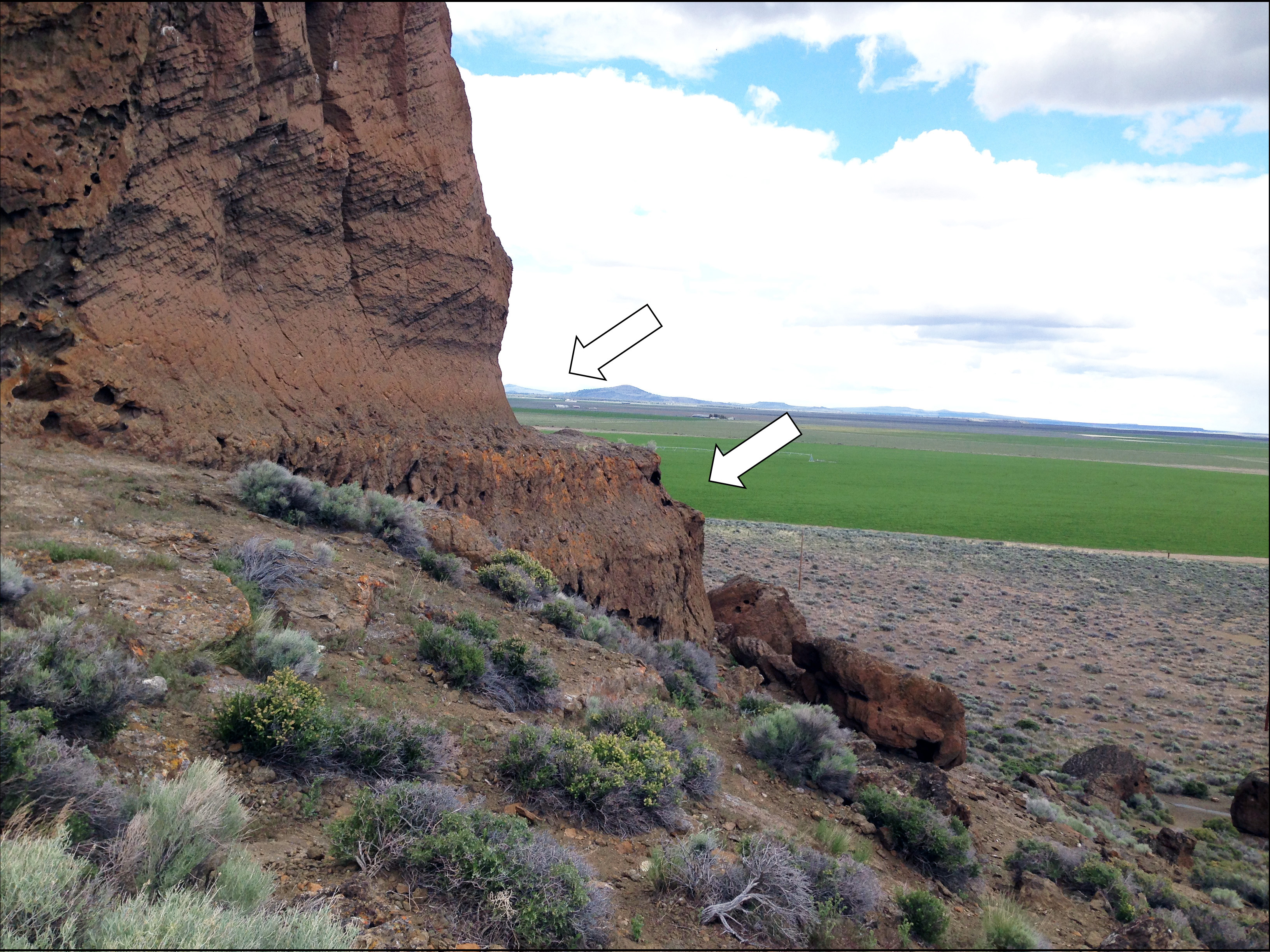
![Pluvial lakes had to have persisted at these elevations for considerable amounts of time to form such distinct cuts.]()
Fig. 2: Ice Age shorelines (white arrows) cut into the Fort Rock formation by wave action.
Pluvial lakes had to have persisted at these elevations for considerable amounts of time to form such distinct cuts. Photo courtesy Tom Connolly