The Cascade mountain system extends from northern California to central British Columbia. In Oregon, it comprises the Cascade Range, which is 260 miles long and, at greatest breadth, 90 miles wide (fig. 1). Oregon’s Cascade Range covers roughly 17,000 square miles, or about 17 percent of the state, an area larger than each of the smallest nine of the fifty United States. The range is bounded on the east by U.S. Highways 97 and 197. On the west it reaches nearly to Interstate 5, forming the eastern margin of the Willamette Valley and, farther south, abutting the Coast Ranges.
Along its Oregon segment, the Cascade Range is almost entirely volcanic in origin. The volcanoes and their eroded remnants are the visible magmatic expression of the Cascadia subduction zone, where the offshore Juan de Fuca tectonic plate is subducted beneath North America. Subduction occurs as two lithospheric plates collide, and an underthrusted oceanic plate is commonly dragged into the mantle by the pull of gravity, carrying ocean-bottom rock and sediment down to where heat and pressure expel water. As this water rises, it lowers the melting temperature in the overlying hot mantle rocks, thereby promoting melting. The molten rock supplies the volcanic arcs with heat and magma. Cascade Range volcanoes are part of the Ring of Fire, a popular term for the numerous volcanic arcs that encircle the Pacific Ocean.
Western Cascades and High Cascades
In Oregon, the Cascade Range is customarily divided into two physiographic subprovinces, the Western Cascades and the High Cascades (fig. 1). The Western Cascades, or Old Cascades in some tourist logs, encompasses volcanic rocks as old as 45 million years. It is a deeply eroded subprovince. West-flowing and northwest-flowing streams have carved canyons as deep as 3,700 feet, measured from adjacent ridgetops to canyon floors.
In contrast, the High Cascades subprovince is little eroded. This distinction arises for two reasons. First, broad uplift of the Western Cascades sometime after 8 million years ago created steep rivers that propelled erosional downcutting. Second, at about that time, volcanism was focused along the axis of the High Cascades, filling old canyons and building up the spine of the range. The Western Cascades subprovince, with only sparse small volcanoes active in the past four million years, was spared the periodic infilling of its canyons by extensive volcanic deposits. Consequently, streams were able to erode unabated, deepening and broadening their courses and continuing to create relief in the Western Cascades.
Volcanic Centers
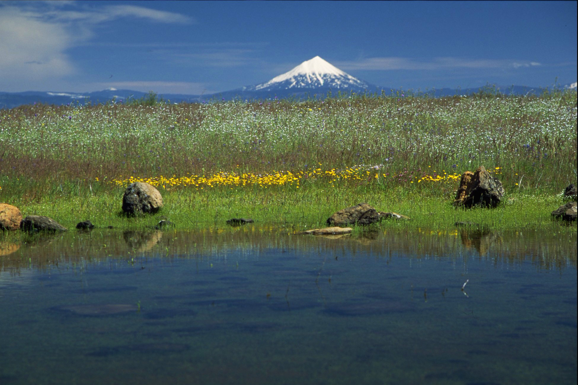
The High Cascades in Oregon are coincident with the currently active volcanic arc, a nearly continuous band of large, long-lasting volcanic centers and smaller volcanoes, cinder cones, and lava domes. Nearly all of these have been active since four million years ago. To the casual observer, many of the smaller vents and volcanoes are merely bumps on the landscape. Better known are the prominent pinnacles of the glaciated shields or stratocones, such as Three Fingered Jack, Mount Washington, and Mount Thielsen and also the smoother slopes of the less-eroded Mount Bachelor and Mount. McLoughlin.
But the crowning glories of the Oregon Cascades are the major volcanic centers—Mount Hood, Mount Jefferson, the Three Sisters, and Crater Lake, which sits in the caldera created by the eruption of Mount Mazama (table 1). These major centers are set apart by their longevity and overall size (though not necessarily their present-day height). Volcanic activity at the major centers has persisted for many thousands of years, whereas the lesser volcanoes flare and go extinct more quickly, over spans of many months to centuries (fig. 2). The major centers, with their longer life spans, develop diverse magmatic systems whose eruptive products can span the entire compositional range from basalt to andesite, dacite, and rhyolite. The hot subterranean environment for the long-lived centers is thought to host the major part of Cascade-related geothermal resources.
In terms of morphology (terrain aspects), the Oregon Cascade Range differs from that in Washington State. In Washington, the active volcanic arc is composed chiefly of isolated large volcanoes that have been built on ridgetops of substantially older bedrock, amid deeply eroded canyons. In contrast, the volcanically active part of the Oregon Cascade Range is almost entirely young volcanoes along the entire chain. The major centers in Oregon are embedded in and superimposed on a broad constructional landscape composed of volcanic rocks thousands of feet thick. The Oregon High Cascades presents, overall, a less rugged alpine landscape than its Washington counterpart.
Glaciation
Numerous glacial episodes have iced over the Oregon Cascade Range during the past two million years. The most recent glacial maximum was about 20,000 years ago, when ice formed a continuous cap from north of Mount Jefferson southward to Mount McLoughlin. At that time, lobes of ice descended into the major river valleys along the west side of the range, reaching as low as 2,000 feet in altitude in the North Santiam and McKenzie River drainages. Glacial ice is dynamic, pulled downslope and down valley by gravity, and rock debris shed from canyon walls is carried along a glacier’s margins or transported to its snout. Upon full meltback, ridges of debris outline the past extent of glaciers in the form of lateral and terminal moraines. One consequence is moraine-dammed lakes, such as Crescent, Odell, Cultus, Miller, and Suttle Lakes, all of them popular for fishing, boating, and swimming.
The few glaciers today in the Oregon Cascade Range exist only on high volcanoes such as Mount Hood, Mount Jefferson, and the Three Sisters. For several millennia these glaciers have grown and shrunk in response to climate change. The last episode of growth, referred to as the Little Ice Age, culminated in the late nineteenth century. Its ice advance was limited in extent and did not form a continuous ice cap, but it still left small distinct moraines poised above about 6,800 feet, just a few hundred feet below the toes of still-visible glaciers on the highest Cascade peaks.
Cascade Range Divides the State
Nothing divides a state like a major mountain range, and the Cascade Range has been a notable barrier. Exemplary of mountain-as-barrier is the contrast of Oregon’s wetter west side and drier east side. Moisture-laden air streaming from the Pacific Ocean cools as it ascends the west flank of the Cascades. Cloud formation is a consequence—the well-known orographic effect—commonly leading to rain or snow. West-flank precipitation in the Cascade Range increases upslope to more than 130 inches (3.3 meters) a year at the Cascade crest (fig. 3), whereas the eastern flank and most of the state’s east side receive less than 20 inches (0.5 meter) in yearly precipitation. This precipitation gradient persists but is less dramatic in the southern part of the Cascade Range, owing to storm paths but also because the Klamath Mountains (part of the Coast Ranges) expand the breadth and average height of the coastal mountains and wring more moisture from incoming weather systems than the lower and narrower Coast Range farther north.
Vegetation Zones
Vegetation zones follow the precipitation patterns. Climax forest in much of the Western Cascades is western hemlock (fig. 3), a zone that hosts the preponderance of Oregon’s Douglas-fir timberlands. In the southern part of the Western Cascades, with less precipitation east of the Klamath Mountains, the same longitudinal zone is characterized by needleleaf-broadleaf forest. Upslope, each of these zones yields to subalpine forests of mountain hemlock, Pacific silver fir, and subalpine fir before passing into rocky alpine zones above the timberline. Downslope on the drier eastern flank, the Cascade Range vegetation is characterized by a forest zone of chiefly ponderosa pine (fig. 3).
The Work of Rivers
River capacity is another response to the orographic effect. For example, streams originating on the west flank of the Cascade Range, in their combined output, transport roughly ten times greater flow than east-flank streams. West-flank streams in the southern part of the Oregon Cascade Range, such as the Rogue, South Umpqua, and North Umpqua Rivers, find their way directly to the ocean by cutting west through the coastal mountain system. Farther north, however, by about the latitude of Eugene, westside Cascade streams begin coalescing into a single major river, the Willamette, which flows north into the Columbia. In many ways the Willamette River is a Cascade Range stream. It gains about 20 percent of its stream flow from Coast Range tributaries, but most of its water comes from Cascade sources: Middle Fork Willamette, McKenzie, South Santiam, North Santiam, and Clackamas Rivers. The Cascade tributaries to the Willamette have about four times the drainage area as Coast Range tributaries.
Eastside streams of the Cascades in Oregon coalesce into the Deschutes and Klamath Rivers. Tributaries to this pair of rivers share a topographic divide just north of Chemult. Streams of the Deschutes river system flow broadly north from there to join the Columbia, whereas the Klamath River flows south and then west to the Pacific. The Klamath River is exceptional for cutting completely across the Cascade Range. It penetrates through the mountains west of Klamath Falls, then winds through northern California to the Pacific Ocean.
Most notable of trans-Cascade rivers is the Columbia, which traverses the range at the latitude of Portland. The path it crosses is not coincidence but is an area that has been topographically low many times in the geologic past. For example, voluminous lava flows of the Columbia River Basalt Group, erupted from dikes in northeast and southeast Oregon and southwest Idaho, flooded through low points in the same broad stretch of the Cascade Range between 17 and 12 million years ago. These lava flows buried the area of present-day Portland and the northern Willamette Valley while spreading westward to reach the Pacific Ocean.
Across-Range Traverses
The geology of the Columbia River through the Cascade Range has shaped human history as well. The Columbia was a travel corridor for Native peoples for millennia. It played prominently in oral traditions that predate European contact, carving the broad gorge between Cascade volcanoes Mount Hood and Mount St. Helens. In the early 1800s, Meriwether Lewis and William Clark followed the river westward on their journey of discovery. Since then, the Columbia River has been the chief corridor for people and goods traveling across Oregon by road, rail, or barge, owing to the comparatively easy transect provided by the river’s valley.
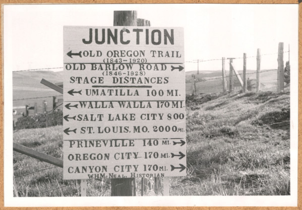
But the free-flowing Columbia River of the past, with its narrow gorge and hazardous rapids, was a challenging route across the Cascade Range. Native American trails and then stage and wagon roads provided crossings farther south, such as the Barlow Road, Santiam Pass, and Willamette Pass. Seven of those roads were well traveled by 1890, and two trans-Cascade highways were surfaced by 1930—the Columbia River Highway and the road to Crater Lake (fig. 4). The Crater Lake road, more or less along today’s Oregon Highway 62, traversed the upper Rogue River valley, crossed the summit south of the lake, and continued east to Fort Klamath. By 1950, the paved-road system of highways across the Cascade Range looked much as it does today. As might be expected, Oregon’s greatest across-Cascade average daily vehicle traffic now crosses on Interstate 84, constructed in the 1970s through the Columbia River Gorge.
Railroads first crossed the Cascade Range in 1882 along a path down the Oregon side of the Columbia River from The Dalles to Portland. Five years later, the first Oregon-California railroad was completed west of the Cascade Range, over Siskiyou summit (similar to the route of Interstate 5). But not until 1926 was the second of Oregon’s across-Cascade rail lines finished, the route from Eugene to Klamath Falls (fig. 4). This trackage follows the Middle Fork of the Willamette River from Eugene to Oakridge, a route paralleled today by Oregon Highway 58.
Continuing southeast from Oakridge, the rail line makes two large hairpin turns while ascending to about 4,800 feet altitude, where trains slip into a 3,700-foot-long tunnel. Few hikers on the Pacific Crest National Scenic Trail are aware that diesel locomotives rumble 100 feet beneath them at the mountain crest just south of Willamette Pass. The tunnel daylights east of the crest on the south side of Odell Lake, at the old Cascade Summit siding. Although used mainly by freight trains, the route is also used by Amtrak’s Coast Starlight, which carries passengers along the Eugene-Klamath Falls alignment across the Cascade Range.
Natural Resources
The main economic resource extracted from the Cascade Range has been timber from privately held tree farms and federal forestlands (fig. 4). The expansion of population and transportation routes southward through the Willamette Valley and beyond during the early to mid-1900s spurred the growth of mill towns in valleys along the Cascade Range. Timber harvests peaked in the 1970s to mid-1980s, but management decisions thereafter reduced the availability of land for timber production from federally managed sources. Consequently, Cascade Range timber harvests, which were taken largely from national forests, plunged dramatically, with a devastating effect on many timber towns. Enhanced tourism and recreation have never come close to matching the economic value once created by the timber harvests of the twentieth century.
The Cascade Range provides opportunities for sightseeing, hiking, camping, fishing, boating, hunting, skiing, and snow play. Visitation at Oregon’s sole national park, Crater Lake, averages about a half-million people per year. National forest visits, which occur across a much larger area, are ten times more numerous, with annual visitation in the period around 2012 at about 5.3 million for the Oregon Cascade Range national forests combined. Nearly one-third of those visits were for winter skiing at resorts near Mount Hood and Mount Bachelor. Oregon residents make the greatest use, by far, of recreational opportunities in the Oregon Cascade Range. After accounting for visitors from southernmost Washington or northern California, only 15 to 20 percent of forest visits originate from other states, and foreign visitors are only one percent or so.
Geologic resources have seen only miniscule extraction from Cascade Range areas. The industrial products, chiefly sand and gravel, are located too far from population centers to warrant production for more than local use. Precious metals (e.g., gold, silver) and base metals (copper, molybdenum, lead, zinc) were mined in the late 1800s and early 1900s at a few Western Cascades localities where small igneous intrusions, all older than about eight million years, led to localized hydrothermal enrichment of ore in quartz vein deposits. These intrusions are probably the ancient roots of large volcanic systems, exposed today by the uplift and deep erosion of the Western Cascades. At several sites, the economically viable part of the deposits has been mined out, although changing technology leads to sporadically renewed interest where mineral resource potential still exists. Erosion and stream sedimentation have stripped and redeposited some ores in stream-terrace deposits downstream from the host sites. The resulting placers are also mined, but mainly as recreational activity.
Geothermal Energy
Geothermal resources became an attractive promise in the western U.S. following the oil embargoes of the 1970s. Although the active volcanic systems of the Cascade Range have always been targets, assessing their geothermal resource potential has proven difficult. Abundant precipitation along the range crest plays havoc on the distribution of surface heat flow from magmatism in the High Cascades. Despite focused volcanism in the High Cascades, hot springs are found almost exclusively in the Western Cascades. Paradoxically, heat flow is substantially higher in the High Cascades than in the Western Cascades, but the deluge of precipitation literally washes magmatic heat down through the permeable lava of the young volcanic rocks. Heated water is shunted in aquifers to a few springs in the Western Cascades, such as Austin, Breitenbush, McCredie, Kitson, and Umpqua hot springs. These springs form a crude north-south lineament, as if aligned along some fundamental Earth structure. But their locations all lie at altitudes between about 2,500 and 3,500 feet on floors of major valleys, where deep canyons have cut into groundwater aquifers sourced in or near the High Cascades. From year to year, geothermal energy exploration is moderated by the cost of energy produced by other methods.
Water Resources
Surface water resources of the Cascade Range are managed for flood control, hydropower, irrigation, and recreation. Segments of the Willamette River’s main tributaries were dammed during the mid-twentieth century by the U.S. Army Corps of Engineers, chiefly for flood control. Reservoirs behind eight of those dams have hydropower-generating capacity, with additional hydropower from commercial operations on reservoirs, forebays, penstocks, and powerhouses on the Clackamas, North Umpqua, Rogue, Klamath, and Deschutes Rivers. Together, these systems have a capacity of about 1.48 gigawatts (GW), similar to single Columbia River dams at The Dalles (1.8 GW) or Bonneville (1.1 GW). Just over 30 percent of the Cascades-based capacity is from the three dams in the Deschutes River hydropower system.
Throughout the Cascade Range, the number of dams may decrease in the future, especially where dams were built as part of federally issued long-term leases. Each lease renewal requires dam improvements for enhanced fish passage and other river-management aspects, the modifications for which often exceed the expected investment returned from power generation. Although the Marmot and Little Sandy dams of the Sandy River hydropower system were removed in 2007–2008, several dams were relicensed recently, and diminished future snowpacks as a likely consequence of climate change may increase the importance of dams for water storage.
Watersheds in the Cascade Range produce high-quality drinking water. Famous among them is the Bull Run watershed on Mount Hood, which once supplied all of Portland’s water needs (the Columbia well field now augments Portland’s water supply in low-flow months). Water from Bull Run is low in dissolved minerals and meets or exceeds all drinking water-quality standards as measured at the entry point to the distribution system. Quality is so high that the city does not filter the water but disinfects it to remove naturally occurring microorganisms.
Rugged, diverse, and dynamic, the Oregon Cascade Range provides a fitting backdrop for forest production, recreational activities, and surface and groundwater resources that serve Oregon and the nation.
-
![]()
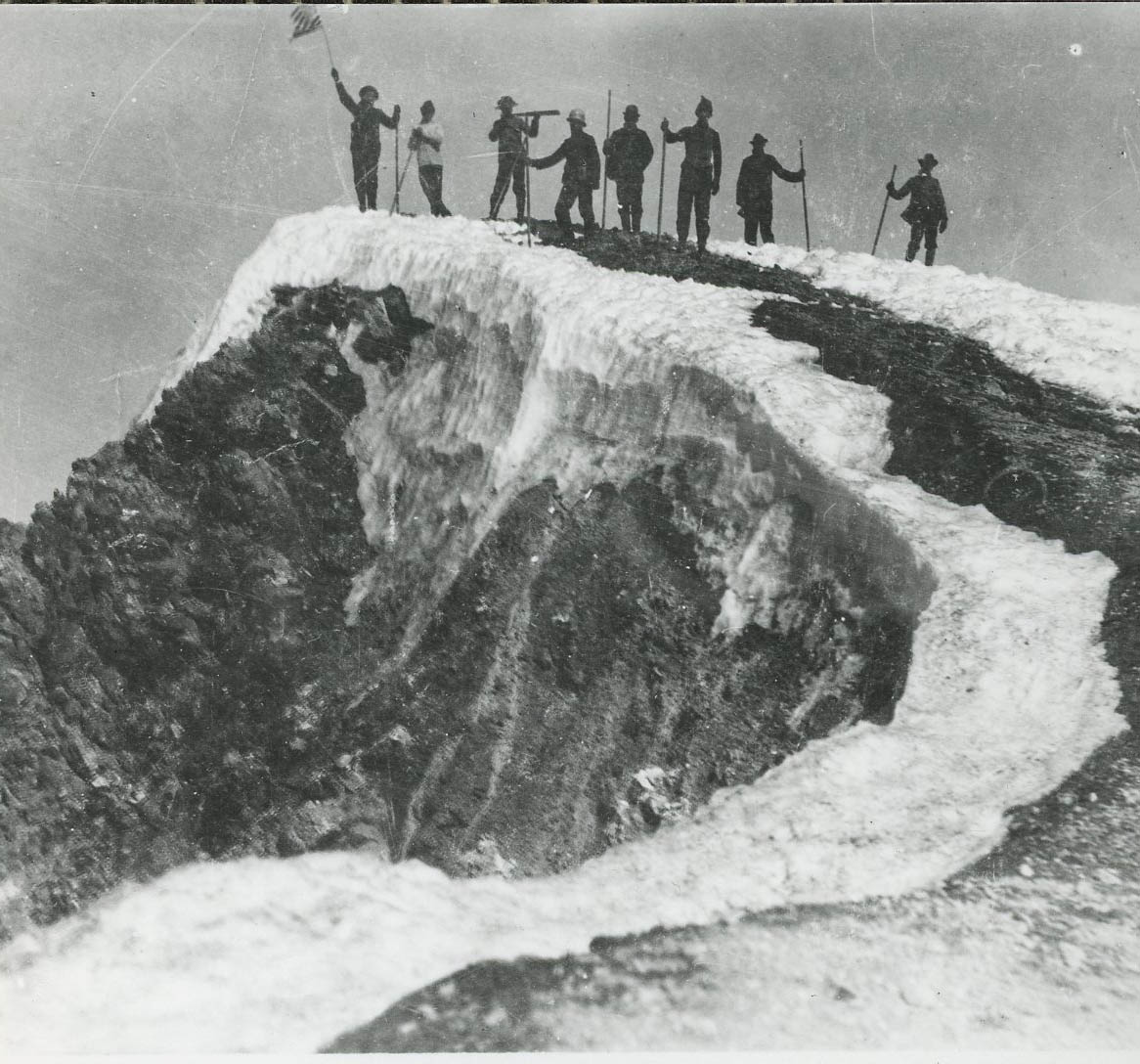
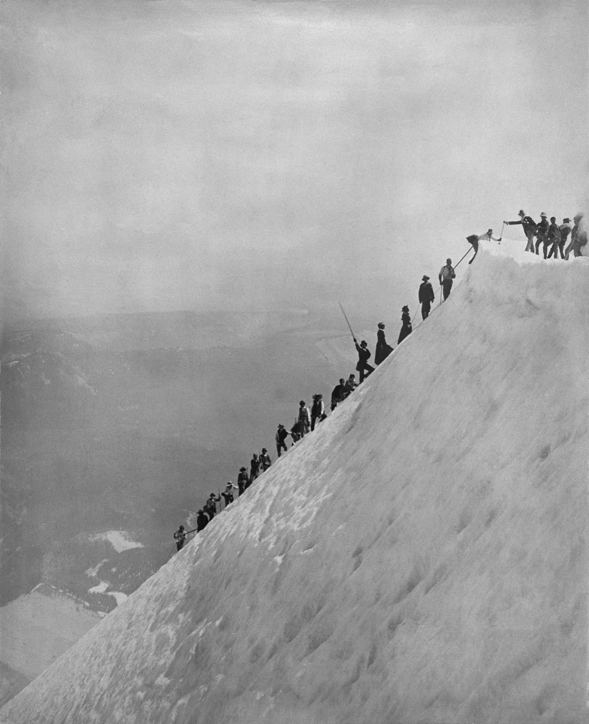
Climbers on the the summit of Mt. Hood, OrHi25468.
Courtesy Oregon Hist. Soc. Research Lib., OrHi25468
-
![]()
Mt. Hood at Sunset, by Eliza Barchus.
Oreg. Hist. Soc. Research Lib., bb006445
-
![]()
Fritz Broeske makes his first ascent of Mt. Hood, 1931.
Courtesy Oregon Hist. Soc. Research Lib., 009661
-
![]()
Skiing club in the Cascades.
Courtesy Oregon Hist. Soc. Research Lib., OrHi75891
-
![]()
Mazama Club members climbing Mt. Hood, c. 1932.
Courtesy Oregon Hist. Soc. Research Lib., 004948
-
![]()
Mt. Jefferson, 1936.
Courtesy Oregon Hist. Soc. Research Lib., 000987
-
![]()
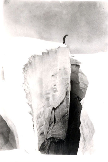
Climbers with Alpenstocks in the Great Crevasse, Mt. Hood, c. 1895.
Courtesy Oregon Hist. Soc. Research Lib., 016502
-
![]()
Oregon Journal ski school, 1940.
Courtesy Oregon Hist. Soc. Research Lib., 47137
-
![]()
Ascent of Mt. Washington by climbers from Bend, c. 1923, Arman Furrer.
Courtesy Oregon Hist. Soc. Research Lib.
Documents
Related Entries
-
![Barlow Road]()
Barlow Road
The Barlow Road is a historic wagon road that created a new route on th…
-
![Crater Lake National Park]()
Crater Lake National Park
Crater Lake National Park, which the U.S. Congress set aside in 1902, i…
-
![Glaciers in Oregon]()
Glaciers in Oregon
Glaciers and permanent snowfields—found in many western states, includi…
-
![Mount Hood]()
Mount Hood
Mount Hood is a stratovolcano in northwest Oregon located about fifty m…
-
![Mount Mazama]()
Mount Mazama
Mount Mazama is located in the southern part of the Cascade Range, abou…
-
![Mount McLoughlin]()
Mount McLoughlin
Mount McLoughlin, at 9,495 feet, is the lowest in Oregon's chain of six…
Map This on the Oregon History WayFinder
The Oregon History Wayfinder is an interactive map that identifies significant places, people, and events in Oregon history.
Further Reading
Loy, William G. Atlas of Oregon (2d ed.). Corvallis: Oregon State Univ. Press, 2001.
Campbell, S., Dunham, P., and Azuma, D.,2004, Timber resource statistics for Oregon: U.S. Department of Agriculture Forest Service, Northwest Research Station Resource Bulletin PNW-RB-242, 67 p. http://www.fs.fed.us/pnw/pubs/pnw_rb242.pdf
Dicken, S.N. Oregon Geography: The People, the Place, and the Time, 4th ed. Ann Arbor, Mich., Edwards Brothers, 1965.
Hildreth, W., 2007, Quaternary magmatism in the Cascades; geologic perspectives: U.S. Geological Survey Professional Paper 1744, 125 p. http://pubs.usgs.gov/pp/pp1744/.
Hildreth, W., Fierstein, J., and Calvert, A.T., 2012, Geologic map of Three Sisters volcanic cluster, Cascade Range, Oregon: U.S. Geological Survey Scientific Investigations Map 3186, 2 sheets, scale 1:24,000. http://pubs.usgs.gov/sim/3186/
Ingebritsen, S.E., Mariner, R.H., and Sherrod, D.R. "Hydrothermal systems of the Cascade Range, north-central Oregon." U.S. Geological Survey Professional Paper 1044-L, 86 p. 1994. http://pubs.er.usgs.gov/publication/pp1044L
Johnson, D.M., Petersen, R.R., Lycan, D.R., Sweet, J.W., and Neuhaus, M.E. Atlas of Oregon Lakes. Corvallis: Oregon State University Press, 1985.
MacLeod, N.S., and Sherrod, D.R., 1992, Reconnaissance geologic map of the west half of the Crescent 1° by 2° quadrangle, central Oregon: U.S. Geological Survey Miscellaneous Investigations Map I-2215, scale 1:250,000. http://pubs.er.usgs.gov/publication/i2215
Major, J.J., O’Connor, J.E., Podolak, C.J., Keith, M.K., Grant, G.E., Spicer, K.R., Pittman, S., Bragg, H.M., Wallick, J.R., Tanner, D.Q., Rhode, A., and Wilcock, P.R., 2012, Geomorphic response of the Sandy River, Oregon, to removal of Marmot Dam: U.S. Geological Survey Professional Paper 1792, 64 p. and data tables. [http://pubs.usgs.gov/pp/1792/]
Moffatt, R.L., Wellman, R.E., and Gordon, J.M., 1990, Statistical summaries of streamflow data in Oregon, volume 1, monthly and annual stream flow and flow-duration values: U.S. Geological Survey Open-File Report 90-118, 413 p.
O’Connor, J.E., Hardison, J.H., III, and Costa, J.E., 2001, Debris flows from failures of Neoglacial-age moraine dams in the Three Sisters and Mount Jefferson Wilderness Areas, Oregon: U.S. Geological Survey Professional Paper 1606, 93 p. http://pubs.usgs.gov/pp/1606/
Priest, G.R. "Volcanic and tectonic evolution of the Cascade volcanic arc, central Oregon." Journal of Geophysical Research 95.B12 (1990): 19583–19600.
Priest, G.R., Woller, N.M., Black, G.L., and Evans, S.H., 1983, Overview of the geology of the central Oregon Cascade Range, in Priest, G.R., and Vogt, B.F., eds., Geology and geothermal resources of the central Oregon Cascade Range: Oregon Department of Geology and Mineral Industries Special Paper 15, p. 3–28. http://www.oregongeology.org/pubs/sp/p-SP.htm
PRISM Climate Group, 2012, Oregon average annual precipitation, 1981-2010: Corvallis, Oregon State University, Northwest Alliance for Computational Science and Engineering, online maps. http://prism.oregonstate.edu/gallery/view.php?state=OR
Reidel, S.P., Camp, V.E., Tolan, T.L., and Martin, B.S., 2013, The Columbia River flood basalt province: Stratigraphy, areal extent, volume, and physical volcanology, in Reidel, S.P., Camp, V.E., Ross, M.E., Wolff, J.A., Martin, B.S., Tolan, T.L., and Wells, R.E., eds., The Columbia River flood basalt province: Geological Society of America Special Paper 497, p. 1-43, doi:10.1130/2013.2497(01) http://specialpapers.gsapubs.org/content/497
Scott, W.E. "Temporal relations between eruptions of the Mount Bachelor volcanic chain and fluctuations of late Quaternary glaciers." Oregon Geology 52.5 (1990): 114-117. http://www.oregongeology.org/pubs/og/OGv52n05.pdf
Sherrod, D.R., and Scott, W.E., 1995, Preliminary geologic map of the Mount Hood 30- by 60-minute quadrangle, northern Cascade Range, Oregon: U.S. Geological Survey Open-File Report 95-219, scale 1:100,000. http://pubs.usgs.gov/of/1995/of95-219/
Sherrod, D.R., and Smith, J.G., 2000, Geologic map of upper Eocene to Holocene volcanic and related rocks of the Cascade Range, Oregon: U.S. Geological Survey Geologic Investigations Series Map I-2569, 2 sheets, scale 1:500,000. http://pubs.usgs.gov/imap/i-2569/.
Sherrod, D.R., Ingebritsen, S.E., Curless, J.M., Keith, T.E.C., Diaz, N.M., DeRoo, T.G., and Hurlocker, S.L. "Water, rocks, and woods: A field excursion to examine the geology, hydrology, and geothermal resources in the Clackamas, North Santiam, and McKenzie River drainages, Cascade Range, Oregon." Oregon Geology 8.5 (1996): 103–124. http://www.oregongeology.org/pubs/og/OGv58n05.pdf
Sherrod, D.R., Taylor, E.M., Ferns, M.L., Scott, W.E., Conrey, R.M., and Smith, G.A., 2004, Geologic map of the Bend 30- by 60-minute quadrangle, central Oregon: U.S. Geological Survey Geologic Investigations Map I-2683, scale 1:100,000. http://pubs.usgs.gov/imap/i2683/
Tolan, T.L., Reidel, S.P., Beeson, M.H., Anderson, J.L., Fecht, K.R., and Swanson, D.A., 1989, Revisions to the estimates of the areal extent and volume of the Columbia River Basalt Group, in Reidel, S.P., and Hooper, P.R., eds., Volcanism and tectonism in the Columbia River flood-basalt province: Geological Society of America Special Paper 239, p. 1-20. http://specialpapers.gsapubs.org/content/239
Trimble, D.E., 1963, Geology of Portland, Oregon, and adjacent areas: U.S. Geological Survey Bulletin 1119, 119 p. http://pubs.er.usgs.gov/publication/b1119


