Crater Lake National Park, which the U.S. Congress set aside in 1902, is a focal point in the Cascade Range for more than a half million visitors every year. Crater Lake was created over seven millennia ago, when the eruption and collapse of Mount Mazama generated such quantities of ash that it formed a distinct layer over several thousand square miles. The ash signifies North America's largest volcanic event of the Holocene epoch (10,000 years ago to the present) and constitutes what is likely the most recognizable time marker in the stratigraphy of the Pacific Northwest.
Crater Lake is located in the collapsed caldera, which is roughly 6 by 9 kilometers (3.7 by 5.5 miles). What sets Crater Lake apart from every other lake in the United States is its depth. At 594 meters (about 1,949 feet), it is the second deepest lake in North America (Great Slave Lake in Canada’s Northwest Territories is the deepest). It is also one of the world's clearest lakes. Clear to a depth of 40 meters (about 130 feet), the lake is essentially a closed basin, with no visible inlets or outlets. The clarity of a lake is largely dependent on a dearth of suspended particles in the water column. Unlike most lakes, relatively few phytoplankton (microscopic plants) are in the top fifty feet (15 meters) of Crater Lake.
For centuries, the Klamath and Modoc people, the Yahooskin Band of Northern Paiute Indians, and the Cow Creek Band of Umpqua Indians have maintained deep ties to what is now Crater Lake National Park. Their ancestors witnessed the collapse of Mount Mazama 7,640 calendar years ago, and many visit the park individually or in small family groups to spend time at traditional sites. Some physical features of the park’s landscape are important in many stories that reinforce tribal values and identity—at Mount Scott, for example, or at the large pumice fields near Red Cone.
Congress designated Crater Lake National Park with an original core of 64,588 hectares (about 159,600 acres). The park’s boundaries were established in the shape of a rectangle, which J. S. Diller, a geologist for the U.S. Geological Survey, thought best encompassed landscape features associated with the climactic eruption of Mount Mazama. In 2023, the park had 73,290 hectares (about 183,224 acres), exceeding the Oregon state park system in size by some 30,000 hectares (about 74,130 acres).
As part of the National Park System, Crater Lake may be most like Lassen Volcanic National Park in California. Both parks experienced collapsed calderas (the Mount Tehama caldera at Lassen is geologically older and larger than the one left by Mount Mazama), though more recent work by the US Geological Survey points to Crater Lake as a model for understanding how these features evolve. Both parks have a strong local and regional draw.
Annual visitation to Crater Lake National Park has generally been well under half a million people, partly because of the park's distance from urban areas. Most people visit only the small part of the park that gives them a view of the blue waters of Crater Lake. There are years when more visitors visit from California than from Oregon, and only three percent of visitors each year are from countries other than the United States. NPS promotional campaigns since 2015 have increased park attendance to 600,000 or more.
National Park Service designers created facilities at Crater Lake to be subordinate to the park setting, with masonry of local stone and wood-frame construction that seems to grow from the ground. More subtle is the naturalistic landscaping that uses a foreground of native plants and stone to set aside places for viewing the lake and surrounding peaks. While rustic architecture is part of the cultural tradition at Crater Lake, the site design of Rim Village and Park Headquarters draws from a tradition that can be traced to ancient Greece and Rome but is more evident in European estates during the eighteenth and nineteenth centuries.
Crater Lake is the most heavily studied caldera lake in the world. Because the lake is largely free of background noise caused by humans—such as point-source pollution or enrichment from chemical fertilizers in agricultural runoff—it is one of the best laboratories to study the intersection of earth science, limnology, climate, and evolution. Much of the research is conducted by the National Park Service, but the NPS owes much to over a century of work by scientists employed by academic institutions and the US Geological Survey. Some examples include classic ecological studies of Wizard Island, Sphagnum Bog, and the Pumice Desert.
Concern about climate change has expanded the scope of research in the park. The study of the historical climate in south-central Oregon began with Henry P. Hansen’s work on forest succession during the 1940s. By the 1970s, radiocarbon dates could be refined by using tree-ring chronologies calibrated with radiocarbon years to yield relatively accurate calendar year dates. That method was applied to mountain hemlock stands in the 1990s, which allowed the detection of long-term hydrological patterns in Crater Lake, including the reconstruction of changes in lake levels as early as the seventeenth century. Those measurements have been useful in obtaining a better picture of the annual variation in regional climate.
By 2006, scientists had found colonies of deep moss living between 100 and 420 feet below the surface of Crater Lake, generally between three and six feet thick, but occasionally up to twenty feet thick. Most of the moss lives on the shelf of Wizard Island, with some situated on the vertical walls of the caldera beneath the lake’s surface. The moss contains pollen that could help investigators determine Crater Lake’s biological history through carbon-dated core samples. The moss also has the potential to monitor the health of the Earth and the effects of global climate change.
Average surface water temperature in Crater Lake has increased by more than 6°F since 1965; the monthly temperature of the lake in July 2021 reached a record high, averaging 63°F. Long strands of fluorescent green algae sprouted from the rocks along the shoreline, coloring the lake water as recently as the summer of 2022. The effects of increased lake temperatures were acutely illustrated in the expansion of the increased range of crayfish along the shoreline at the expense of the endemic Mazama newt. The decline of the newt does not bode well for the lake’s famed clarity.
Before trout and crayfish became dominant in Crater Lake, Mazama newts were the top predator. Their diet consists primarily of aquatic insects such as midge larvae, worms, small fish, and tiny shrimp, and they evolved as a rough-skinned newt that has very low levels of toxicity to other predators. Mazama newts were at the top of the food chain in Crater Lake before humans introduced fish such as the rainbow trout or kokanee salmon. The newts depend on a food chain shaped by deep-water mixing events, which occur when the upper layers of Crater Lake hold extremely cold water in the winter. Those layers are driven downward by strong winds, which force an upwelling of nutrients that contribute to algae growth. The deep mixing replaces dissolved oxygen that is otherwise depleted by the decomposition of algae and creates conditions that allow smaller life forms to survive. Warmer winters have led to fewer deep-water mixing events, which affects the water chemistry, clarity, and biological productivity of Crater Lake. Research on the effects of climate change at Crater Lake will continue to help scientists better understand patterns and processes associated with the dynamics of a warming planet.
-
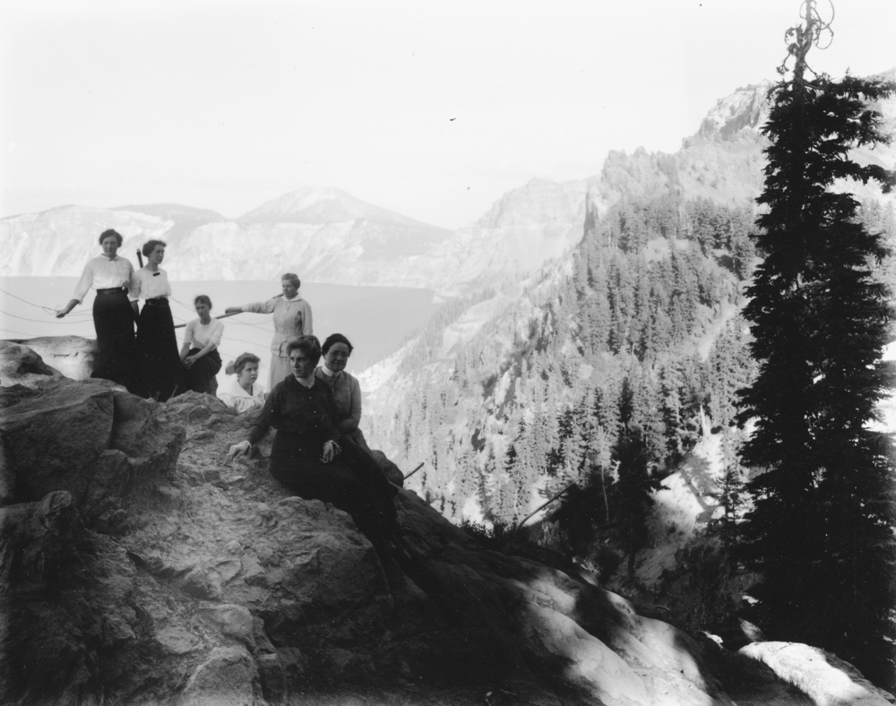
![Parkhurst Hotel group at Victor Rock, Crater Lake.]()
Crater Lake, women, bb000347 and OrHi 101922.
Parkhurst Hotel group at Victor Rock, Crater Lake. Photo by Kiser Studios, courtesy Oreg. Hist. Soc. Research Lib., bb000347
-
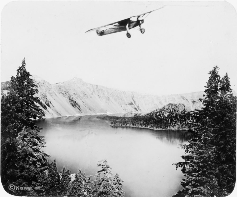
![Charles Lindbergh flies over Crater Lake.]()
Crater Lake, Lindburgh, Charles at, bb000370.
Charles Lindbergh flies over Crater Lake. Photo by Kiser Studios, courtesy Oreg. Hist. Soc. Research Lib., bb000370
-
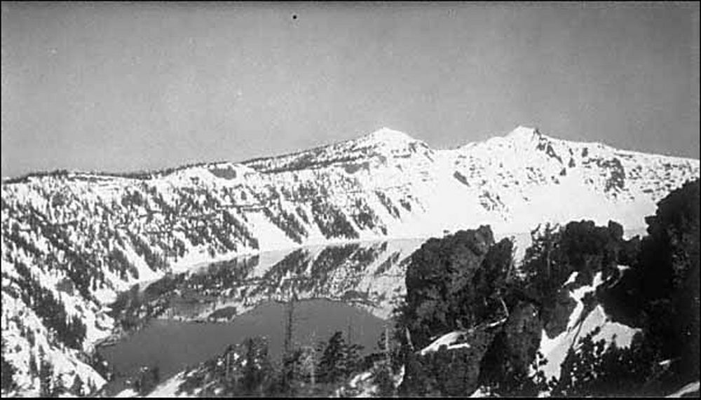
![Crater Lake in winter, 1925.]()
Crater Lake, winter, 1925, OrHi 093198.
Crater Lake in winter, 1925. Photo by John Maben, courtesy Oreg. Hist. Soc. Resarch Lib., OrHi 093198
-
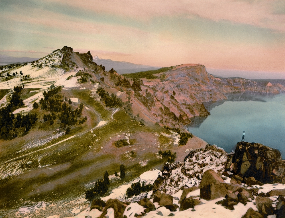
![Watchman and Llao Rock formations at Crater Lake.]()
Crater Lake, Watchman and Llao Rock, OHQ cover, 1-02.
Watchman and Llao Rock formations at Crater Lake. Oreg. Hist. Soc. Research Lib.
-
![William Steel, Phil Metscham, Dr. Hill, Senator Fulton, and Joaquin Miller at Crater Lake.]()
Crater Lake, Steel, Will G., and prominent Oregonians at, OrHi23615 and bb000360.
William Steel, Phil Metscham, Dr. Hill, Senator Fulton, and Joaquin Miller at Crater Lake. Photo by Kiser Studios, courtesy Oreg. Hist. Soc. Research Lib., bb000360
-
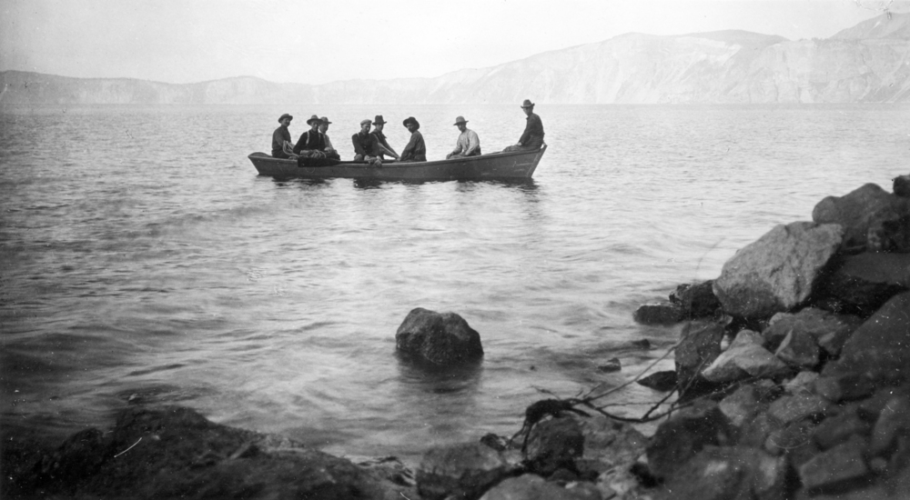
![William Steel, Phil Metscham, Dr. Hill, Senator Fulton, and Joaquin Miller on Crater Lake.]()
Crater Lake, Steel, Will, & others on boat, bb000363.
William Steel, Phil Metscham, Dr. Hill, Senator Fulton, and Joaquin Miller on Crater Lake. Photo by Kiser Studios, courtesy Oreg. Hist. Soc. Research Lib., bb000363
-
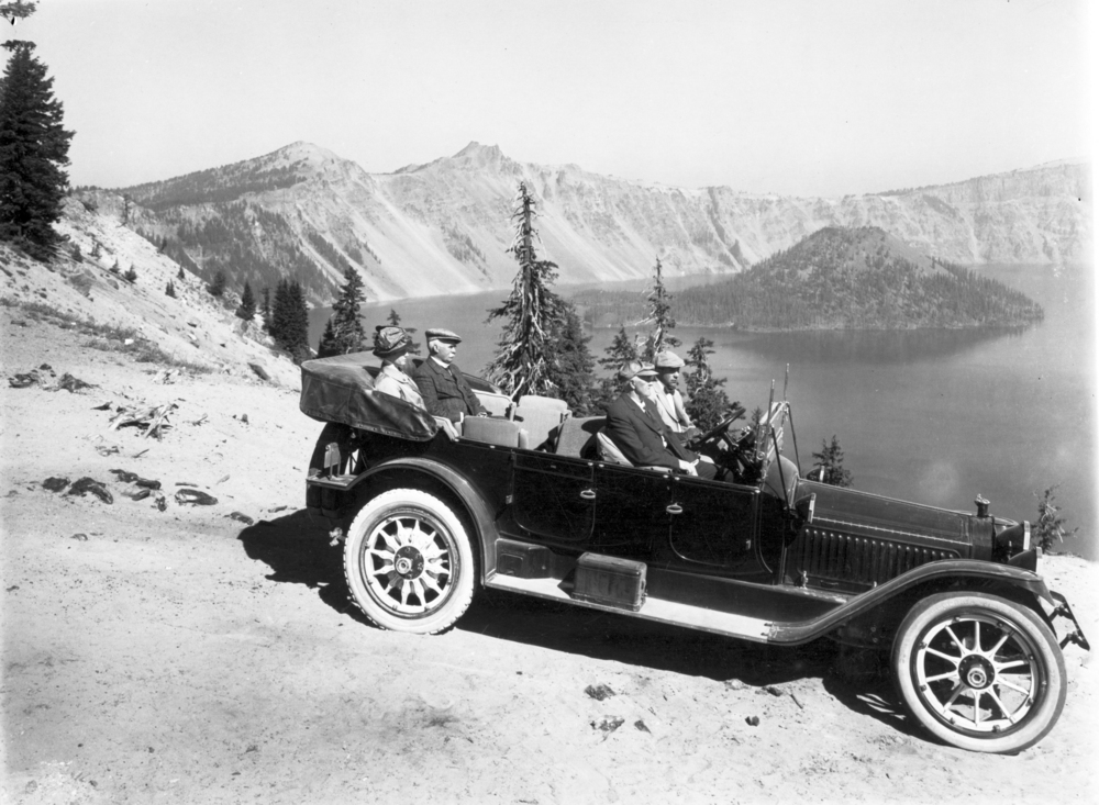
![Recreationists at Crater Lake.]()
Crater Lake, drivers at, OrHi 48833.
Recreationists at Crater Lake. Photo by Kiser Studios, courtesy Oreg. Hist. Soc. Research Lib., OrHi 48833
-
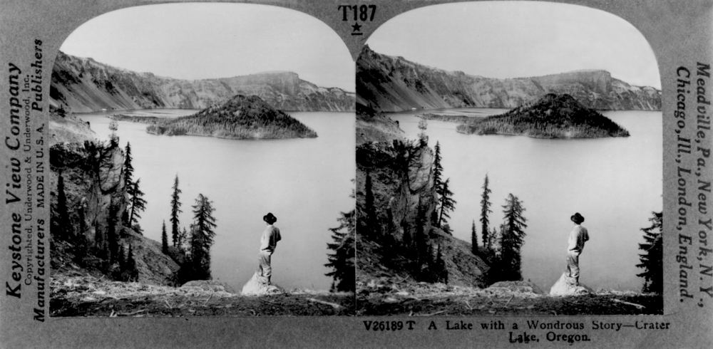
![Stereoscopic view of Crater Lake and Wizard Island, 1880s. Peter Britt likely took this photo.]()
Crater Lake, stereo, OrHi 97644.
Stereoscopic view of Crater Lake and Wizard Island, 1880s. Peter Britt likely took this photo. Oreg. Hist. Soc. Research Lib., OrHi 97644
-
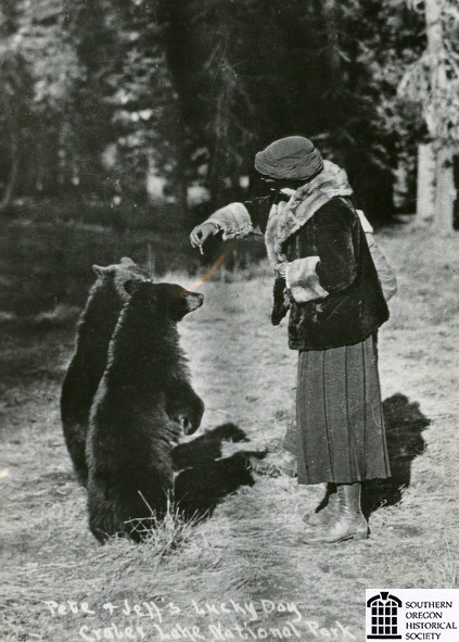
![Woman feeding bears at Crater Lake National Park, about 1920.]()
Crater Lake NP, woman feeding bears, ca 1920.
Woman feeding bears at Crater Lake National Park, about 1920. Southern Oreg. Hist. Soc., SOHS01i_20574
-
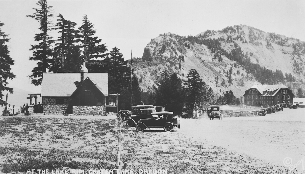
![South entrance to Crater Lake National Park, about 1925.]()
Crater Lake NP, S entrance, ca. 1925.
South entrance to Crater Lake National Park, about 1925. Photo Frank Patterson and Josephine Patterson, Southern Oreg. Hist. Soc., SOHS01i_15907
-
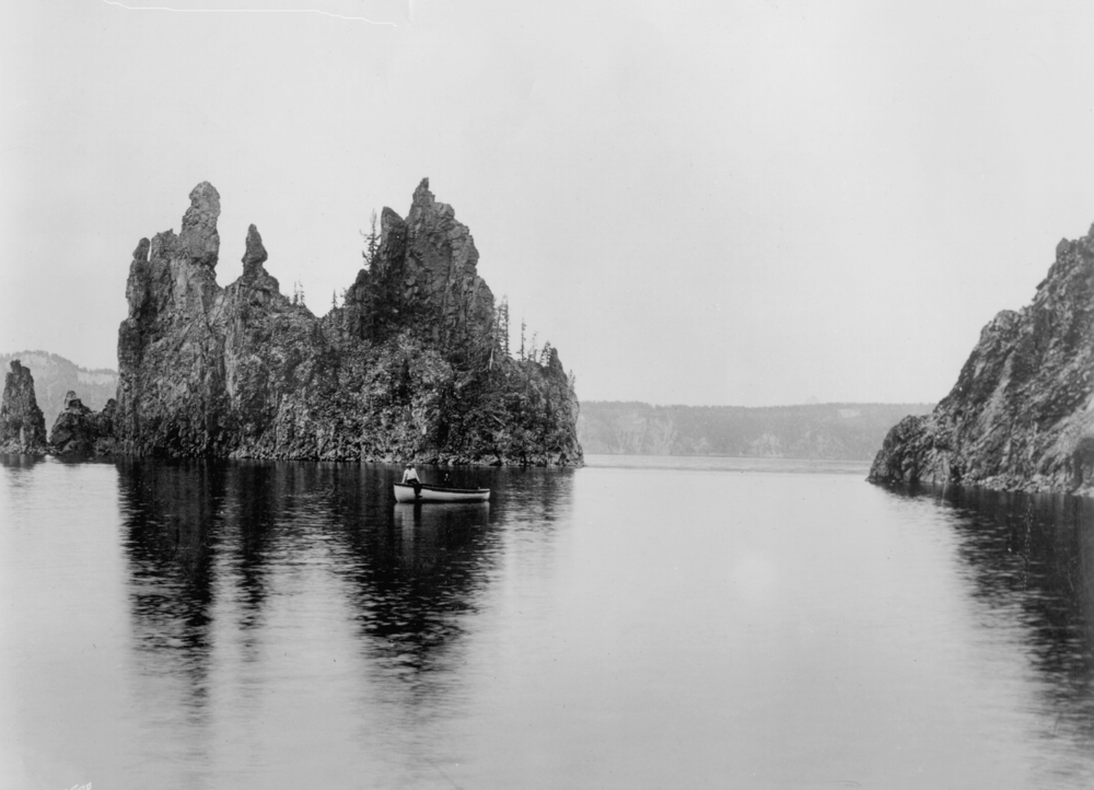
![Boating on Crater Lake.]()
Crater Lake, Gifford photo, OrHi neg,. GI10133, OHQ 1-02.
Boating on Crater Lake. Photo by Benjamin Gifford, courtesy Oreg. Hist. Soc. Research Lib., GI10133
-
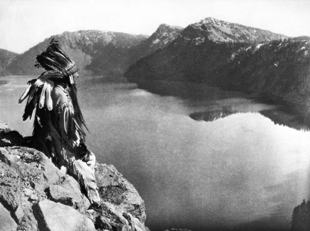
![A member of the Klamath tribe at Crater Lake.]()
Crater Lake, Klamath Indian at, OrHi 78069.
A member of the Klamath tribe at Crater Lake. Photo by Edward S. Curtis, courtesy Oreg. Hist. Soc. Research Lib., OrHi 78069
-
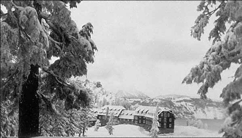
![Crater Lake Lodge, winter 1925.]()
Crater Lake Lodge, winter, 1925, OrHi 093200.
Crater Lake Lodge, winter 1925. Photo by John Maben, courtesy Oreg. Hist. Soc. Research Lib., OrHi 93200
-
![Photographer Fred Kiser's Studio near Crater Lake Lodge, 1920s.]()
Crater Lake, Kiser Studio at, OrHi 68539.
Photographer Fred Kiser's Studio near Crater Lake Lodge, 1920s. Photo by Kiser Studios, courtesy Oreg. Hist. Soc. Research Lib., OrHi 68539
-
![Frame tent foundations at Crater Lake in the winter.]()
Crater Lake, foundations for tent cabins, 1925, OrHi 093199.
Frame tent foundations at Crater Lake in the winter. Photo by John Maben, courtesy Oreg. Hist. Soc. Research Lib., OrHi 093199


Related Entries
-
![Climate Change in Oregon]()
Climate Change in Oregon
Within a few hundred miles in Oregon, you can see snowy volcanoes, parc…
-
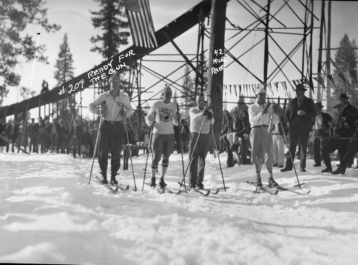
![Fort Klamath to Crater Lake Ski Race, 1927-1938]()
Fort Klamath to Crater Lake Ski Race, 1927-1938
In February 1927, the forty-two-mile, round-trip, cross-country ski rac…
-
![Mount Mazama]()
Mount Mazama
Mount Mazama is located in the southern part of the Cascade Range, abou…
-
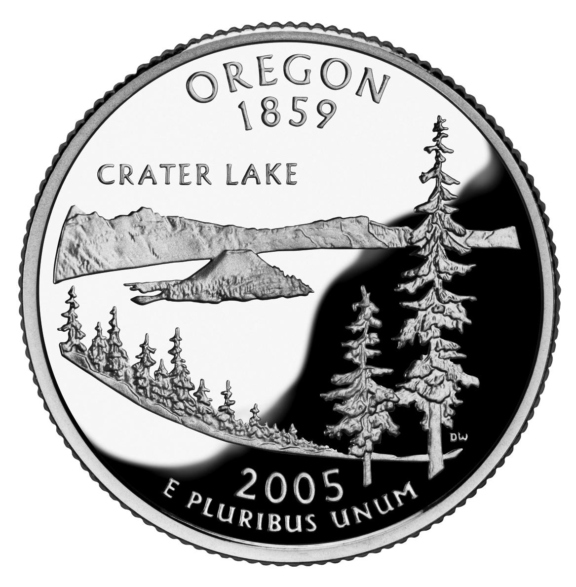
![Oregon Commemorative Quarter]()
Oregon Commemorative Quarter
In 2005, Crater Lake was featured on the Oregon State Quarter, part of …
-
![William Gladstone Steel (1854–1934)]()
William Gladstone Steel (1854–1934)
Born in Ohio on September 7, 1854, William Gladstone Steel was raised i…


Related Historical Records
Map This on the Oregon History WayFinder
The Oregon History Wayfinder is an interactive map that identifies significant places, people, and events in Oregon history.
Further Reading
Atlas of Oregon Lakes. Online version. https://aol.research.pdx.edu/
Cressman, Luther S. The Sandal and the Caves. Corvallis: Oregon State University, 2005.
Darling, John. “Unraveling the Secret of Crater Lake’s Deep Moss.” Medford Mail Tribune, April 2, 2007.
Harmon, Rick. Crater Lake National Park: A History. Corvallis: Oregon State University Press, 2002.
Johnson, Daniel M. Atlas of Oregon Lakes. Corvallis, Or. : Oregon State University Press, 1985.
Larson, Douglas W. "Probing the Depths of Crater Lake: A Century of Scientific Research." Oregon Historical Quarterly 100:3 (Fall 1999).
Larson, Gary L. et al., eds. Long-term Limnological Research and Monitoring at Crater Lake, Oregon. The Netherlands: Springer, 2007.
Mark, Stephen R. Administrative History. Seattle: Government Printing Office, 2003, ch. 18.
Mark, Stephen R. "Natural Heritage and the Maintenance of Iconic Stature: Crater Lake, Oregon, USA." In Lake Tourism: An Integrated Approach to Lacustrine Tourism Systems. Clevedon, England: Channel View, 2006.
Oregon Historical Society. Special Issue on Crater Lake National Park. Oregon Historical Quarterly, 103:1 (Spring 2002).
Peterson, David L. et al. “Detecting Long-Term Hydrological Patterns at Crater Lake, Oregon.” Northwest Science 73, no. 2 (1999): 121–30.
Stetler, Jonathan T. et al. “Atmospheric Stilling and Warming Air Temperatures Drive Long-term Changes in Lake Stratification in a Large Oligotrophic Lake.” Limnology and Oceanography 9999 (2020): 1–11.