Camp Polk, a 151-acre meadow along Whychus Creek four miles downstream from Sisters, has been the site of centuries of human activity. The meadow is also notable for its biological diversity.
Chinookan, Sahaptin, Northern Paiute, and Molala peoples used the meadow as part of their seasonal harvest rounds. Deer and fish were available, and families harvested a variety of plants, including tule, sweetgrass, cattail down, willow shoots, yarrow, dogbane, camas, biscuitroot and other Lomatium species, balsamroot, Indian celery, service and other berries, and Oregon grape. Laboratory testing has determined that obsidian points found at the meadow were worked 2,000 to 4,000 years ago. Traditional names for the creek included Why-chus (a Sahaptin word for place to cross water) and Sic-se-que (a Paiute word for tall rye grass); no traditional name for the meadow has survived.
The meadow is located along a natural alignment of east-west crossings—Santiam Pass and the canyons of Whychus Creek and the Deschutes River—and is among the largest riparian sites in the middle Deschutes Basin. Whychus Creek, shown as the main stem of the Deschutes, appears on a map printed in London in 1816, probably as a result of exploration by Donald McKenzie in 1812. Trappers Finan McDonald, Thomas McKay, Joseph Gervais, and Peter Skene Ogden likely visited the meadow in 1825 and 1826, and Steven Meek and Nathaniel Wyeth in 1834-1835. Looking for a route across the Cascade Mountains, John Charles Frémont’s expedition visited the meadow in 1843 en route to California and the Pacific Railroad Survey in 1855.
The Hunipui band of Northern Paiute were effectively resisting EuroAmerican entry into their homeland, and Camp Polk was part of the government’s strategy to eliminate what they called the Snake Indians. Troops stationed at camps across Oregon’s Great Basin conducted winter raids against the Indians. Camp Polk was the western-most of these camps, intended also to protect the Santiam wagon road from Albany to Boise.
Forty volunteer infantrymen, mostly farmers from Polk County, built and named Camp Polk—seven cabins and a storehouse—which they occupied in September 1865. The camp was located on the wagon road and afforded travelers spring and creek water, meadow grass, and abundant deer. Camp Polk was abandoned in May 1866.
In the early years of white settlement, Camp Polk was a hub of west-central Oregon. By 1870, Samuel Hindman and his family bought the Camp Polk site from the wagon road company to operate it as a stock farm and as a way station on the wagon road. The first known white settlers in west-central Oregon, the Hindmans, had trailed to the Albany area from Iowa in 1862. Hindman, an expert axe-man, assisted surveyors and knew log construction. The station was an outpost of Linn County business interests that wanted to supply cattle, military, gold, and road development east of the Cascades.
The Camp Polk post office was moved to just north of the present town of Sisters in 1888. No original structures remain at the site except hand-hewn timbers of the Hindman barn and the pioneer cemetery. In 2000, the Deschutes Land Trust acquired 145 acres of the meadow, part of a strategy to restore anadromous fish runs in the upper Deschutes Basin. The Trust restored the natural functions of the meadow, slowing flow with meanders for spawning and rearing habitat and augmenting low stream flow with cooler water.
-
![]()
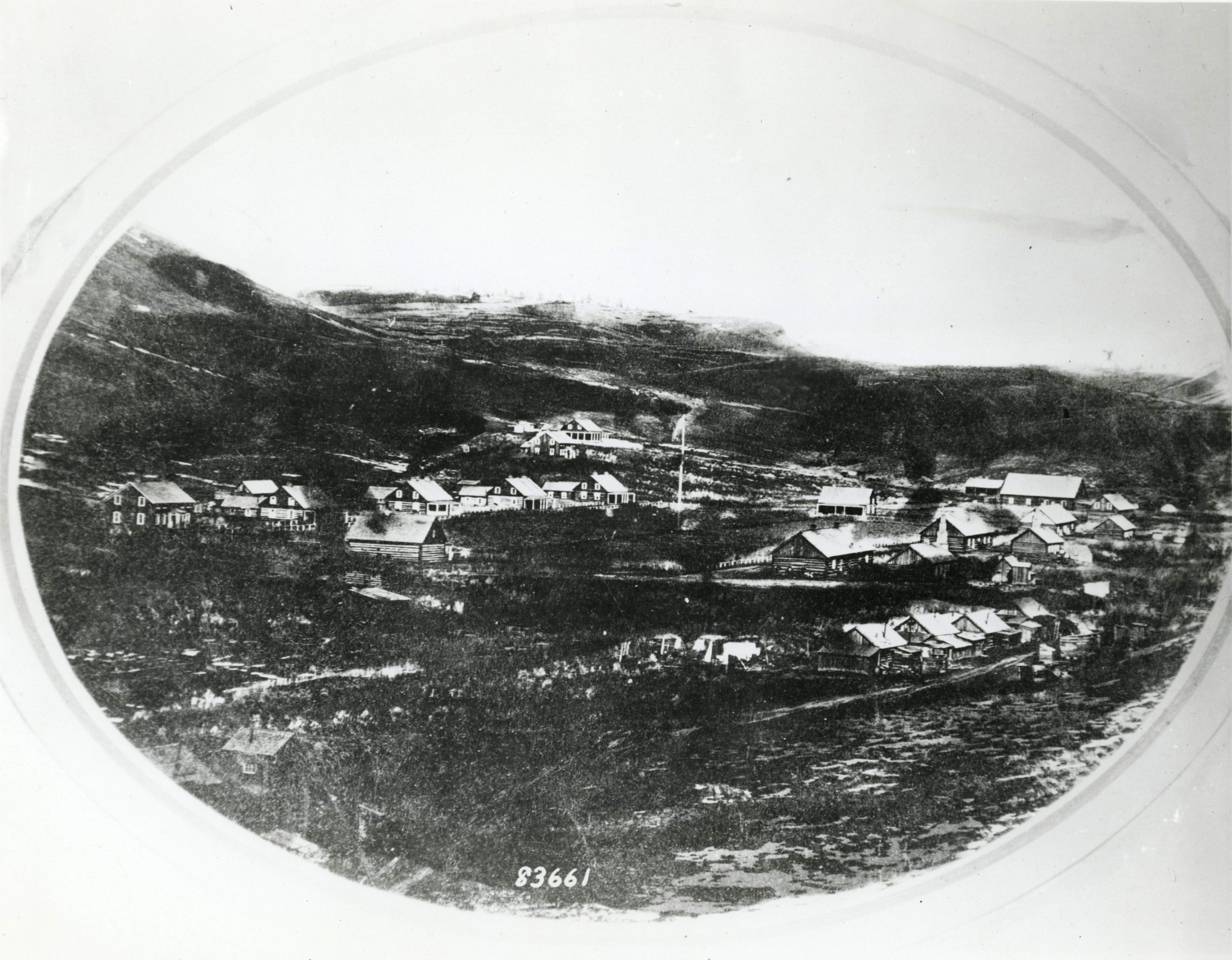
Camp Polk Meadow Preserve.
Courtesy Deschutes Land Trust -
![]()
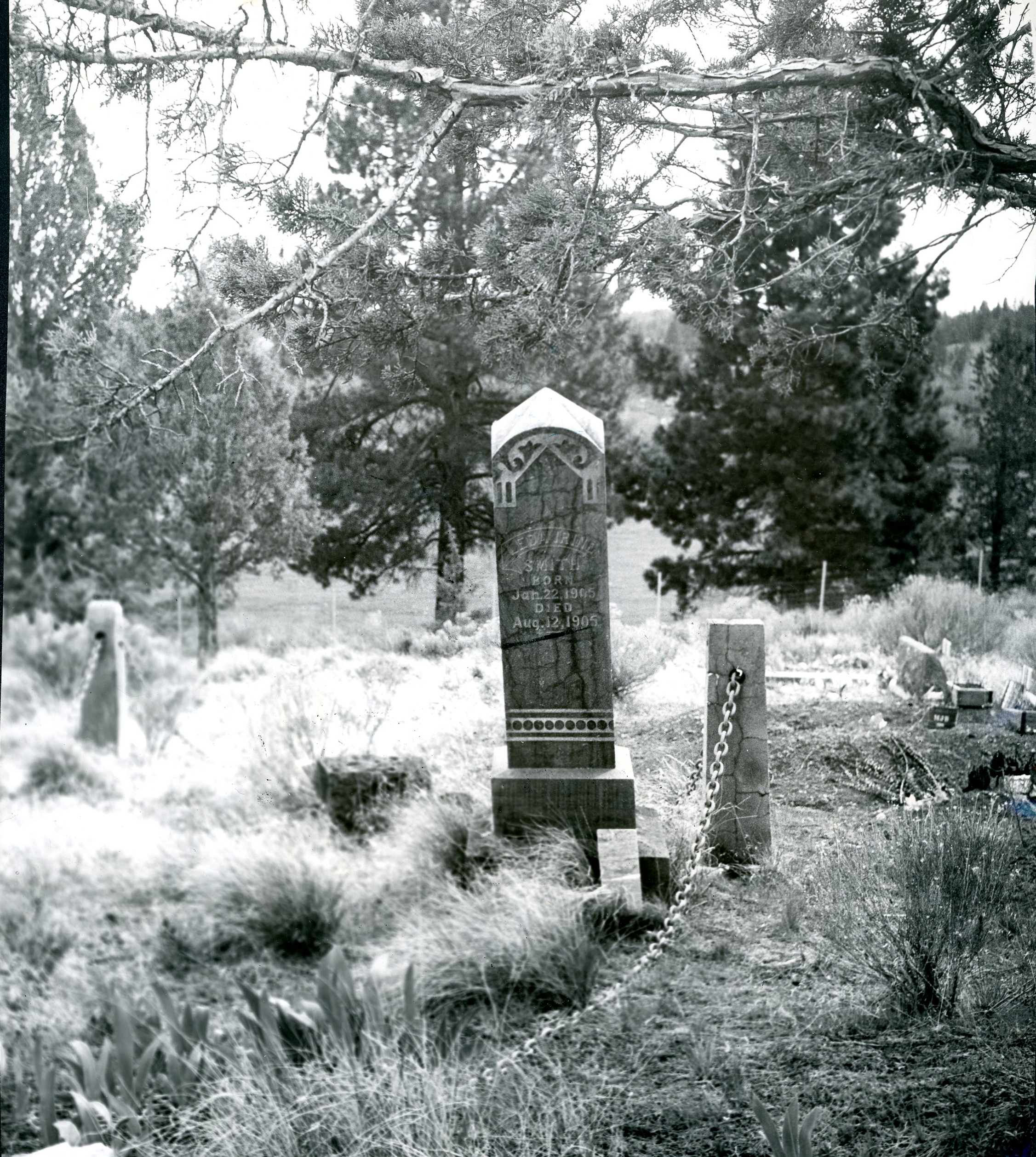
Camp Polk Cemetery, 1961.
Oregon Historical Society Research Library, Oregon Journal, photo file 407

Related Entries
-
![Camp Abbot]()
Camp Abbot
Camp Abbot, located on the Deschutes River several miles south of Bend,…
-
![Camp Harney]()
Camp Harney
From 1867 to 1880, the U.S. Army’s Camp Harney provided a strategic mil…
-
![Camp Polk Cemetery]()
Camp Polk Cemetery
Camp Polk Cemetery—also known as the Hindman Cemetery, for the family w…
-
![Deschutes Land Trust]()
Deschutes Land Trust
The Deschutes Land Trust works cooperatively with landowners to conserv…

Related Historical Records
Map This on the Oregon History WayFinder
The Oregon History Wayfinder is an interactive map that identifies significant places, people, and events in Oregon history.
Further Reading
Winch, Martin. Biography of a Place: Passages through a Central Oregon Meadow. Bend: Deschutes County Historical Society, 2006.