In 1956, with the help of Oregon senators Wayne Morse and Richard Neuberger, Crook County landowners and officials persuaded Congress to authorize and fund the Crooked River Project. The project's main component, Bowman Dam (named for A.R. Bowman, a Crook County commissioner and chief project booster), along with pumping stations and irrigation canals, provided water for 10,000 new acres of farmland and 10,000 acres already under cultivation.
Ranchers and farmers in central Oregon's Crooked River Basin had long struggled with having enough water for crops and livestock. The basin had experienced an influx of new settlers in the early twentieth century. People poured into the area - Crook County's population grew over 200% between 1900 and 1910 - hoping to capitalize on inexpensive homesteads and open grazing areas. New settlers placed greater demands on water and prime farmland.
The first successful attempt to irrigate the Crooked River Basin on a wide scale occurred in 1917. Based on unrealized federal and state plans, local landowners formed the Ochoco Irrigation District, raised bonds, and in 1921 built a dam on Ochoco Creek. The reservoir was slated to hold enough water to irrigate 17,000 acres, but it rarely filled to capacity, burdening the local irrigation district with debt and leaving farmers with insufficient water.
For the next thirty-five years, Crook County farmers and ranchers lobbied state and federal officials to build a dam on the Crooked River that would provide additional irrigation for dry farms and ranchlands. In 1957, they finally succeeded when Congress approved the Crooked River Project. The project was one of many Congress approved in the 1950s, as the federal Reclamation Bureau and Army Corps of Engineers competed to build water projects throughout the U.S.
The Crooked River Project delivered on its promises for Crook County irrigators, bolstering the area's agricultural economy by providing an inexpensive, predictable water supply. But area irrigators soon found unexpected competition for Crooked River waters. Fishing, boating, recreational, and retirement industries discovered that the Prineville Reservoir and a recharged Crooked River were valuable commodities, and tourists became the new users of the basin's water.
For years, recreational and agricultural interests battled with the U.S. Bureau of Reclamation for control of the Prineville Reservoir and, by default, much of the Crooked River. While competing interests fought over how the water should be used, more and more Oregonians were lured to the river and the reservoir for recreation.
By federal law, the reservoir is still designated only for flood control and irrigation purposes. In 1988, however, sections of the Crooked River and its tributaries gained protection under the Wild and Scenic Rivers Act. This change in status, led by Oregon Senator Mark O. Hatfield, helped solidify recreational and fish and wildlife industries as major factors in how the basin's water is used.
The Crooked River Project remains an irrigation and flood control endeavor, but its significance for the region's economy and its fish and wildlife habitat now go well beyond agricultural uses and the protection of property.
-
![]()
Confluence of Crooked and Deschutes Rivers, 1940.
Oreg. State Univ. Archives, Gifford Photo Coll., Deschutes Basin Explorer series, P218:RIG 0853
-
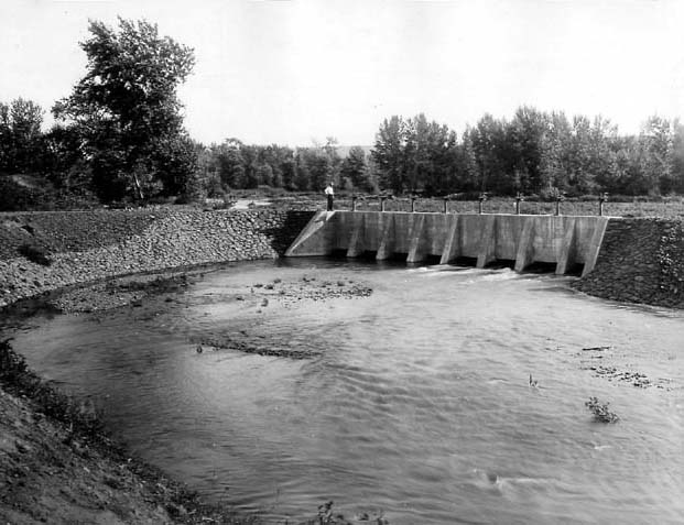
![Gate tower of Ochoco Dam stands above Ochoco Lake, five miles east of Prineville, January 1931.]()
Ochoco Dam.
Gate tower of Ochoco Dam stands above Ochoco Lake, five miles east of Prineville, January 1931. Oreg. Hist. Soc. Research Lib., CN 000386
-
![Ochoco Dam.]()
Ochoco Dam.
Ochoco Dam. Photo by David M. Walsh, courtesy U.S. Bureau of Reclamation
-
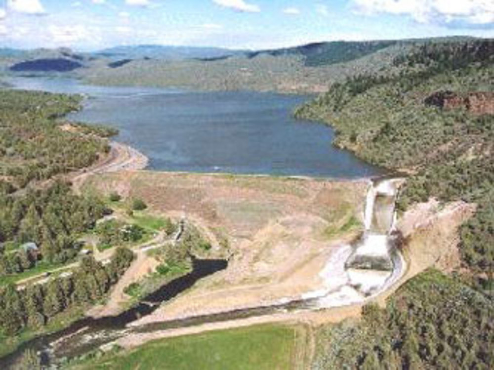
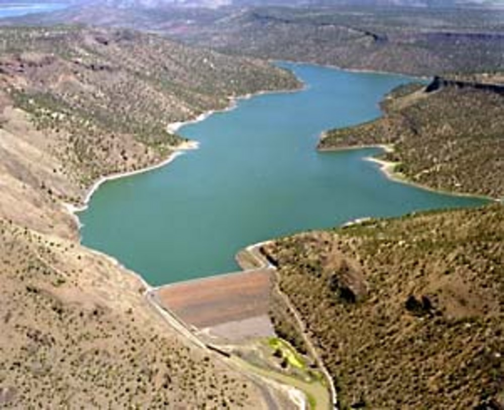
![]()
Arthur R. Bowman Dam, 1997.
Photo by David M. Walsh, courtesy U.S. Bureau of Reclamation
-
![]()
Crooked River, 1920.
Oreg. State Univ. Archives, Gifford Photo Coll., Deschutes Basin Explorer series, P020:0756


Related Entries
-
![Crooked River]()
Crooked River
The Crooked River Basin lies in the heart of central Oregon, east of th…
-
![Richard Neuberger (1912-1960)]()
Richard Neuberger (1912-1960)
When he was elected to the United States Senate in 1954, Richard Neuber…
-
![U.S. Bureau of Reclamation]()
U.S. Bureau of Reclamation
The U.S. Bureau of Reclamation, in the Department of the Interior, has …
-
![Wayne Morse (1900-1974)]()
Wayne Morse (1900-1974)
Wayne Morse and the Vietnam War: the name and the conflict will be fore…


Map This on the Oregon History WayFinder
The Oregon History Wayfinder is an interactive map that identifies significant places, people, and events in Oregon history.
Further Reading
Cohen, Scott. "Controlling the Crooked River: Changing Environments and Water Uses in Irrigated Central Oregon, 1913-1988." Oregon Historical Quarterly 109:2 (2008): 36 pars. 28 Dec. 2008 .
Donald Pisani, Water and the American Government (Berkeley: University of California Press, 2002).
John T. Whistler and John H. Lewis, Ochoco Project and Crooked River Investigation (Washington D.C.: GPO, 1916).