The U.S. Bureau of Reclamation, in the Department of the Interior, has been an important force in Oregon since soon after the agency's founding with the 1902 Reclamation (Newlands) Act. Twenty-nine Reclamation dams, most of them in the arid parts of the state, have impounded reservoirs for irrigation purposes—some of them, like Lake Owyhee, quite large.
The rationale for calling the agency the Bureau of Reclamation was that irrigation would "reclaim" otherwise fertile land from the "stingy, unproductive" thralldom of aridity. The fruition of westerners' long-held dream to "make the desert bloom as a rose," Reclamation's massive water diversions have more recently brought the agency and its farmer clients up against the reality of the West's limited water.
Originally called the U.S. Reclamation Service as part of the U.S. Geological Survey, the agency owes its creation to the federal government's unprecedented entry during the Progressive Era into natural resource management. Unlike the U.S. Forest Service, the National Park Service, and the Fish and Wildlife Service, however, the Bureau of Reclamation represented a continuation of traditional federal land policy: settling the public domain with hard-working farmers who, upon meeting federal requirements, gained ownership to 160-acre parcels of government land.
The Carey Act of 1894, along with other federal actions that had been inspired in part by the writings of John Wesley Powell, encouraged private and state efforts at reclaiming the West's arid valleys, but these projects often failed well before any stored water touched the soil. Oregon’s Carey Act projects in the upper Deschutes basin, for example, experienced just such difficulties. Western politicians successfully pressed for full federal funding and active participation in the crusade.
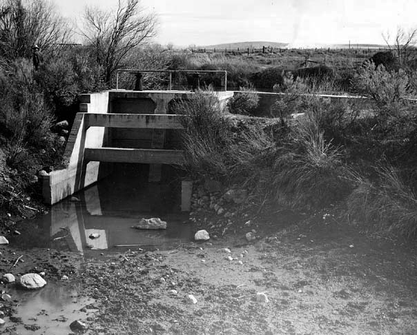
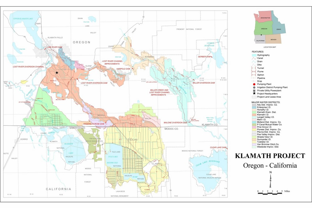
Under early leaders such as Frederick Newell, Reclamation engineers set out to identify, design, and build irrigation projects. The earliest in Oregon were the Klamath Project and the Umatilla Project (both of them subsequently expanded). The Klamath Project, located on the Oregon-California state line and begun in 1906, received its first irrigation water in 1907. Additions to this project over subsequent decades—including a 6,000-foot-long tunnel through the base of a massive lava butte, linking the basins of Tule and Lower Klamath Lakes—greatly enlarged the original irrigated area. The Umatilla Project began with the earthfill construction of 115-high Cold Springs Dam in 1908. Because the government received bids from private construction firms that it repeatedly rejected as too high, the Bureau of Reclamation hired and directed its own work force to build the dam, including a crew of immigrants from Greece. The Umatilla Project expanded substantially with completion of McKay Dam in 1927.
The period between the 1920s and 1940, especially under the leadership of Commissioner Elwood Mead (1924-1936), was Reclamation's high-water mark for large proposals and completed projects in the Pacific Northwest. Those years resulted in development of the largest of the 180 projects in the 17 western states.
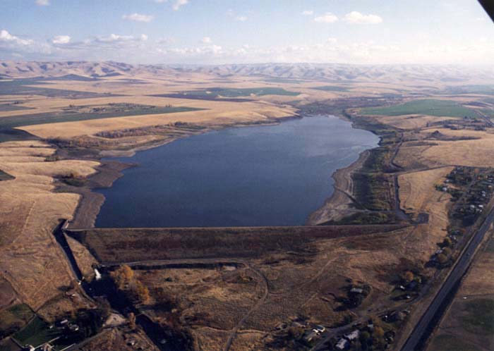
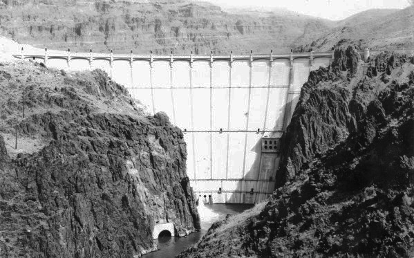
Two Oregonians, Marshall Dana and Robert Sawyer, who each served as presidents of the National Reclamation Association, helped to steer Reclamation project funding to their state. The first major development in Oregon during this period was the Owyhee Project in the late 1920s. The Owyhee Dam, just over 400-feet high, used a pioneering concrete-dam design and construction that served as a proving ground for techniques later used on Hoover Dam. The Deschutes Project, which began during the New Deal and was completed by 1950, featured the earthfilled Wickiup and Crane Prairie Dams.
Irrigation districts in Oregon—many had built their own facilities, which were often inadequate or unsafe—faced bankruptcy during the Depression. Shortly before and especially after World War II, Congress charged the Bureau of Reclamation with rescuing some of those hard-pressed districts. The agency improved or enlarged old dams, constructed new ones, and added new distribution facilities such as canals. The Crooked River and the Rogue Basin Projects, developed during the 1950s, are among the largest of these.
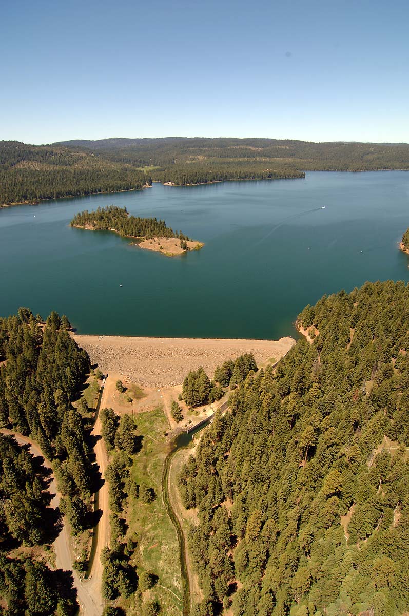
At Crooked River, the Bureau of Reclamation took over and repaired the old, privately built Ochoco Dam in 1949. The Bureau also took over the failing Ochoco Irrigation District to develop the Crooked River Project, building the Bowman Dam in 1961 that created the Prineville Reservoir, soon to become one of central Oregon's major recreational sites. Among the Rogue Basin's main projects were development of Howard Prairie Reservoir in the Cascades and major expansion of Emigrant Creek Dam and its reservoir in the southern Bear Creek valley.
The Rogue Basin Project's Green Springs Power Plant is the only Reclamation hydroelectric power-generation facility in Oregon. The other Oregon projects, unlike some of Reclamation's big dams in other states, do not have hydropower among the reservoirs' ancillary benefits (e.g., flood control and recreation); however, relatively small private hydropower-generation facilities have been added in recent years to some of the Bureau's Oregon projects.
Even by the 1910s-1920s, the long-term economic wisdom of adding vast acreages of irrigated acres to the nation's already highly productive farmlands was questioned. Compared to many other western states, Oregon received few large Bureau of Reclamation projects, a result of the state's physical, economic, and political environment. In addition, some of the Bureau's Oregon projects proved to be of marginal profitability.
By the 1950s-1960s, controversies over the environmental impact of ever-more dams, combined with wrangling over such issues as Reclamation clients' inability to pay the fees for its services and the difficulty of "making a go of it" on only the 160 allotted acres, resulted in the effective end of new projects in Oregon and elsewhere in the West. Today, in sixteen Oregon projects, well over half-a-million acres are irrigated (or irrigable) by Bureau of Reclamation facilities.
-
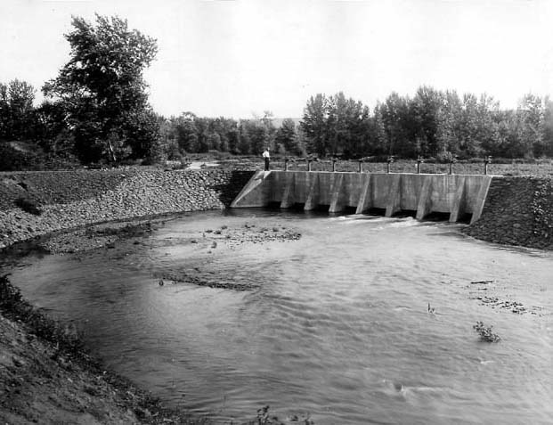
![Umatilla Project Stanfield diversion feeder canal for Cold Springs Reservoir, 1907.]()
Umatilla Proj, Stanfield diversion dam, Sep 1907.
Umatilla Project Stanfield diversion feeder canal for Cold Springs Reservoir, 1907. U.S. Bureau of Reclamation, P30-100-921
-
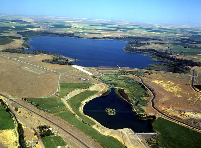
![Cold Springs Dam and reservoir, June 2003.]()
Cold Springs Dam, 2003.
Cold Springs Dam and reservoir, June 2003. U.S. Bureau of Reclamation
-
![Downtown Bend and North Dam of the Middle Deschutes River, Aug. 2004.]()
Deschutes Proj, downtown Bend, Aug 2004.
Downtown Bend and North Dam of the Middle Deschutes River, Aug. 2004. Photo Dave Walsh, U.S. Bureau of Reclamation, CN-100-220
-
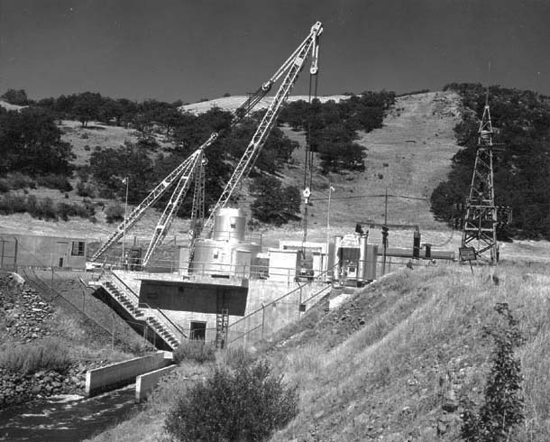
![Green Springs Powerplant on Emigrant Creek, July 1970.]()
Green Springs Powerplant, Jul 1970.
Green Springs Powerplant on Emigrant Creek, July 1970. Photo J.D. Roderick, U.S. Bureau of Reclamation, P448-100-256
-
![Keene Creek Dam and Reservoir provides water for the Green Springs Powerplant. May 1970.]()
Kane Creek Dam, May 1970.
Keene Creek Dam and Reservoir provides water for the Green Springs Powerplant. May 1970. Photo J.D. Roderick, U.S. Bureau of Reclamation, P448-100-230
-
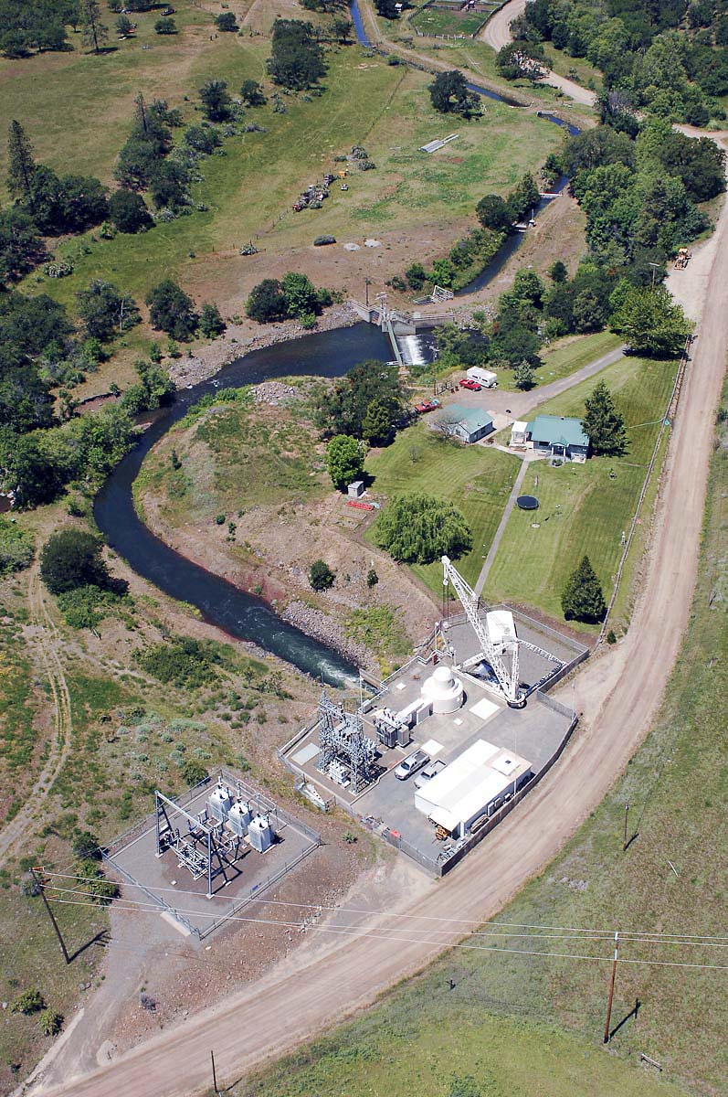
![Green Springs Powerplant, June 2008.]()
Green Springs Powerplant, Jun 2008.
Green Springs Powerplant, June 2008. Photo Dave Walsh, U.S. Bureau of Reclamation, B448-100-88
-
![Hermiston and McNary Dam, July 1963.]()
Hermiston and McNary Dam, Jul 1963.
Hermiston and McNary Dam, July 1963. Photo D.J. Weir, U.S. Bureau of Reclamation, P30-100-940
-
![Howard Prairie Dam, June 2008.]()
Howard Prairie Dam, Jun 2008.
Howard Prairie Dam, June 2008. Photo Dave Walsh, U.S. Bureau of Reclamation, B448-100-24
-
![Upstream face of McKay Dam, June 1975.]()
McKay Dam, Apr 1910.
Upstream face of McKay Dam, June 1975. U.S. Bureau of Reclamation, P30-100-932
-
![McKay Dam, June 2003.]()
McKay Dam, Jun 2003.
McKay Dam, June 2003. Photo Dave Walsh, U.S. Bureau of Reclamation, CN33-100
-
![]()
Owyhee Dam near Nyssa, 1930.
Courtesy Gerald W. Williams Collection, Oregon State University. "Owyhee Dam near Nyssa, Oregon" Oregon Digital -
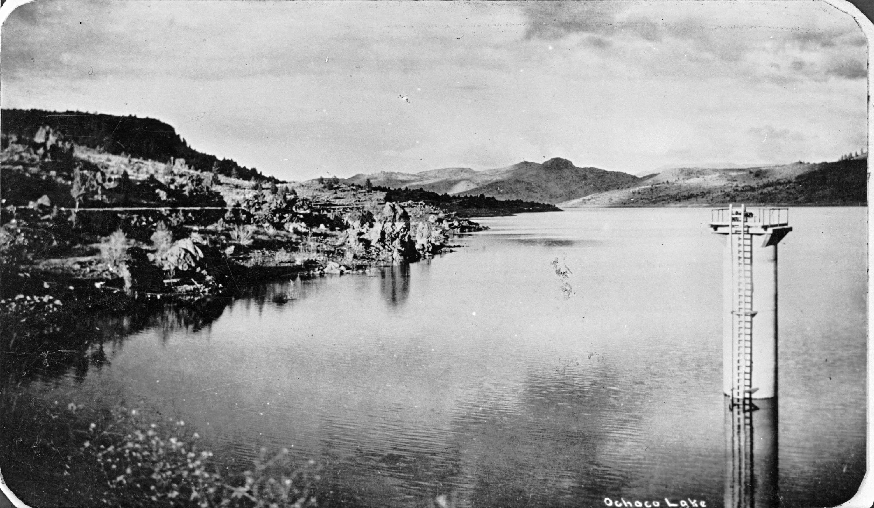
![Ochoco Dam gate tower above Ochoco Lake, 1931.]()
Ochoco Dam, bb004071 and CN 000386.
Ochoco Dam gate tower above Ochoco Lake, 1931. Oreg. Hist. Soc. Research Libr., bb004071
-
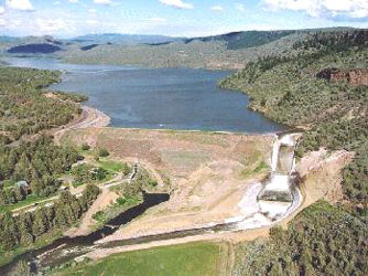
![Ochoco Dam.]()
Ochoco Dam.
Ochoco Dam. Photo David M. Walsh, U.S. Bureau of Reclamation
-
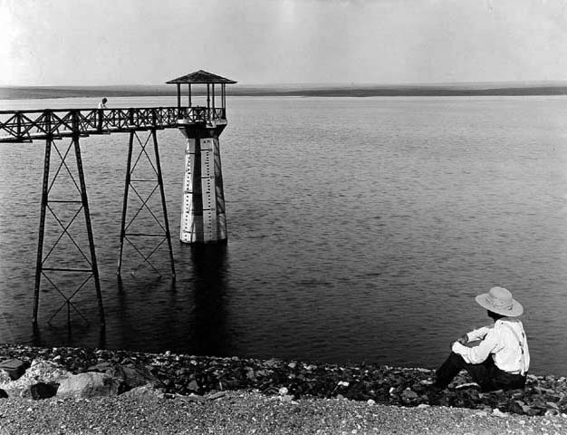
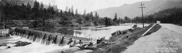
![Cold Springs Dam and reservoir, July 1909.]()
Cold Springs Dam, Jul 1909.
Cold Springs Dam and reservoir, July 1909. U.S. Bureau of Reclamation, P30-100-934
-
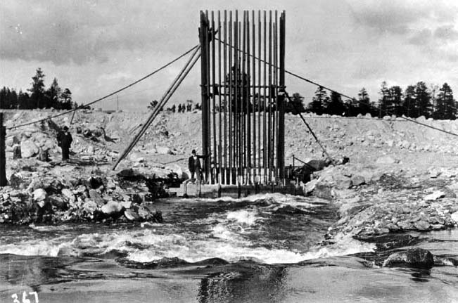
![Early construction in the Rogue River Basin, June 1910.]()
Rogue River, early USBR constr, Jun 1910.
Early construction in the Rogue River Basin, June 1910. U.S. Bureau of Reclamation, P448-100-383
-
![Umatilla Project diversion dam, Maxwell Canal, Hermiston, March 1947.]()
Umatilla Proj, Maxwell Canal diversion dam, Mar 1947.
Umatilla Project diversion dam, Maxwell Canal, Hermiston, March 1947. Photo Merritt, courtesy U.S. Bureau of Reclamation, P30-100-951
-
![Stanfield diversion, Umatilla Project, about 1950.]()
Umatilla Proj, Stanfield diversion, ca 1950.
Stanfield diversion, Umatilla Project, about 1950. Photo Merritt, courtesy U.S. Bureau of Reclamation, P30-100-947;
-
![Swamp in West Extension, Umatilla Project, March 1947.]()
Umatilla Project, swamp, Mar 1947.
Swamp in West Extension, Umatilla Project, March 1947. Photo Merritt, U.S. Bureau of Reclamation, P30-100-946
-
![Typical Umatilla Project wind breaks, March 1947.]()
Umatilla Proj, wind break, Mar 1947.
Typical Umatilla Project wind breaks, March 1947. Photo Merritt, courtesy U.S. Bureau of Reclamation, P30-100-945
-
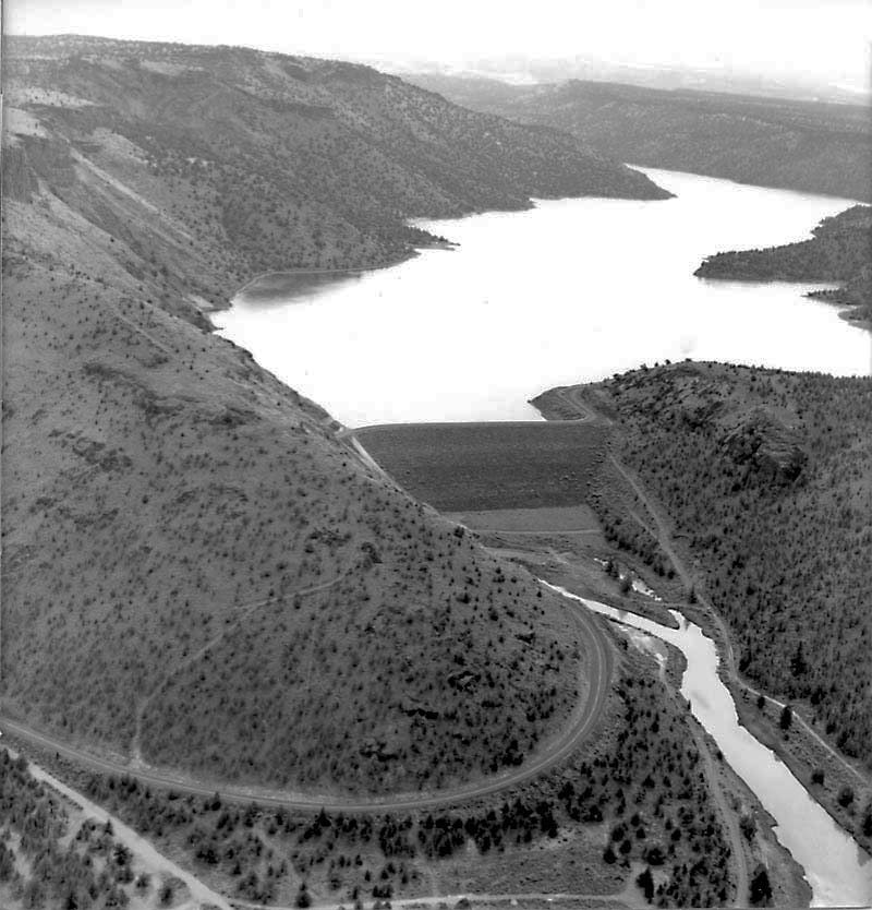
![Wickiup Reservoir at low water, Sep. 2005]()
Wickiup Dam, Aug 2004.
Wickiup Reservoir at low water, Sep. 2005 U.S. Bureau of Reclamation, C121-100-199;
-
![Bowman Dam and Prineville Reservoir, July 1987.]()
Bowman Dam, Jul 1987.
Bowman Dam and Prineville Reservoir, July 1987. U.S. Bureau of Reclamation, P113-100-2
-
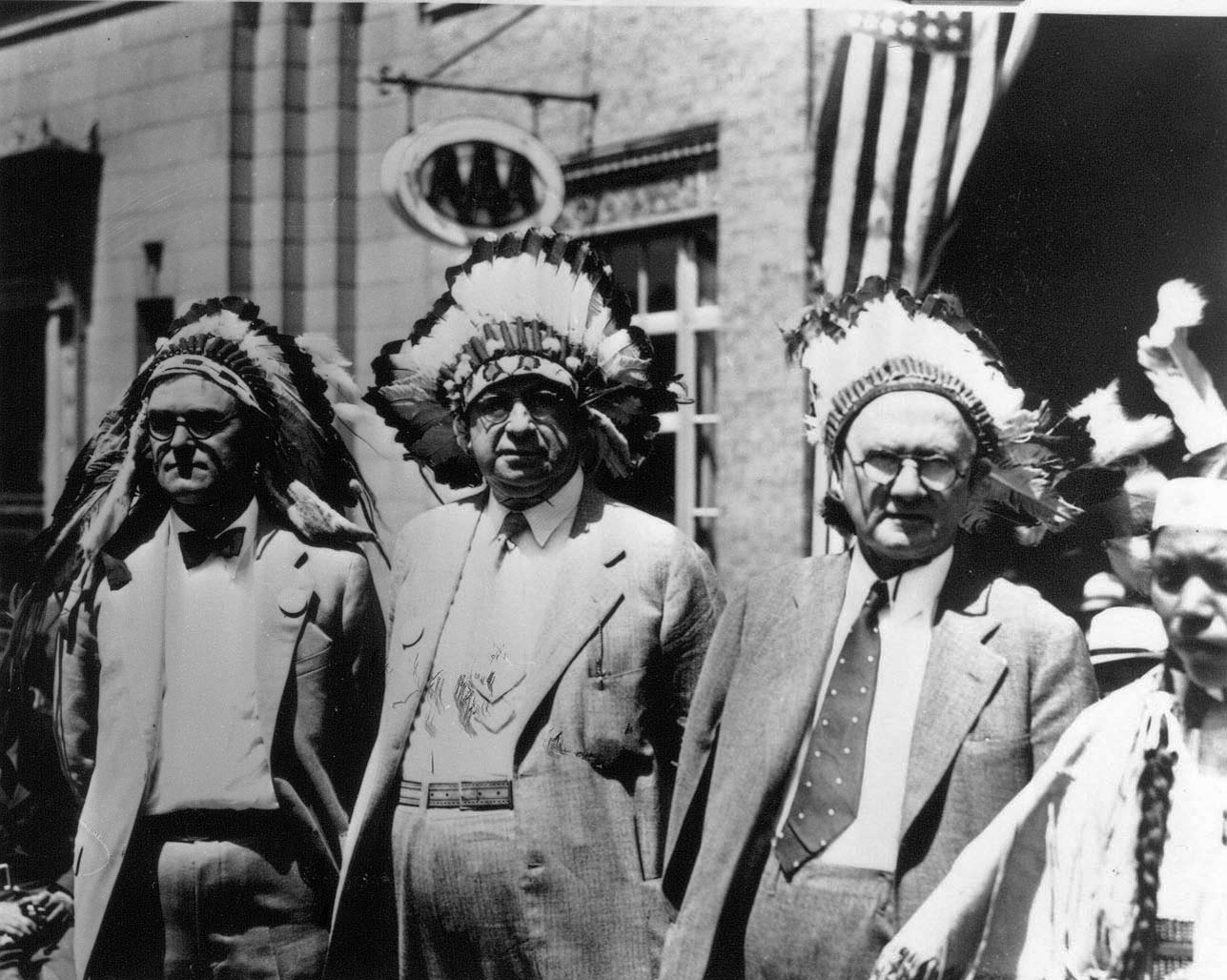
![USBR officials (l to r) Frank Banks, Elwood Mead, and R.F. Walt during tribal celebration at Coulee Dam, Colorado, March 1935.]()
Mead, Elwood, and others, Mar 1935.
USBR officials (l to r) Frank Banks, Elwood Mead, and R.F. Walt during tribal celebration at Coulee Dam, Colorado, March 1935. U.S. Bureau of Reclamation, ARCH. 0099 OR 946; MAR.1935 NO. 1855
-
![U.S. Army soldier at Elwood Mead commemorative plaque overlooking Lake Mead, CO, Jan. 1942.]()
Mead, Elwood, soldier and plaque, Jan 1945.
U.S. Army soldier at Elwood Mead commemorative plaque overlooking Lake Mead, CO, Jan. 1942. U.S. Bureau of Reclamation, PERM-No-5570
-
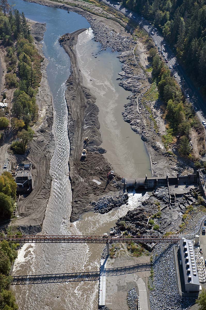
![Savage Rapids Dam, about 1930.]()
Savage Rapids Dam, ca 1930.
Savage Rapids Dam, about 1930. Photo Frank Patterson, courtesy Oreg. State Univ. Librs., Gerald W. Williams Collec.
-
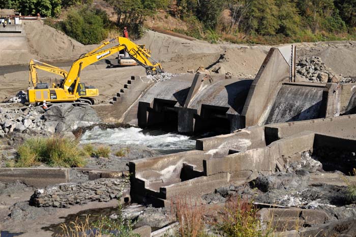
![Removing temporary berm to allow the Rogue River to run freely past the dam for the first time in 89 years, Oct. 9, 2009.]()
Savage Rapids Dam, breaching temp berm, Oct 2009.
Removing temporary berm to allow the Rogue River to run freely past the dam for the first time in 89 years, Oct. 9, 2009. Photo Dave Walsh, U.S. Bureau of Reclamation, B712-100-55
-
![Final stages of demolition on of Savage Rapids Dam, Oct. 8. 2009.]()
Savage Rapids Dam, deconstruction, Oct 2009.
Final stages of demolition on of Savage Rapids Dam, Oct. 8. 2009. Photo Andrew Pernick, U.S. Bureau of Reclamation, B712-100-44
-
![Rogue River channel at former Savage Rapids Dam, Oct. 9, 2009.]()
Rogue River, former Savage Rapids Dam, Oct 2009.
Rogue River channel at former Savage Rapids Dam, Oct. 9, 2009. Photo Andy Pernick, U.S. Bureau of Reclamation, B712-100-85
-
![Crane Prairie Dam, Deschutes County, July 2005.]()
Crane Prairie Dam, Jul 2005.
Crane Prairie Dam, Deschutes County, July 2005. U.S. Bureau of Reclamation, CN112-100


Related Entries
-
![Crooked River]()
Crooked River
The Crooked River Basin lies in the heart of central Oregon, east of th…
-
![Crooked River Project]()
Crooked River Project
In 1956, with the help of Oregon senators Wayne Morse and Richard Neube…
-
![Klamath Basin Project (1906)]()
Klamath Basin Project (1906)
When trapper Peter Skene Ogden first saw the Upper Klamath River Basin …
-
![National Reclamation Act (1902)]()
National Reclamation Act (1902)
When Congress passed the National Reclamation Act in 1902, the measure …
-
![Robert Sawyer (1880-1959)]()
Robert Sawyer (1880-1959)
From 1917 to 1953, Robert Sawyer held sway from his desk as editor and …


Related Historical Records
Map This on the Oregon History WayFinder
The Oregon History Wayfinder is an interactive map that identifies significant places, people, and events in Oregon history.
Further Reading
Bureau of Reclamation Projects in Oregon, descriptions and histories.
Cohen, Scott B. “Controlling the Crooked River: Changing Environments and Water Uses in Irrigated Central Oregon, 1913-1988.” Oregon Historical Quarterly 109:2 (Summer 2008): 204-225.
Fiege, Mark. Irrigated Eden: The Making of an Agricultural Landscape in the American West. Seattle: University of Washington Press, 1999.
Lovin, Hugh T. "Arid Land Reclamation in Eastern Oregon during the Twentieth Century." Pacific Northwest Quarterly 100:4 (Fall 2009): 169-180.
Rowley, William D. The Bureau of Reclamation: Origins and Growth to 1945, vol. 1. U.S. Department of the Interior, Bureau of Reclamation, 2006.