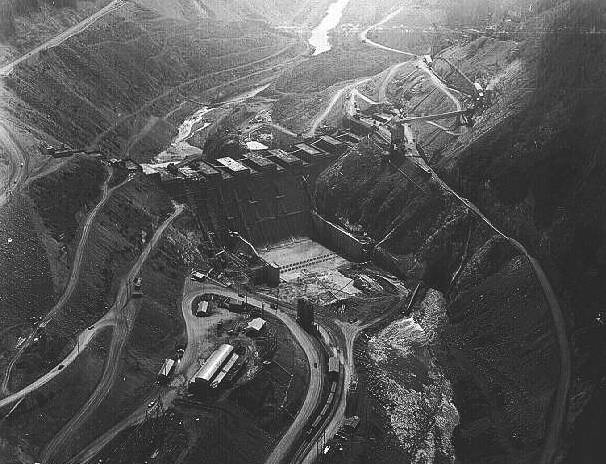
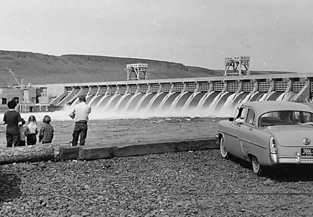
Forty-five miles east of Salem, Detroit Dam rises 463 feet out of the North Santiam River, looming large in the landscape and history of the North Santiam Canyon and the Willamette Valley. By the time it was completed in 1953, Detroit Dam and its regulating dam, Big Cliff Dam, had cost $62,729,000; it provided 455,000 acre-feet of water storage capacity and 118,000 kilowatts of electricity and created a five-square-mile reservoir, Detroit Lake.
Detroit Dam is part of the U.S. Army Corps of Engineers’ Willamette Valley Project, an extensive system of dams originally designed for flood control on the river’s tributaries. During the 1930s, Willamette Valley farmers and business interests had demanded federal protection of their investments along the river, where floods had caused millions of dollars in damage. With the Flood Control Act of 1938, Congress authorized seven dams, including Detroit Dam. At an estimated construction cost of $13,615,000, the dam would provide flood control as well as benefits for navigation, irrigation, power, stream purification, and recreation.
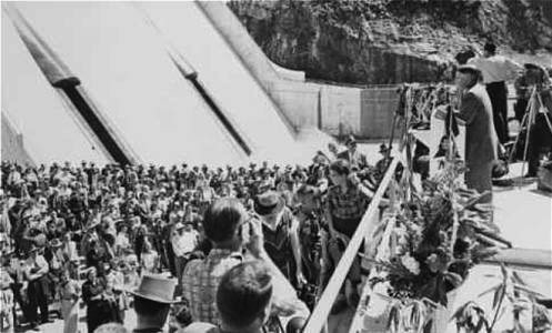
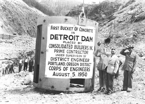
World War II delayed the project until 1946, when the Corps began acquiring and clearing more than 3,000 acres that would be inundated by the dam’s reservoir. The Corps awarded the construction contract to Consolidated Builders, an interest of West Coast industrialist Henry J. Kaiser. Construction began on April 1, 1949, and Consolidated Builders poured the first bucket of concrete on August 3, 1950. The reservoir began filling in 1952, and Secretary of the Interior and former Oregon Governor Douglas McKay dedicated the dam on June 10, 1953.
Detroit Dam and its reservoir transformed the North Santiam Canyon. Nearly 200 residents of the unincorporated town of Detroit were moved, and Oregon State Highway 22 and the North Santiam River were realigned. Over 1,000 dam workers and engineers labored on the project, many of whom moved into nearby towns, including Mill City, Idanha, Gates, and a new town of Detroit.
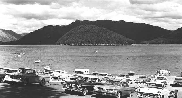
In an effort to mitigate the loss of migrating fish caused by the dams and to stock rainbow trout for the reservoir, the Corps built Marion Forks Hatchery and Minto Holding Pond, operated by the Oregon Department of Fish and Wildlife. Two state parks, Detroit Lake State Parks and Mongold Day Use Area, were built to accommodate boating, swimming, and fishing. By the 1970s, the parks drew more than 200,000 visitors a year, spurring the growth of tourism in the area.
But Detroit Dam’s other authorized uses have sometimes taken priority over recreational tourism. In the summer of 2001, a drought completely dried up the reservoir while the river flowed downstream for hydroelectricity, endangered fish species, and pollution abatement. Although the reservoir refilled on its seasonal schedule that fall, Corps officials warned that drawdowns might be necessary to meet future downstream demands—a reminder that Detroit Dam has bound together the future of the North Santiam Canyon and the Willamette Valley.
-
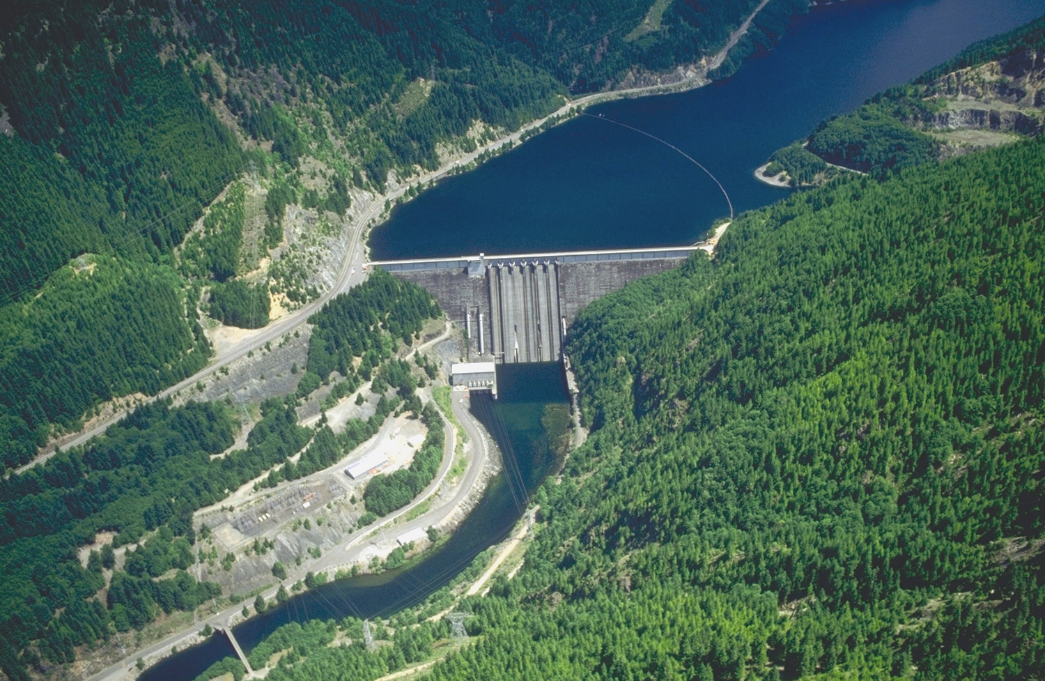
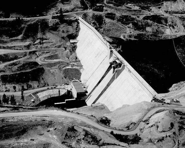
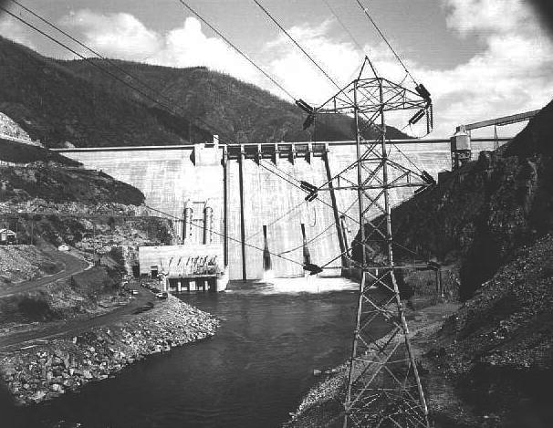
![Detroit Dam, July 1990.]()
Detroit Dam, USACE, 1990.
Detroit Dam, July 1990. Photo Bob Heims, U.S. Army Corps of Engineers
-
![Dedication of Detroit Dam, June 10, 1953.]()
Detroit Dam, dedication of, Jun 10 1953.
Dedication of Detroit Dam, June 10, 1953. Photo Ben Maxwell, Salem Public Libr., 7292
-
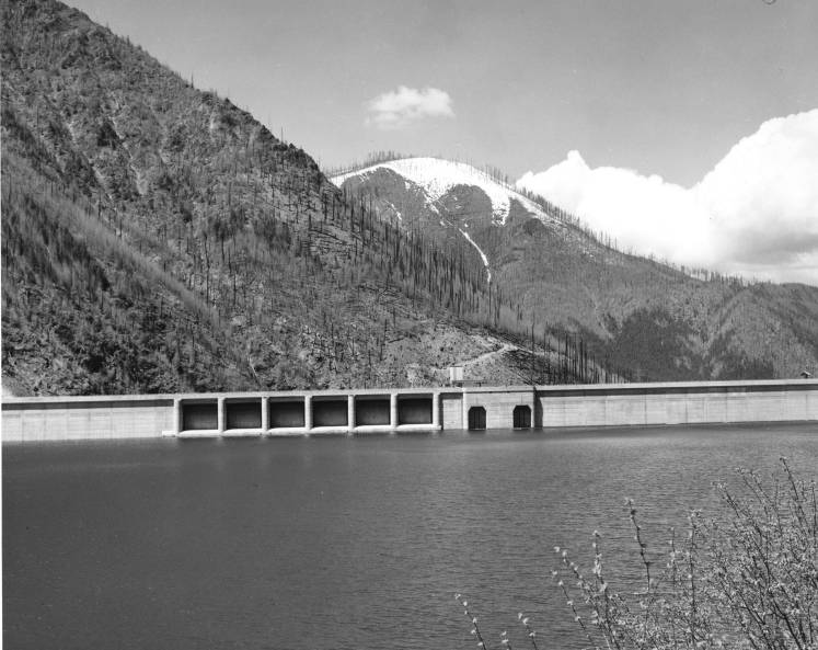
![Detroit Dam on the North Santiam River, 1960.]()
Detroit Dam and reservoir, 1960.
Detroit Dam on the North Santiam River, 1960. Oreg. State Univ. Archives, Ofc. of Univ. Publ. collec., Willamette Basin Explorer, P094:Acc 95:014
-
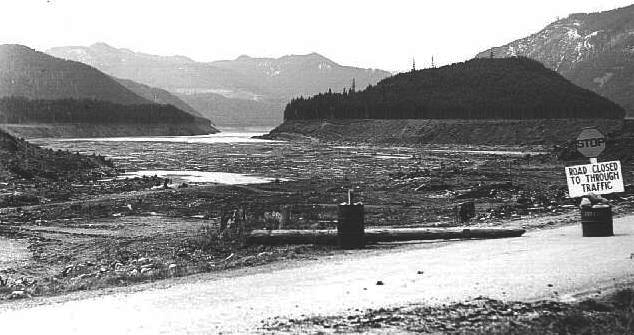
![Detroit Lake, July 1960.]()
Detroit Lake, 1960.
Detroit Lake, July 1960. Oreg. State Archives
-
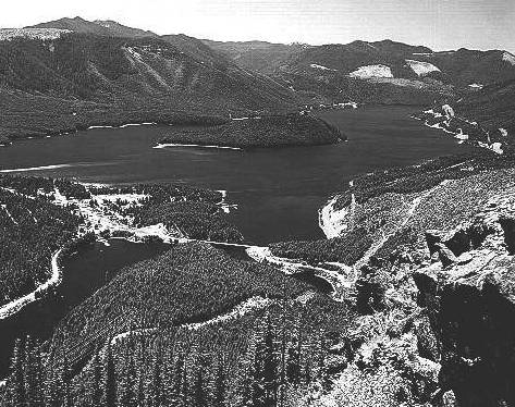
![Detroit Dam on the Santiam River, 1967]()
Detroit Lake, aerial of, 1967.
Detroit Dam on the Santiam River, 1967 Photo Statesman Journal, Salem Public Libr. Hist. Photo Collec., SJ271
-
![Filling of Detroit Lake behind Detroit Dam, April 1953.]()
Detroit Lake, filling of, Apr 19 1953.
Filling of Detroit Lake behind Detroit Dam, April 1953. Photo Ben Maxwell, Salem Public Libr., 7286
-
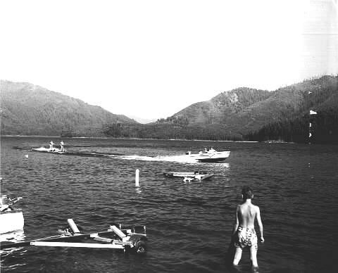
![Fishing at Detroit Lake, 1957.]()
Detroit Lake, fishermen at, 1957.
Fishing at Detroit Lake, 1957. Photo Ben Maxwell, Salem Public Libr., SCC8
-
![Boat ramp at Detroit Lake, 1962.]()
Detroit Lake, boat ramp at, 1962.
Boat ramp at Detroit Lake, 1962. Photo Ben Maxwell, Salem Public Libr., 7301
-
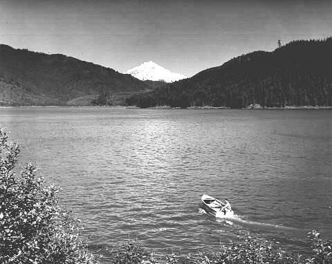
![Detroit Lake and Mount Jefferson from Highway 22, 1950s..]()
Detroit Lake, from Hwy 22, ca. 1950s.
Detroit Lake and Mount Jefferson from Highway 22, 1950s.. Photo Ben Maxwell, Salem Public Libr., SCC5
-
![Detroit Dam , June 1953.]()
Detroit Dam, June 4 1953.
Detroit Dam , June 1953. Photo Ben Maxwell, Salem Public Libr., 7290
-
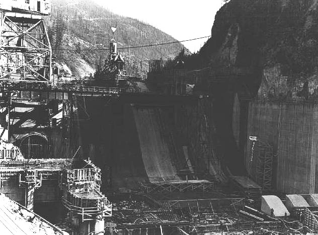
![Detroit Dam construction, 1952.]()
Detroit Dam, construction of, Sep 1 1952.
Detroit Dam construction, 1952. Salem Public Libr. Hist. Photo Collec., 7285
-
![Detroit Dam construction, 1952.]()
Detroit Dam, construction of, aerial, 1952, 1.
Detroit Dam construction, 1952. Salem Public Libr. Hist. Photo Collec.
-
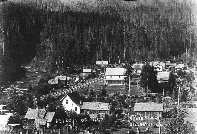
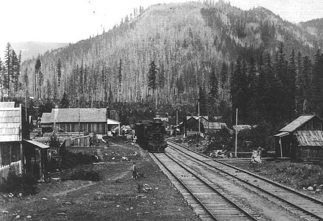
![Detroit, 1912.]()
Detroit, 1912.
Detroit, 1912. Photo Ben Maxwell, Salem Public Libr., 5861
-
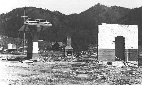
![Remains of original Detroit townsite, about Sept. 1953.]()
Detroit, town remains, Sep 1953.
Remains of original Detroit townsite, about Sept. 1953. Photo Ben Maxwell, Salem Public Libr.
-
![Detroit Dam construction, 1952.]()
Detroit Dam, construction of, aerial, 1952, 2.
Detroit Dam construction, 1952. Oreg. State Archives, Oreg. Water Resources Dept., OWR0043
-
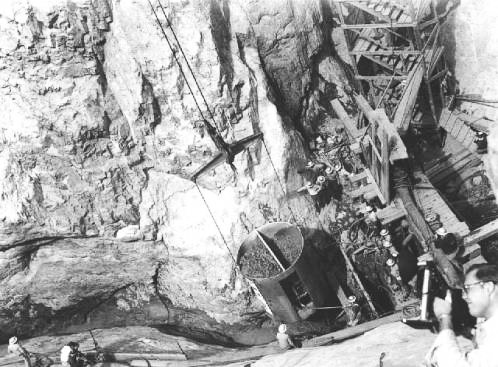
![Commencement of Detroit Dam construction, Aug. 1950.]()
Detroit Dam, construction of, concrete bucket, Aug 5 1950.
Commencement of Detroit Dam construction, Aug. 1950. Salem Public Libr. Hist. Photo Collec., 7279
-
![Commencement of Detroit Dam construction, Aug. 1950.]()
Detroit Dam, construction of, concrete bucket, Aug 5 1950, 2.
Commencement of Detroit Dam construction, Aug. 1950. Salem Public Libr. Hist. Photo Collec., 7280
-
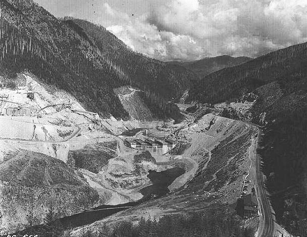
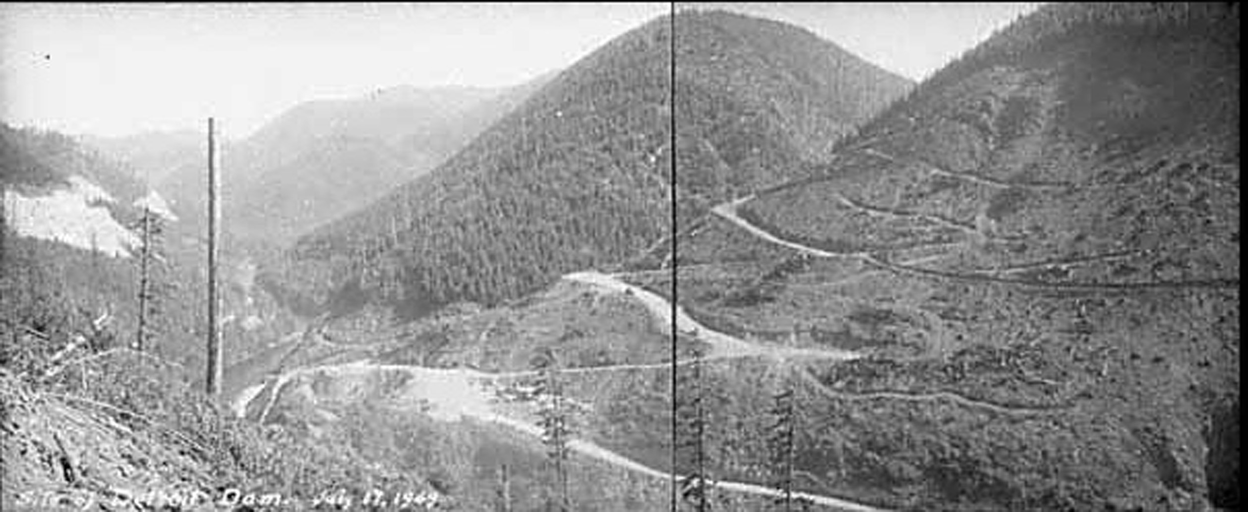
![Site of Detroit Dam, 1949.]()
Detroit Dam, 1949, CN 015430.
Site of Detroit Dam, 1949. Photo Carl P. Richards, Oreg. Hist. Soc. Research Libr., CN 015430
-
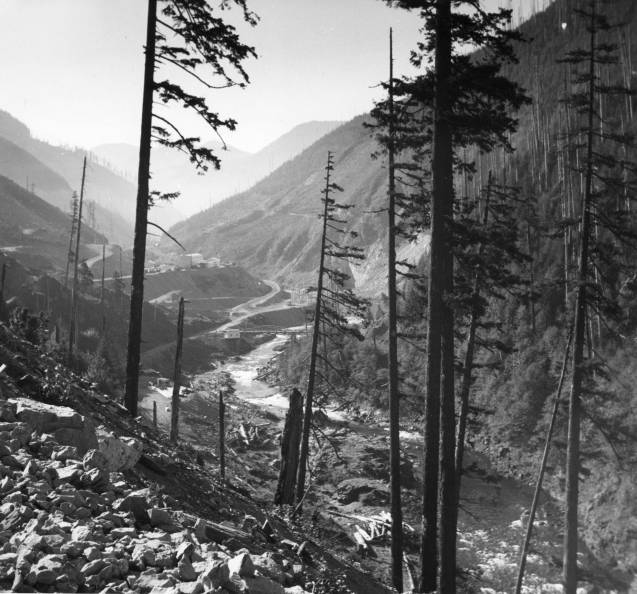
![Looking up the North Santiam River toward the Detroit Dam construction, 1951.]()
Detroit Dam constr, 1951.
Looking up the North Santiam River toward the Detroit Dam construction, 1951. Oreg. State Univ. Archives, Ofc. of Univ. Publ. collec., Willamette Basin Explorer, P218:WMG 0370b
-
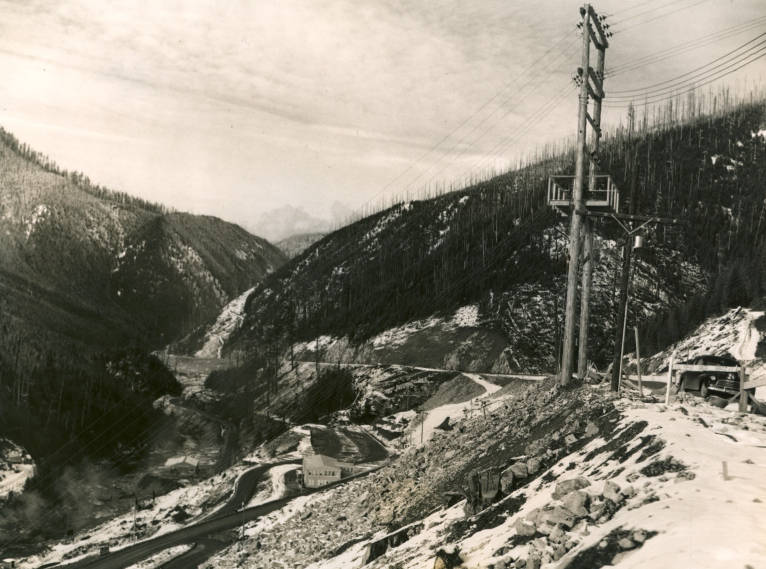
![South Santiam River, Highway 22 and the Detroit Dam construction site, 1952.]()
Detroit Dam, constr site, 1952.
South Santiam River, Highway 22 and the Detroit Dam construction site, 1952. Oreg. State Univ. Archives, Ofc. of Univ. Publ. collec., Willamette Basin Explorer, P218:WMG 0557f
-
![Detroit Lake, 1965.]()
Detroit Lake, from Hwy 22, 1965.
Detroit Lake, 1965. Photo Ben Maxwell, Salem Public Libr., SCC7
Related Entries
Related Historical Records
Map This on the Oregon History WayFinder
The Oregon History Wayfinder is an interactive map that identifies significant places, people, and events in Oregon history.
Further Reading
"Detroit Dam and Lake." U.S. Army Corps of Engineers, Portland District.
Robbins, William G. “The Willamette Project of Oregon: A Study in the Political Economy of Water Resource Development.” Pacific Historical Review 47( 1978): 585-605.
Willingham, William F. Army Engineers and the Development of Oregon: A History of the Portland District U.S. Army Corps of Engineers. Washington, D.C.: GPO, 1983.