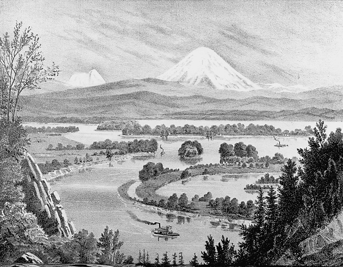
The Willamette Valley, bounded on the west by the Coast Range and on the east by the Cascades, is the largest river valley in Oregon. Part of the Cascades geological province that extends from British Columbia to northern California, the valley is an elongated, relatively flat body of land extending approximately 150 miles from the Columbia River south to the Calapooya Divide. The valley’s elevation, approximately ten feet above sea level where the Willamette River joins the Columbia, rises to about 450 feet south of Cottage Grove.
Toward the end of the Pleistocene (approximately 12,000 years ago), a succession of powerful floods—known as the Missoula Floods—washed down the Columbia River, reshaping landforms and topography on their way to the ocean. Those cataclysmic events pushed floodwaters up the Willamette Valley, leaving in their wake anomalies, small buttes in an otherwise flat landscape. Under the warming and drying conditions that followed, lakes and marshes in the valley diminished in size, and grasslands and oaks began to appear. With the establishment of the post-glacial regime, environmental conditions in the Pacific Northwest, including the Willamette Valley, have remained relatively stable for some ten thousand years.
The Willamette Valley is the homeland of numerous Native bands, whose subsistence practices changed little over thousands of years. With the arrival of increasing numbers of EuroAmericans in the 1840s, the landscape began to change, reflecting the newcomers’ elimination of Kalapuyan and Chinookan controlled burning and the introduction of cultivated agriculture. As they resettled land that Indigenous peoples had shaped through fire and other means, the EuroAmericans “husbanded the familiar,” in historian Richard White’s words, introducing new plants and animals from the East and Midwest. Their practices succeeded in part because rich deposits of glacial till had created some of the most fertile agricultural land in North America.
Non-Native Settlement and Farming
Although American explorers Meriwether Lewis and William Clark were briefly at the north end of the Willamette Valley in 1806, American and British fur traders were the first nonindigenous people to travel its length. A few of them established farmsteads in the lower valley during the 1820s. Trading company employees and explorers, such as members of Lt. Charles Wilkes’s party, wrote narrative accounts of the Willamette Valley that sparkled with possibility—a place of bounty, requiring only the hard work of an enterprising people to make good on its agricultural prospects. In the midst of the newcomers’ arrival, a series of malaria outbreaks between 1830 and 1833—spread by mosquito vectors that devastated the Native population in the valley—reduced their numbers by 90 percent.
American missionaries arrived in the Willamette Valley in the 1830s, followed by a tide of white immigrants in the 1840s, most of them from the Mississippi Valley. The new settlers first established Oregon City, followed by Portland downriver and upriver valley communities at strategic vantage points such as Salem, Albany, and Eugene. Beyond those settlements, immigrants traveling to Oregon took out land claims in the Willamette and tributary valleys, where western Oregon’s humid climate created an ideal environment for wheat and other grain crops. Oregon City, at Willamette Falls, was the valley’s first marketing and processing point for upriver farms and forests. The federal Donation Land Act in 1850—which granted 320 acres of land to adult white males and another 320 acres if they were married—attracted many newcomers.
Following the California gold rush in 1849, merchants took advantage of Portland’s location, ten miles from the confluence of the Willamette and Columbia Rivers, to ship goods downriver to the Pacific and on to San Francisco. The gold rush spurred commercial agriculture in the Willamette Valley and created new markets, as products such as lumber and flour passed through Portland.
Between 1840 and 1846, seven ships sailed into the Willamette’s tidewater; in 1849, fifty ships arrived to purchase grain and lumber at any price, a response to the demand in California. The Portland Oregonian, which began publishing in 1850, observed that California gold contributed to “a marked improvement in the manner of living among farmers in Oregon.” Portland subsequently became a transshipping point for Willamette Valley wheat transported up the Columbia River to Idaho mining country.
With improvements in river travel, wheat production in the Willamette Valley grew apace. Valley farmers produced 200,000 bushels in 1850, 660,000 in 1860, and more than two million in 1870. The increased production was a result of more acres put to the plow and new technology, including mowers, threshers, and wheat separators. River travel, important to moving wheat to Portland, was improved by removing river obstructions, especially snags above Willamette Falls.
Flooding Abatement and Transportation
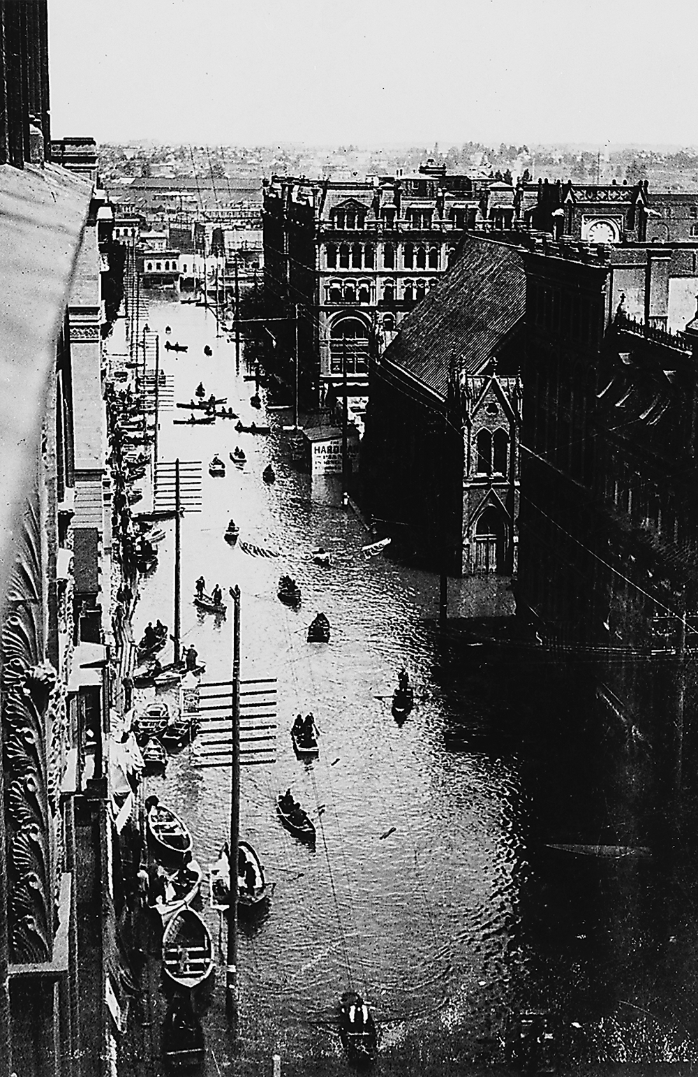
Portland benefited from the increased commercial traffic, supporting a growing number of mercantile houses, sawmills, planing mills, and warehouses. The city’s population was 805 in 1850, 2,874 in 1860, and 8,292 in 1870. Portland prospered as a point of exchange among its up-valley hinterland, California markets, and eventually distant oceanic metropolitan centers, including Liverpool, England, beginning in 1869. The annual floods that arrived with seasonal rains occasionally raised havoc with agricultural crops. The largest flood on record occurred in 1861, with one eyewitness reporting that “the whole Willamette Valley was a sheet of water.” Other damaging floods occurred in 1890 and 1894.
With the Oregon & California Railroad completed through the valley in 1872 and the opening of the canal and locks at Willamette Falls in 1873, farmers enjoyed alternative routes—and rates—for shipping goods to Portland. Salem, Albany, and Eugene grew into sizable communities during the nineteenth century, but Portland remained the dominant city in the Willamette Valley primarily because of its strategic location. Linked to transcontinental rail lines to the east with the Northern Pacific Railroad in 1883 and the Union Pacific by way of the Oregon Short Line across the Blue Mountains in 1884, Portland was at “the ‘Railroad Cross-Roads’ of the Pacific Northwest,” the Oregonian reported. “The situation of the city at the junction of the Willamette and Columbia valleys is invincible.”
During the last half of the nineteenth century, the Army Corps of Engineers accelerated its dredging of the Willamette River and built revetments to improve transportation. Entrepreneurs constructed small dams to power waterwheels and generators, and farmers organized small irrigation works. With the advent of powerful technologies, private companies built dams to generate electricity, curb flooding, and store water for agricultural use in the summer. Governor Walter Pierce led the way, urging the legislative assembly in 1925 to take advantage of “Oregon’s splendid power streams” to attract new industries to the state. “The stage is set,” he told lawmakers, “for the hydro-electric drama in Oregon.”
Although Oregon lacked the financial means to build dams on the flood-prone Willamette River system, developments in the nation’s capital during the 1920s lay the groundwork for regional planning, river surveys, and the technical infrastructure and funding for projects that would dramatically reconfigure the valley’s landscape. The Great Depression and the election of Franklin D. Roosevelt as president led to important spending on public projects, including river-basin planning outlined in House Document 308. The plan proposed multipurpose dams in the Columbia and Willamette river systems, with the Willamette contributing about 15 percent of the Columbia’s volume. The Army Corps of Engineers designed Willamette River dams to develop the resources of the entire river basin—flood control, recreation, navigation, and water storage for irrigation.
The Corps of Engineers completed its surveys of the Willamette Basin in April 1937. Adopted as House Document 544, the plan proposed seven dams in the Willamette system to control flooding, improve navigation, generate hydropower, provide water for irrigation, and improve river flows in late summer to flush pollutants downriver. With the exception of commercial and sports fishers, most people supported the project, believing it would put people to work, improve Oregon’s economy, and end seasonal flooding. Two dams were constructed before World War II: Fern Ridge Dam, west of Eugene, and Cottage Grove Dam, southwest of Cottage Grove. The war suspended all dam-building, and construction of dams in America’s river basins would not begin again until 1945.
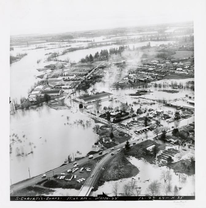
The Corps completed the last of the thirteen projects, Green Peter Dam northeast of Sweet Home, in 1969. In the end, the Willamette Valley Project dams ended the most destructive flooding along the valley’s floodplain. Although heavy rainfall and melting snows caused Willamette system streams to overflow in 1964 and again in 1996, agricultural lands and towns and cities have experienced little damage from seasonal floodwaters since the last dams became operable.
Farmers cleared floodplain woodlands and turned those rich soils to mostly row-crop production. The development of quick-couple aluminum pipes after World War II enabled farmers to irrigate crops from the Willamette River, the flow of which was augmented in the late summer with water released from project reservoirs. The higher late-season flows also help migrating fish and dilute pollution in the Portland Harbor.
Land-Use Planning
Beginning in the 1930s, the valley’s prairie lands were turned to growing forage and seed crops, especially common rye grass, which had an international market. With its moist, mild winters and relatively dry summers, the valley provided ideal conditions for seed-grass production. Growers planted approximately 11,000 acres to seed-grass crops in 1940, 100,000 acres in 1950, and more than 300,000 acres in the 1960s. By the early 1980s, seed-grass production covered more than 30 percent of valley cropland, including 56 percent of crops in Benton, Linn, and Lane Counties.
When diseases threatened the purity of the seed crops, growers began burning their fields during the 1940s to protect against contaminants and to control weeds, an inexpensive practice that was immensely successful. When billowing clouds of smoke drifted into Springfield and Eugene in the late 1960s, citizens began to protest the dense autumnal hazes that blanketed their neighborhoods. After automobile accidents in 1988 left seven people dead on Interstate 5 because of smoke from a grass fire, protests opposing field-burning forced the legislature to limit burning to a few hillside acres. The prohibition of burning, however, did not seriously disrupt seed-grass production, with Linn County proudly advertising itself as the seed-grass capital of the world.
For most of Oregon’s existence, the majority of its population has lived in the Willamette Valley—the percentage hovering about 70 percent since World War II. The valley’s growing population after the war and the sprawling suburbs of metropolitan Portland, Salem, and Eugene threatened valuable farmland and forestland and prompted the legislature—with Governor Tom McCall serving as the Pied Piper—to enact in 1973 the nation’s most progressive land-use planning system. Although the legislature’s decisions were tested with initiatives and court challenges, lawmakers established urban-growth boundaries to protect farm and forest land and passed other measures to preserve green spaces and keep industrial, commercial, and residential development within growth perimeters. Flying the length of the Willamette Valley today reveals a landscape that is considerably different from that in adjacent states.
-
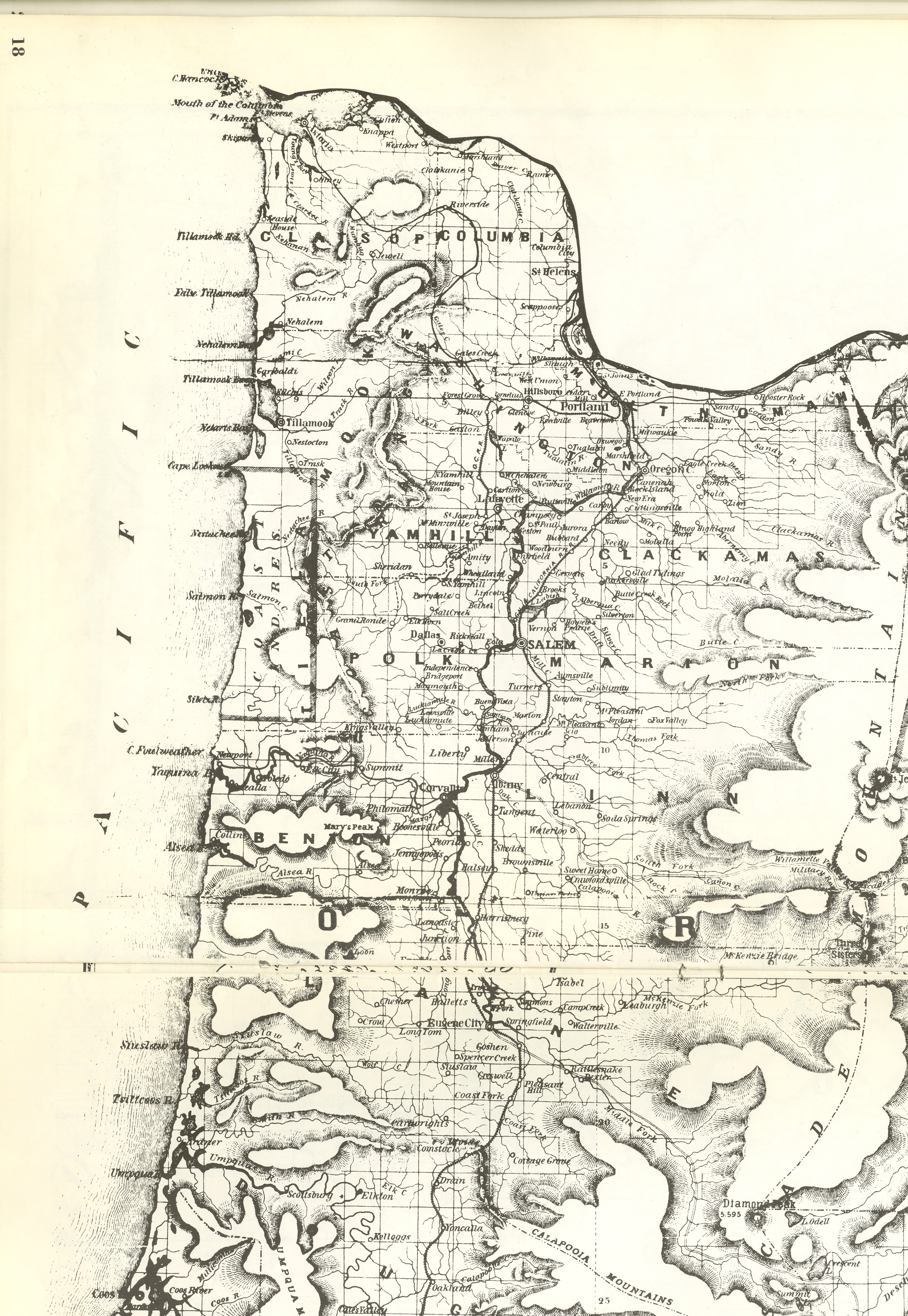
![From the Historical Oregon Atlas, 1970 edition]()
1878 map of the Willamette Valley in western Oregon.
From the Historical Oregon Atlas, 1970 edition Courtesy Oregon Hist. Soc. Research Lib., 911.791T489h
-
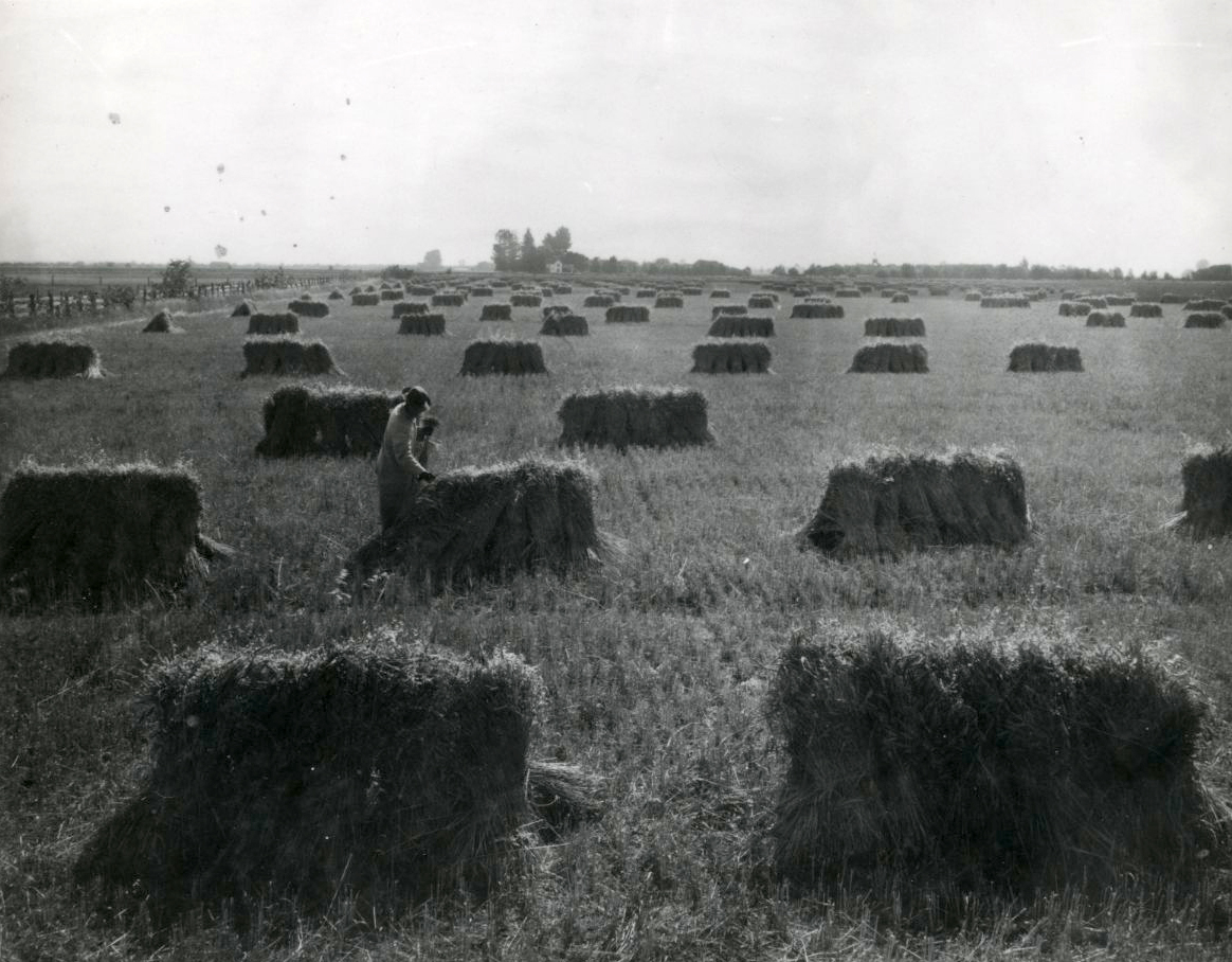
![]()
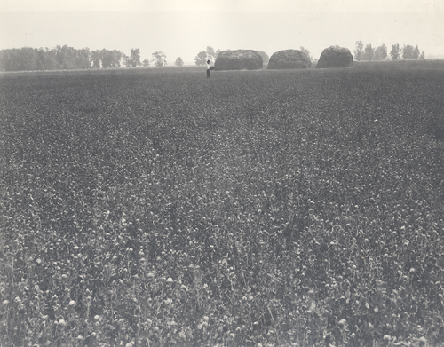
Wheat field in Albany, Oregon.
Courtesy Oregon Hist. Soc. Research Lib., 018899
Related Entries
-
![Albany]()
Albany
The Albany area—situated at the confluence of the Calapooia and Willame…
-
![Corvallis]()
Corvallis
Nestled on the west side of the mid-Willamette River, Corvallis is domi…
-
![Disease Epidemics among Indians, 1770s-1850s]()
Disease Epidemics among Indians, 1770s-1850s
In 1972, historian Alfred Crosby introduced the term Columbian Exchange…
-
![Eugene]()
Eugene
Eugene is a metropolitan center at the head of the Willamette Valley, a…
-
![Grass seed industry]()
Grass seed industry
The Willamette Valley, with its temperate climate, wet winters, and ari…
-
![Indian Use of Fire in Early Oregon]()
Indian Use of Fire in Early Oregon
Anthropogenic (human-caused) fire was a major component of the Native s…
-
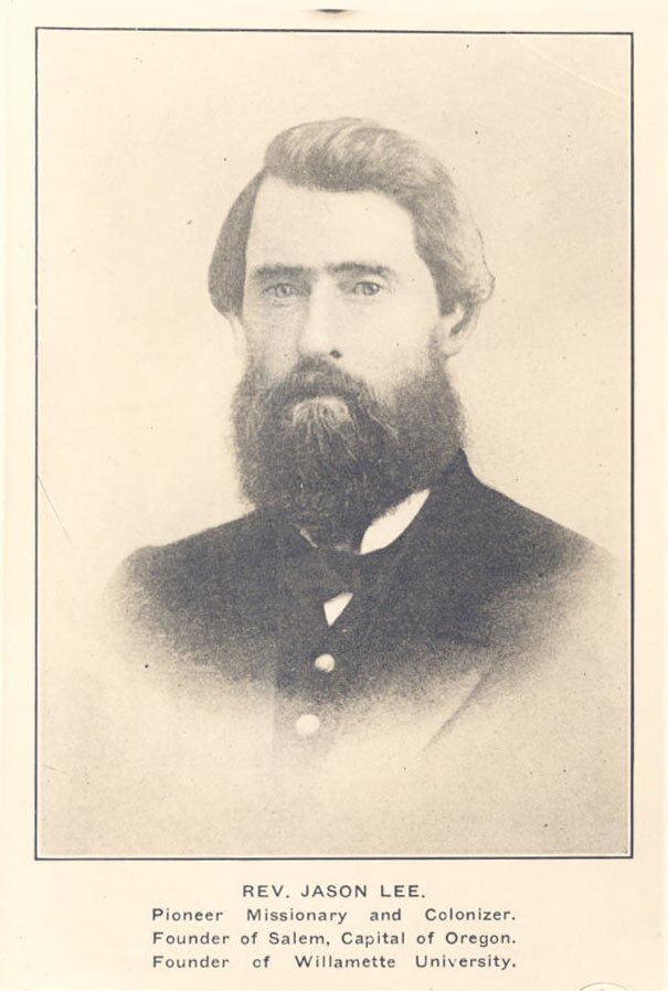
![Jason Lee (1803-1845)]()
Jason Lee (1803-1845)
Few names in the history of early nineteenth-century Oregon are better …
-
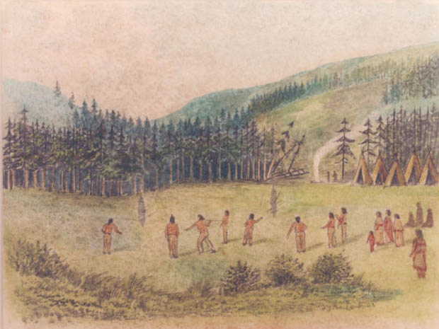
![Kalapuyan peoples]()
Kalapuyan peoples
The name Kalapuya (kǎlə poo´ yu), also appearing in the modern geograph…
-
![Land Use Planning]()
Land Use Planning
In 1973, Oregon took a pioneering step in land use planning. Signed int…
-
![Portland]()
Portland
Portland, with a 2020 population of 652,503 within its city limits and …
-
![Senate Bill 100]()
Senate Bill 100
Signed into law on May 29, 1973, Oregon Senate Bill 100 created an inst…
-
![Urban Growth Boundary]()
Urban Growth Boundary
Each urban area in Oregon is required to define an Urban Growth Boundar…
-
![Willamette Falls]()
Willamette Falls
The largest falls in Oregon and the second in the United States by volu…
-
![Willamette River]()
Willamette River
The Willamette River and its extensive drainage basin lie in the greate…
-
![Willamette River flood of 1894]()
Willamette River flood of 1894
The Willamette River, in its natural state, has been subject to annual …
-
![Willamette River flood of 1964]()
Willamette River flood of 1964
The Willamette River, in its natural state, was subject to annual flood…
-
![Willamette River flood of 1996]()
Willamette River flood of 1996
In 1996, as part of a larger pattern of winter flooding in the Pacific …


Related Historical Records
Map This on the Oregon History WayFinder
The Oregon History Wayfinder is an interactive map that identifies significant places, people, and events in Oregon history.
Further Reading
Abbott, Carl, Deborah Howe, and Sy Adler, eds. Planning the Oregon Way: A Twenty-Year Evaluation. Corvallis: Oregon State University Press, 1994.
Aikins, Melvin. Archeology of Oregon. Portland: Oregon State Office, U. S. Department of the Interior, Bureau of Land Management, 1986.
Boag, Peter G. Environment and Experience: Settlement Culture in Nineteenth-Century Oregon. Berkeley: University of California Press, 1992.
Bowen, William A. The Willamette Valley: Migration and Settlement on the Oregon Frontier. Seattle: University of Washington Press, 1978.
Hunn, Eugene S. Nch’i-Wana, “The Big River”: Mid-Columbia Indians and Their Land. Seattle: University of Washington Press, 1990.
Robbins, William G. Landscapes of Promise: The Oregon Story, 1800-1940. Seattle: University of Washington Press, 1997.
_______. Landscapes of Conflict: The Oregon Story, 1940-2000. Seattle: University of Washington Press, 2004.
Walth, Brent. The Fire at Eden’s Gate: Tom McCall and the Oregon Story. Portland: Oregon Historical Society Press, 1994.
Willingham, William F. Army engineers and the Development of Oregon: A History of the Portland District. Washington, D. C.: Government Printing Office, 1983.