The Willamette River and its extensive drainage basin lie in the greater Cascades geological province, extending from British Columbia to northern California. The river and its principal tributaries drain 11,478 square miles (12 percent of Oregon), with the basin's runoff fluctuating dramatically between the heavy precipitation of the winter months and relatively rain-free summers. The Willamette River Basin is approximately 180 miles in length and roughly 100 miles wide. The riverbed is approximately 450 feet above sea level at the southern end of the valley and ten feet above sea level at its confluence with the Columbia River.
Although the Willamette drainage is fairly small by comparison with the vast Snake River Basin, its river system contributes 15 percent of the average annual flow of the Columbia River. The south-to-north-flowing Willamette is the thirteenth largest river in the contiguous United States, with an average annual discharge of 32,000 cubic feet per second (cfs) at its confluence with the Columbia River northwest of Portland. Before the construction of federal dams on its tributaries between 1941 and 1969, the river and its tributaries provided important spawning grounds for spring Chinook salmon and steelhead trout.
With significant annual precipitation and moderate evaporation, the Willamette is somewhat of an anomaly among American rivers. The Willamette Basin discharges more runoff per acre than any other large river in the United States, with most of it occurring during the winter rainy season. Summer rainfall in the basin averages only about 5 percent of the yearly total. The seasonal nature of precipitation—heavy winter rains and dry, hot summers—provides some interesting contrasts. The peak river flow during the floods of late January 1996 was estimated at about 460,000 cfs at Portland. In contrast, officials recorded a low flow for Portland of a mere 4,200 cfs on July 10, 1978.
The Willamette Basin is bounded on the west by the relatively low Coast Range, with Mary's Peak, at 4,097 feet, its highest point. The more spectacular Cascade Range to the east—with Mount Hood at 11,249 feet—contributes to the basin's unique temperature and precipitation ranges. Maritime influences—northward and southward seasonal ocean currents and westerly prevailing winds—shape the regional climate. Warm, moist air blowing in from the southwest produces heavy precipitation in the late fall, winter, and early spring months in the Coast Range, producing intense seasonal rains with light, transitory snowfall, most of it at higher elevations.
The Cascade Range to the east has an equally significant seasonal precipitation. Most of it, however, occurs as snowfall, and there are some glaciers and permanent snowfields. The Cascades also provide a buffer from continental climatic influences, creating a unique blend of topographic relationships that shape the regional climate.
Historically, the Willamette River ran "wild" during winter and spring, overflowing its many braided channels and sloughs and flooding extensive low-lying areas of the valley. The annual floodwaters—reflecting forty to fifty inches of seasonal precipitation—left fresh soil deposits in their wake and sustained an abundance of aquatic, plant, and animal life. David Douglas, the Scottish botanist who traveled through the Willamette Valley in the dry, hot months of late autumn 1826, witnessed spectacular changes to the valley landscape when he returned in November after the seasonal rains had begun. In place of the charred, Indian-fired countryside on his trip up the valley, he now reported lush, green prairie grasses, occasional marshlands, and small lakes.
Navigation Projects
Although numerous Native American bands lived along sections of the Willamette River system for some ten thousand years, their alterations to the river and its tributaries were minor, other than building weirs and traps to catch salmon and steelhead and using the waterway for transportation. Those relatively stable ecological relationships, however, began to change with the arrival of ever-increasing numbers of EuroAmericans during the 1840s and 1850s. The introduction of cattle, hogs, and sheep and then the expansion of wheat production contributed to dramatic changes to the valley landscape.
Because the Willamette River provided the critical transportation route for moving wheat to Portland and then on to oceanic markets, the federal government funded the construction of a steam-powered "snag-puller" in 1869 to remove obstructions from the river. The snag-pulling operation and the construction of a canal and locks at Willamette Falls in 1873 marked the beginning of human efforts to reshape the waterway to meet the needs of commercial and industrial traffic.
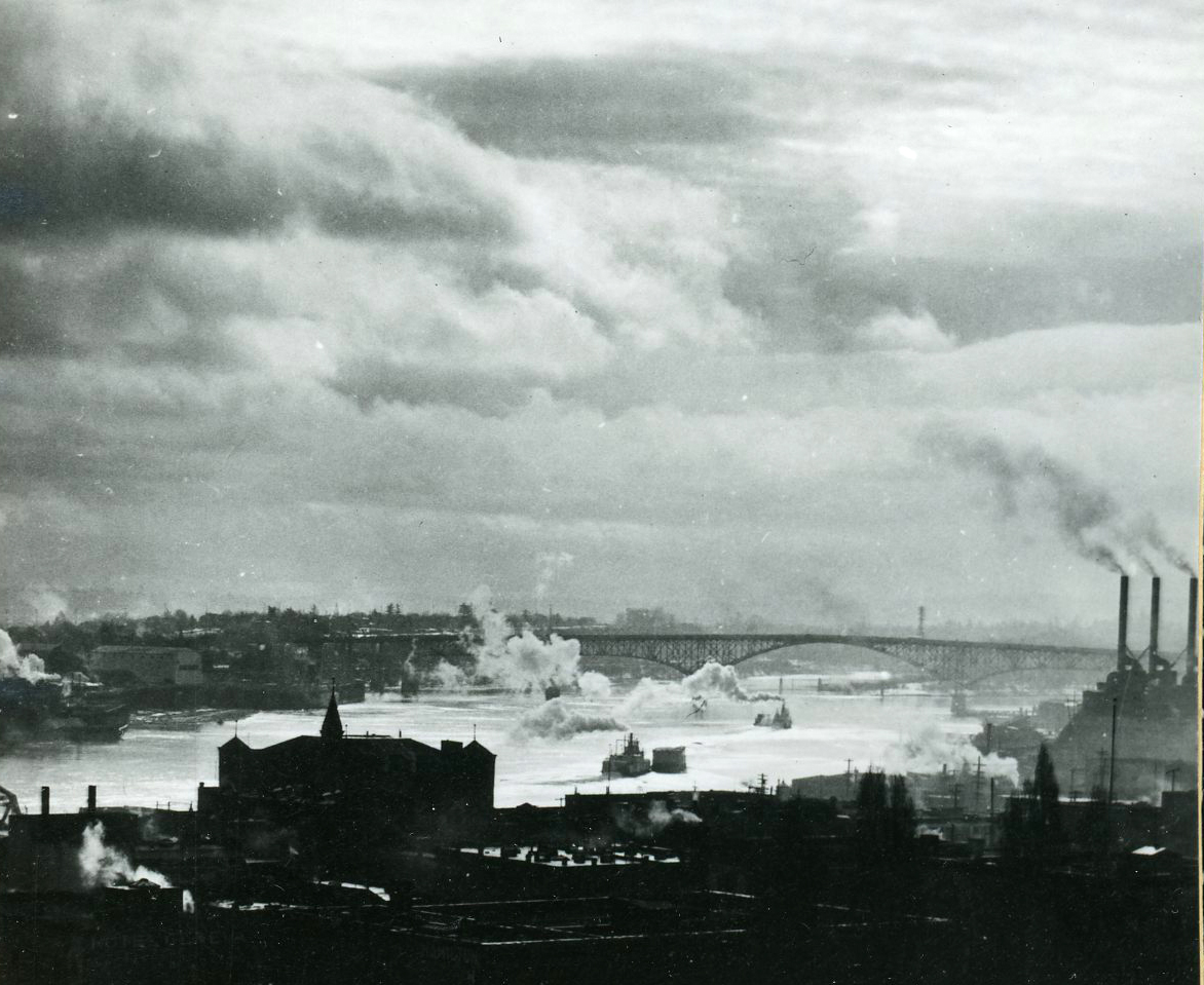
The major population centers that developed in the Willamette Valley were all "river cities," located along the Willamette, McKenzie, and Santiam Rivers. As these fledgling urban areas expanded in population and in the amount of human activity, they treated the waterway as a place to dispose of both domestic and industrial wastes. In that sense, the river functioned as a commercial artery, serving the industrial and commercial needs of people who lived in the valley. This was especially so for the valley's largest cities: Portland, Newberg, Salem, Albany, Corvallis, Eugene, and Springfield.
As the twentieth century advanced, transportation developers and agriculturalists built dikes and revetments (rock or cement embankments) designed to channelize the Willamette River and circumvent its meandering tendencies during high-water months. At the same time, the ever-increasing population and industries in the basin continued to treat the Willamette and its major tributaries as a dumping ground for domestic and industrial waste, essentially turning the main-stem river into an open sewer by the 1920s.
Pollution, Abatement, and Flood Control
Slowly, private and public organizations and agencies began raising concern about the increasingly polluted Willamette River. In 1927, a Portland City Club report declared that the waterway was "filthy and ugly," with the City of Portland the worst offender. The river's growing notoriety finally prompted the Oregon Anti-Stream Pollution League to bring a modest pollution-abatement measure before the 1937 legislature. Although lawmakers easily passed the bill, Governor Charles Martin vetoed the measure.
Undaunted, the Izaak Walton League and the Oregon Wildlife Federation countered the governor's veto and sponsored an initiative measure, the Water Purification and Prevention of Pollution bill, which voters easily approved in November 1938. The new law established the Oregon State Sanitary Authority, with modest enforcement powers, and marked the incremental beginnings of a program to rid the Willamette River system of pollution.
Each year, as the population of the valley grew, floods wrought increasing havoc on businesses and industries, from Eugene and Springfield downstream to Portland. As pressure on the valley's land base increased, citizens the length of the waterway intensified their campaign for federal action. During the Great Depression, the Army Corps of Engineers drafted an ambitious plan to construct a series of reservoirs on the main-stem Willamette and tributary streams that promised to bring widespread benefits to the Willamette Valley and help rid the waterway of pollution.
The Willamette Valley Project was firmly grounded in engineering surveys and planning that proposed a system of dams that would promote the efficient development of the resources of the Willamette Valley. In the best of all possible worlds, the dams would control flooding, improve navigation, help flush pollution from the river, generate hydropower, and provide recreational waterscapes. The project was based on the premise that the waterway was dysfunctional and unreliable in its natural state. Its seasonal fluctuations hampered progress: destructive torrents of water during the winter months and meager summer flows hindered navigation and allowed municipal and industrial pollutants to build up in the lower river.
The effort to mitigate pollution in the Willamette River was deferred during the early 1940s while the United States was engaged in a two-ocean war. With the end of the war in 1945, Oregon began to mandate primary and secondary sewage treatment facilities for all municipalities. While these advances were taking place, the Corps was in the process of completing a series of big storage dams on the rivers in the Willamette system. When the Willamette Valley Project was completed in the early 1970s, the waterway had become a technically understood phenomenon, with its seasonal fluctuations, the volume of water stored and released from reservoirs, and its monthly flow per cubic foot measured and controlled.
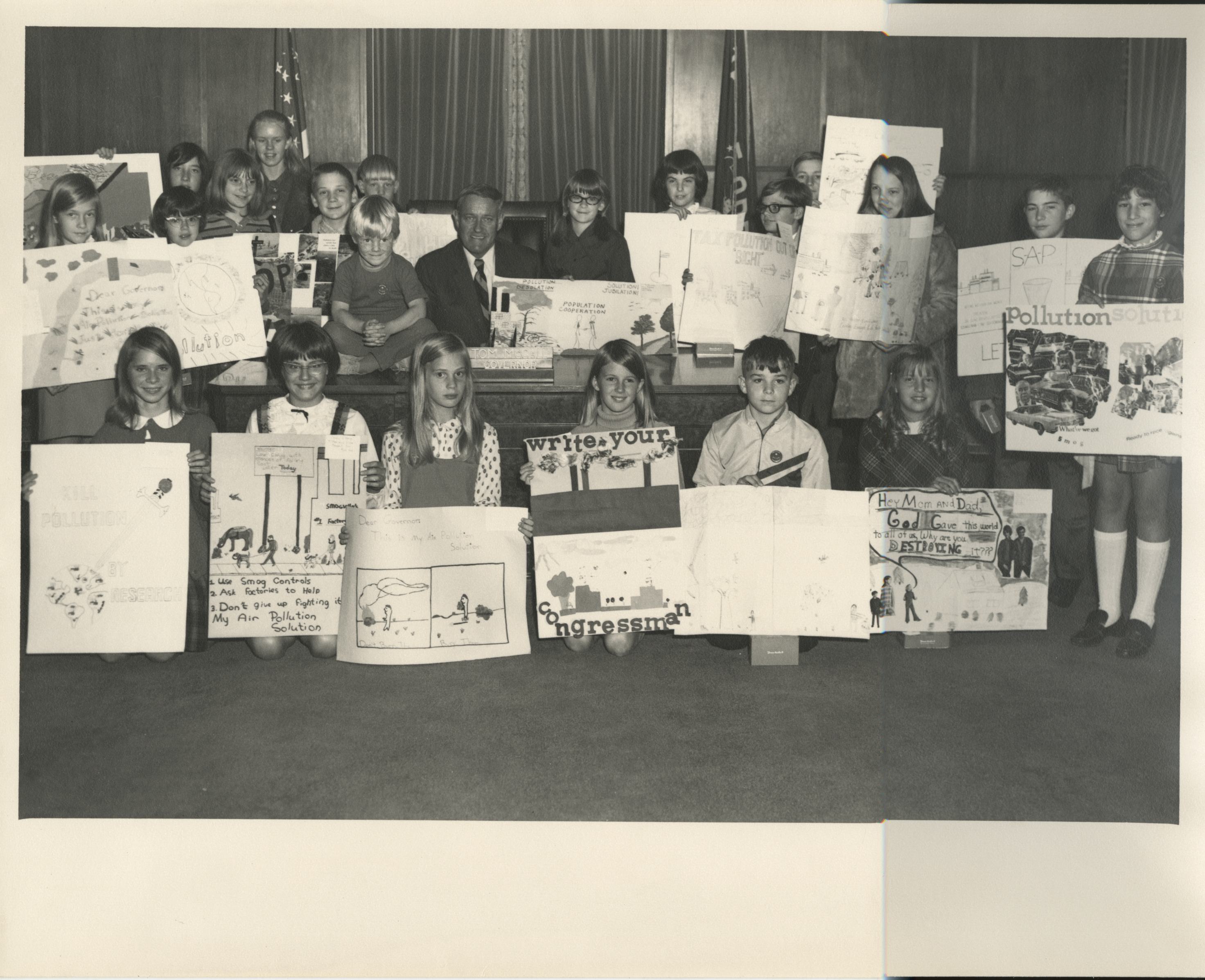
By the early 1970s, Oregon was successful in persuaded five big pulp and paper mills to install wastewater treatment facilities before returning water to the river, a key factor in preventing industrial pollution from entering the waterway. Finally, during the governorship of Tom McCall (1967-1975), Oregon gained national acclaim for its work in cleaning up the Willamette River. This recognition coincided with the national effort to cope with both water and air pollution.
In addition to bringing an end to dumping most point-source pollutants into rivers and steams—the most egregious and readily identifiable types flowing from pipes and sewers—the thirteen Army Corps of Engineers dams and reservoirs stored seasonal water for release during the low-flow months of August and September, thereby providing a major contribution to the improving water quality in the Willamette River.
In the late 1990s, the troubled river once again made headlines. Sharp increases in the Willamette Valley's population had added to the river's burdens. In addition, the corresponding development of more sophisticated scientific instruments made possible the detection of petroleum residues, toxic chemicals, and metal byproducts in urban waterways and pesticides and nutrient contaminants in rural streams. It became clear that what Oregon had accomplished in the 1970s was the elimination of the more visible types of point-source pollutants. The problems with the Willamette system in the twenty-first century reflect the growing volume of non-point-source pollution entering waterways from sources that include driveways, parking lots, streets and highways, agricultural land, and seemingly green environments such as heavily fertilized golf courses.
Governor John Kitzhaber's Willamette River Basin Task Force reported in 1997 that non-point-source pollution entering the Willamette system during periods of high precipitation far exceeded point-source contamination in the waterway. The report pointed out that urban areas contributed a higher pollutant load per acre than rural land, although the latter produced a larger overall quantity because of the infinitely greater area involved.
The task force reported that dioxin, PCBs, industrial and municipal effluent, riverbank development, and farming were poisoning the Willamette, causing deformities in fish, contributing to dwindling salmon and steelhead runs, and threatening domestic water supplies. By the early twenty-first century, the Willamette River was beset with all sorts of problems. The waterway may be a miner's canary of sorts, revealing the flaws of a culture that believed it had bested the river.
For 150 years, alterations to the Willamette River system have largely reflected agricultural, forestry, and urban activities. In the engineering designs for the river, the survival of anadromous fishes such as salmon and steelhead were not at the center of Willamette Valley Project ambitions. Although sports and commercial fishers protested building main-stem dams on the Willamette, commercial and industrial interests in the valley, local chambers of commerce, the Corps of Engineers, and Oregon's congressional delegation gave their wholehearted support to the project. For the most part, the dams have kept winter flood waters at bay, the augmented volume of water during late summer and autumn helps maintain a semblance of water quality in the lower river, and the lakes behind project dams provide recreational opportunities.
-
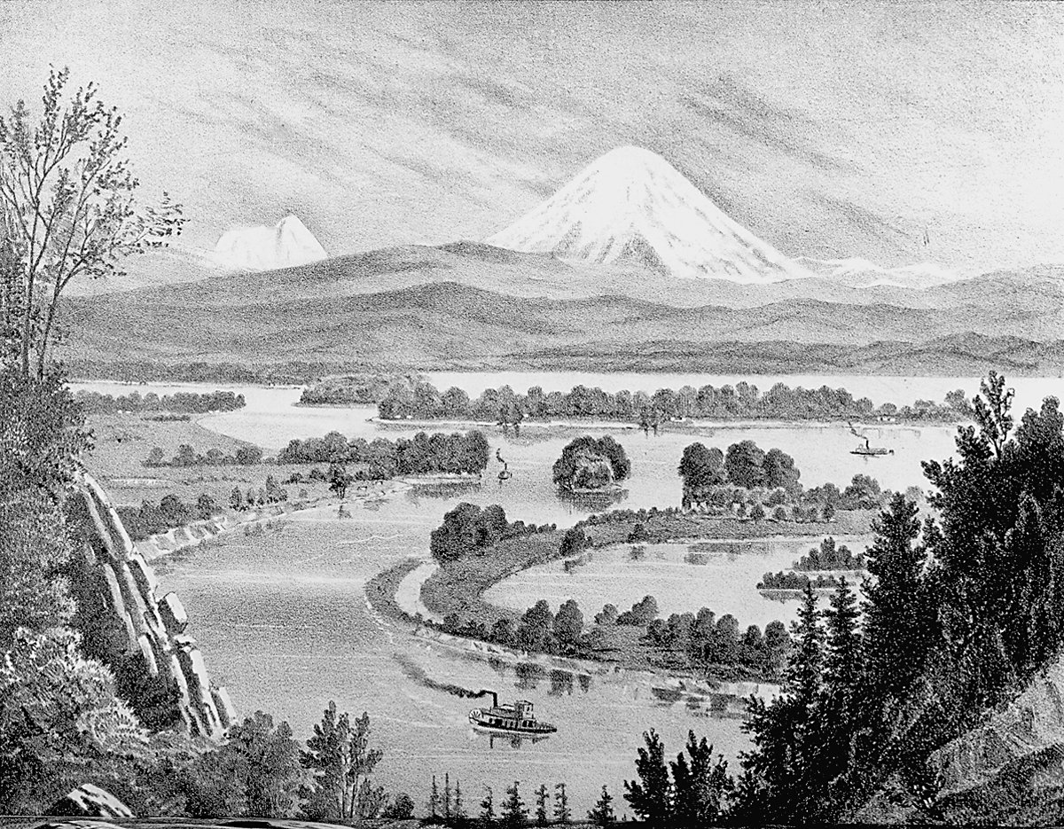
![Cleveland Rockwell's sketch "Mouth of the Willamette" for West Shore magazine, Oct. 1883.]()
Willamette R., sketch of, by Rockwell, 1883, OrHi 76413.
Cleveland Rockwell's sketch "Mouth of the Willamette" for West Shore magazine, Oct. 1883. Oreg. Hist. Soc. Research Libr., OrHi 76413
-
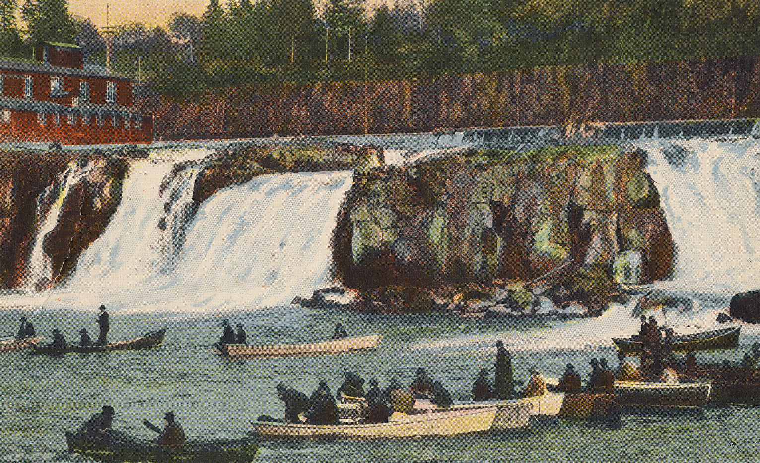
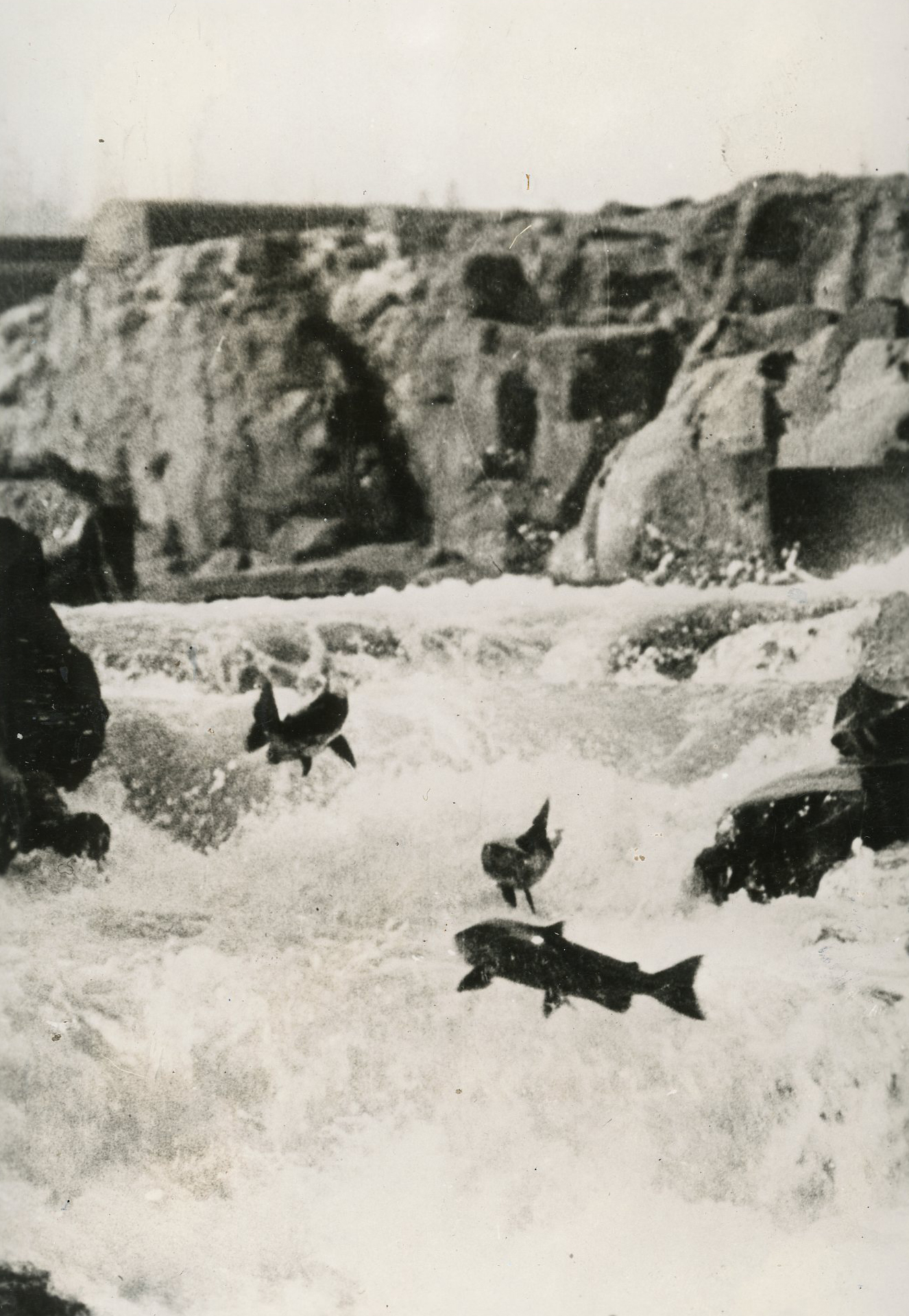
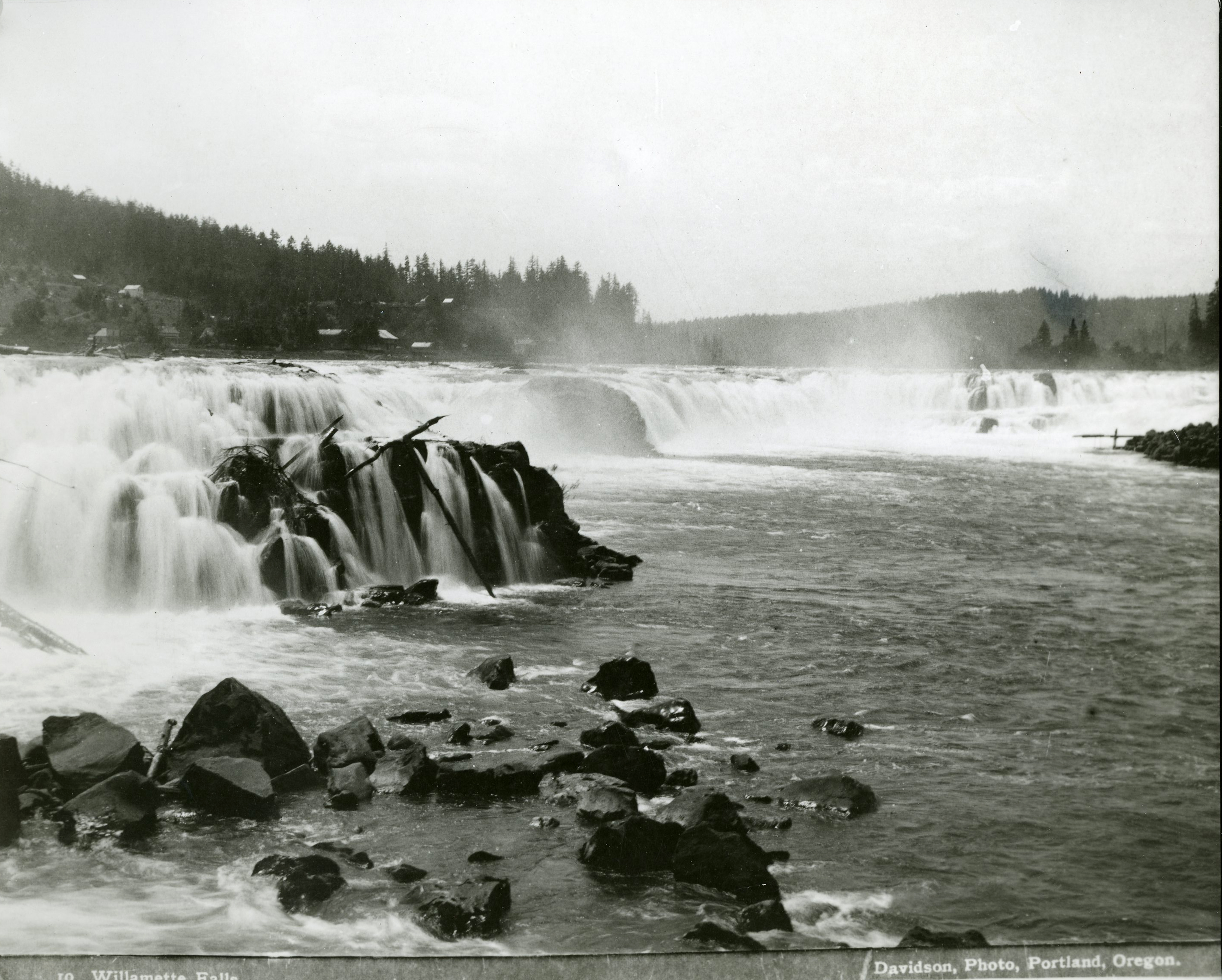
![Willamette Falls, about 1900.]()
Willamette Falls, salmon fishing, postcard.
Willamette Falls, about 1900. Publisher Charles B. Lipschuetz Co., courtesy Robert L. Hamm
-
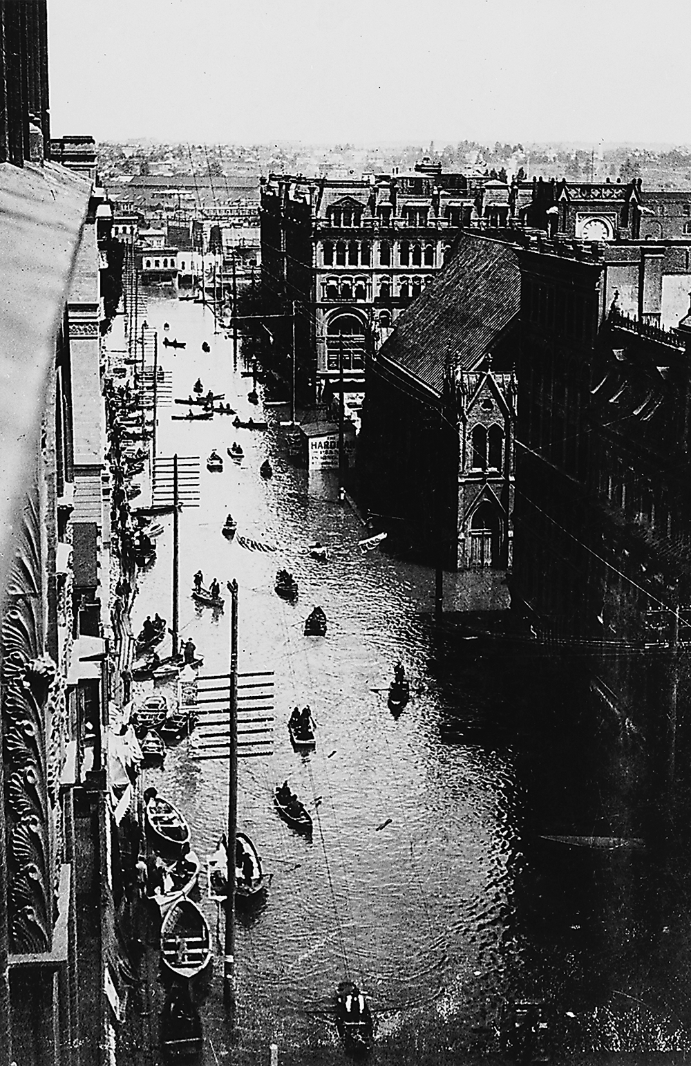
![3rd St., Portland, between Washington and Burnside streets, Willamette River flood, 1894.]()
Willamette flood, 1894, OrHi 3845.
3rd St., Portland, between Washington and Burnside streets, Willamette River flood, 1894. Oreg. Hist. Soc. Research Libr., OrHi 3845
-
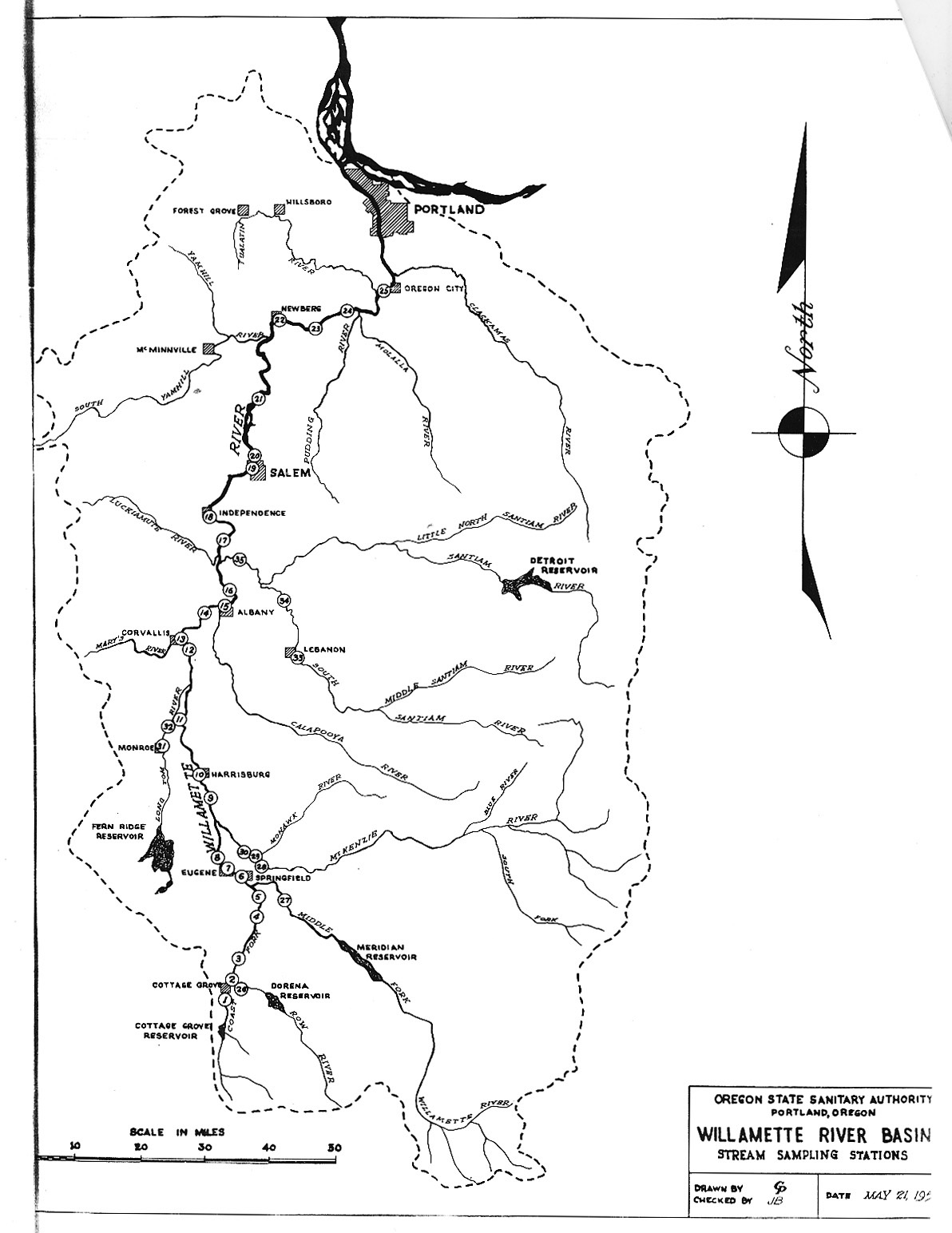
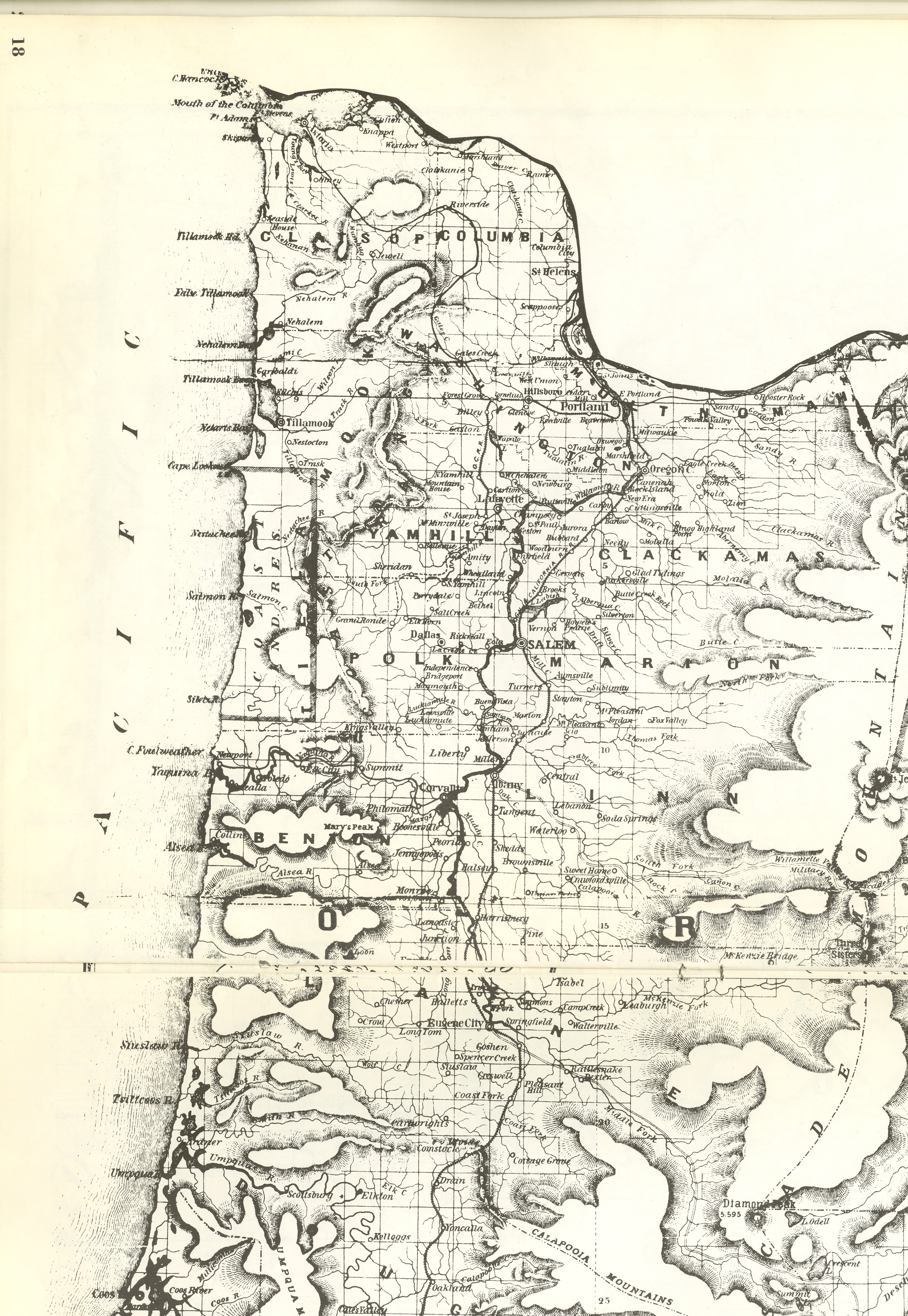
![Willamette Basin map showing water quality sampling locations, 1951.]()
OSSA Willamette basin map, 1951.
Willamette Basin map showing water quality sampling locations, 1951. Oreg. State Sanitary Auth., "Stream Survey Report: Willamette River," 1951
-
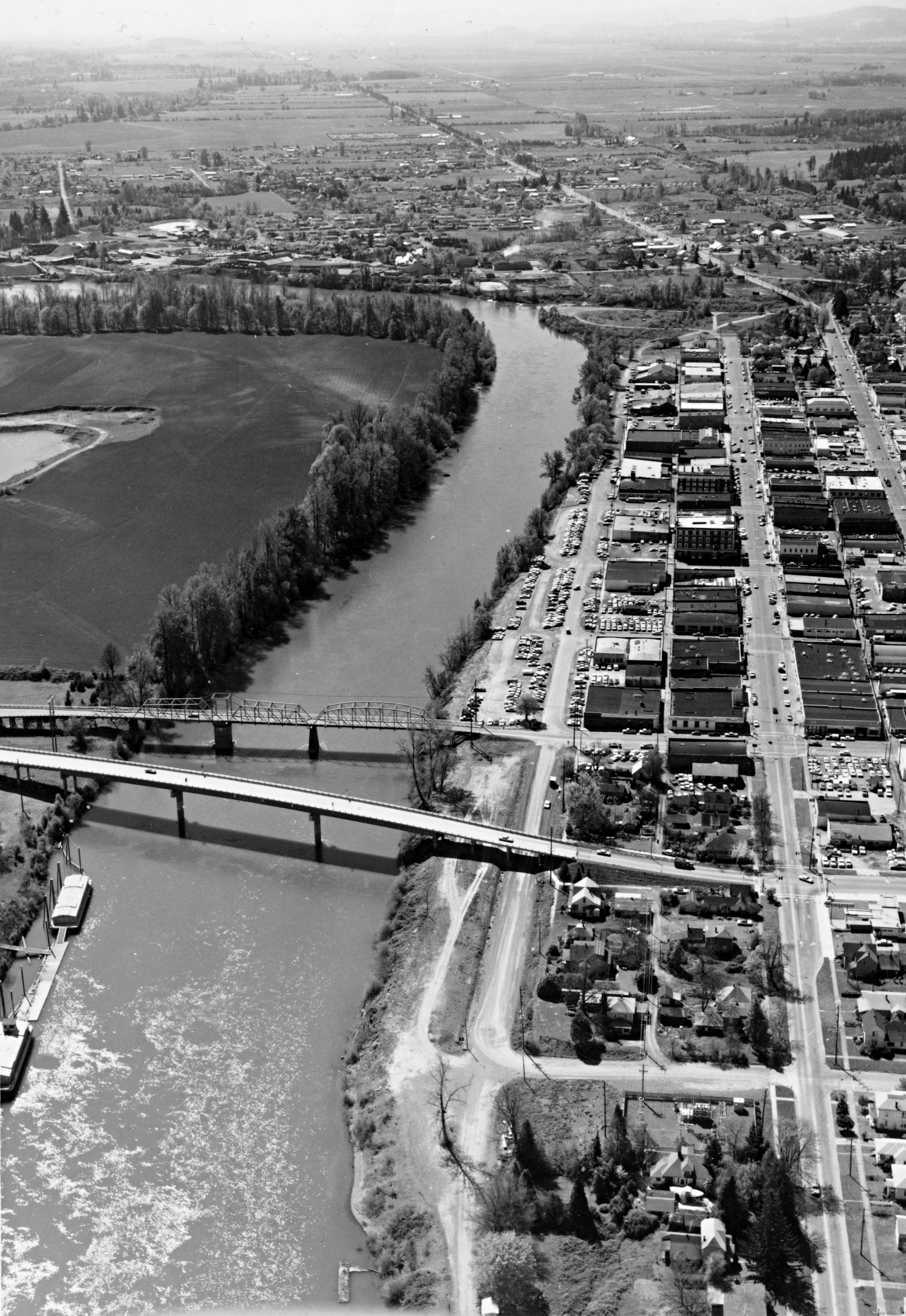
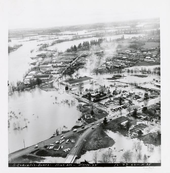
![Corvallis and the Willamette River, looking south, about 1970.]()
Corvallis, aerial, bc005380.
Corvallis and the Willamette River, looking south, about 1970. Oreg. Hist. Soc. Research Libr., bc005380

Related Entries
-
![Department of Environmental Quality]()
Department of Environmental Quality
The Oregon Department of Environmental Quality (DEQ) administers and en…
-
![Kalapuyan peoples]()
Kalapuyan peoples
The name Kalapuya (kǎlə poo´ yu), also appearing in the modern geograph…
-
![McKenzie River]()
McKenzie River
The McKenzie River, on the western slope of the Cascade Range, starts o…
-
![Pollution in Paradise (documentary film)]()
Pollution in Paradise (documentary film)
KGW-TV aired Tom McCall’s one-hour documentary Pollution in Paradise on…
-
![Portland Basin Chinookan Villages in the early 1800s]()
Portland Basin Chinookan Villages in the early 1800s
During the early nineteenth century, upwards of thirty Native American …
-
![Salmon]()
Salmon
The word “salmon” originally referred to Atlantic salmon (Salmo salar),…
-
![Willamette Falls]()
Willamette Falls
The largest falls in Oregon and the second in the United States by volu…
-
![Willamette River flood of 1894]()
Willamette River flood of 1894
The Willamette River, in its natural state, has been subject to annual …
-
![Willamette River flood of 1964]()
Willamette River flood of 1964
The Willamette River, in its natural state, was subject to annual flood…
-
![Willamette River flood of 1996]()
Willamette River flood of 1996
In 1996, as part of a larger pattern of winter flooding in the Pacific …
-
![Willamette Valley]()
Willamette Valley
The Willamette Valley, bounded on the west by the Coast Range and on th…


Related Historical Records
Map This on the Oregon History WayFinder
The Oregon History Wayfinder is an interactive map that identifies significant places, people, and events in Oregon history.
Further Reading
Robbins, William G. Landscapes of Conflict: The Oregon Story, 1940-2000. Seattle: University of Washington Press, 2004.
Robbins, William G. Landscapes of Promise: The Oregon Story, 1800-1940. Seattle: University of Washington Press, 1999.
Walth, Brent. Fire At Eden's Gate: The Tom McCall Story. Portland: Oregon Historical Society, 1995.
Willamette Riverkeeper. "Physical Character Tributaries Watershed Uses Pollution Problem." www.willamette-riverkeeper.org/river1.htm.
Hillegas, James V. "Working for the 'Working River': Willamette River Pollution, 1926-1962." MA thesis, Portland State University, 2009.