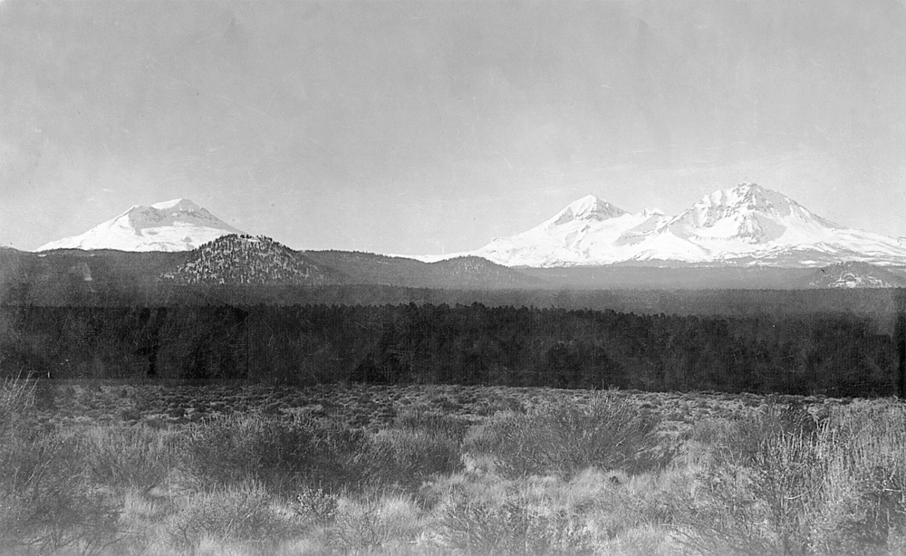
The McKenzie River, on the western slope of the Cascade Range, starts on the east at the volcanic Three Sisters and extends approximately ninety miles to the west. The main McKenzie River is joined by the South Fork below the town of McKenzie Bridge, the Blue River at the town of Blue River, and the Mohawk River just north of Springfield. The McKenzie joins the Willamette River just southwest of Coburg.
Native Americans have lived along the McKenzie for at least 8,000 years. In more recent history, the Kalapuya and Molala people lived in the area, wintering in the lower valley and summering in the high Cascades. During the 1850s, most of the Native people who called the McKenzie home were sent to federal reservations.
The first recorded explorations of the McKenzie River area occurred in the spring of 1812. The Pacific Fur Company traders had established a post in 1811 near the mouth of the Columbia River at Fort Astoria. The following spring, Donald Mackenzie (or McKenzie), one of Astor's partners, organized an exploring party that traveled up the Willamette River. The party named McKenzie's Fork of the Willamette River in his honor.
In the fall of 1853, Benjamin Franklin Owen and a party of seven other immigrants who separated from “The Lost Wagon Train of 1853” crossed the Cascades from the east and traveled down the McKenzie River, where they were rescued. It was the first recorded passage over the Cascades and down the entire length of the river. The first recorded crossing over McKenzie Pass from west to east was made in 1862, when Felix Scott Jr. slowly made his way up the river with 60 yoke of work cattle, 900 cattle, and nine freight wagons. In 1871, a toll road was built; it was sold in the late 1890s to Lane County.
The first automobile passed over the McKenzie road in 1910. For decades, the McKenzie Valley was a dead end during winter, as heavy snows block the road over McKenzie Pass. Today, this old road section, Oregon State Highway 242, is called the McKenzie Pass Scenic Highway; it is still closed during the winter. A new highway section connecting Belknap Springs with the South Santiam Highway (U.S. 20) was completed in the early 1960s, opening the valley to east-west traffic year-round.
The McKenzie River is known for its sports fishing, and many famous anglers stayed at Thomson's Lodge, which opened in 1912 below Martin Rapids in Ben and Kay Dorris State Park. The lodge, where Herbert Hoover was a regular visitor, was sold in 1948 and was destroyed by fire in April 1954. In 1931, several river guides—including the Thompson family (Carey, Dayton, Milo, and Rube), Prince Helfrich, John and Roy West, and Rube Montgomery—formed McKenzie River Guides Association.
The river, with adjacent heavy stands of Douglas-fir and western hemlock, served as a major timber supplier to the sawmills of the Willamette Valley. Numerous companies, including the Booth-Kelly Lumber Company and later Weyerhaeuser, cut millions of trees and provided employment for thousands of valley residents. For a number of years before the highway and railroad were built, the river was used to float logs to the sawmills in Coburg. Springfield became a major sawmill and later pulpwood center.
Major cities and towns in the McKenzie River watershed include Eugene-Springfield, Coburg, Mabel, Marcola, Walterville, Leaburg, Vida, Blue River, and McKenzie Bridge. Several covered bridges are preserved on the river or its tributaries, including the Belknap, Ernest (across the Mohawk River, Mohawk Valley), Goodpasture, and Wendling (across Mill Creek, Mohawk Valley), and there are two well-known hot springs, Belknap Hot Springs and Terwillger Hot Springs. A third public hot springs, Foley Hot Springs near McKenzie Bridge, closed in 1950, and the main lodge burned in 1981.
The upper reaches of the McKenzie River and mountain areas are managed by the U.S. Forest Service as part of the Willamette National Forest. There are four dams and reservoirs: Leaburg, Cougar, Blue River, and the Carmen-Smith Project.
The McKenzie River has played an important part in Oregon history. Today, the river adds huge recreation and forestry values to the residents of the state.
-
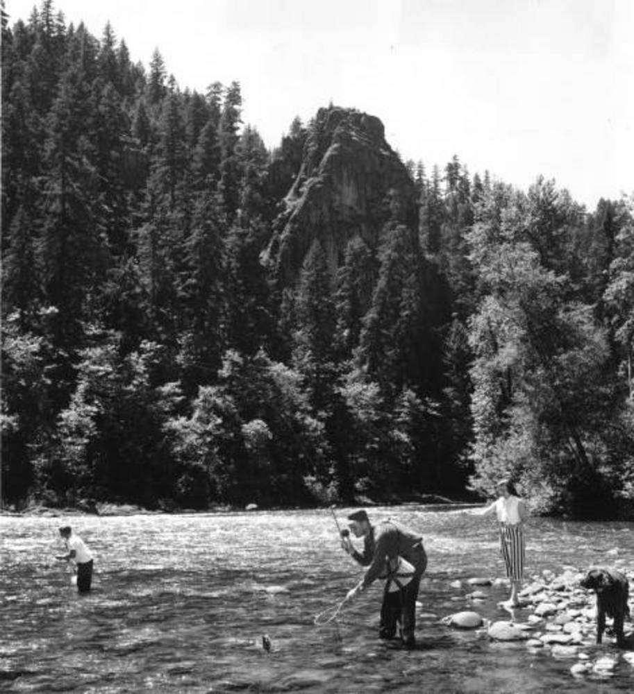
![Rainbow trout fishing on the McKenzie River near Nimrod, 1960.]()
McKenzie R., fishing on.
Rainbow trout fishing on the McKenzie River near Nimrod, 1960. Oreg. State Univ. Archives, Office of Univ. Pubs., Willamette Basin Explorer, P094:Acc 95:014
-
![Goodpasture Bridge on the McKenzie River near Leaburg, 1960.]()
McKenzie R., Goodpasture Bridge.
Goodpasture Bridge on the McKenzie River near Leaburg, 1960. Oreg. State Univ. Archives, Office of Univ. Pubs., Willamette Basin Explorer, P094:Acc 95:014
-
![McKenzie River white water parade, April 1, 1955.]()
McKenzie R., White Water Parade.
McKenzie River white water parade, April 1, 1955. Oreg. State Univ. Archives, Office of Univ. Pubs., Willamette Basin Explorer, P094:Acc 95:014


Related Entries
-
![Kalapuyan peoples]()
Kalapuyan peoples
The name Kalapuya (kǎlə poo´ yu), also appearing in the modern geograph…
-
![Molalla Peoples]()
Molalla Peoples
The name Molalla ([moˈlɑlə, ˈmolɑlə], usually spelled Molala by anthrop…
-
![Pacific Fur Company]()
Pacific Fur Company
The Pacific Fur Company, employee Alexander Ross wrote in 1849, was “an…
-
Three Sisters Wilderness
The Three Sisters Wilderness area in the central Cascade Mountains has …
-
![Willamette National Forest]()
Willamette National Forest
The Willamette National Forest stretches along the western slope of …
Related Historical Records
Map This on the Oregon History WayFinder
The Oregon History Wayfinder is an interactive map that identifies significant places, people, and events in Oregon history.
Further Reading
Inman, LeRoy B. Beautiful McKenzie: A History of Central Lane County. Bend, Ore.: Maverick Press, 1996.
Mackenzie, Cecil. Donald Mackenzie: King of the Pacific Northwest. Los Angeles: Ivan Deach Jr., 1937.
McArthur, Lewis A., and Lewis L. McArthur. Oregon Geographic Names. 7th ed. Portland: Oregon Historical Society Press, 2003.
Williams, Gerald W. McKenzie River Names. Forthcoming.