One of the oldest neighborhoods in Portland, Goose Hollow has a history that includes roving bands of geese, the Great Plank Road, a tannery that helped put Portland on the map, blue-collar immigrants in the hollow and wealthy merchants in the heights, Chinese American gardeners, and Native American traders.
The name Goose Hollow first referred to the area around a hollow carved out by Tanner Creek. Since the mid-1970s, however, when the neighborhood association was formed, the name has applied to the larger neighborhood of flats and adjacent heights—King’s Hill, Vista Ridge, and Gander Ridge—and Tanner Creek and Cable Car Canyons. Today, Goose Hollow neighborhood boundaries are I-405 (west) to Washington Park and from Burnside Street (south) to the low slopes of the West Hills. The 1926 Vista Bridge spans Tanner Creek Canyon and connects King's Hill to Vista Ridge, with Tanner Creek still draining the Tualatin Mountains, though it is now buried in a culvert below the street. All are in Goose Hollow.
The first resident of Goose Hollow was Daniel Lownsdale, who established a claim in 1845 near what became known as Tanner Creek. He opened a tannery where Civic Stadium/Providence Park now stands, near Southwest Eighteenth Avenue and Taylor Street. Lownsdale’s was the only tannery north of Mexico and west of the Rocky Mountains, and it it played a significant role in boosting commerce for the young frontier town. Lownsdale sold the tannery and land in 1848 and bought out Francis Pettygrove’s claim on the Willamette River. A town booster, he helped persuade Portland to tax itself and build the Great Plank Road (now Jefferson Street, which becomes Canyon Road as it leaves Goose Hollow). The planks covered a muddy road in the narrow Tanner Creek Canyon and led to the Willamette River, providing a somewhat navigable road for Tualatin Valley farmers to take produce to the port.
A few blocks east of the canyon, Tanner Creek flowed into Tanner Creek Gulch, which began near Jefferson Avenue and Seventeenth Street. The creek carved out a deep, meandering hollow through Goose Hollow and then headed east toward Couch Lake (now the Pearl District and parts of Old Town/Chinatown). The hollow/gulch was approximately twenty blocks long, fifty feet deep, and two blocks wide. In the late nineteenth and early twentieth centuries, Tanner Creek was buried and rerouted to the Willamette River through five-foot-tall pipes, and the Tanner Creek Gulch was infilled.
In the early days of the city, Native American encampments were in the hollow near today's Alder Street, and Native women sold baskets, kindling, and berries to nearby households. From 1870 to 1909, Chinese farmers rented land in the hollow. Their farms covered twenty-one acres of Goose Hollow, including the slopes and the gulch where Lincoln High School, the Multnomah Amateur Athletic Club, and Multnomah Stadium (named Civic Stadium in 1966) were later built. Portland’s merchant/capitalist class—some German, some Jewish, some British—built homes in the heights that are now part of Goose Hollow. The low-lying area around Tanner Creek and the hollow was populated by blue-collar laborers who were mostly German, Irish, Jewish, and Chinese immigrants.
Historians Harvey Scott and Joseph Gaston credit Chief of Police James Lappeus with naming the neighborhood Goose Hollow in the 1870s. Lappeus was inspired to coin the Goose Hollow name after the “War about Geese,” written about in local papers, in which women who lived near Tanner Creek argued over who owned the geese and assaulted a police officer who responded to the ruckus. The first use of the name Goose Hollow appeared in the Oregonian in the 1870s. Like many American place-names with the word “hollow,” it was a name with negative connotations. In 1889, there was a brief, but failed, attempt to change the name to Paradise Valley.
At the turn of the twentieth century, cable cars and streetcars transformed the neighborhood but were left behind a few decades later as the city changed again to accommodate automobiles. The 1960s brought urban renewal, and the construction of Interstate 405 demolished large chunks of the neighborhood. In 1967, Bud Clark (later elected Portland mayor) bought Ann’s Tavern on Southwest Nineteenth Street and Jefferson and renamed it the Goose Hollow Inn to help rekindle civic regard for the neighborhood. He had lived in Goose Hollow when he was a child in the 1930s, and decades later he feared that people were forgetting the neighborhood name. His efforts helped save the now beloved neighborhood name.
Goose Hollow has many historic buildings; access to lightrail; and a mix of condos, apartments, and single-family houses. In 2009, the Goose Hollow neighborhood association designed the Goose Hollow flag and sign caps. Some famous residents Charles Erskine Wood, Dr. Marie Equi, Abigail Scott Duniway, Julius Meier, Pietro Belluschi, and Minor White.
-
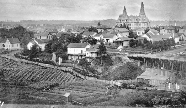
![Trestle bridge, Chinese vegetable gardens, Portland High School]()
Goose Hollow, c. 1890s.
Trestle bridge, Chinese vegetable gardens, Portland High School Courtesy Oreg. Hist. Soc. Research Lib., bb007389
-
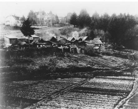
![]()
Chinese truck gardens, Tanner Creek Gulch, c. 1880s.
Courtesy City of Portland archives
-
![Goose Hollow (Portland), 1894]()
Goose Hollow (Portland), 1894.
Goose Hollow (Portland), 1894 Courtesy City of Portland Archives
-
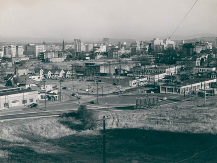
![SW Columbia and Jefferson]()
Goose Hollow (Portland).
SW Columbia and Jefferson Courtesy City of Portland Archives
-
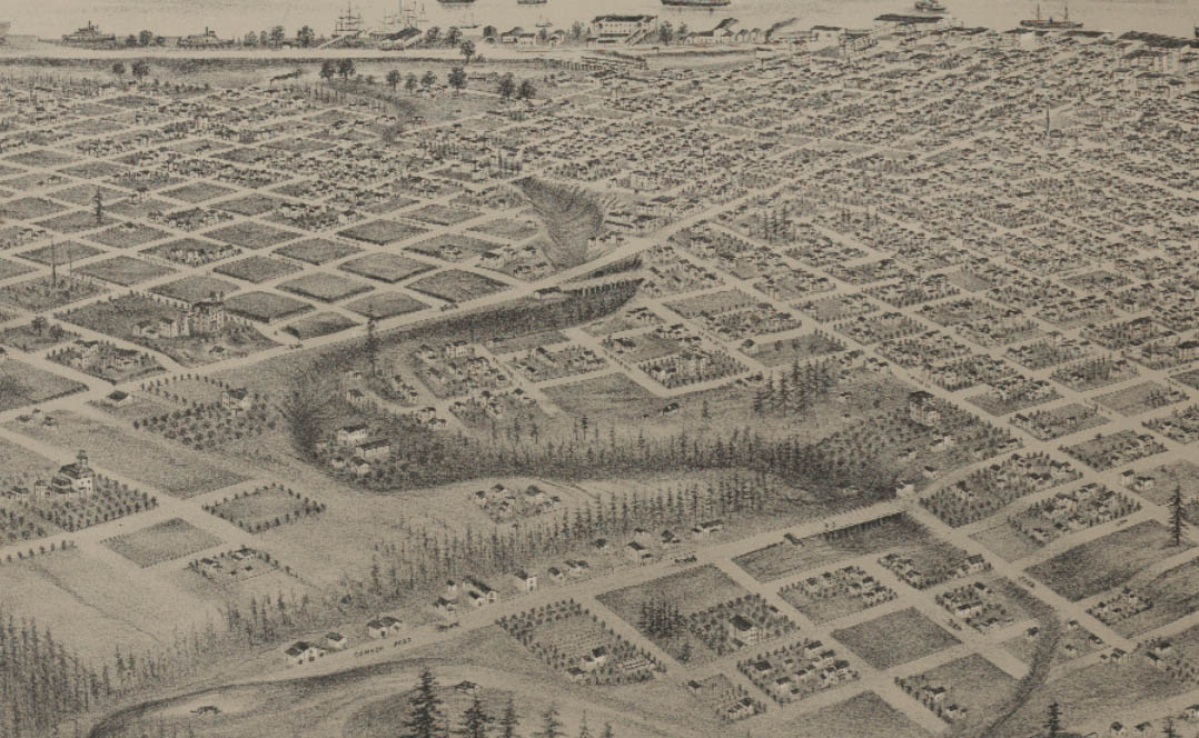
![Late 1870s drawing, Goose Hollow in foreground; Tanner Creek Gulch]()
Map of Goose Hollow area, late 1870s.
Late 1870s drawing, Goose Hollow in foreground; Tanner Creek Gulch Courtesy Library of Congress
-
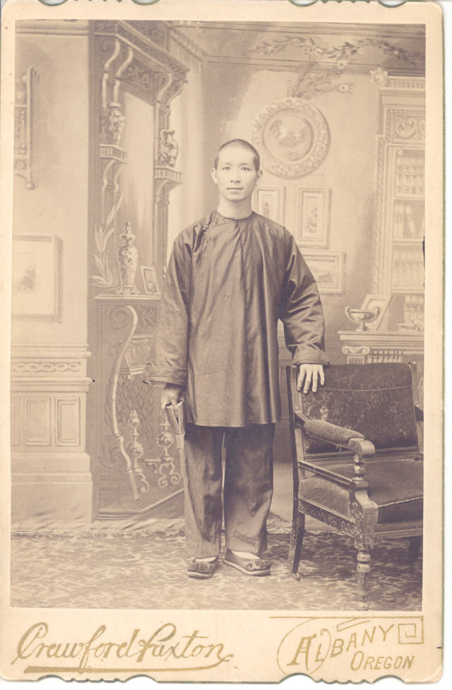
![]()
Chinese peddler in Portland, c. 1880s.
Courtesy Oreg. Hist. Soc. Research Lib., neg13128
-
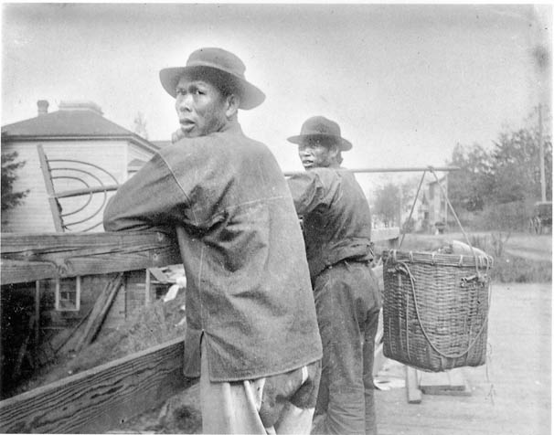
![]()
Chinese gardeners on 50' trestle over Tanner Creek (today SW 18th Ave), c. 1880s.
Courtesy Oreg. Hist. Soc. Research Lib., bb007429


Related Entries
-
![Chinese Americans in Oregon]()
Chinese Americans in Oregon
The Pioneer Period, 1850-1860 The Cantonese-Chinese were the first Chi…
-
![Great Plank Road]()
Great Plank Road
The Great Plank Road, constructed in 1856, connected productive agricul…
-
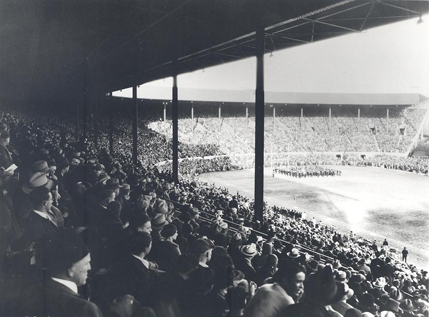
![Multnomah Stadium]()
Multnomah Stadium
Multnomah Stadium—also known as Civic Stadium, Portland General Electri…
-
![Portland]()
Portland
Portland, with a 2020 population of 652,503 within its city limits and …
Map This on the Oregon History WayFinder
The Oregon History Wayfinder is an interactive map that identifies significant places, people, and events in Oregon history.
Further Reading
Prince, Tracy J. Portland’s Goose Hollow. Mt. Pleasant, S.C.: Arcadia Publishing, 2011.
Wong, Marie Rose. Sweet Cakes, Long Journey: The Chinatowns of Portland, Oregon. Seattle: University of Washington Press, 2004.