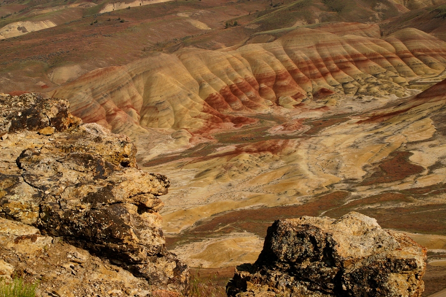
The John Day fossil beds in north-central Oregon have one of the world’s most complete records of organisms fossilized during the Cenozoic Era (past 66 million years), a period of time known as the Age of Mammals. The evolution of plants (flora) and animals (fauna) that is so well documented in the fossil beds was largely in response to changes in the global climate. Previously, during the Mesozoic Era, Earth had been in a greenhouse state, without polar ice and with more uniformly warm conditions than exist today. During the Cenozoic, however, our planet gradually cooled, and polar ice sheets grew as plate tectonics changed the positions and elevations of the continents. As a result, atmospheric and oceanic circulation patterns also changed, leading to cooler conditions. Fossils in the rocks of the John Day area show how organisms adapted to changing climatic conditions.
From 45 to 7 million years ago, highly explosive eruptions spewed ash over vast distances, including the area known as the John Day fossil beds. In north-central Oregon, geologists discovered large volcanic calderas that are depressions—up to 42 kilometers (26 miles) wide—formed when volcanoes exploded and the edifices collapsed. The calderas in Oregon are among the largest known explosive eruptions on Earth.
Volcanic eruptions were also important for preserving life forms. To be fossilized, organisms must be buried rapidly to prevent their decomposition. The unusual conditions of the terrestrial environments in John Day—quiet-water environments where floods and volcanic eruptions quickly buried sediments—led to the exceptional preservation we see today. Although super-hot volcanic ash flows will incinerate most living things in their path, the ash at more distant locations can mix with water and sediments and cover organisms without destroying them.
During the past 7 million years, the land has been uplifted and eroded, exposing the fossil record and allowing scientists to interpret how climate was changing in present-day Oregon during this interesting time period. Visitors to the John Day Fossil Beds National Monument, established in 1975, can see the sedimentary and volcanic layers at Sheep Rock, Painted Hills, and Clarno Palisades. The Visitor Center at Sheep Rock displays examples of the flora and fauna collected from the fossil beds.
The Clarno Formation
The Clarno Formation, the oldest stratigraphic unit of the John Day Fossil Beds National Monument, was deposited from 54 to 39 million years ago, during the early to middle Eocene. It contains volcanic ash flows and lahars, which are debris flows formed from a mixture of hot ash, gas, mud, and debris in the flow’s path. The Clarno Nut Beds contain fossils of tropical plants, such as banana and avocado trees, ferns, fan palms, and extensive vines. They are called “nut beds” because the fossils are plant parts, such as nuts and seeds. These plant fossils indicate subtropical temperatures and rainfall of as much as 300 centimeters (120 inches) a year, about ten times the rainfall in the region today. The environment was similar to the lush coastal rain forests in present-day southern Costa Rica. Animals included relatives of crocodiles and hippopotamuses and small, dog-sized horses.
The Hancock Mammal Quarry, which overlies the nut beds, has yielded a large concentration of mammals that were preserved near a river where animals would have gone to drink. Most of the animals were herbivores (plant eaters)—including tapirs, animals similar to rhinoceroses, and two varieties of small horses—that took advantage of the abundant vegetation. A few predators, such as alligators, also have been found. At the time, most of present-day western Oregon was under the ocean, and the coastline was not too far west of where the Clarno sediment was being deposited.
The John Day Formation
The John Day Formation was deposited from 39 to 18 million years ago, during the upper Eocene and Miocene Epochs. Geologists have subdivided the formation into units called members. From oldest to youngest, they are the Big Basin Member, the Turtle Cove Member, the Kimberly Member, and the Haystack Member (also referred to as the Upper John Day Member). During this time, global climate was cooling, but there were brief interruptions of warmer conditions.
Big Basin Member. The Big Basin Member consists mostly of volcanic ash that formed into clay soils that have weathered into a variety of earth tones, interlayered with thin mudstone. Preserved in the mudstone layers are leaves from more than a hundred species of trees and imprints of more than fifty species of seeds, cones, and nuts.
Plants are also preserved in a type of low-grade coal called lignite, also known as “brown coal,” which is formed from peat beds in marshes. These plant fossils, referred to as the Bridge Creek Flora, indicate cooler temperatures and less precipitation than existed during Clarno time, but still warmer and wetter than current conditions. The tree species found in these fossil layers, such as maples, walnuts, alder, and birch, are similar to the species found today in deciduous hardwood forests in parts of Asia and the southeastern United States.
The abundant paleosols—that is, ancient soils—are an important indicator of changing climatic conditions. Paleosols in the Big Basin Member are spectacularly displayed at the Painted Hills, where red oxidized soils formed during warmer, wetter geological time periods and tan soils formed during cooler, drier periods. Because of the overall cooling of the climate during the formation of Big Basin, red soils are less common and tan soils are more common toward the top of the Big Basin Member.
Turtle Cove Member. The Turtle Cove Member is best exposed at the Sheep Rock location. It consists of mudstones deposited in floodplains and lakes interspersed with abundant volcanic ash beds. These layers are the richest source of fossils in Oregon, which make up the majority of the collection at the John Day Fossil Beds National Monument.
Plant fossils are rare in the Turtle Cove sediments, but more than a hundred different species of mammals have been identified there. By the end of Turtle Cove time, the climate had become cooler and drier. Forests persisted, but they were more open and grassy woodlands had developed, although grass was uncommon. Herds of sheeplike herbivores, which browsed on leafy plants in the area, were stalked by carnivores such as fierce catlike and giant piglike predators. Burrowing and fast-running animals appeared as more open areas developed.
Kimberly and Haystack Members. Fossils in the younger Kimberly and Haystack Members indicate a continuing trend to more dry, open grassland environments. Burrowing gophers were abundant, and running animals included an ancestor of modern dogs.
Columbia Basalt Group and the Mascall and Rattlesnake Formations
The Columbia River Basalt Group (CRB) and the overlying Mascall and Rattlesnake Formations record a climate that got cooler and drier over time. These three volcanic and sedimentary rock units were formed during the Miocene, from 18 to 7 million years ago. Although found mainly outside the national monument, they provide important evidence about continued climate changes.
In contrast to the explosive eruptions of volcanic ash that characterized events in other units, the CRB consists of highly fluid basalt lava flows that covered vast areas of Oregon and contain few sediments with fossils. Reddish paleosols between basalt layers indicate deep weathering during an exceptionally warm period known as the Mid-Miocene Climate Optimum. The MMCO was a time when oceanic and atmospheric conditions caused the planet to warm during what was an overall cooling trend.
Eruptions of basaltic lava flows ceased about 15 million years ago. Sedimentary layers of the Mascall Formation that overlie the CRB were deposited as Earth’s climate resumed cooling following the MMCO. As the climate cooled and dried, the region could no longer support lush forests, and extensive grasslands took their place. The landscape was more open, and long-legged hoofed animals such as camels and deer appeared. Horses adapted to eating grasses, a gritty food item that wears down tooth enamel, by developing high-crowned molars that grew during their lifetimes. They also grew larger and developed different leg types for faster running in the more open landscape.
By Rattlesnake Formation time, about 7 million years ago, the environment would have looked much as it does today, except for the presence of animals such as elephants, saber-toothed tigers, and giant sloths. Many of those animals are related to modern mammals. Explosive-type volcanism had resumed, and those ash-flow deposits provided numerical ages for the Mascall and Rattlesnake Formations.
Summary
Changes in plant and animal life in the John Day fossil beds are consistent with global climate cooling from a greenhouse state to an icehouse state during the Cenozoic Era. Organisms adapted to the environmental change from lush tropical forest (Clarno time) to open grassland (Rattlesnake time). In the John Day region, drier conditions accompanied cooling global climate. During Clarno time, this region was near the coast; but by Mascall/Rattlesnake time, the coast was much farther west and the Cascade Range had developed. The mountains captured much of the precipitation and created a rain shadow to the east, which created much wetter conditions in western Oregon and much drier conditions in eastern Oregon.
Understanding how plants and animals adapted to climate change over millions of years (geologic time) can help humans plan for climate changes occurring over shorter time scales (human time). Whether over ten years or a thousand years, species adapt to environmental changes by altering aspects of their own physiology, migrating to other regions, or becoming extinct. Groups such as the Upper Columbia Basin Network of national parks between the Rocky Mountains and the Cascades are studying the record of adaptations in ancient climates, recorded in John Day fossil beds, to help them understand how organisms might adapt in present and future climates. Adaptations during warming events such as the MMCO provide important clues for researchers and managers striving to protect plant and animal life on our planet today, which is once again in a warming phase.
-
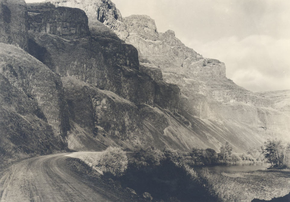
![John Day Fossil Beds, basalt bluffs, 1937]()
John Day Fossil Beds, basalt bluffs, 1937.
John Day Fossil Beds, basalt bluffs, 1937 Courtesy Oreg. Hist. Soc. Research Lib., OrHi830535
-
![]()
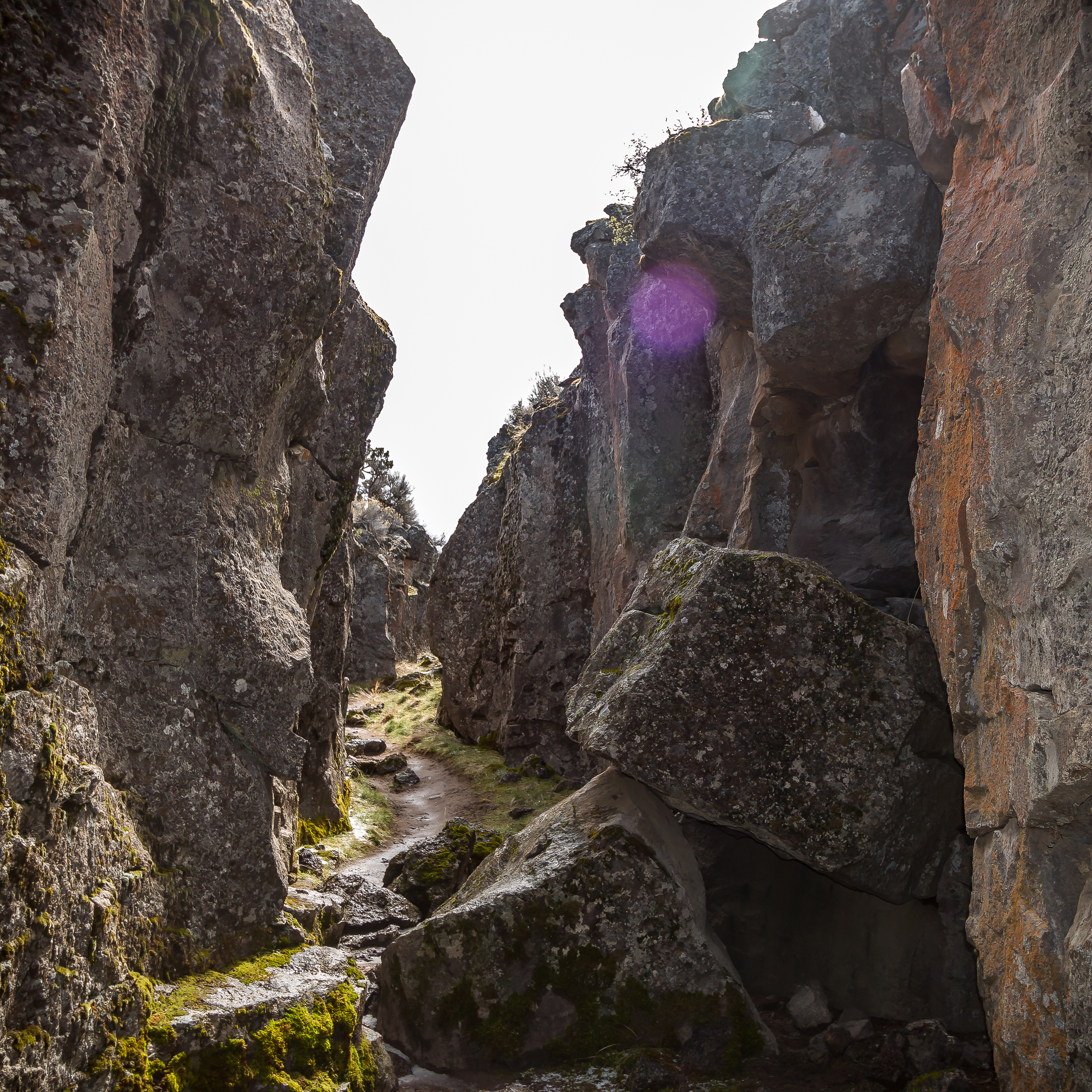
John Day Fossil Beds.
Oregon Historical Society Research Library, ba013428, photo file 412
-
![]()
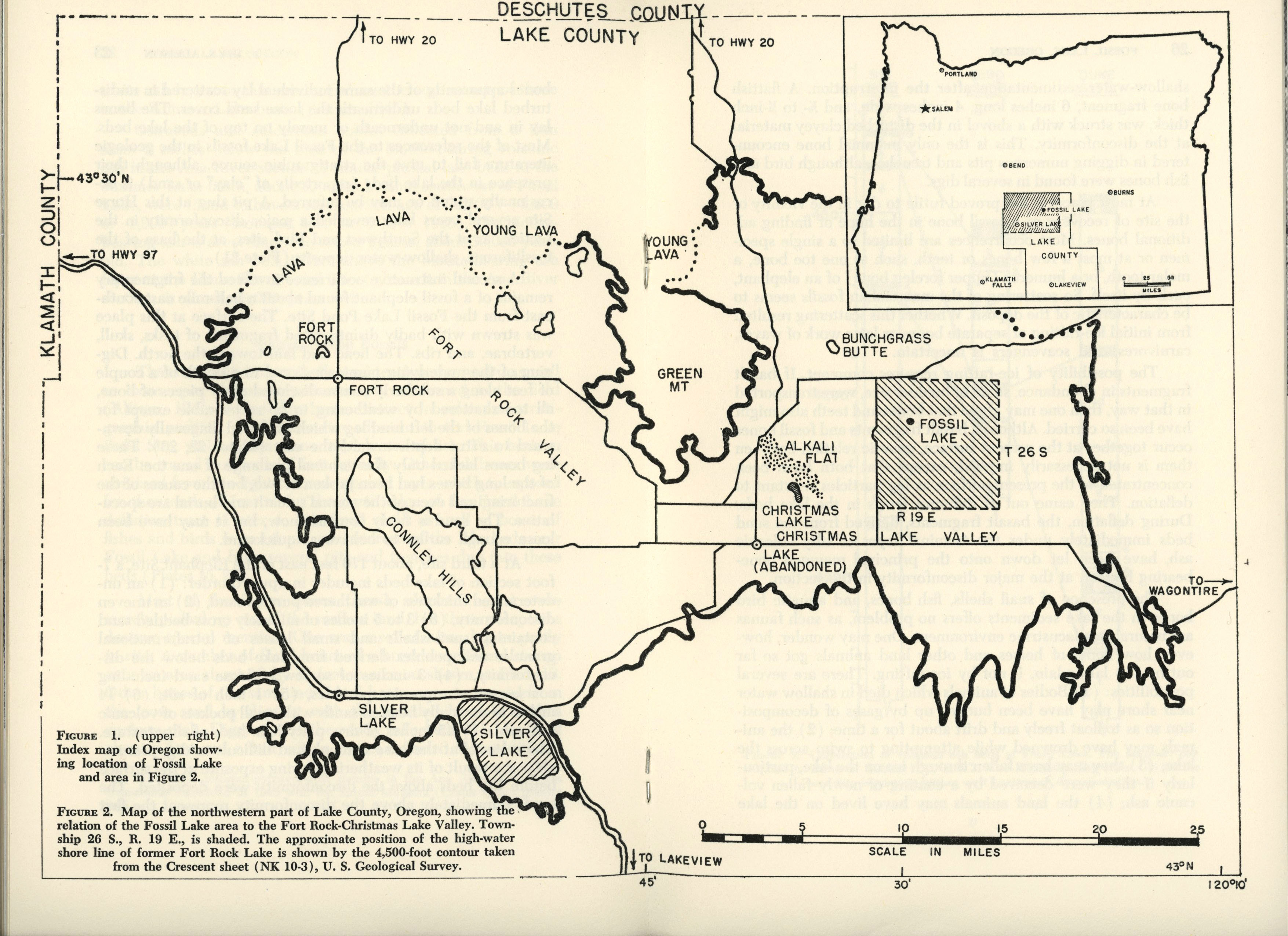
John Day Fossil Beds Map.
Courtesy U.S. National Park Service -
![]()
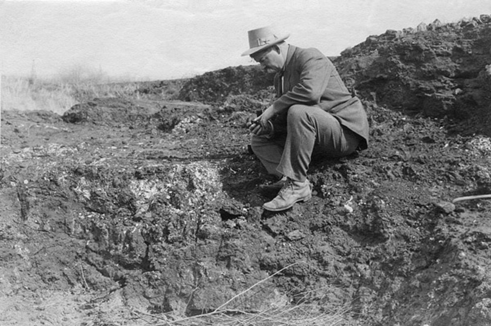
Sheep Rock, John Day Fossil Beds, 1962.
Oregon Historical Society Research Library, ba013400, photo file 412
Related Entries
-
![Climate Change in Oregon]()
Climate Change in Oregon
Within a few hundred miles in Oregon, you can see snowy volcanoes, parc…
-
![Crack in the Ground]()
Crack in the Ground
Crack in the Ground is just that, a gaping fracture of tectonic origin …
-
![Diamond Craters]()
Diamond Craters
Diamond Craters is a geologically youthful lava field 52 road miles sou…
-
![Fossil Lake]()
Fossil Lake
A small, sandy playa in central Oregon's Fort Rock Basin, Fossil Lake i…
-
![John C. Merriam (1869-1945)]()
John C. Merriam (1869-1945)
Born in Iowa in 1869, John C. Merriam was a geologist, zoologist, and p…
-
![John Day Fossil Beds National Monument]()
John Day Fossil Beds National Monument
John Day Fossil Beds National Monument, established in October 1975, sh…
Related Historical Records
Map This on the Oregon History WayFinder
The Oregon History Wayfinder is an interactive map that identifies significant places, people, and events in Oregon history.
Further Reading
Bestland, E.A., et al. "Geologic framework of the Clarno Unit, John Day Fossil Beds National Monument, Central Oregon," 2002. DOGAMI Open-file Report O-02-03.
Miller, M.B. Roadside geology of Oregon. Missoula, MT.: Mountain Press, 2014.
"Generalized stratigraphic column of the John Day Fossil Beds region." Geology of National Parks.

