Lakeport, for a brief time the largest town in Curry County, was located on Floras Lake, a 236-acre freshwater lake on the Oregon Coast ten miles north of Port Orford. The town had a dramatic rise and fall in the early twentieth century, when the adroit boosterism of Lakeport’s potential as a port town turned out to be based on false promises.
In 1907, L.B. Reeder and A.D. Parker, residents of Spokane, Washington, vacationed at Floras Lake. There were no ports in Curry County, and the potential for a port at nearby Coos Bay had not yet been realized, so the two entrepreneurs decided to create a new town that would be the largest port between San Francisco and Seattle. In about 1908, they petitioned the U.S. War Department for permission to build a canal through the dunes to connect Floras Lake to the sea, along with two protective jetties in the ocean. Their 1910 Lakeport plat, filed with Curry County, shows Floras Lake with a maximum depth of forty-four feet, with shallower depths of between twenty-two and thirty feet in the arms of the lake. The ocean area targeted for the canal and jetties indicates a depth of twenty-one to twenty-four feet. The project would have required considerable dredging at both ends to accommodate ocean-going ships.
Reeder and Parker purchased land in exchange for promissory notes from enthusiastic local farmers, timber owners, and residents. They then filed Articles of Incorporation and platted more than seventy-five hundred city-sized lots for a new town, which they initially named Pacific City.
Promotion of the town and its associated port appears to have been spearheaded by the Port Orford Orchards Tracts Company, which hired commission agents throughout the western United States. Company agents promoted Lakeport’s future with advertising brochures boasting maps and promotional drawings of the city-to-be located next to “the best harbor on the Pacific.” Pacific City, one brochure crowed, was “the city with an immediate future, situated on beautiful Floras Lake.” The home office was listed as Spokane, with local agents in Portland acting as the contact points for interested purchasers. Lots began selling at $12.50, but the price ballooned to $300 as the speculation bubble grew with investors (and subsequent residents) from such cities as Portland, Walla Walla, Washington, and Butte, Montana.
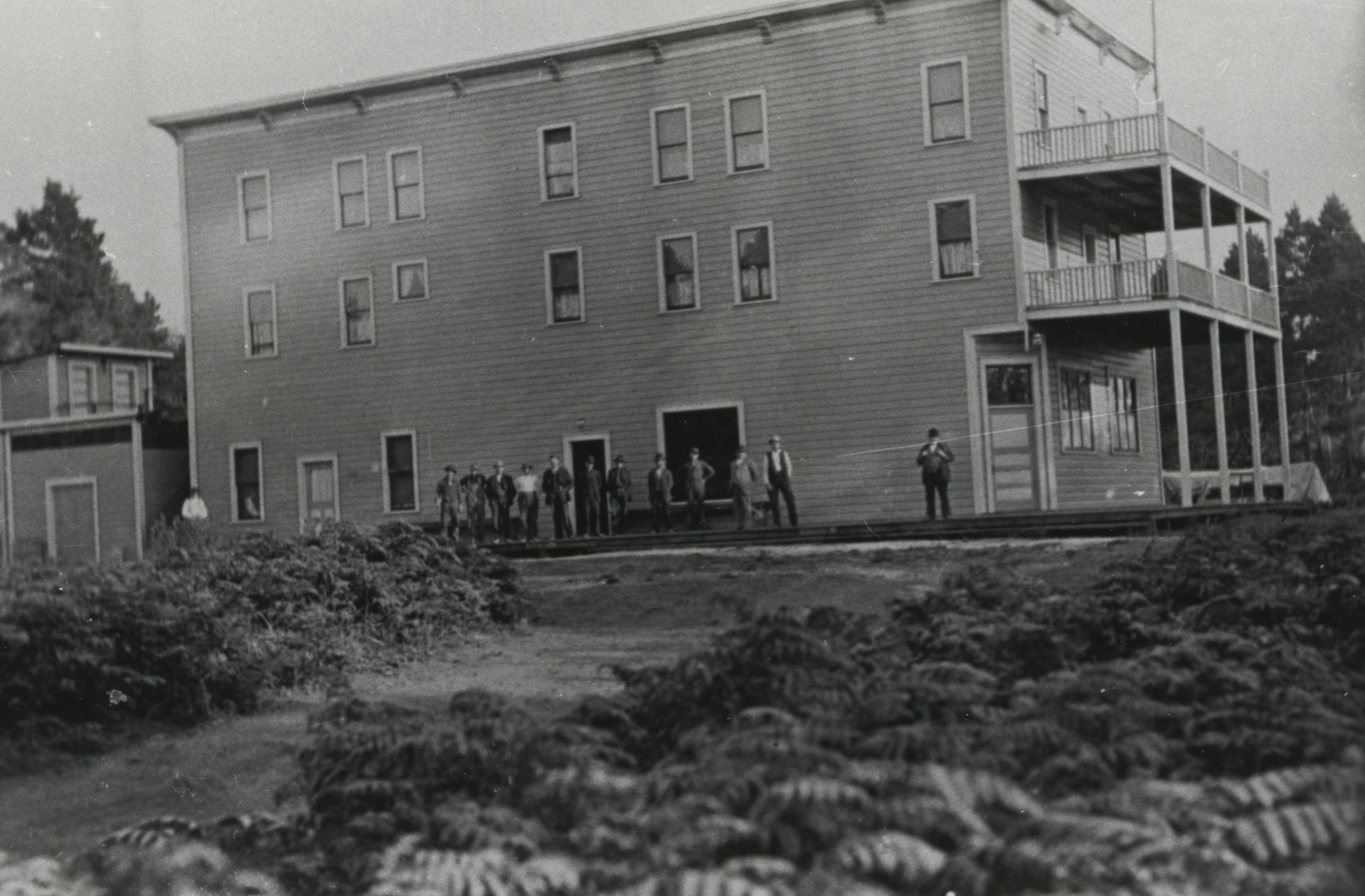
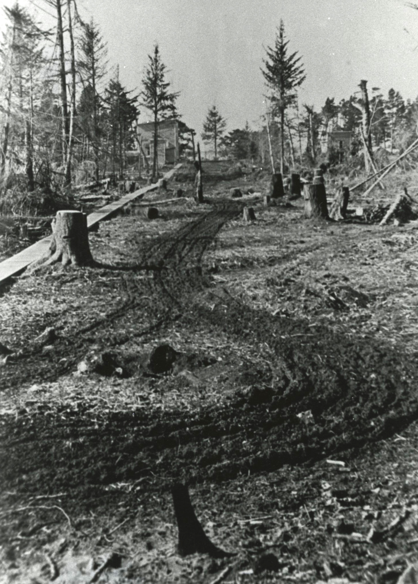
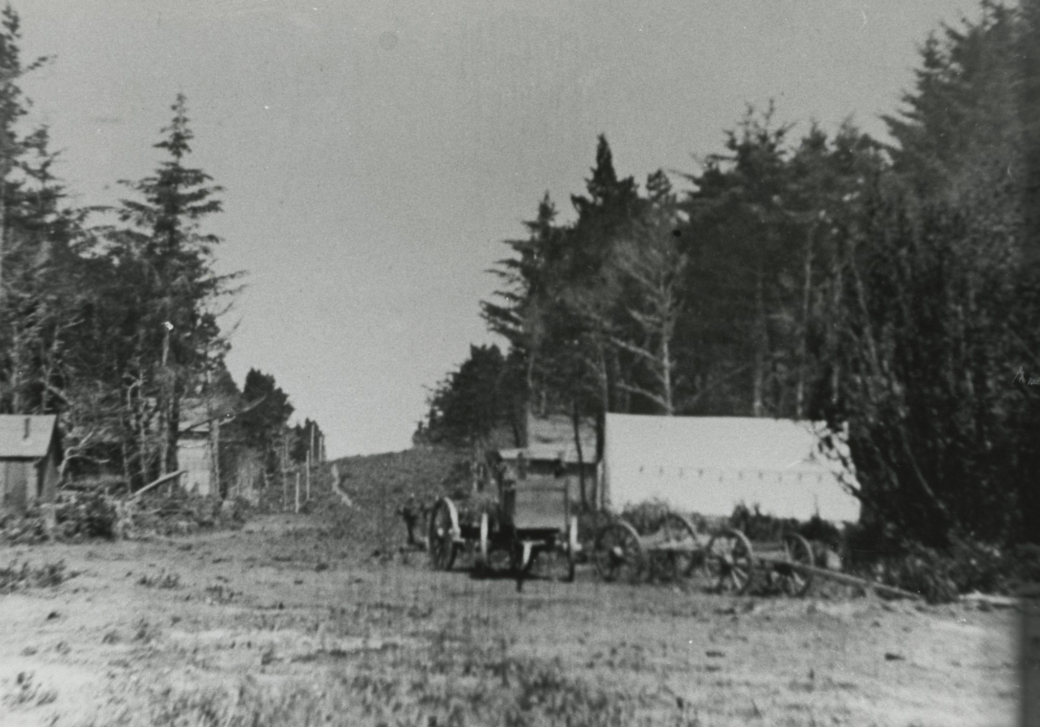
The town began to take shape as land surveys were used to lay out streets and residential lots, and the population grew to 300. One of the earliest businesses was a sawmill, which provided lumber for the new town from the quickly-logged virgin forests covering the area. Messrs. Anderson and Severson built a three-story hotel in 1908, which they advertised as the finest such establishment between San Francisco and Portland. It was the most popular establishment in town for the many young, unattached laborers in Lakeport, as the hotel served three family-style meals a day in its large dining room.
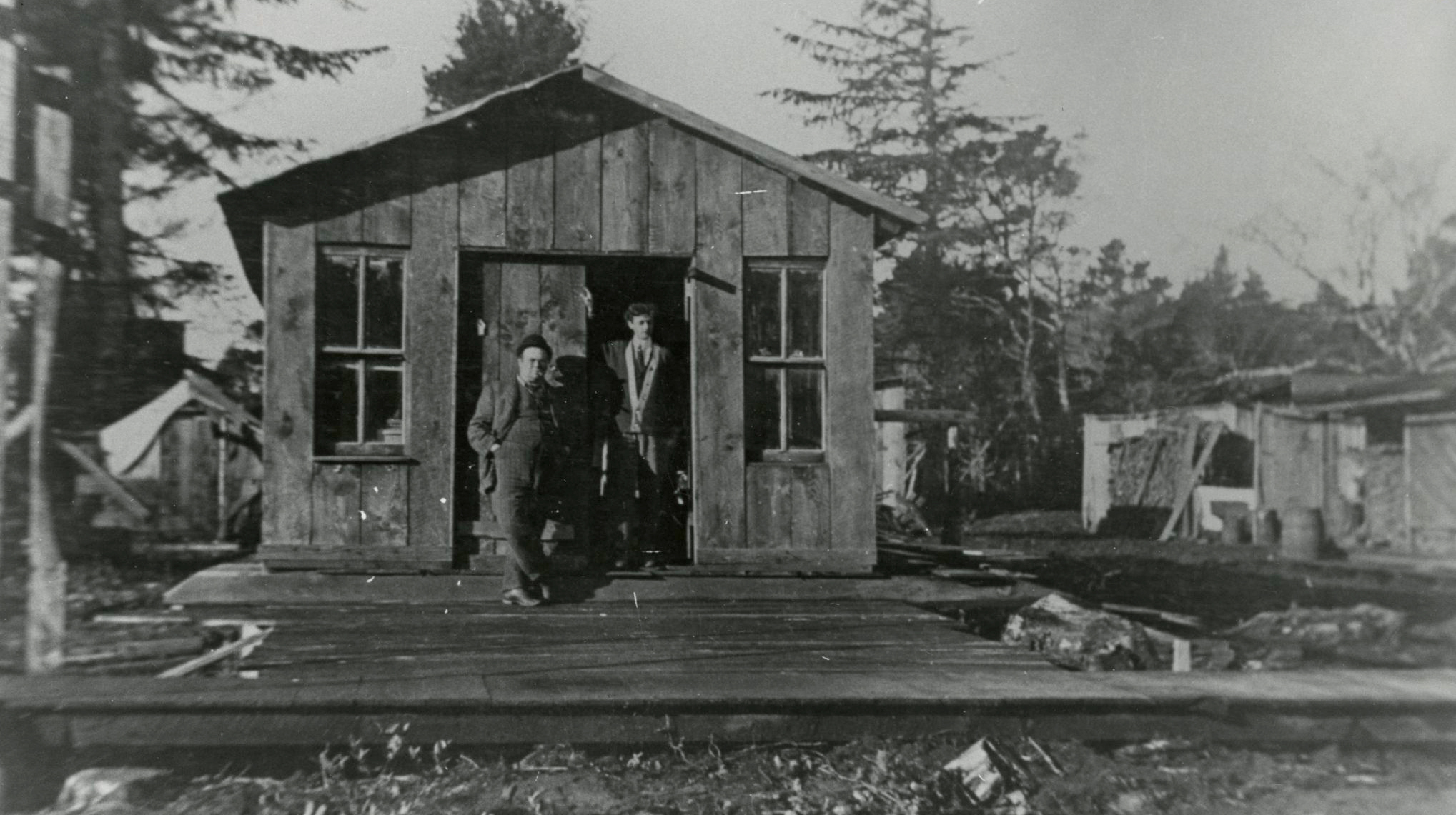
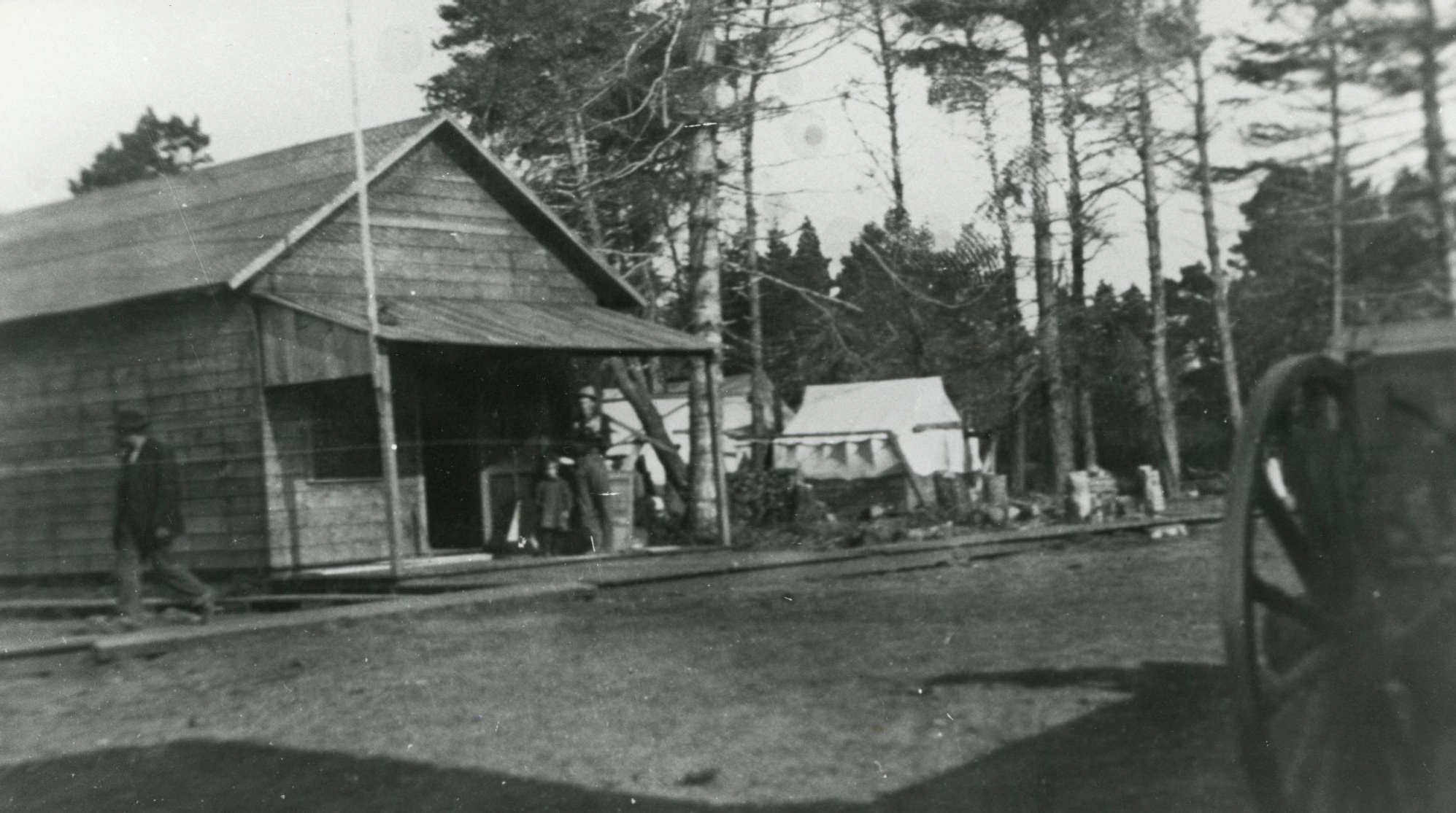
Hardware and clothing stores and a meat market opened, and farmers from nearby Denmark sold their cheese to Lakeport residents. Messrs. Smith and Quarles set up a small print shop, where they published the first issue of Floras Lake Banner on March 26, 1910. Residents petitioned the federal government for a post office using the name Pacific City, but they were rejected because the name had just been approved for a town in Tillamook County. They settled on Lakeport, and the post office opened on June 22, 1910. Emile Berg, who owned the general store, was postmaster. A school district was organized, and school was set to begin in the fall of 1911, with Willamette graduate Helen Smith as the teacher.
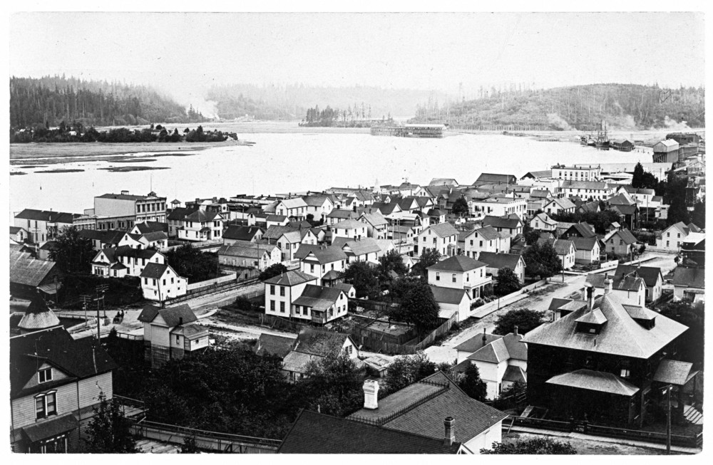
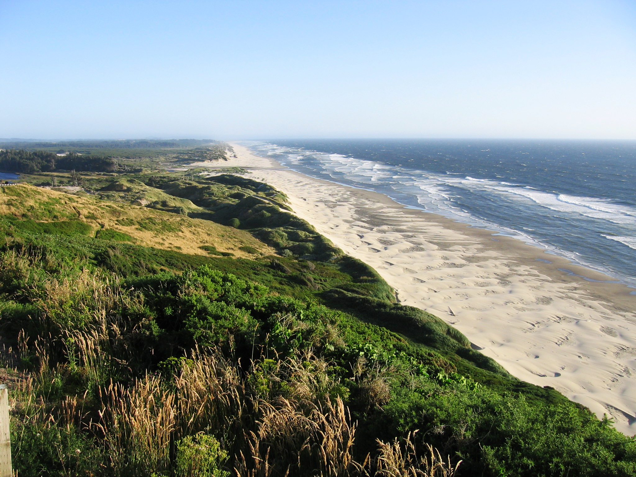
By 1909-1910, Lakeport was the largest town in Curry County, with some four hundred residents. But those residents soon began asking where the freight cargo would come from and how it would be transported to their town, which was far from transportation hubs or reliable roads. Then the fatal blow fell. Although the War Department had given permission to dig a canal linking the lake and the ocean, surveyors discovered that the lake was ten feet above sea level. If the canal were dug, the lake would empty into the sea unless expensive locks were built. The primary sand dune between the lake and the sea was about forty feet high, erroneously reported later as the height of the lake itself above sea level.
The news spread quickly, and the land speculation bubble burst. Businesses closed their doors, residents left, professional men vanished, and the hotel stood largely empty. The Floras Lake Banner published its last issue in October 1911, and the Lakeport post office closed on June 30, 1915.
Floras Lake is now a popular fishing and windsurfing site. Lakeside residences dot the northern shore, and Boice Cope County Park provides easy access to the lake. At the south end of the lake, Curry County owns about four hundred acres of the land once platted for Lakeport that landed in the county’s ownership through tax foreclosure when the town collapsed. Nothing remains of Lakeport itself, its buildings having rotted away or used for other local building projects.
-
![]()
Lakeport Hotel., c.1909.
Courtesy Oregon Hist. Soc. Research Lib., Masterson Coll., photo file628
-
![]()
Floras Lake Banner print shop, Lakeport, c.1909.
Courtesy Oregon Hist. Soc. Research Lib., Masterson Coll., photo file628
-
![]()
Lakeport, c.1909.
Courtesy Oregon Hist. Soc. Research Lib., Masterson Coll., photo file628
-
![]()
Post office, Lakeport, c.1910.
Courtesy Oregon Hist. Soc. Research Lib., Masterson Coll., photo file628
-
![]()
Bandon-Lakeport Freight Co. wagons, c.1910.
Courtesy Oregon Hist. Soc. Research Lib., Masterson Coll., photo file628
-
![]()
Lakeport, c.1910.
Courtesy Oregon Hist. Soc. Research Lib., Masterson Coll., photo file628
Related Entries
-
![Coos Bay]()
Coos Bay
The Coos Bay estuary is a semi-enclosed, elongated series of sloughs an…
-
Oregon Dunes
Miles and miles of windblown sand. The Oregon Dunes stretch for fifty-f…
-
![U.S. Army Corps of Engineers]()
U.S. Army Corps of Engineers
The U.S. Army Corps of Engineers, a hybrid military and civilian federa…
Map This on the Oregon History WayFinder
The Oregon History Wayfinder is an interactive map that identifies significant places, people, and events in Oregon history.
Further Reading
“Floras Lake.” In Atlas of Oregon Lakes. Corvallis: Oregon State University Press. 1985.
Federal Writers’ Project. Oregon End of the Trail, American Guide Series. Revised. Portland, Ore.: Binfords and Mort, 1951.
Peterson, Emil R. and Alfred Powers. A Century of Coos and Curry: History of Southwest Oregon. Portland, Ore.: Binford & Mort, 1952.
Webber, Bert and Margie. Lakeport: Ghost Town of the South Oregon Coast. Medford, Ore.: Pacific Northwest Books Company, 1990.

