The Laurelhurst neighborhood in Portland is an historic twentieth-century neighborhood of residences and parkland, with origins in the nineteenth century. It was developed along streetcar lines as an exclusive residential suburb and now, only forty blocks from downtown Portland, its unique street pattern and housing stock remain distinctive features of the city's landscape.
Laurelhurst is one of many properties acquired by William Sargent Ladd in the last half of the 1800s. In 1850, the area that would become the Laurelhurst neighborhood in Portland was a forested tract of land crisscrossed by Native and fur trapper trails. Donation land claims were granted to Terrence Quinn and Elijah Davidson in late 1851, and both claims came into Ladd’s possession in the 1870s.
Ladd began a large dairy farm, commonly known as Ladd’s Farm, which he called Hazel Fern Farm. When Ladd died in 1893, the 464-acre farm went into probate. Ladd’s son, William Mead Ladd, finally settled the estate and sold the farm in 1909 to the Laurelhurst Company for two million dollars. The neighborhood and company were named for a neighborhood in Seattle, which had been developed by company principal Paul Murphy.
W.M. Ladd, in anticipation of eventual residential development, had consulted with landscape architect John Charles Olmsted to lay out the streets for the plat. While Olmsted never developed a final plan, the Laurelhurst Company retained his ideas with minor changes, and the neighborhood today exhibits the character of an Olmsted design. It was marketed as “Portland’s Premier Residence Addition.”
The site of the Ladd Farm was initially the home of Oregonian publisher Harvey Scott; his house was demolished in 1966 and replaced by All Saints Parish church and school. Near the center of the neighborhood is Coe Circle, originally the site of the sales office for Laurelhurst homes and a stop on the Glisan streetcar line.
By 1925, most of the platted 2,880 lots had been sold and the office and streetcar tracks removed, but Coe Circle and its gilded Joan of Arc statue—donated by Portland doctor Henry Waldo Coe in 1925—remain one of several landmarks that distinguish the neighborhood. Laurelhurst has an impressive stock of homes built from 1910 through 1925, with Arts and Crafts, Bungalow, Portland Foursquare, and Spanish Revival styles found throughout. Several of the homes are listed on the National Register of Historic Places.
Other distinctive features include the nearly thirty-acre Laurelhurst Park at the southern edge of the neighborhood. While early plans for Laurelhurst included a park surrounding spring-fed Firwood Lake, its final location and configuration are attributable to the efforts of Emanuel T. Mische. As parks director for the City of Portland from 1908 to 1914 and former horticulturalist for the Olmsted Brothers, Mische was instrumental in persuading the city to acquire several parcels of land based on the recommendations in Olmsted’s 1903 Portland Parks Plan. The city bought the land for Laurelhurst Park in 1909 for $92,482. The park received National Historic Place designation in 2001.
The original Laurelhurst plat extended to Halsey Boulevard, but completion of the Banfield Freeway (I-84) in 1955 and increasing traffic on Sandy Boulevard in the post-World War II era effectively cut off the northeast and northwest corners of the neighborhood. The northwest corner is still part of the official Neighborhood Association boundaries and has similar housing stock, but it is more commercial and is framed by two busy traffic corridors.
Despite the traffic on the northern edge of the neighborhood and through the center along Cesar Chavez (previously 39th) Boulevard, the character of the neighborhood, the original street design, and much of the original plat remain intact. The Laurelhurst Gates, sandstone pillars, still mark entry into the neighborhood at major streets on the western and southern edges.
Laurelhurst, along with several other Ladd properties that were developed into residential neighborhoods—Ladd’s Addition, Eastmoreland, and Dunthorpe—remains distinctive in the residential fabric of the city. It retains its original design integrity, which evoked the Olmsted tradition and the City Beautiful Movement, and its character is still intact with a large number of early twentieth-century housing. Despite an era of property value decline in the 1960s and 1970s, Laurelhurst has retained its cachet as a desirable neighborhood.
-
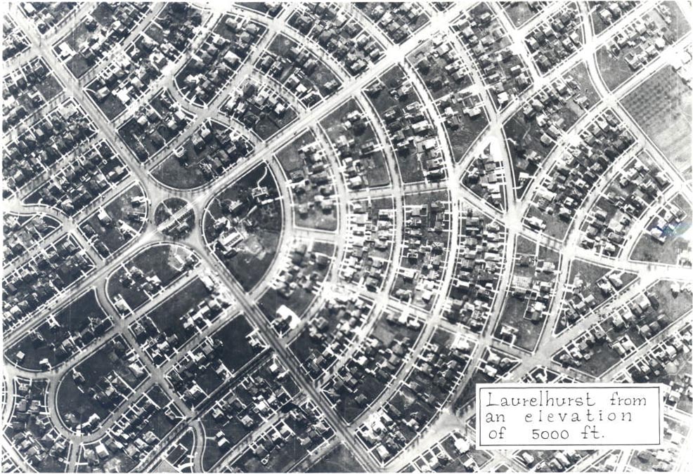
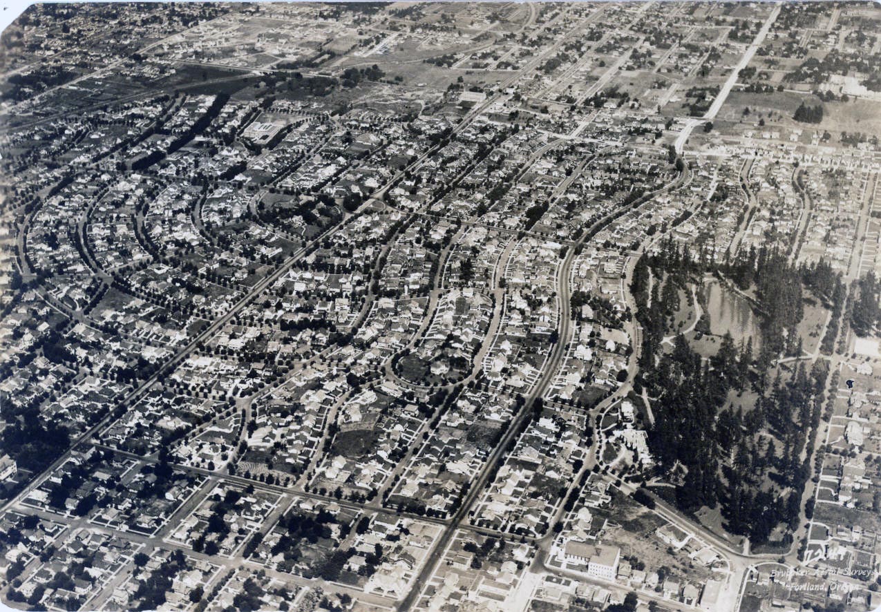
![Laurelhurst, aerial]()
Laurelhurst, aerial.
Laurelhurst, aerial Courtesy Oreg. Hist. Soc. Research Lib., 56901
-
![Laurelhurst park, 1930]()
Laurelhurst park, 1930.
Laurelhurst park, 1930 Courtesy Oreg. Hist. Soc. Research Lib., 005483
-
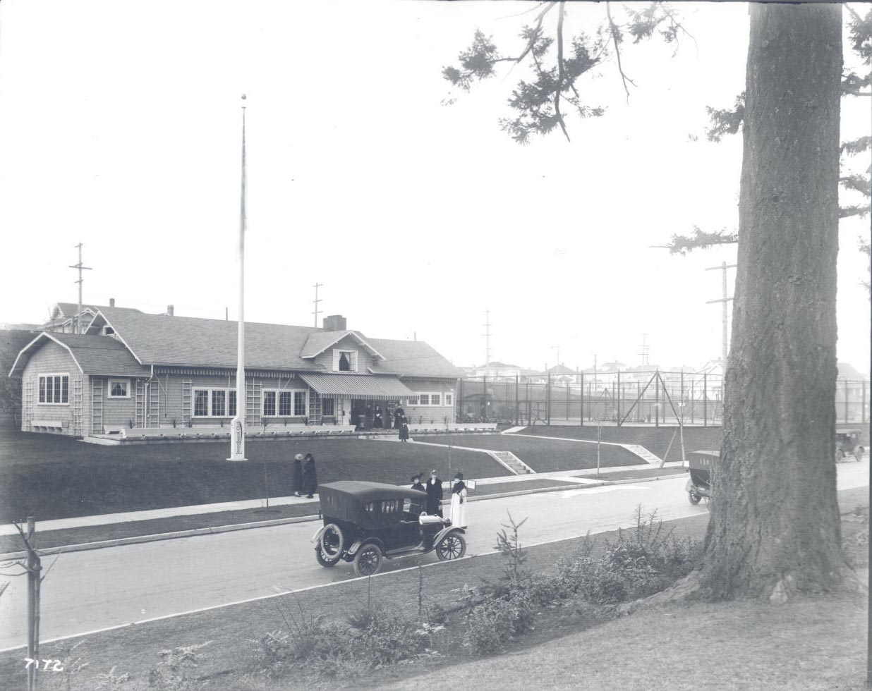
![Laurelhurst Club, c.1910]()
Laurelhurst Club, c. 1910.
Laurelhurst Club, c.1910 Courtesy Oreg. Hist. Soc. Research Lib., GI7172
-
![Laurelhurst neighborhood ad, 1912]()
Laurelhurst neighborhood ad, 1912.
Laurelhurst neighborhood ad, 1912 Courtesy Oreg. Hist. Soc. Research Lib., OrHi 100759
-
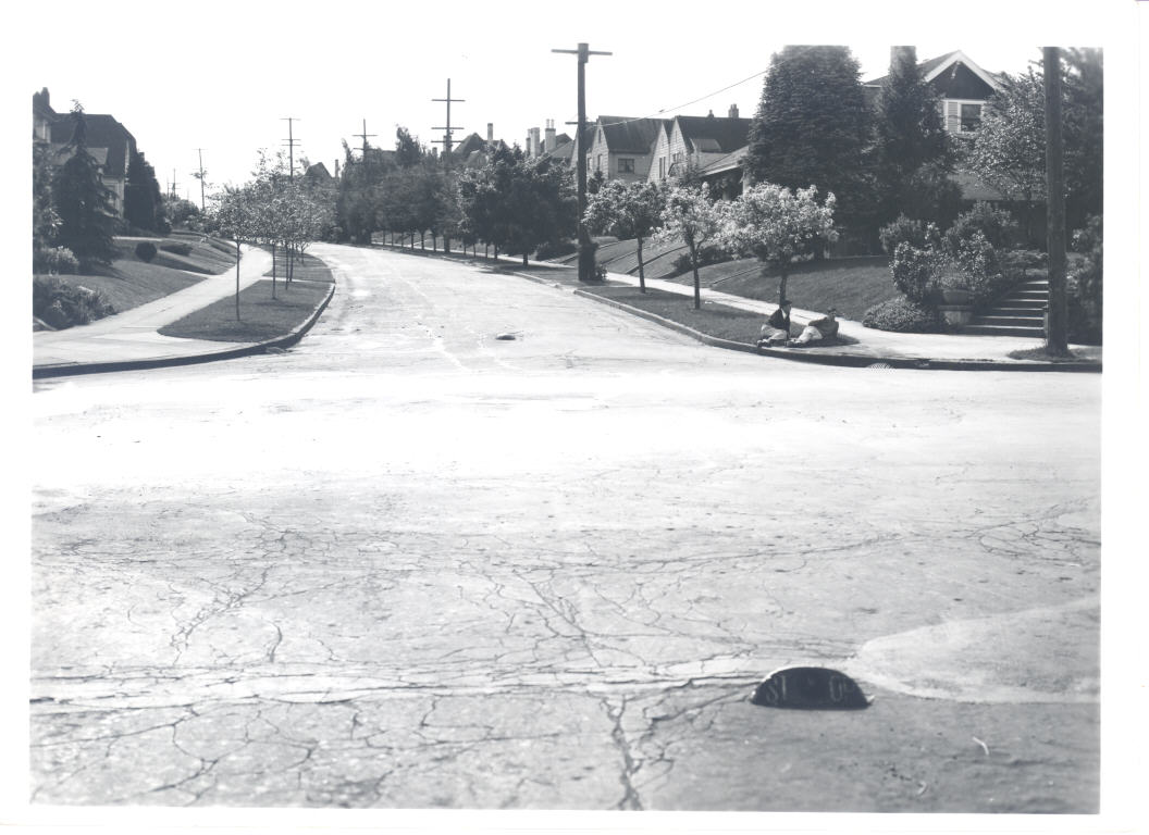
![Laurelhurst, 1935]()
Laurelhurst, 1935.
Laurelhurst, 1935 Courtesy Oreg. Hist. Soc. Research Library, COP01320
-
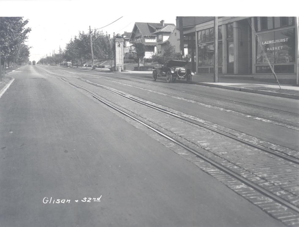
![Laurelhurst neighborhood, 1921, NE Glisan and 32nd, with streetcar tracks.]()
Laurelhurst neighborhood, 1921.
Laurelhurst neighborhood, 1921, NE Glisan and 32nd, with streetcar tracks. Courtesy Oreg. Hist. Soc. Research Lib., COP01852
-
![Laurelhurst gate (left) at 39th and SE Stark, 1925]()
Laurelhurst gate (left) at 39th and SE Stark, 1925.
Laurelhurst gate (left) at 39th and SE Stark, 1925 Courtesy Oreg. Hist. Soc. Research Library, 001654
-
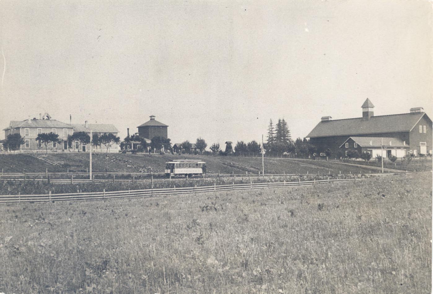
![Ladd farm, c. 1900, approximate site of present-day Coe Circle]()
Ladd farm, c. 1900.
Ladd farm, c. 1900, approximate site of present-day Coe Circle Courtesy Oreg. Hist. Soc. Research Lib., OrHi 104407
-
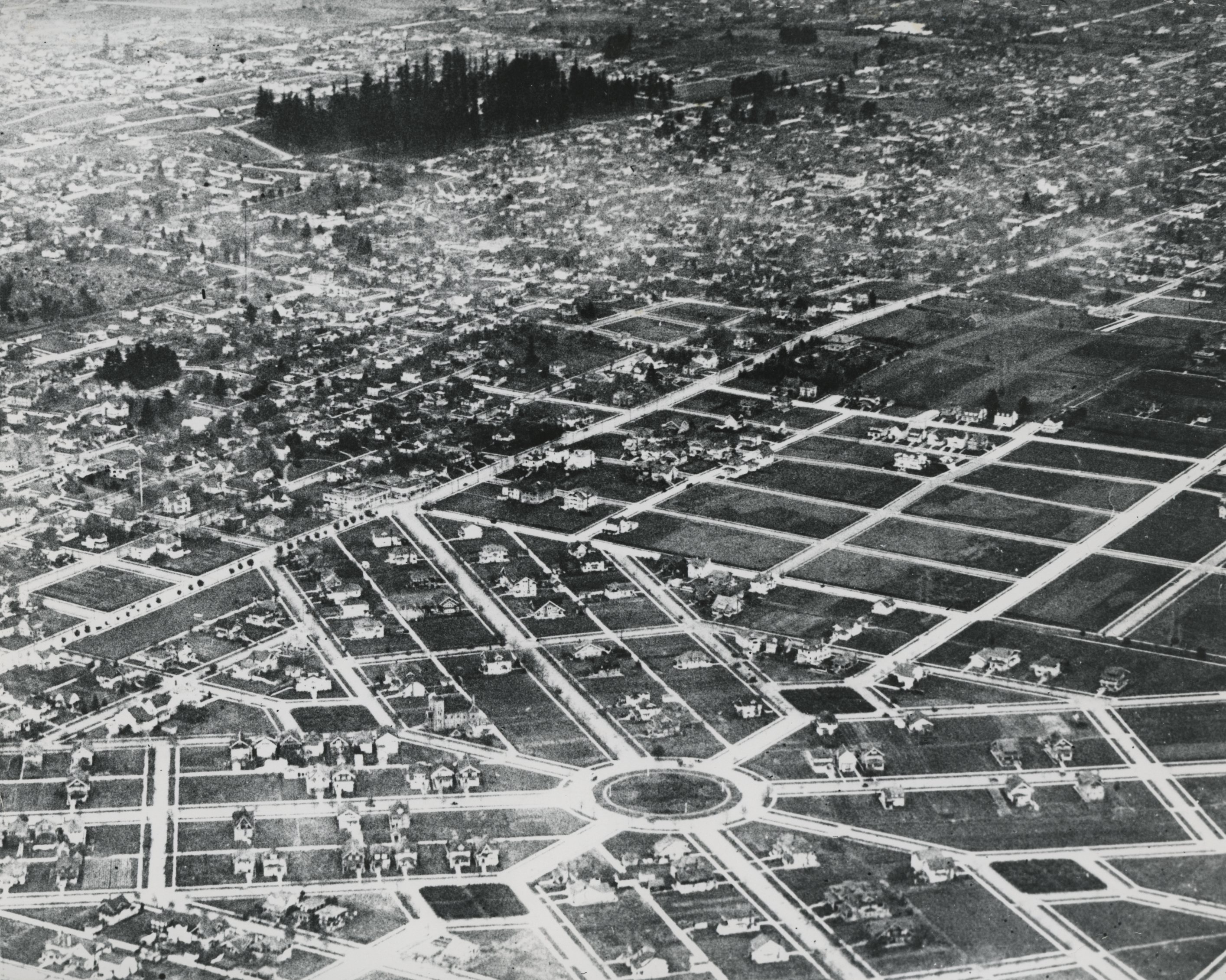
![Laurelhurst, aerial, c.1930]()
Laurelhurst, aerial, c.1930.
Laurelhurst, aerial, c.1930 Courtesy Oreg. Hist. Soc. Research Lib., OrHi 54060
-
![Laurelhurst, Coe Circle, Joan of Arc statue, 1968]()
Laurelhurst, Coe Circle, Joan of Arc statue, 1968.
Laurelhurst, Coe Circle, Joan of Arc statue, 1968 Courtesy Oreg. Hist. Soc. Research Library


Related Entries

Map This on the Oregon History WayFinder
The Oregon History Wayfinder is an interactive map that identifies significant places, people, and events in Oregon history.
Further Reading
Guzowski, Kenneth James. "Portland’s Olmsted Vision (1897-1915): A Study of the Public Landscapes Designed by Emanuel T. Mische in Portland, Oregon." M. A. Thesis, University of Oregon, Eugene, 1990.
MacColl, E. Kimbark, with Harry H. Stein. Merchants, Money, and Power: The Portland Establishment, 1843-1913. Portland, Ore.: The Georgian Press, 1988.
Works, Martha Adrienne. "Creating and Recreating an Ideal: The role of Historic Landscapes in a Rapidly Changing Urban Area." Yearbook, Association of Pacific Coast Geographers, 1998.