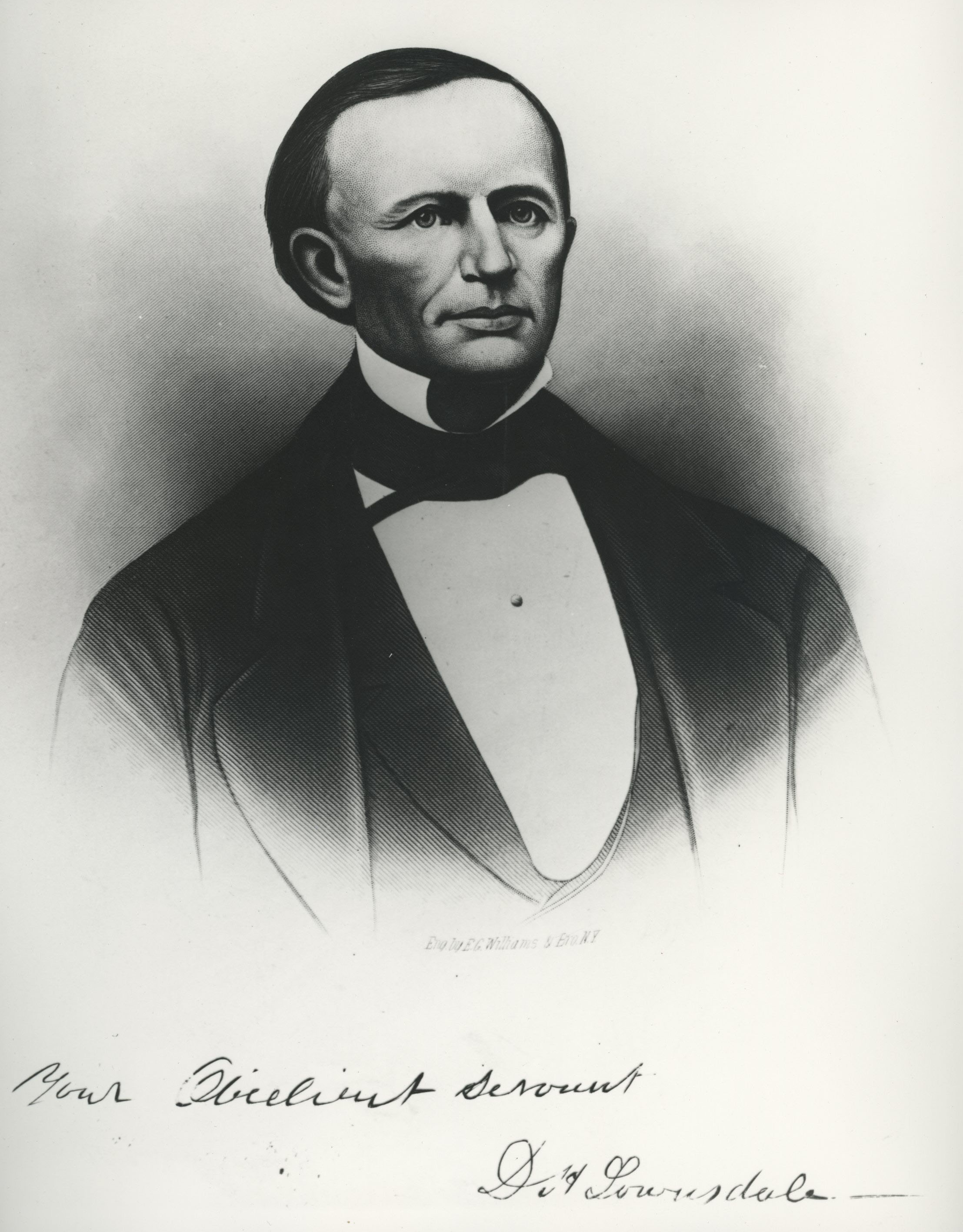
Daniel H. Lownsdale was an early Portland townsite settler who served in the Provisional Government legislature. As a real-estate investor, he owned much of the land that became Portland's central city, and he led the effort to build the Great Plank Road, the city’s first major infrastructure project. Lownsdale also bequeathed to the city a strip of land that became Portland's first public park, the South Park Blocks.
Born in Mason County in northern Kentucky in 1803, Lownsdale married Ruth Overfield in 1826 and moved west to Indiana. The couple had three children, and after Ruth died, Daniel, in failing health, was encouraged to move to Europe, which he did in 1842. He returned to the United States in 1844 and a year later joined a wagon train bound for the Oregon Country. When he arrived in Portland that fall, he purchased part of the Amos King land claim, located below the southwest hills of the new settlement on the Willamette River and adjoining the claims of Asa Lovejoy and Francis Pettygrove.
Lownsdale established a tannery, one of the first in the region, at present-day Southwest Eighteenth Avenue between Taylor and Morrison Streets (today’s Providence Park). Tanner Creek, which ran through the property, carried off the blood and chemicals that were basic to the operation. During the 1840s, when so much of people’s lives and livelihoods depended on tannery products, the business would have been a significant source of income for Lownsdale. With additional earnings from his real estate operations and his docks on the Willamette River, at the eastern end of his property, he became a major financial contributor to Portland's early growth.
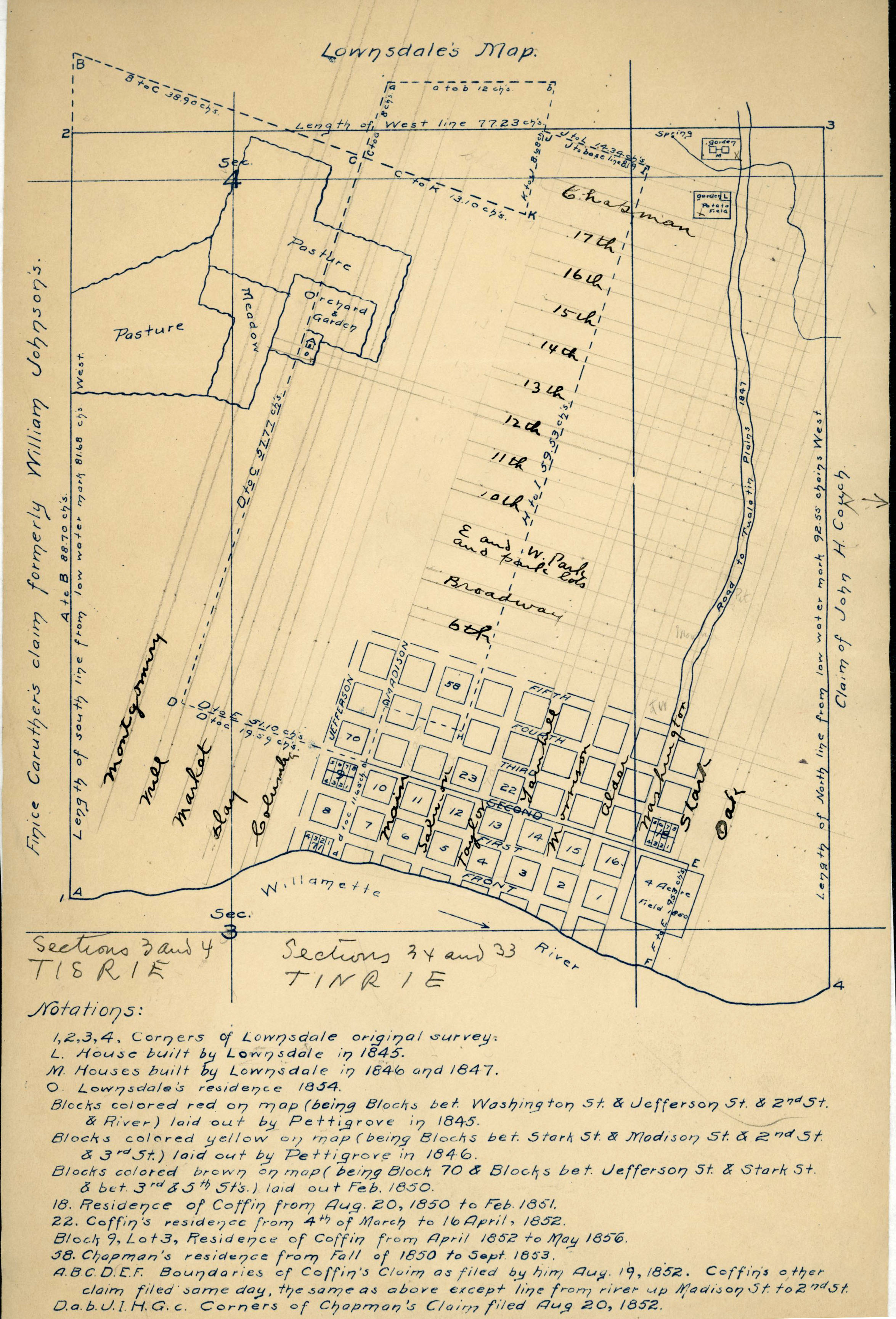
In 1846, Lownsdale served in the Provisional legislature, helping build the foundation for government in the region. In 1849, for $5,000 (about $150,000 in 2019 dollars), he purchased Pettygrove’s land, essentially the area bounded by today’s Southwest Salmon Street, Southwest Eighteenth Avenue, the foothills of South Portland, and the banks of the Willamette. He resurveyed his new property—maintaining the 200-by-200-foot block size—and began to sell lots.
To preserve the property from the fires that sometimes swept into the town from the west hills, in 1852 Lownsdale donated a strip of land to the city, 100 feet wide and more than a half-mile long (today’s South Park Blocks, between Southwest Park and Ninth Avenues), with the provision that it was cleared of trees and shrubs to create a firebreak. He may have been inspired by a similar strip of cleared land in Louisville, Kentucky, about 130 miles west of his boyhood home. William Chapman, Lownsdale’s attorney, donated three blocks of his own property to the city, between Fourth and Fifth Avenues and Salmon and Jefferson Streets. The central block of that donation is present-day Chapman Square.
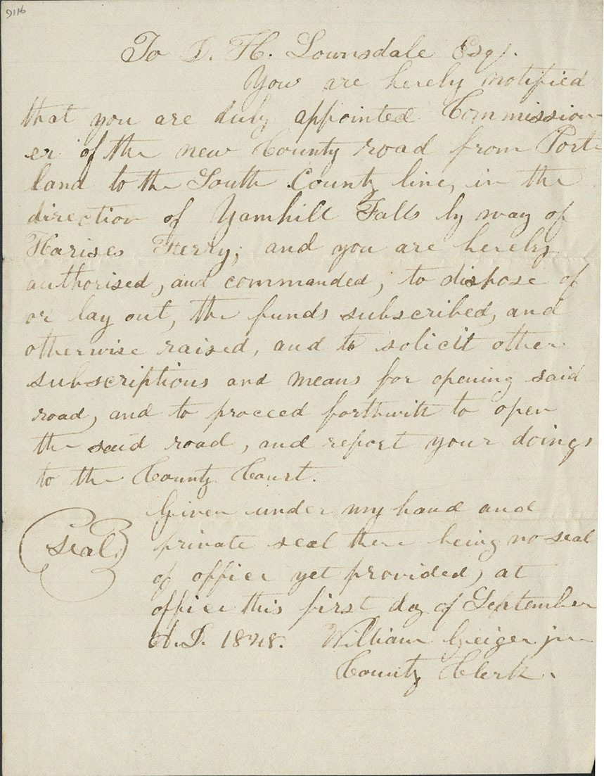
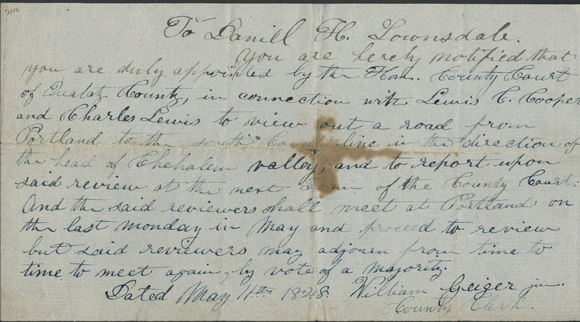
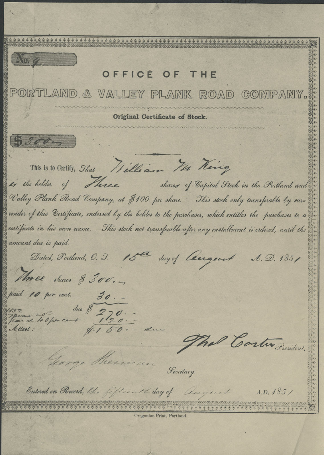
Lownsdale supported exporting Oregon wheat to San Francisco buyers, who shipped it to Asia and Europe, a trade that helped shape the Portland and Oregon economy for much of the twentieth century. By 1849, he had scouted a route for a road from Lafayette in the Yamhill Valley to Portland and within several hundred yards of his tannery. The road would give farmers in the valley a way to get their wheat to docks on the Willamette River. Along with partners Stephen Coffin and William Chapman, Lownsdale received approval for the road from the territorial legislature in August 1851, and the Great Plank Road was constructed in 1856.
In 1850, Lownsdale married Nancy Gillihan, a widow, and had two more children. He became the federal postal agent, appointed by President Millard Fillmore, and was a volunteer in the Indian Wars in 1856. His later years were marked by a legal dispute over his 1840s claim to land, levees, and docks on the west side of the Willamette. Led by the Rev. Josiah Parrish, downtown investors claimed that land on the banks of the river was public and argued that they should have free access to the levees there. In 1858, the U.S. Supreme Court ruled in Lownsdale v. Parrish that because there were no laws governing land in Oregon until 1850, no one could claim title to it.
Lownsdale died in 1862 and is buried in Lone Fir Cemetery. The central six half-blocks of his original donation to Portland, from Southwest Salmon Street to Southwest Washington Street, was never formally deeded to the city. After their father’s death, Lownsdale’s children offered the city the opportunity to purchase the land. The city declined the offer, and it was sold for development. Commercial buildings, hotels, restaurants, and Director Park now fill the space between Lownsdale’s South Park Blocks and O’Bryant Square.
-
![]()
D. H. Lownsdale.
Courtesy Oregon Hist. Soc. Research Lib., 72569
-
![]()
Lownsdale's surveyed land, 1852.
Courtesy Oregon Hist. Soc. Research Lib., G494.P6G46.1852.T619.G2
-
![]()
Lownsdale's appointment as Commissioner of the Plank Road, 1848 .
Courtesy Oregon Hist. Soc. Research Lib., Mss 134
-
![]()
Note authorizing Lownsdale to survey the road route, 1848.
Courtesy Oregon Hist. Soc. Research Lib., Mss 134
-
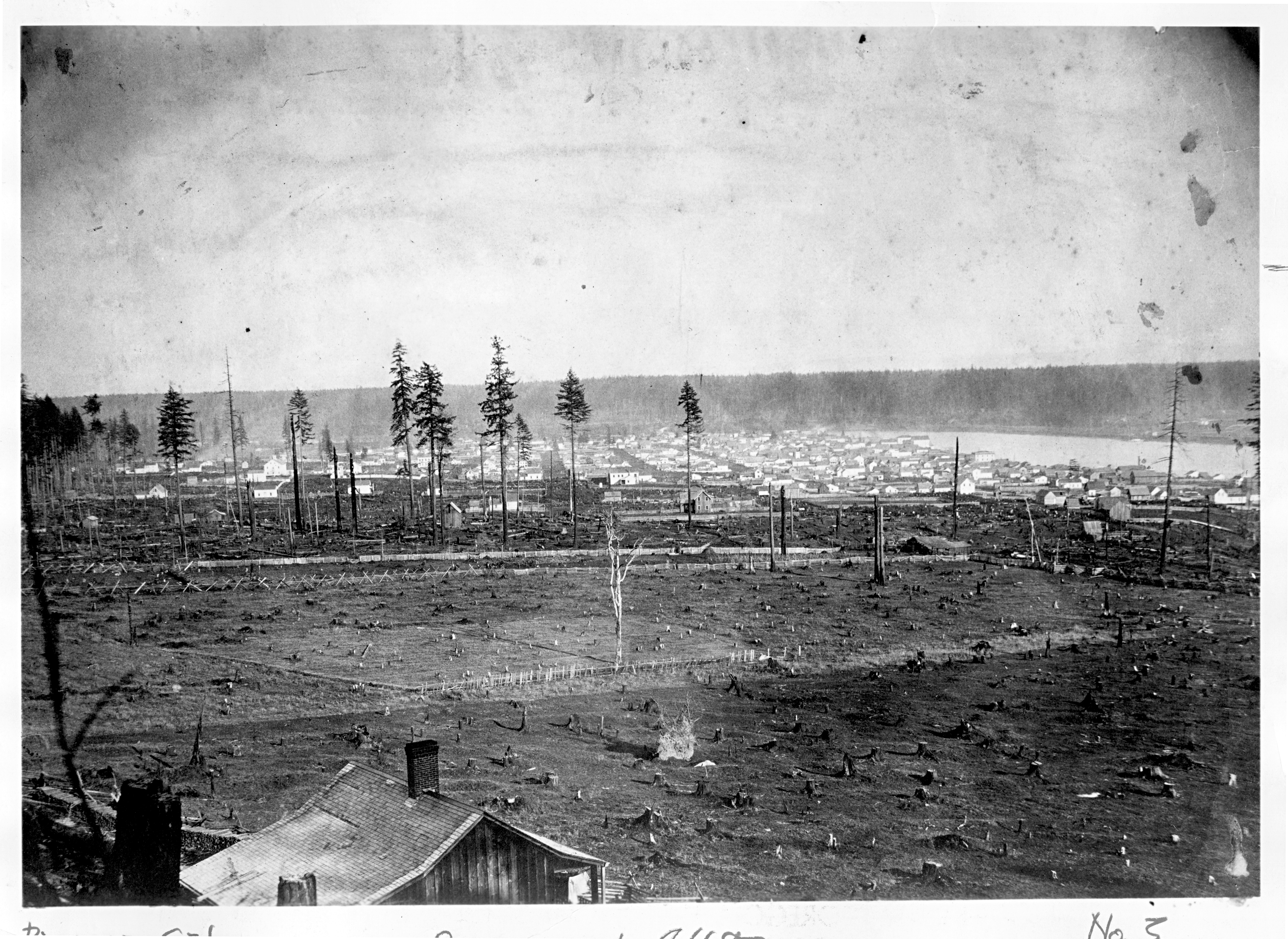
![Portland Park Blocks, 1878]()
Portland Park Blocks, 1878.
Portland Park Blocks, 1878 Courtesy Oreg. Hist. Soc. Research Lib., orhi23454
-
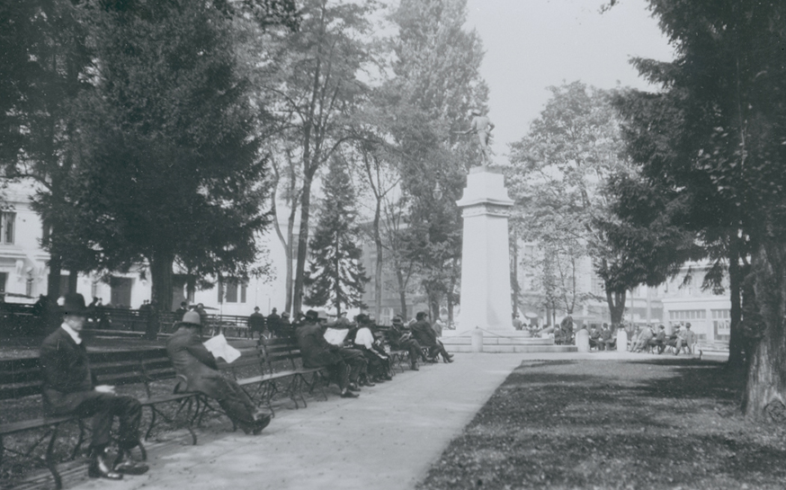
![Lownsdale Park, Portland, about 1910.]()
Lownsdale Park, Portland, ca 1910, bb008493.
Lownsdale Park, Portland, about 1910. Oreg. Hist. Soc. Research Libr., bb008493
Documents
Related Entries
-
![Great Plank Road]()
Great Plank Road
The Great Plank Road, constructed in 1856, connected productive agricul…
-
![Josiah L. Parrish (1806–1895)]()
Josiah L. Parrish (1806–1895)
Josiah Parrish played a central role in foundational activities at the …
-
![Portland]()
Portland
Portland, with a 2020 population of 652,503 within its city limits and …
-
![Portland Park Blocks]()
Portland Park Blocks
While America's premier landscape architect, Frederick Law Olmsted, tra…
Related Historical Records
Map This on the Oregon History WayFinder
The Oregon History Wayfinder is an interactive map that identifies significant places, people, and events in Oregon history.
Further Reading
Lansing, Jewel. Portland: People, Politics, and Power, 1851-2001. Corvallis: Oregon State U. Press, 2005.
MacColl, Kimbark. Merchants, Money, & Power: The Portland Establishment, 1843-1913. Athens, GA: Georgian Press, 1988.
Reps, John. The Making of Urban America. Princeton, NJ: Princeton U. Press, 1992.
Snyder, Eugene E. Early Portland: Stump-town Triumphant. Portland, Ore.: Binford & Mort, 1970.

