Mount Mazama is located in the southern part of the Cascade Range, about sixty miles north of the Oregon-California state line. It holds Crater Lake (giiwas in the Klamath language), at 1,943 feet the deepest freshwater body of water in the United States. Much of the mountain is a caldera formed by a massive volcanic eruption and collapse after the magma chamber emptied tons of material over a wide area. This climactic event, which took place about 7,700 years ago, was more than forty times as powerful as the eruption of Mount St. Helens in 1980. Mazama ash is so extensive that it represents a time marker throughout the Pacific Northwest, as the light-colored band is readily recognizable in relation to other strata.
Because Mount Mazama holds Crater Lake, it has been cited as a classic example of how small calderas evolve. The oldest lavas assigned to it are those resulting from a cluster of volcanoes that erupted between 400,000 and 420,000 years ago. An example is readily seen in the lake—a cone fragment called Phantom Ship. Mount Mazama attained a height of 12,140 feet (3,700 meters), and the summit once loomed a mile above the surface of present-day Crater Lake.
Due to the mountain’s growth between and during numerous colder periods, Mount Mazama supported glaciers over much of its existence. Some were large, such as the three glacial canyons on its south flank—Munson Valley, Sun Notch, and Kerr Notch. The last glacial advance there ended 27,000 years ago. By the time of the mountain’s climactic eruption, when conditions were relatively warm and dry, ice must have been restricted to only the highest elevations.
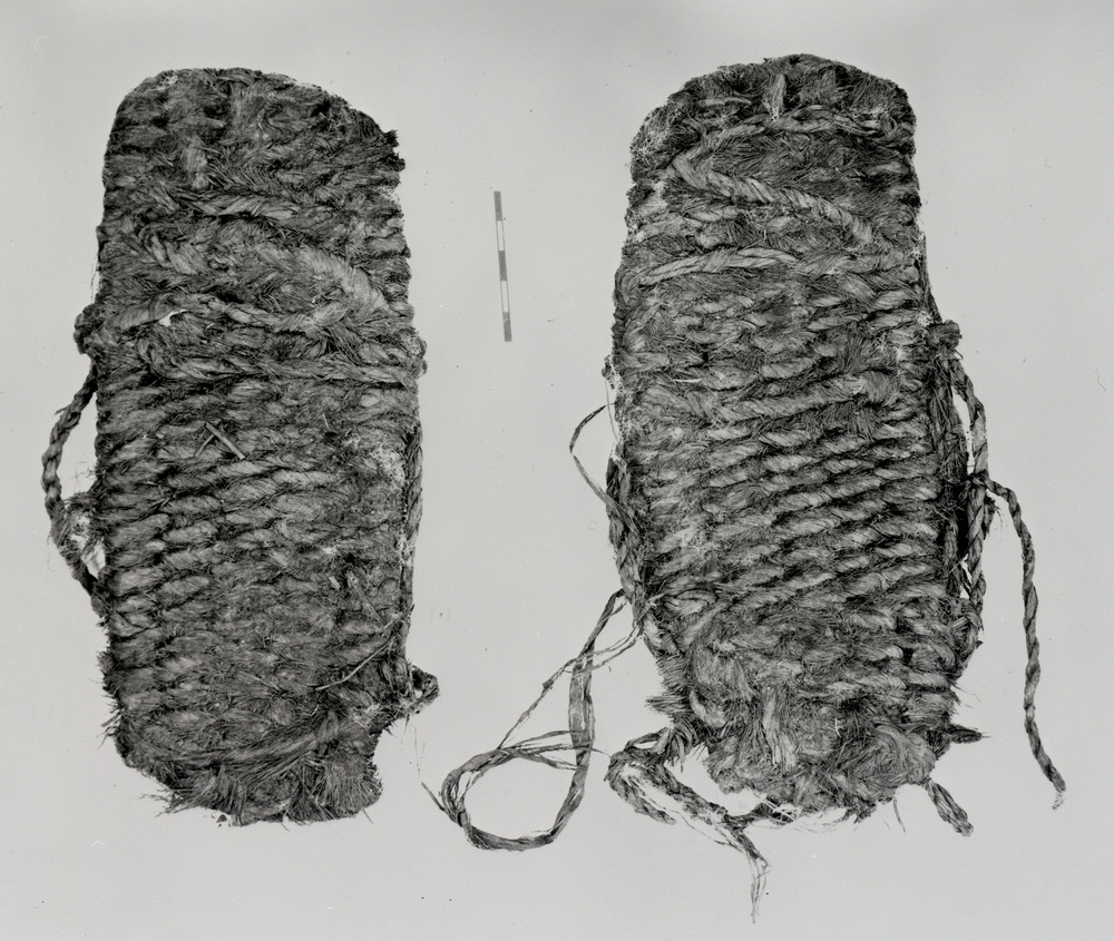
Two precursory events interrupted the more than 20,000 years that Mazama remained dormant. About 8,000 years ago, flows from Llao Rock and associated pumice deposits, followed by the opening of a new vent on Mazama’s north flank, signaled a new and explosive period of activity. This took place while humans occupied at least some of the area around the mountain. To the east, people whose existence is documented through artifacts such as sagebrush sandals became increasingly threatened by both a drier climate and renewed volcanic activity. To the south, Mazama's eruption disrupted the lives of people sufficiently so that stories about its wrath and after-effects have been passed down from one generation to the next.
The climactic eruption began with a towering column of pumice and ash rising from a vent located northeast of the summit, which resulted in deposits as thick as several centimeters as far away as present-day central Alberta. This phase of the eruption included pyroclastic flows—high speed and super-hot avalanches—that resulted from the vent widening and erupting at an increasing rate. Having drained a large portion of the magma chamber, the volcano lacked a foundation and began to collapse inward. The eruption entered a ring-vent phase, where contents in the magma chamber were forced out through cracks and fractures in a shape roughly corresponding to what later became Crater Lake. Large pyroclastic flows rushed past the mountain’s flanks and onto once-glaciated valleys.
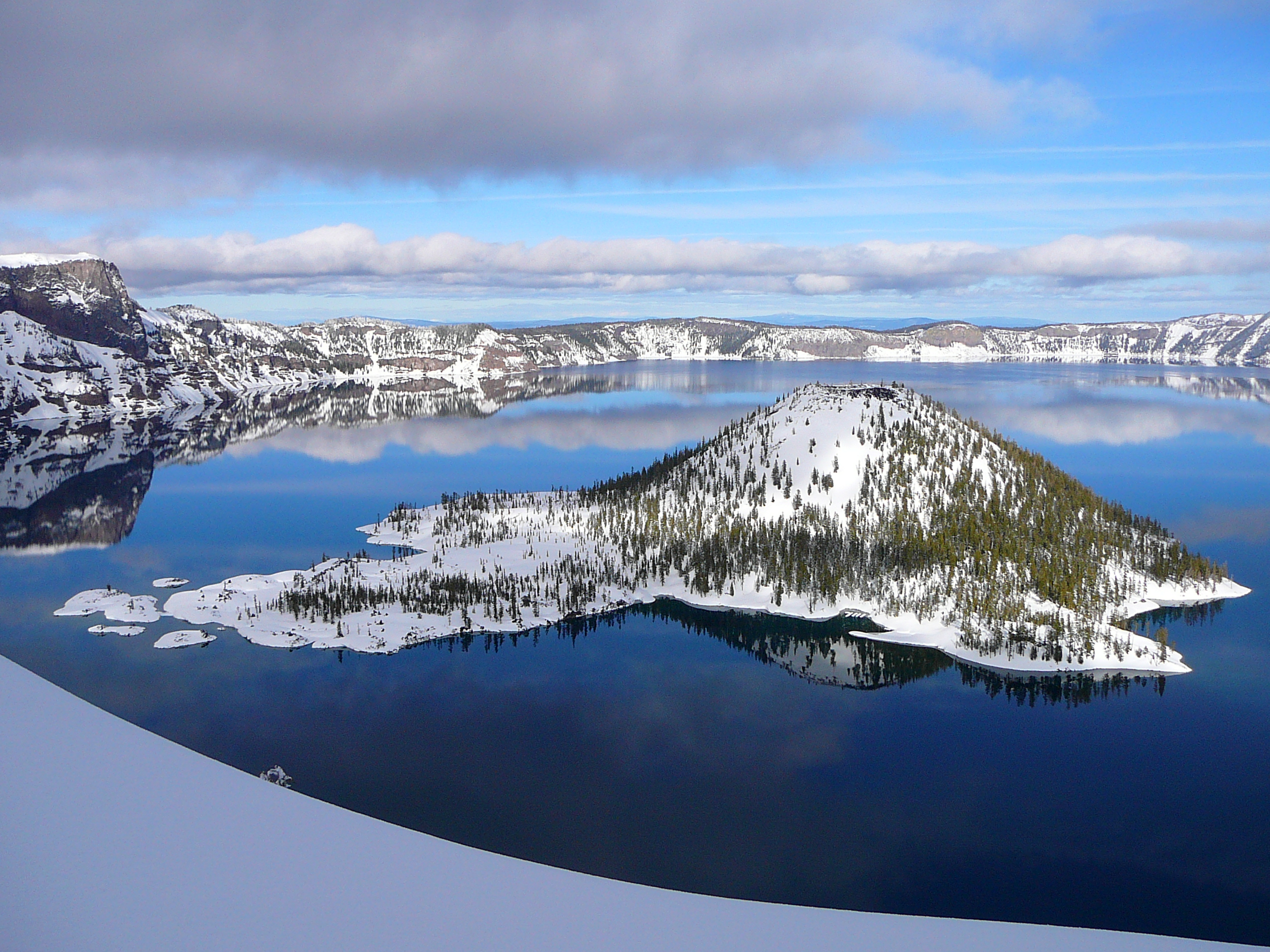
The eruption and collapse, which lasted only a few days, was followed by volcanism restricted to the resulting caldera. Most of the post-caldera volcanism is hidden from view by Crater Lake, with Wizard Island amounting to only 2 percent of the activity that for the most part ceased around 4,800 years ago. The early lake formed from precipitation but also through a hydrothermal system fueled by residual heat from the magma chamber. Crater Lake has some of the purest water known due to the general lack of organic nutrients, and it holds the world record for clarity. Still, its seemingly bucolic state will change in the future as the mountain is reawakened by renewed volcanic activity.
The name Mazama came from William G. Steel, who is known as the father of Crater Lake National Park and is the founder of the Mazamas, a mountaineering group formed on Mount Hood in 1894. Mazama is among the obsolete names for mountain goat, though it is derived from an Aztec word meaning “small deer.” When geologist Joseph S. Diller of the U.S. Geological Survey was making the first topographic map of the Crater Lake area in 1896, he asked about a name for the mountain that holds the lake. Steel suggested his organization as the namesake, partly because the group’s excursion to Crater Lake that summer had the purpose of promoting national park status for the area.
In August, the Mazamas “christened” the mountain, and Diller and other scientists gave the first interpretive talks to visitors at what later became known as Rim Village. President Theodore Roosevelt signed the Crater Lake National Park bill into law in 1902.
-
![]()
The eruption of Mount Mazama, by Paul Rockwood.
Courtesy of National Park Service, Crater Lake National Park Museum and Archive Collections
-
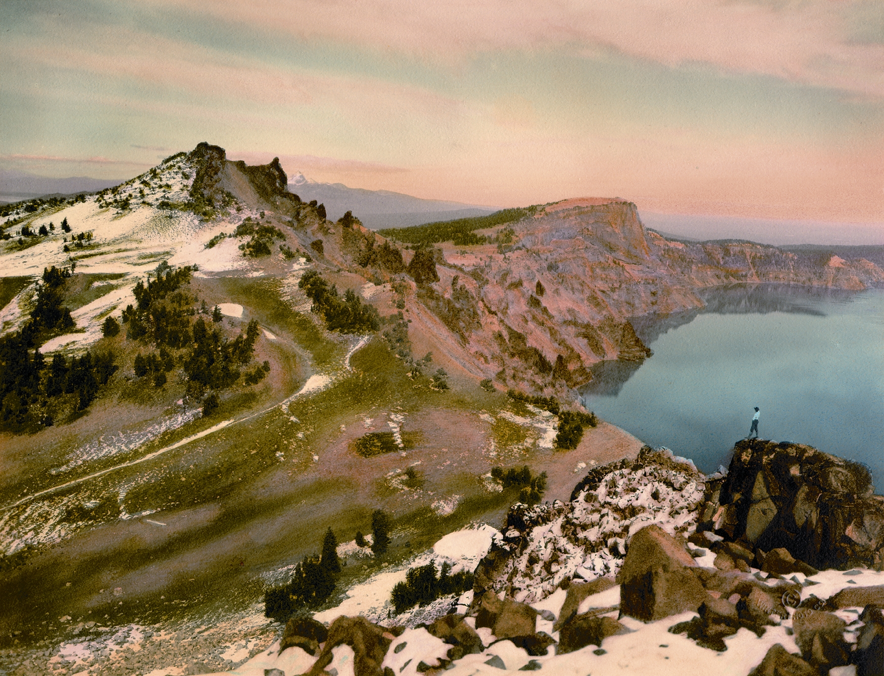
Crater Lake, Watchman and Llao Rock.
Watchman and Llao Rock formations at Crater Lake. Oreg. Hist. Soc. Research Libr.
-
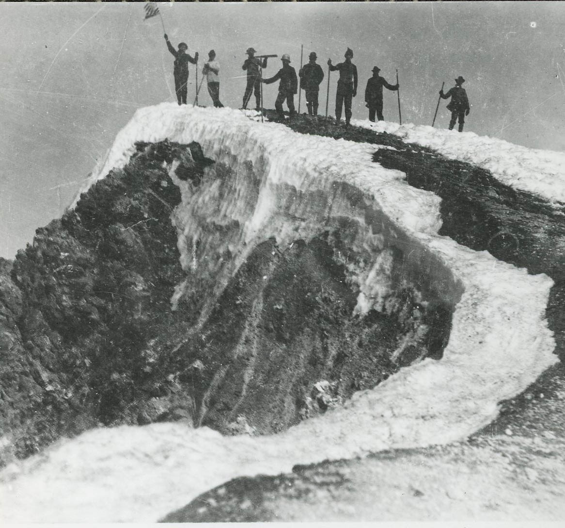
![At Crater Lake: Phil Metscham, Dr. Hill, Senator Fulton, Joaquin Miller, and William Steel, 1903.]()
Crater Lake, Steel, Will G., and prominent Oregonians at, 1903, bb000360.
At Crater Lake: Phil Metscham, Dr. Hill, Senator Fulton, Joaquin Miller, and William Steel, 1903. Photo Fred Kiser, Oreg. Hist. Soc. Research Libr., OrHi 101870
-
![Crater Lake National Park.]()
Crater Lake NP 3.
Crater Lake National Park. Courtesy U.S. National Park Service, Crater Lake National Park
Related Entries
-
![Cascade Mountain Range in Oregon]()
Cascade Mountain Range in Oregon
The Cascade mountain system extends from northern California to central…
-
![Crater Lake National Park]()
Crater Lake National Park
Crater Lake National Park, which the U.S. Congress set aside in 1902, i…
-
![Fort Rock Sandals]()
Fort Rock Sandals
Fort Rock sandals are a distinctive type of ancient fiber footwear foun…
-
![Mazamas]()
Mazamas
The history of the Mazamas began in early 1894 when William Gladstone S…
-
![William Gladstone Steel (1854–1934)]()
William Gladstone Steel (1854–1934)
Born in Ohio on September 7, 1854, William Gladstone Steel was raised i…
Related Historical Records
Map This on the Oregon History WayFinder
The Oregon History Wayfinder is an interactive map that identifies significant places, people, and events in Oregon history.
Further Reading
Bishop, Ellen Morris. In Search of Ancient Oregon: A Geological and Natural History. Portland, Ore.: Timber Press, 2003.
Harmon, Rick. Crater Lake National Park: A History. Corvallis: Oregon State University Press, 2002.
Willliams, Howel. Crater Lake: The Story of Its Origin. Berkeley: University of California Press, 1972.


