Mount McLoughlin, at 9,495 feet, is the lowest in Oregon's chain of six major Cascade Range volcanic peaks (the others are Mount Hood, Mount Jefferson, and the Three Sisters, all above 10,000 feet). Viewed from the northwest, Mount McLoughlin's symmetrical shape is the dominant landmark of the Rogue River Valley.
Except for its eastern base, which is in Klamath County, Mount McLoughlin lies within Jackson County on the watershed divide between the Rogue River and the upper Klamath River basin. It is situated entirely within the Sky Lakes Wilderness of the Rogue River-Siskiyou and the Fremont-Winema National Forests.
Geologically quite young, the mountain's mass was formed from alternating andesitic lava flows and pyroclastic eruptions during the very late Pleistocene (Ice Age), most dating to around 60,000 years ago but with some small flows only around 10,000 years old. Mount McLoughlin's original summit may have exceeded 10,000 feet, but glacial erosion of the northeast slope during the late Pleistocene removed the top of the peak, creating the present summit at a lower point on the mountain's southwest slope.
Mount McLoughlin's higher slopes are forested with Shasta red fir and mountain hemlock, with gnarled clumps of whitebark pine at timberline. The first recorded ascent was by a group of Jacksonville men in 1858. From the 1860s through the 1880s, the lower slopes of the mountain became a storied region among Oregon hunters for its abundant deer, elk, and grizzly bear.
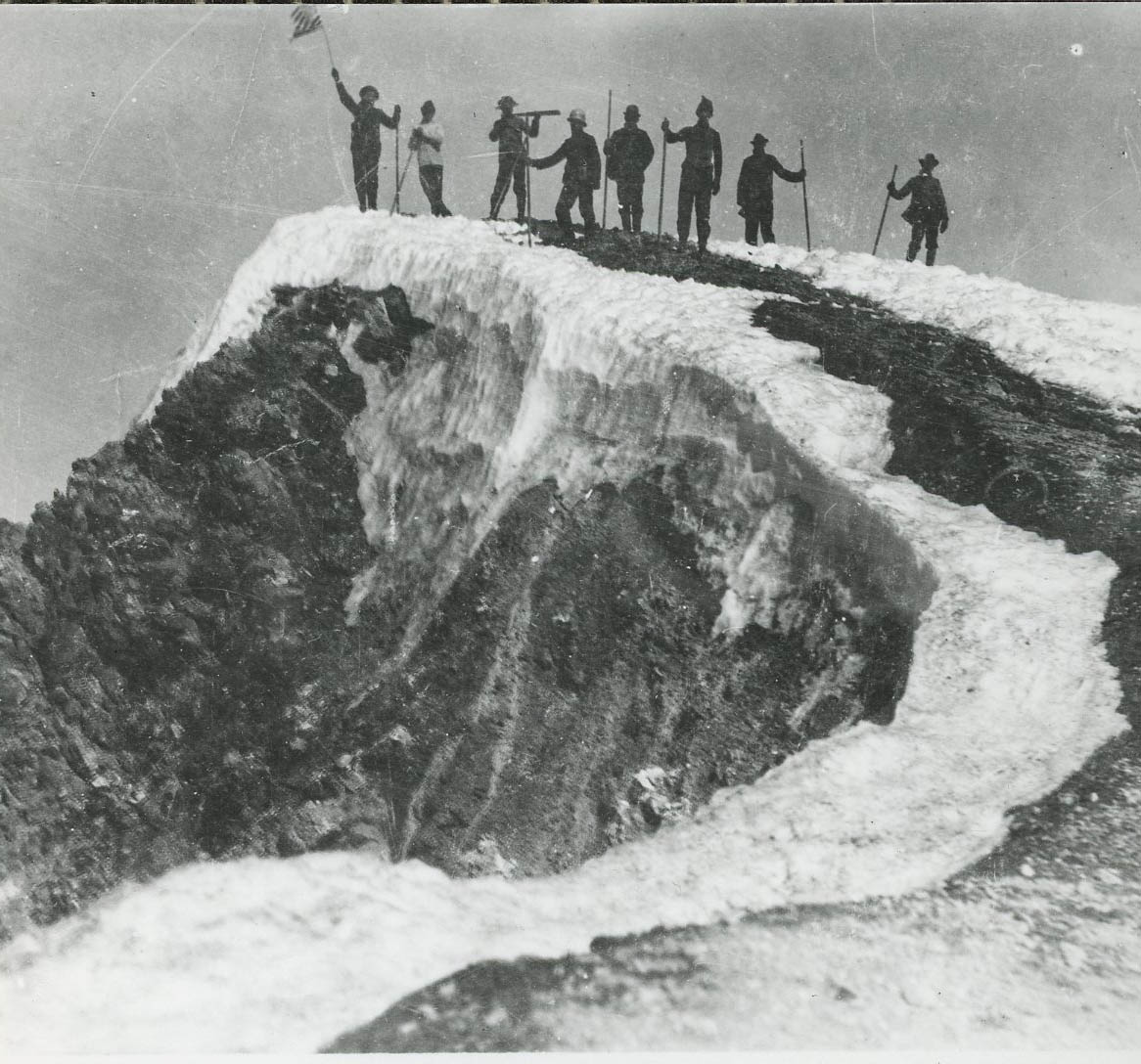
In 1896, a large party of Mazamas, a mountaineering club, climbed Mount McLoughlin. Among the summiteers were prominent Portlanders Lottie Reed, Henry Pittock, and Leslie Scott. Reaching the summit is a long, hard hike rather than a technical climb, and hundreds of visitors each year have been rewarded with the outstanding view and with shelter from the wind at the remnant stone walls of an old Forest Service fire lookout.
Mount McLoughlin has been known by a number of names. The Takelma people to the west called it Alwilamchaldis, an important hero in their traditional stories; the Shasta people to the south knew it as Mayakax, one of three peaks that rose above an ancient ocean; and the Klamath people to the east named it Kesh yainatat, the abode of "dwarf old woman," who made the west wind blow.
Hudson's Bay Company (HBC) fur trader Peter Ogden, the first EuroAmerican to record a description of Mount McLoughlin, dubbed it Mount Sastise in 1827, for the Sastise (or Shasta) Indians. Mount Shasta, the 14,000-foot-high volcano in California acquired that name due to subsequent cartographic confusion. It had previously been mapped as Pit Mountain because of its proximity to Ogden's Pit River. A toponymic transposition occurred during the 1840s, when Pit Mountain became today's Mount Shasta. By the 1850s, the original Mount Sastise/Shasta—today's Mount McLoughlin—thereby came to be mapped first as Mount Pit and then as Mount Pitt, a name that some local people still use.
The name McLoughlin, for Dr. John McLoughlin, the HBC chief factor at Fort Vancouver, came into use for the peak in the 1830s. With the arrival of American settlers in western Oregon during the 1840s and 1850s, additional names were applied, including Mount John Quincy Adams, Big Butte, Snowy Butte, and Mount Clear View. The name Mount McLoughlin was officially adopted by the Oregon legislature in 1905.
Since 1926, the lower western slope of Mount McLoughlin has formed the municipal watershed for the City of Medford. The melting snows run down and through the lava layers to emerge at the city's Big Butte Springs. A beloved landmark for Rogue Valley residents, Mount McLoughlin remains a focus of local folklore. Each summer, as the mountain’s long-lasting, west-slope snow patch melts and shrinks, the snow takes on the shape of what is known as “the angel wings” (or "the diving eagle"), a sign that the fishing in the nearby mountain lakes is at its peak.
-
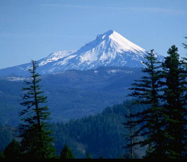
![Mt. McLoughlin from Lower Table Rock.]()
Mt. McLoughlin 3.
Mt. McLoughlin from Lower Table Rock. U.S. Bureau of Land Mgmt., Medford Distr., WF110LTRL-52
-
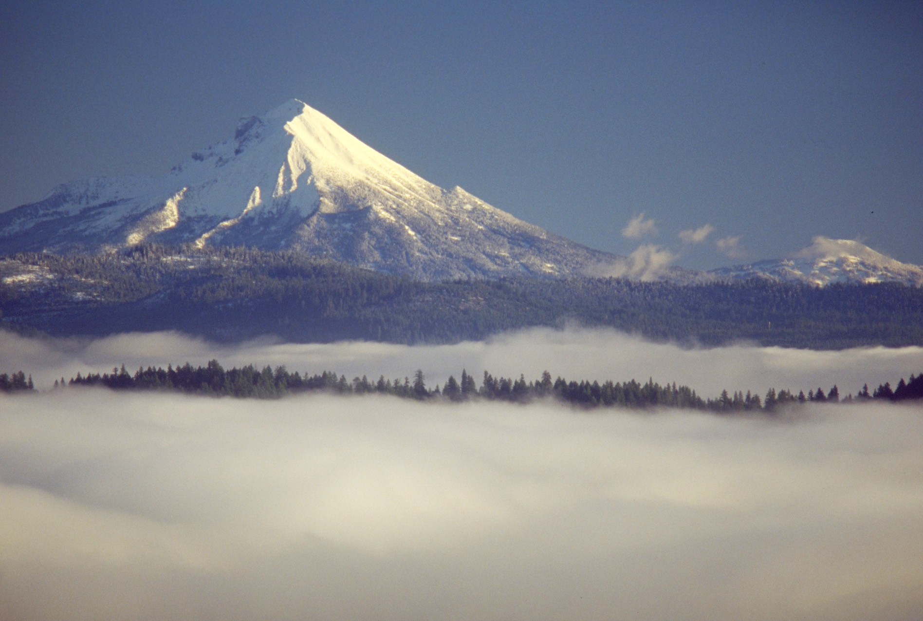
![Last light on Mount McLoughlin, from West Branch Elk Creek, Jackson County.]()
Mt. McLoughlin 4.
Last light on Mount McLoughlin, from West Branch Elk Creek, Jackson County. U.S. Bureau of Land Mgmt., Medford Distr., Wildflowercd3L-052
-
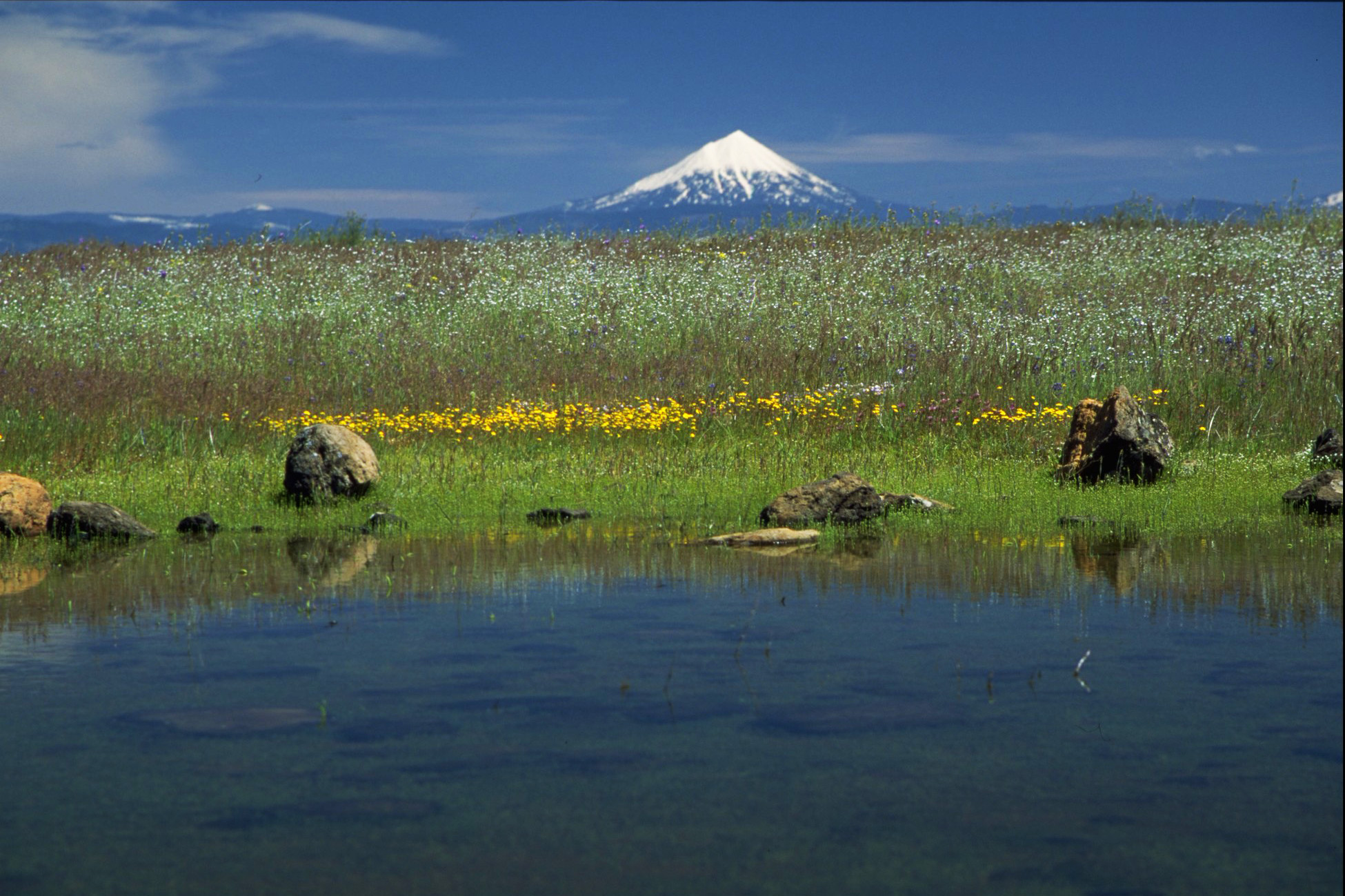
![Upper Table Rock and Mount Mcloughlin in background.]()
Mt. McLoughlin 2.
Upper Table Rock and Mount Mcloughlin in background. U.S. Bureau of Land Mgmt., Medford Distr., Medcd2L-031
-
![Mt. McLoughlin.]()
Mt. McLoughlin 1.
Mt. McLoughlin. U.S. Bureau of Land Mgmt., Medford Distr., Medcd2L-004

Related Entries
-
![Cascade Mountain Range in Oregon]()
Cascade Mountain Range in Oregon
The Cascade mountain system extends from northern California to central…
-
![Mount Ashland]()
Mount Ashland
At 7,532 feet, Mount Ashland is the tallest mountain in Oregon west of …

Map This on the Oregon History WayFinder
The Oregon History Wayfinder is an interactive map that identifies significant places, people, and events in Oregon history.
Further Reading
LaLande, Jeff. From Abbott Butte to Zimmerman Burn: A Place-Name History and Gazetteer of the Rogue River National Forest. Medord, Ore.: U.S.D.A. U.S. Forest Service, 2001.
Smith, James, et al. Geologic Map of the Medford Quadrangle. U.S. Geological Survey, 1982.