At 7,532 feet, Mount Ashland is the tallest mountain in Oregon west of the Cascade Range's chain of volcanic peaks. Located about six miles west of Siskiyou Pass, the mountain appears from the south simply as a higher point along the Siskiyou Crest, the major east-west ridge system of the Siskiyou Mountains and the watershed divide between the Rogue and Klamath Rivers. From the north, however, Mount Ashland is visible from many places in the Rogue River Valley and is a dominating backdrop to the city of Ashland.
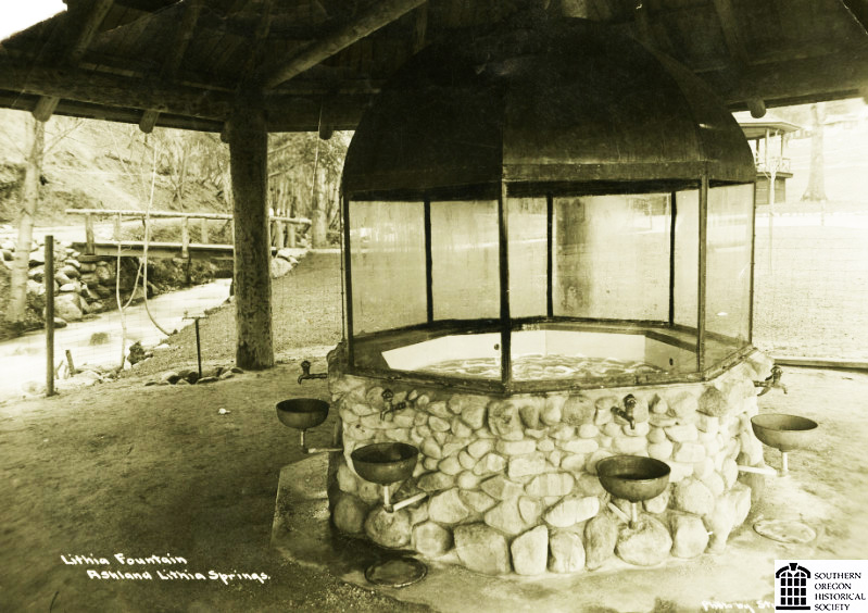
The mountain is made entirely of granitic rocks such as granodiorite, and its bedrock forms the most resistant (and hence highest) part of a 150-square-mile, Jurassic era, intrusive-granitic body known as the Ashland Pluton. Northward-flowing Ashland Creek originates high on Mount Ashland and drains much of the mountain. Fed by snowpack, the stream once powered early Ashland's mills, and the creek continues to provide the city's domestic water supply. Its shady, boulder-studded, lower stretch is the centerpiece of Lithia Park.
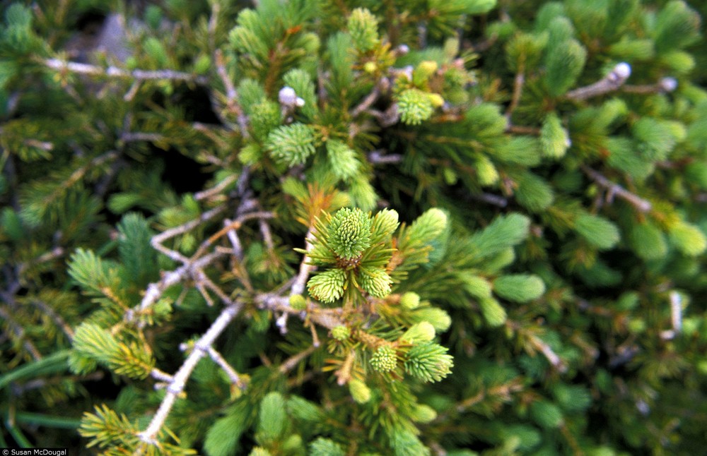
A small Pleistocene glacier carved the steep-walled cirque just below Mount Ashland's summit. The mountain's higher elevations are largely forested with Shasta red fir and mountain hemlock. On the north slope, near the summit, scattered groves of Engelmann spruce, fewer than a dozen whitebark pines, and at least a single subalpine fir—all growing on the far southern edge of their range—are relicts from the Pleistocene/Ice Age flora. Above 6,800 feet, several open sandy-soil areas on the southwest and west sides of the mountain comprise the entire range of the tiny Mount Ashland lupine (Lupinus aridus ssp. Ashlandensis).
Called Siskiyou Peak by early settlers and later known as Ashland Butte, Mount Ashland acquired its more impressive-sounding moniker from the town's boosters in about 1910. In 1893, with the threat of polluted water from large herds of sheep that then grazed on the mountain’s higher slopes, residents successfully petitioned for a thirty-six-square-mile Ashland Forest Reserve, which banned livestock and focused on the area's importance as a municipal watershed.
During Ashland's tourist boom in the early twentieth century, a horseback ride up Mount Ashland was a popular daylong excursion and signing the register at the summit's fire lookout became obligatory for visitors. In the mid 1930s, the Civilian Conservation Corps (CCC) built a road from Ashland up to the mountain and farther west along the Siskiyou Crest.
The CCC's work included developing a small ski slope along the road. Situated over 2,500 feet lower than the summit, the area’s warming hut and gas-engine-powered rope tow helped create the group of local skiers who eventually lobbied the Forest Service for a major ski area on the mountain. Opened in the winter of 1963-1964, Mount Ashland Ski Area now attracts experienced skiers and snowboarders to its steep slopes. The limited number of beginner and lower-intermediate runs, periodic high winds, and a marginal snowpack have been factors in the area's intermittent financial problems over the years. In 2011, after over twenty years of environmental planning and unsuccessful lawsuits opposing the plan, the ski area's expansion plans were approved. In 2017, following review and approval by the Oregon State Historic Preservation Office, the historic 1963 Mt. Ashland Ski Lodge underwent a remodel that expanded its interior square footage.
Although the fire lookout on the summit of Mount Ashland was removed many years ago, the top of the mountain now includes a NOAA weather-radar station, a television transmission facility, and the terminus of the ski area's longest chairlift. Hundreds of sightseers drive the narrow service road to reach the mountaintop each summer. Since the 1980s, the hardy finishers of the annual Mount Ashland Hillclimb Run, which begins at Lithia Park, has required competitors to gain 5,600 feet in slightly over thirteen miles to reach the summit. Less grueling but more popular is the 50-kilometer/15-kilometer Siskiyou Outback trail run, which ends at the ski area's parking area.
-
![Glenn Jackson (second from left) at Mt. Ashland, about 1965.]()
Jackson, Glenn, at Mt Ashland, ca 1965.
Glenn Jackson (second from left) at Mt. Ashland, about 1965. Photo Kenn Knackstedt, Southern Oreg. Hist. Soc., SOHS01i_18595
-
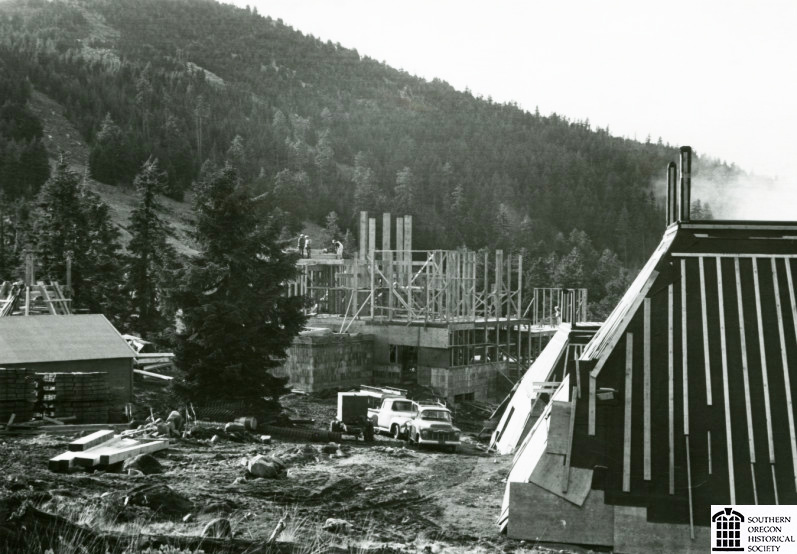
![Construction of Mt. Ashland lodge, 1963.]()
Mt. Ashland, lodge constr, 1963.
Construction of Mt. Ashland lodge, 1963. Photo Medford Mail Tribune, Southern Oreg. Hist. Soc., SOHS01i_13780
-
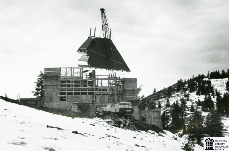
![Construction of Mt. Ashland lodge, 1963.]()
Mt. Ashland, lodge constr 2, 1963.
Construction of Mt. Ashland lodge, 1963. Photo Medford Mail Tribune, Southern Oreg. Hist. Soc., SOHS01i_13941
-
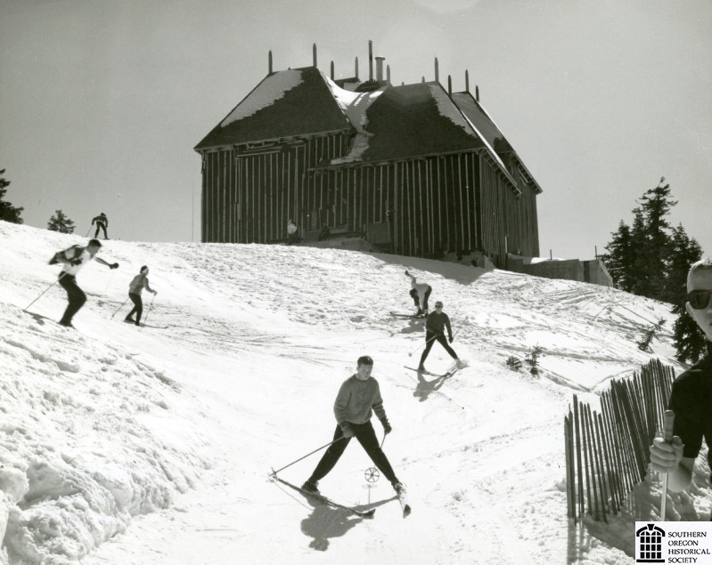
![Mt. Ashland lodge and skiers, 1964.]()
Mt. Ashland, lodge, 1964.
Mt. Ashland lodge and skiers, 1964. Photo Kenn Knackstedt, Southern Oreg. Hist. Soc., SOHS01i_15810
-
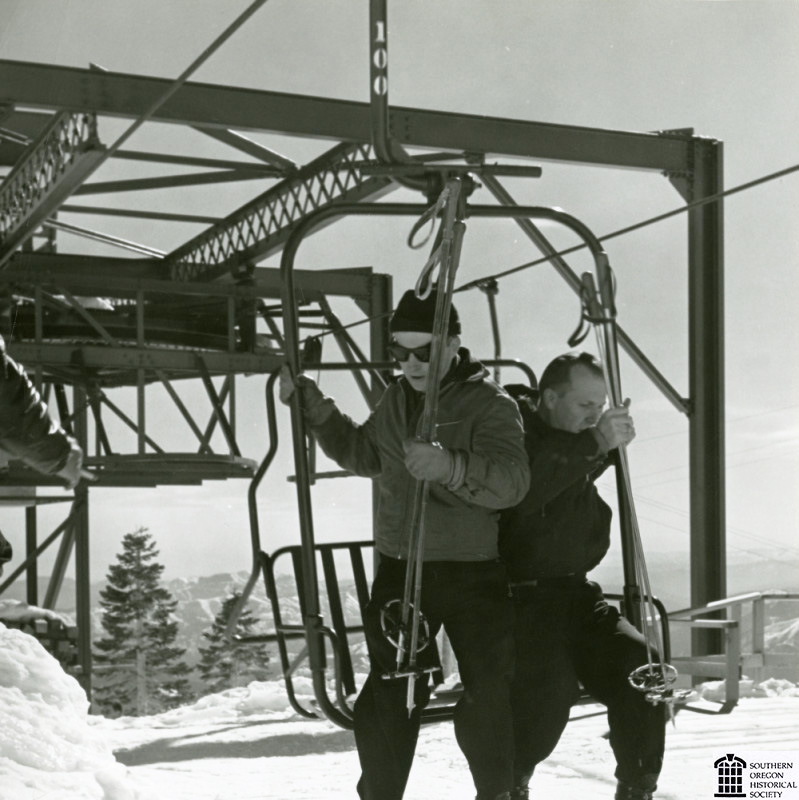
![Mt. Ashland ski lift, about 1968.]()
Mt. Ashland, lift, ca 1968.
Mt. Ashland ski lift, about 1968. Photo Medford Mail Tribune, Southern Oreg. Hist. Soc., SOHS01i_20836
-
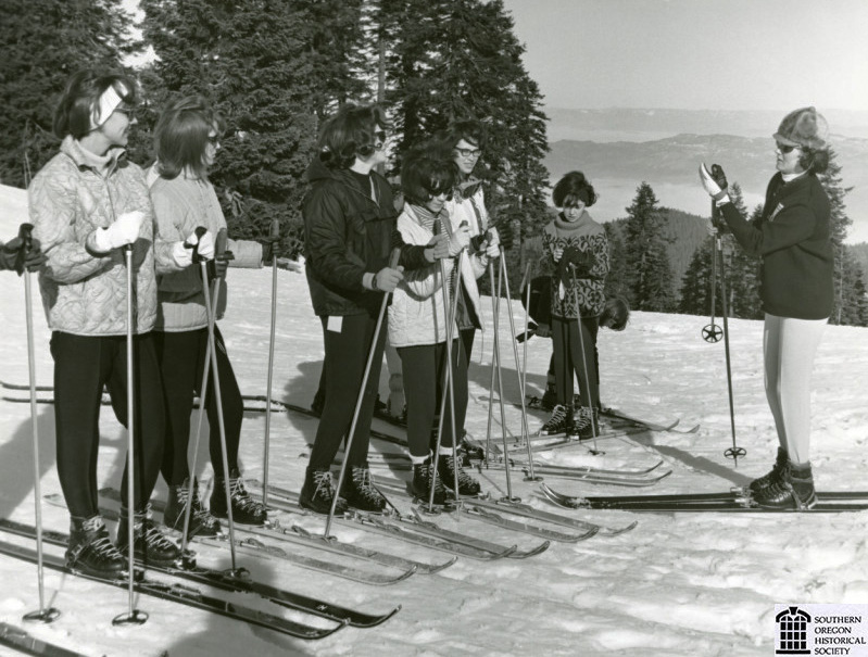
![Adult ski class on Mt. Ashland, 1965.]()
Mt. Ashland, ski class, 1965.
Adult ski class on Mt. Ashland, 1965. Photo Medford Mail Tribune, Southern Oreg. Hist. Soc., SOHS01i_20840
-
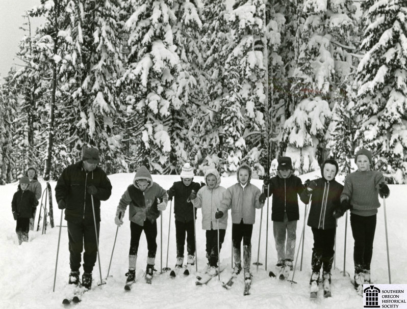
![Children's skiing class at Mt. Ashland, about 1965.]()
Mt. Ashland, ski class, kids, ca 1965.
Children's skiing class at Mt. Ashland, about 1965. Photo Medford Mail Tribune, Southern Oreg. Hist. Soc., SOHS01i_20839
-
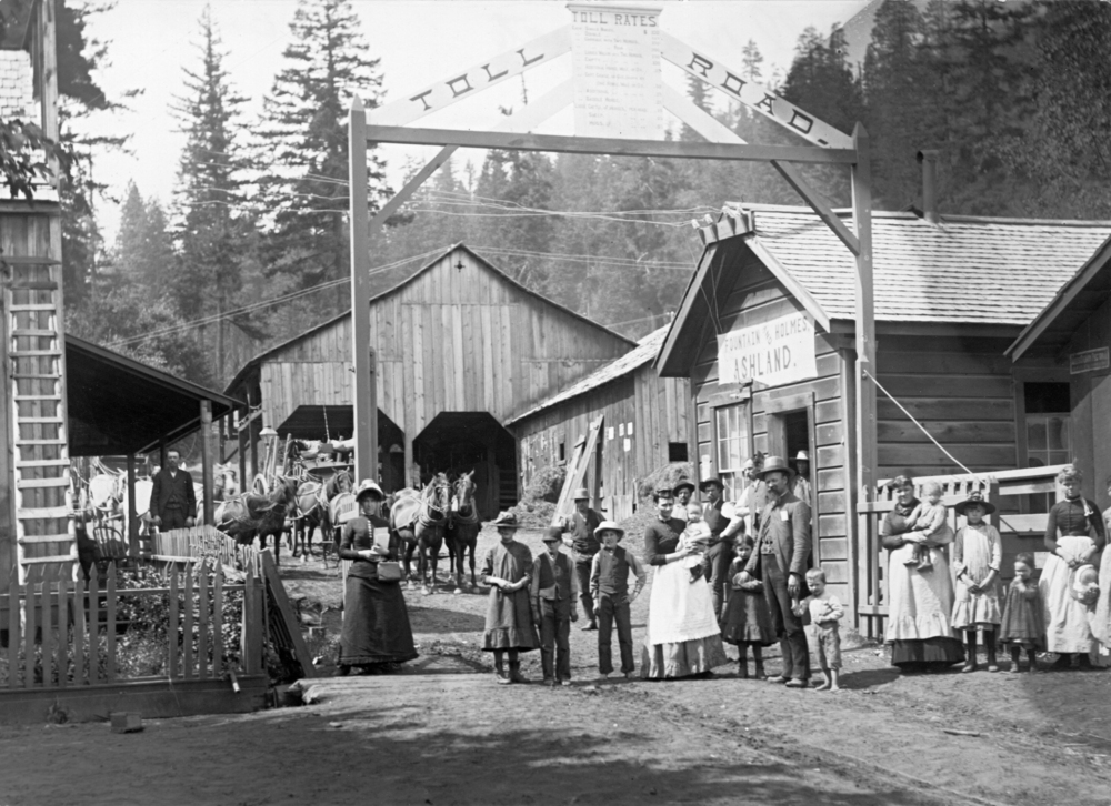
![Picnic on Mt. Ashland, May 1910.]()
Mt. Ashland, picnic, 1910.
Picnic on Mt. Ashland, May 1910. Photo Jackson E. Hendricks, Southern Oreg. Hist. Soc., SOHS01i_7692


Related Entries
-
![Ashland]()
Ashland
Ashland, a city of 21,360 people in Jackson County, is situated in the …
-
![Engelmann Spruce]()
Engelmann Spruce
With its stiff, sharp-pointed needles and scaly bark, Engelmann spruce …
-
![Lithia Park]()
Lithia Park
Lithia Park in Ashland is a good example of what Fredrick Law Olmsted c…
-
![Siskiyou Pass]()
Siskiyou Pass
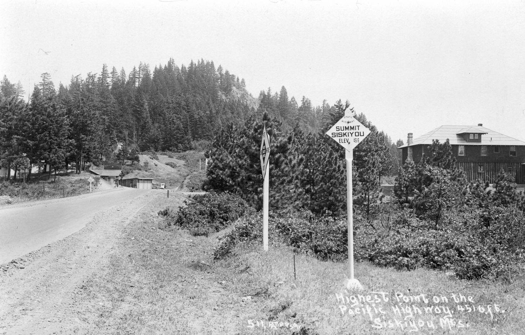
Siskiyou Pass, including the 4,310-foot-high Siskiyou Summit of Interst…
-
![Western hemlock]()
Western hemlock
Western hemlock, or Alaska-spruce (Tsuga heterophylla), is a common con…
-
![Whitebark pine]()
Whitebark pine
Whitebark pine (Pinus albicaulis) is arguably Oregon's quintessential t…


Map This on the Oregon History WayFinder
The Oregon History Wayfinder is an interactive map that identifies significant places, people, and events in Oregon history.
Further Reading
LaLande, Jeff. Guide to the Historical Records Collection of the Rogue River National Forest. Medford, Ore.: U.S. Department of Agriculture, U.S. Forest Service, 2007. (Held at National Archives and Records Service Pacific Alaska Region, Seattle.)
LaLande, Jeff. Prehistory and History of the Rogue River National Forest: A Cultural Resource Overview. Portland, Ore.: U.S. Department of Agriculture, U.S. Forest Service, 1981.