The city of Silverton was established where Silver Creek flows northwest out of the foothills of the Cascades and enters the Willamette Valley at the 45th parallel. Historically a mill and timber town, the city of over ten thousand people in 2016 is the host of the Oregon Gardens and is known as the Gateway to Silver Falls because of its proximity to Silver Falls State Park.
In a gentle bend, Silver Creek turns due west into an open oak grove, where Kalapuya and Molalla people burned the grove yearly to encourage the growth of camas. Early white settlers noted a large Oregon white oak tree about a hundred yards north of the creek where Native peoples gathered. The Old Oak, as it was called, was a well-known stopping point for people traveling on what was referred to as the Molalla Trail, a spur of the longer Klamath Trail that hugged the east edge of the Willamette Valley. It was the major route taken by Natives during their annual travels to summer gatherings. In the nineteenth century, the route became the northern leg of the Territorial Road that connected the middle valley to Oregon City. It is now Highway 213.
Two miles upstream where a waterfall punctuates the creek, pioneers James Smith and John Barger saw Silver Creek as a source of energy. In 1846, they and others constructed a sawmill, a store, and several other buildings that created a short-lived community called Milford. Its distance upstream from the junction of the Territorial Road was an issue, as even two miles was substantial, especially during wet Oregon’s winters and springs. Smith, Barger, and others relocated to the downstream location, so that by 1854 when Silverton was platted, Milford had been all but abandoned.
By the early 1850s, several claims had been established in what is now Silverton. In about 1853, Beauford Smith built a sawmill and flourmill near where the Silverton city hall is now located. Silver Creek has had numerous dams and water diversion systems, serving various mills, log ponds, and a local hydroelectric system.
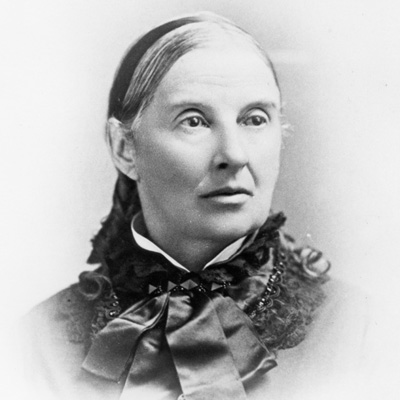
In 1851, Thomas Coon laid claim to the land along Silver Creek, where the city’s central business district is now. When he died in January 1854, the claim passed to his wife Polly (née Crandall) Coon, who had the claim platted by surveyor Timothy W. Davenport into lots and sold them to form the center of the town growing along Silver Creek. Instead of the township-and-range grid system, Coon directed Davenport to center the town on the Old Oak. Silverton was registered with Marion County in 1854, and a post office opened the following year. Polly Coon married Stephan Price, and they moved to Hood River.
Silverton grew as resettlers arrived to take advantage of the town’s location. After the Scottish-financed narrow-gauge Oregonian Railroad reached the town in 1880, Silverton became an economic hub of the northeast Willamette Valley. The town was incorporated in 1885 and within ten years had nearly nine hundred residents.
Schools were a priority, and the secular Liberal University of Oregon was established in 1895. The school was dedicated to the Free Thought movement, whose proponents espoused an educational system divorced from all religion. Liberal University closed after seven years.
Like many timber communities constructed initially of wood, Silverton experienced fires, including the April 23, 1935, conflagration that destroyed the historic wood-framed Palace Opera House and the rest of the block it was on.
The turn of the twentieth century marked an economic and cultural shift as the timber industry gradually replaced the flour and gristmills. Industrial lumber operations such as the Silverton Lumber and Silver Falls Timber companies attracted immigrants, primarily from Scandinavian countries. By 1937, the population of Silverton was almost three thousand.
Like many other Oregon lumber towns, Silverton became dependent on that single industry. When the major sawmills went out of business after World War II, the town contracted and stabilized into a typical rural Oregon community. Many of the aspects of self-sufficiency, such as small businesses, could not compete with nearby metropolitan areas. While Silverton’s economy is not stagnant, the majority of residents today work elsewhere, usually in Salem or Portland.
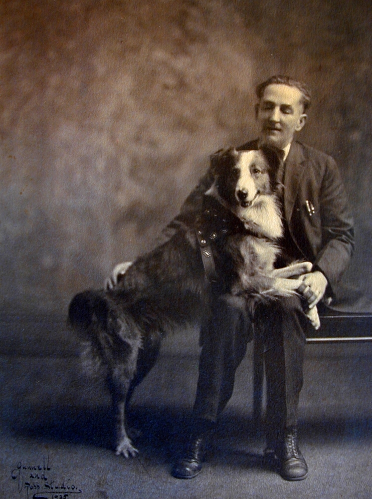
An active sense of community heritage and pride is evident in the active arts association, the historical society, the library, and fraternal and other service groups. Nationally known Silvertonians include political cartoonist Homer Davenport; Stu Rasmussen, the nation’s first transgender mayor; Don Pettit, a veteran NASA astronaut; and Bobbie the Wonder Dog, the remarkable pet who made news when he traversed the country on his own to get back to his Silverton family.
-
![]()
Main Street, Silverton, looking Southwest with "The Old Oak," 1866.
Courtesy Silverton County Historical Society
-
![]()
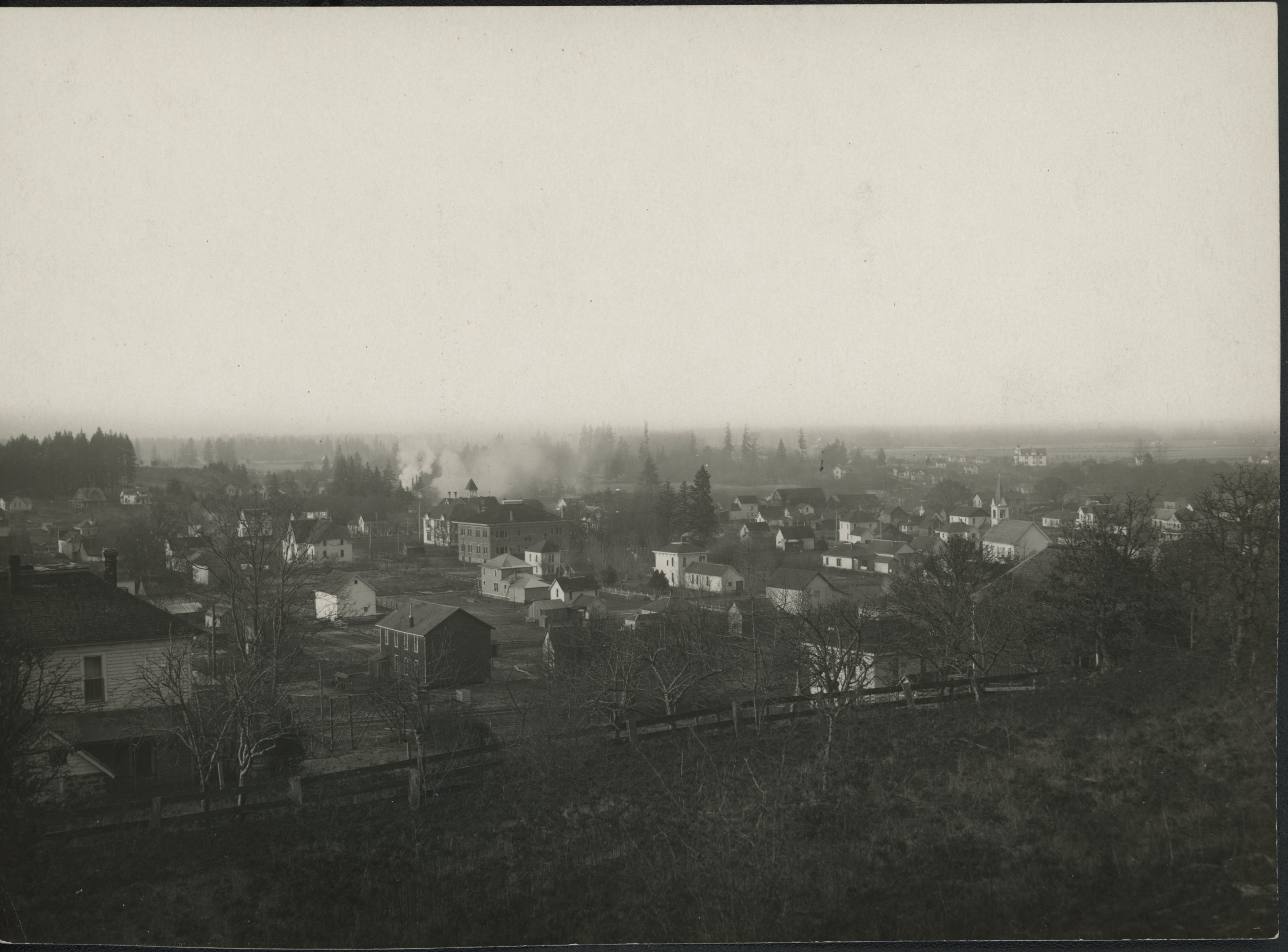
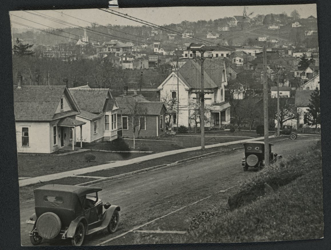
Looking westward from East Hill, Silverton.
Courtesy Oregon Hist. Soc. Research Lib., Orhi84161
-
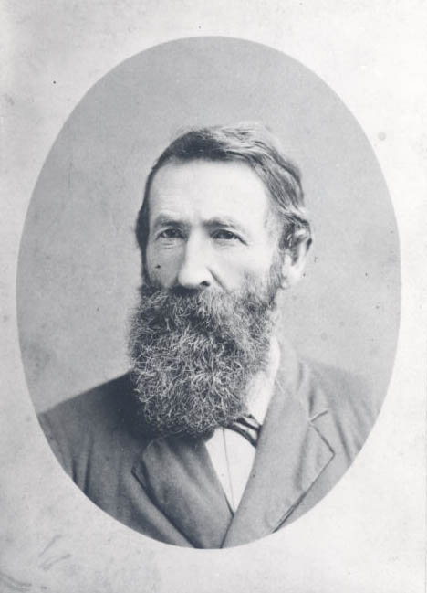
![]()
Poly Crandall Coon Price, Silverton's Founding Mother, c. 1860.
Courtesy Silverton County Historical Society
-
![]()
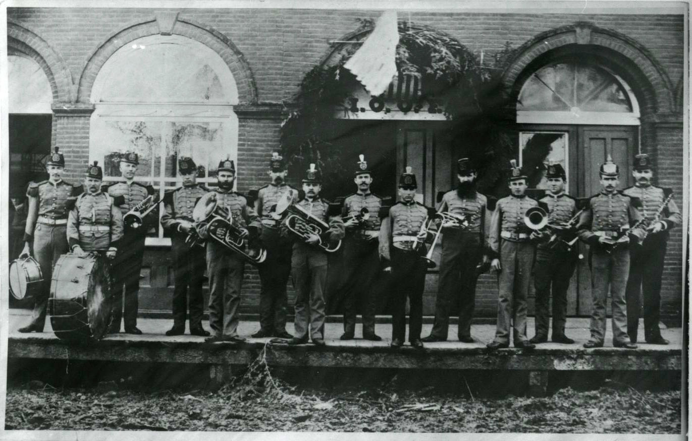
Main St, IOOF Building, 1880s; Homer Davenport, far left.
Courtesy Oregon Hist. Soc. Research Lib., Orhi58989
-
![]()
Public school in Silverton, c.1889.
Courtesy Oregon Hist. Soc. Research Lib., 25078
-
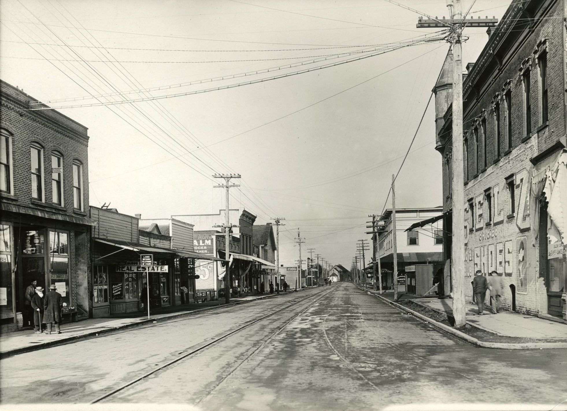
![]()
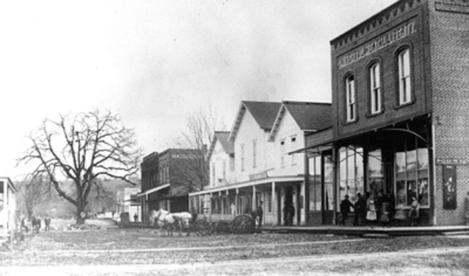
Main Street from SW Corner of Water Street, Silverton, c. 1890.
Courtesy Silverton County Historical Society
-
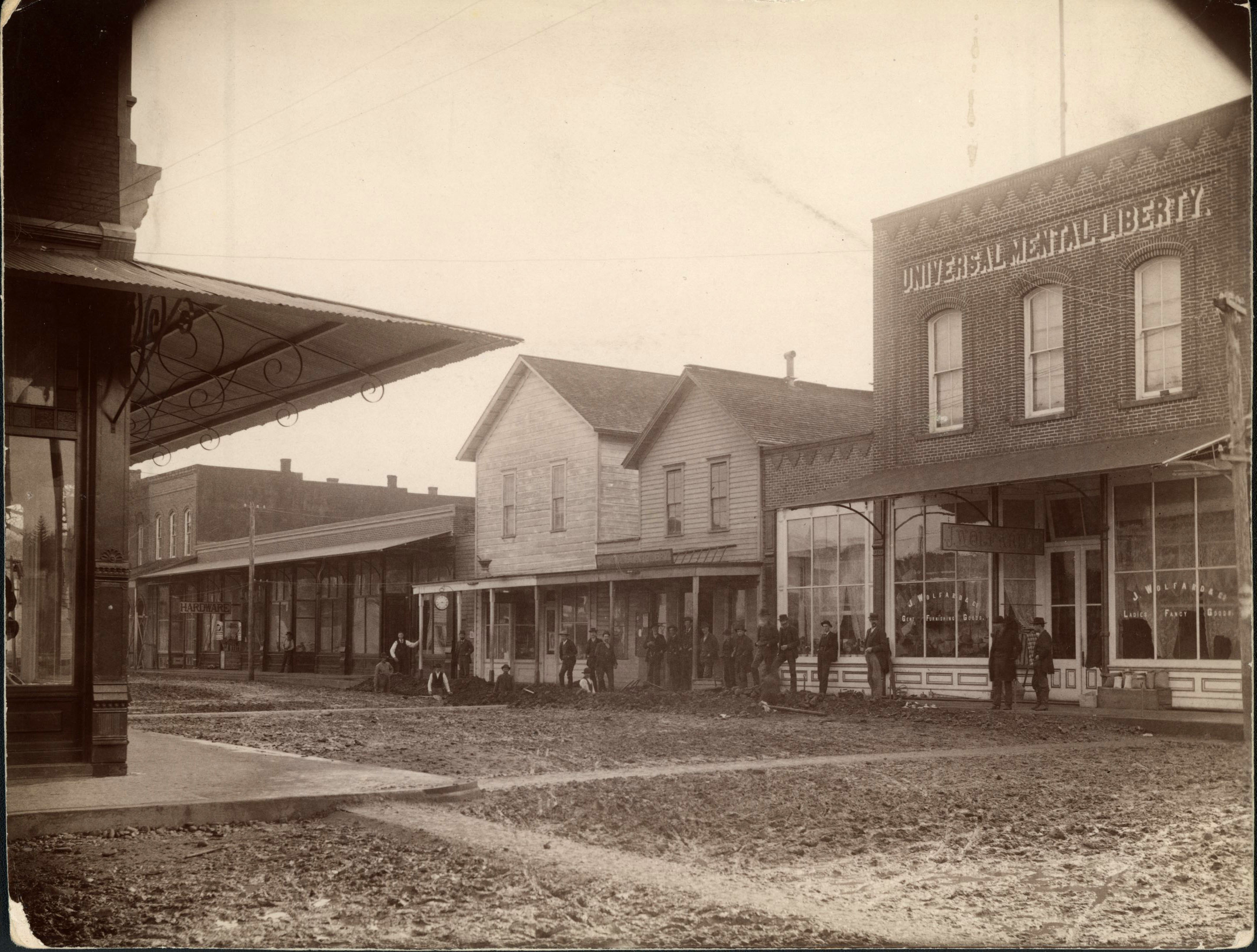
![]()
Construction of Wolf Building, Main and Water Streets, Silverton, c. 1891.
Courtesy Silverton County Historical Society
-
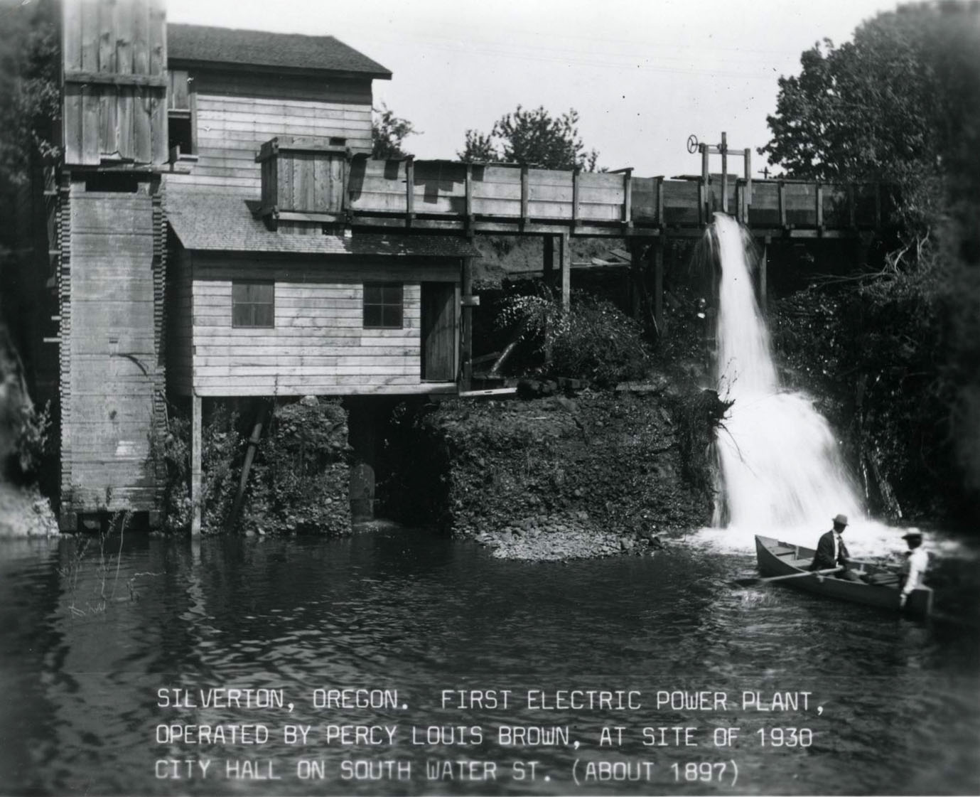
![]()
First power plant in Silverton, c. 1897.
Courtesy Oregon Hist. Soc. Research Lib., bb007071
-
![]()
Main Street, Silverton, 1898.
Courtesy Oregon Hist. Soc. Research Lib., 37703
-
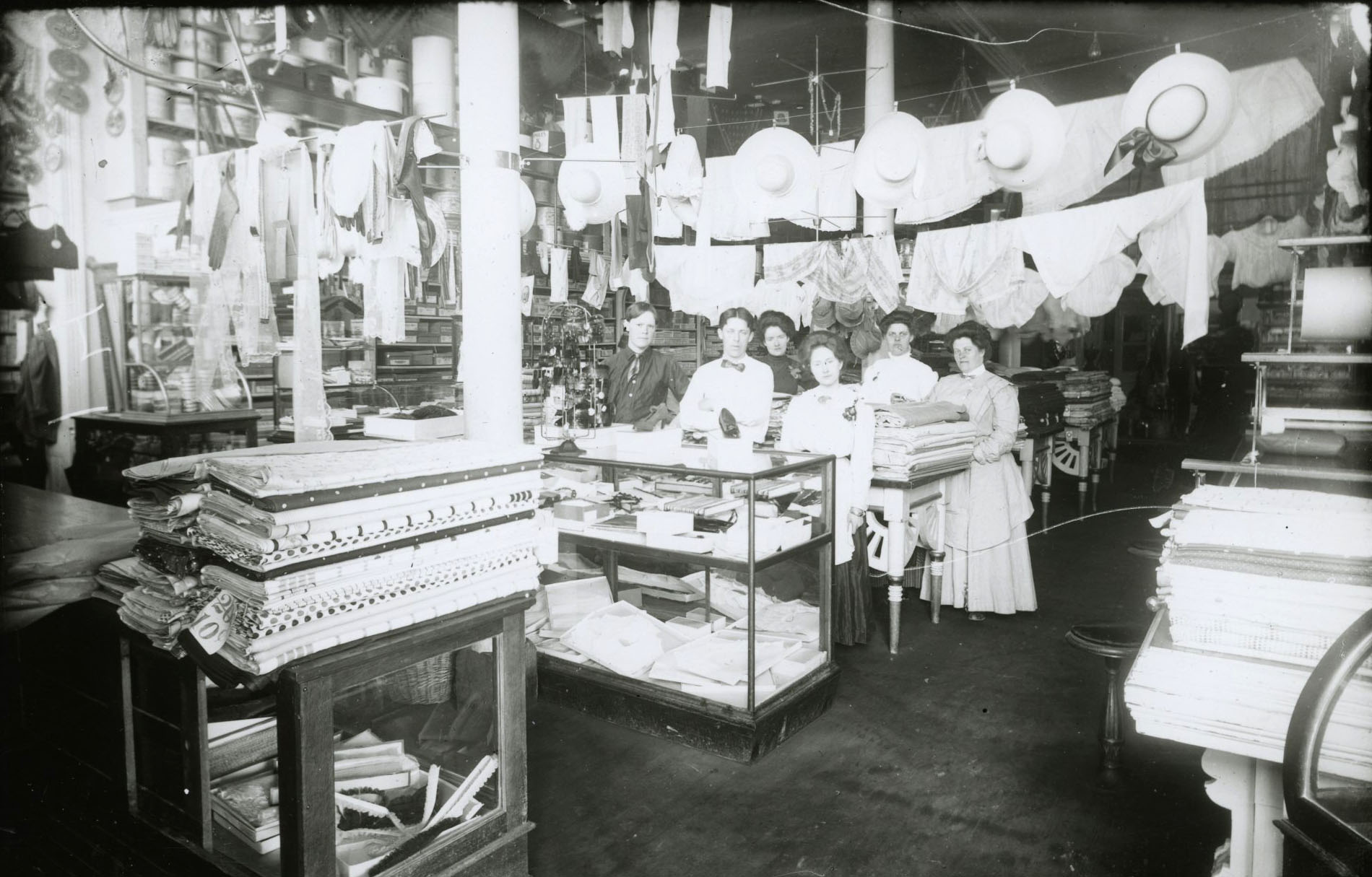
![]()
An early dry goods shop, Silverton.
Courtesy Oregon Hist. Soc. Research Lib., 25106
-
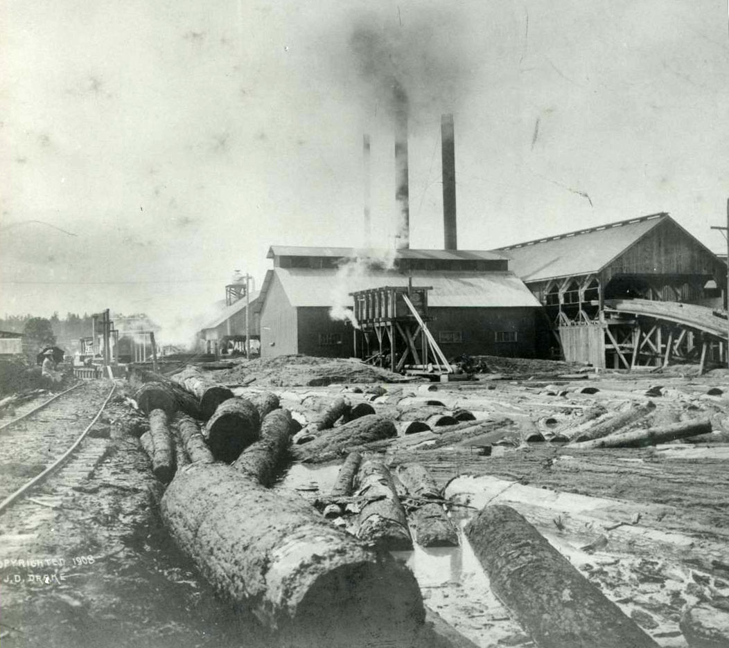
![]()
Silverton Lumber Co., 1908.
Courtesy Oregon Hist. Soc. Research Lib., 006761
-
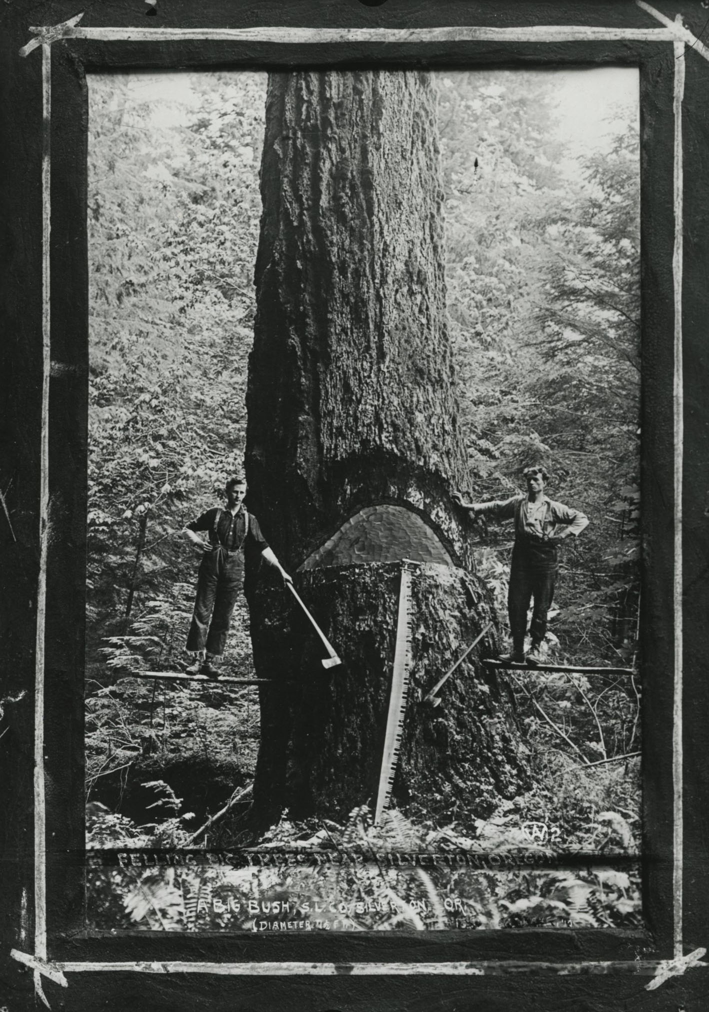
![]()
Lumbermen working near Silverton.
Courtesy Oregon Hist. Soc. Research Lib., 18379
-
![]()
Silverton from Liberty Hill looking Northeast, 1912.
Courtesy Silverton County Historical Society, Photographer June Drake.
-
![]()
Water Street, looking north, Silverton.
Courtesy Oregon Hist. Soc. Research Lib., 58988
-
![]()
Laying first hard surface pavement. Corner of First and Park, Silverton, 1912.
Courtesy Silverton County Historical Society, Photographer June Drake.
-
![]()
Wolf Building and Ames Hardware on the NE corner of Main and Water Streets, Silverton, 1915.
Courtesy Silverton County Historical Society, Photographer June Drake.
-
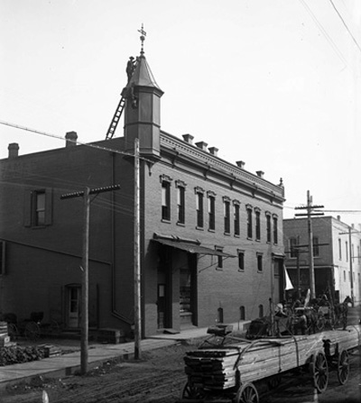
![]()
Silverton City Hall, 1925.
Courtesy Oregon Hist. Soc. Research Lib., 006372
-
![]()
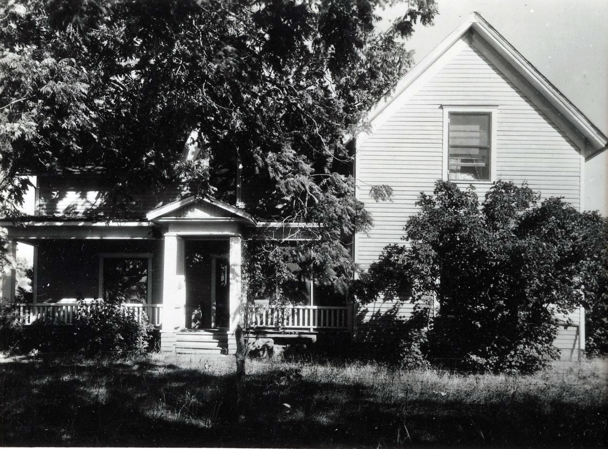
Davenport's home in Silverton, c. 1939.
Courtesy Oreg. Hist. Soc. Research Library, 022330
-
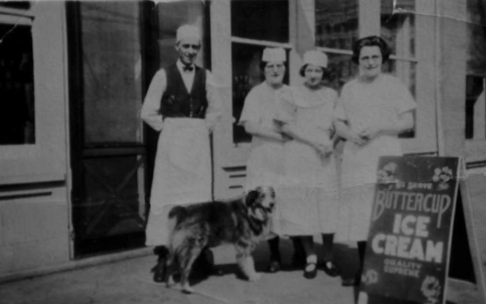
![(L to R): unidentified cook, Elizabeth Meyers Baumgartner Brazier, unidentified waitress, and Leona Baumgartner.]()
Bobbie at The Reo restaurant at South Water St., Silverton..
(L to R): unidentified cook, Elizabeth Meyers Baumgartner Brazier, unidentified waitress, and Leona Baumgartner. Courtesy Vades Crockett, Silverton
-
![]()
Silverton.
Courtesy Oregon Hist. Soc. Research Lib., photo file 969
-
![]()
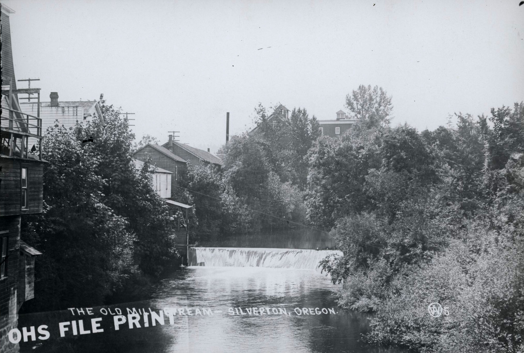
Fischers Flouring Mill and Race, Silver Creek.
Courtesy Oregon Hist. Soc. Research Lib., 18380
-
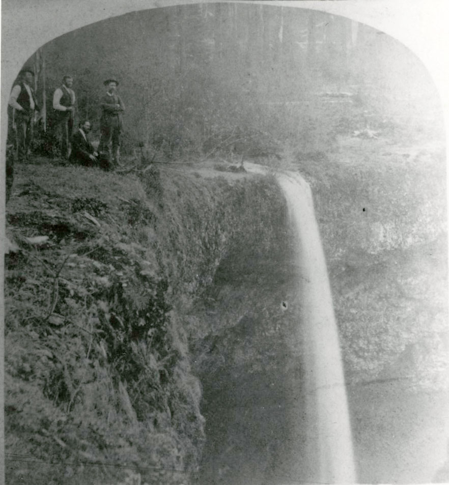
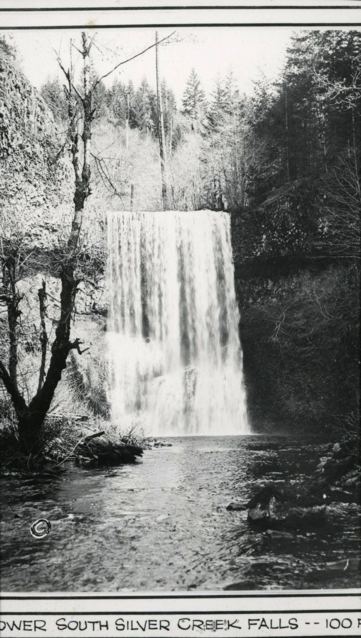
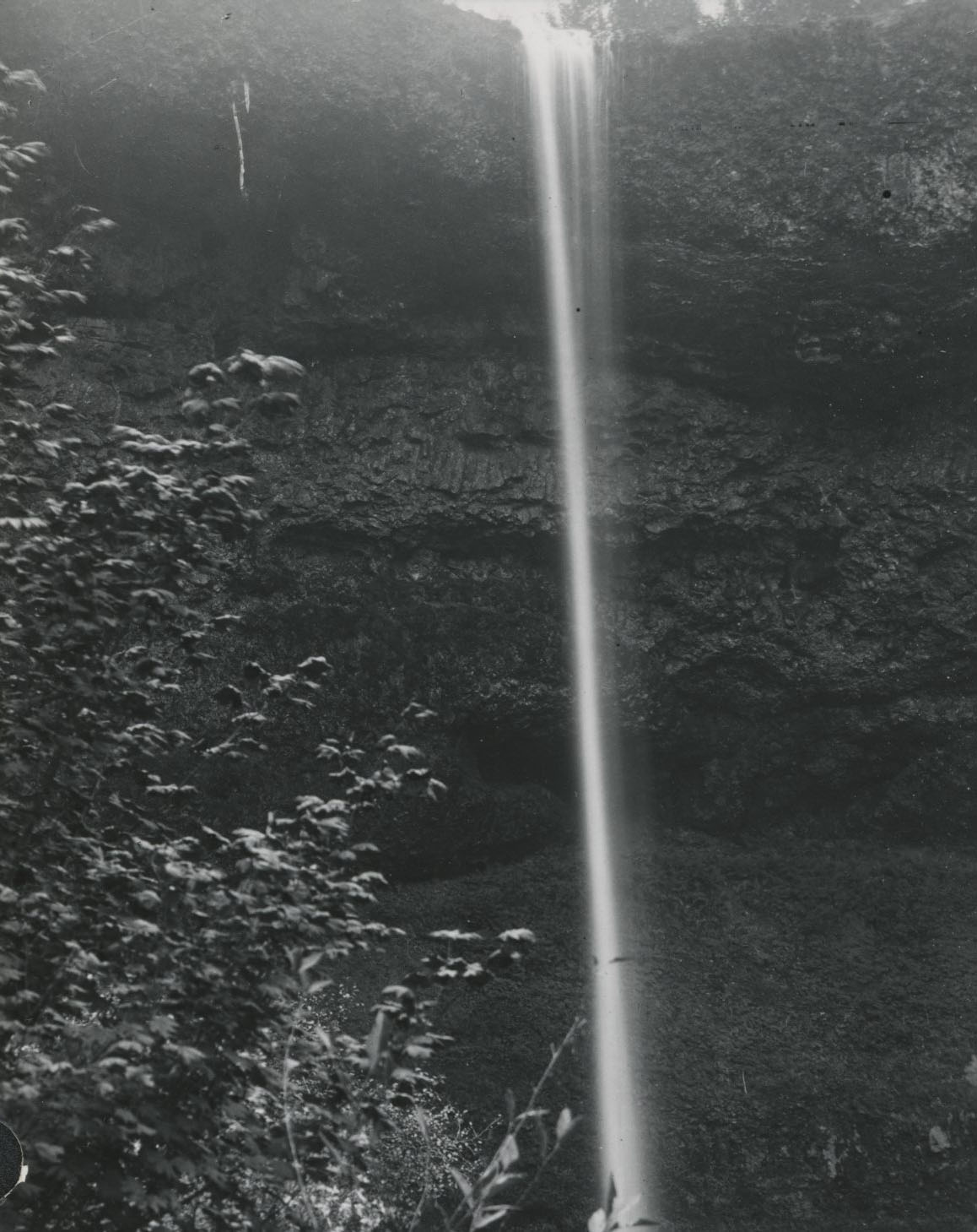
![]()
Silver Creek Falls; would become state park.
Courtesy Oregon Hist. Soc. Research Lib., 019036
-
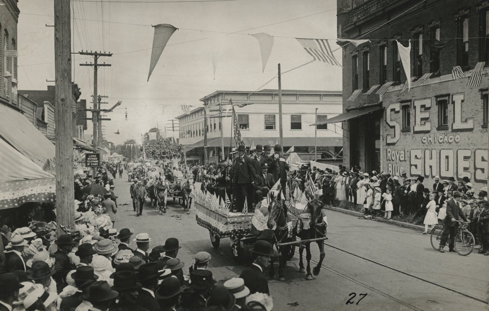
![]()
Silverton, 4th of July parade.
Courtesy Oregon Hist. Soc. Research Lib., photo file 969
-
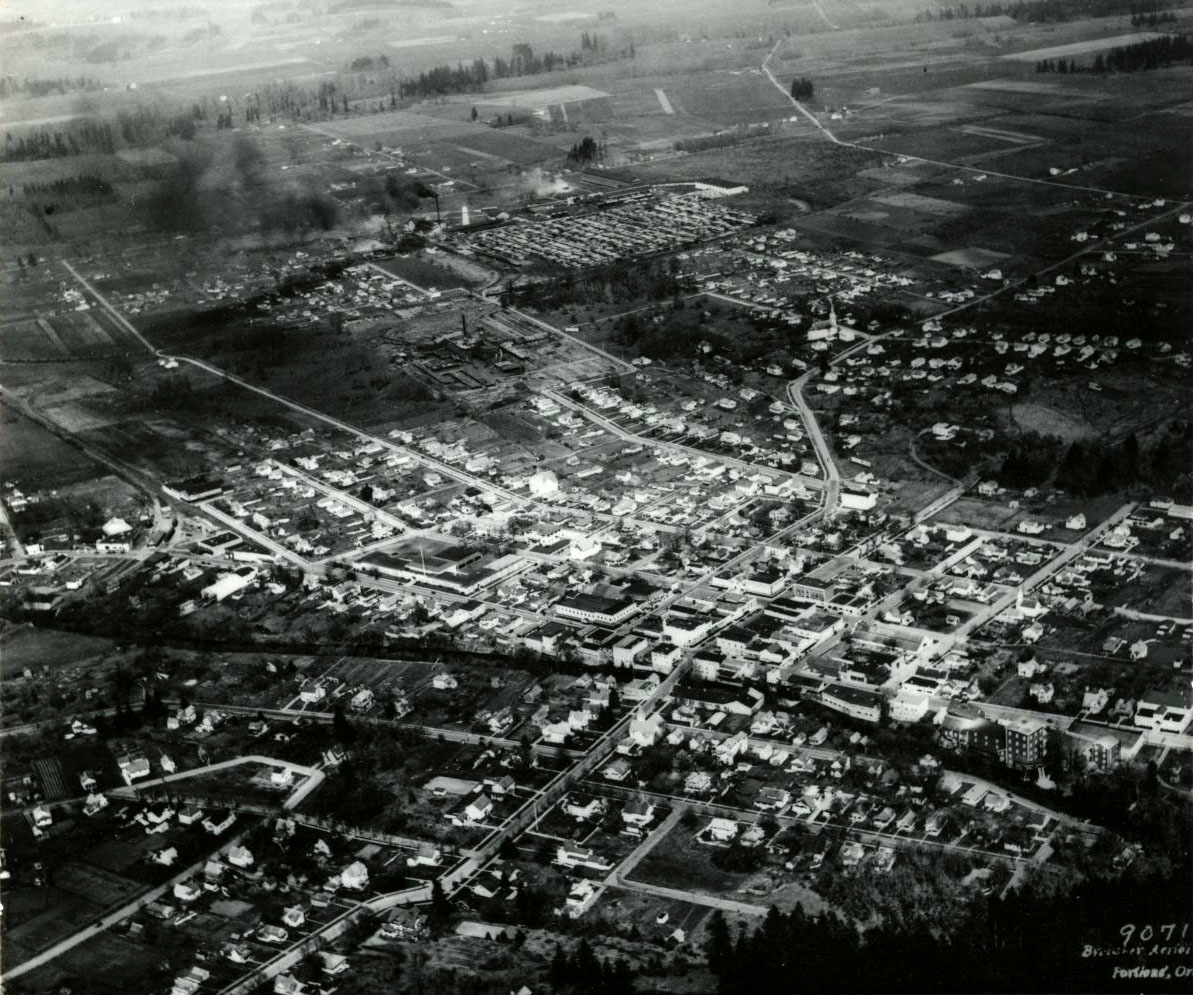
![]()
Aerial view of Silverton, 1931.
Courtesy Oregon Hist. Soc. Research Lib., 006373
-
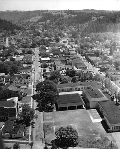
![]()
Aerial view of Silverton, looking southeast. Eugene Field School is in foreground, 1957.
Courtesy Silverton County Historical Society
-
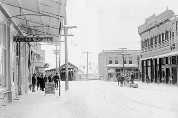
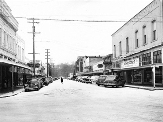
![]()
Main Street, Silverton, looking NE after light snow fall, c. 1957.
Courtesy Silverton County Historical Society
-
![]()
Silver Creek Falls, 1928.
Courtesy Oregon Hist. Soc. Research Lib., 014224
-
![]()
Julius Alm Building, (1906) First and Oak Street, Silverton, 2016.


Related Entries
-
![Bobbie the Wonder Dog]()
Bobbie the Wonder Dog
Bobbie the Wonder Dog, of Silverton, was the canine hero in a story tha…
-
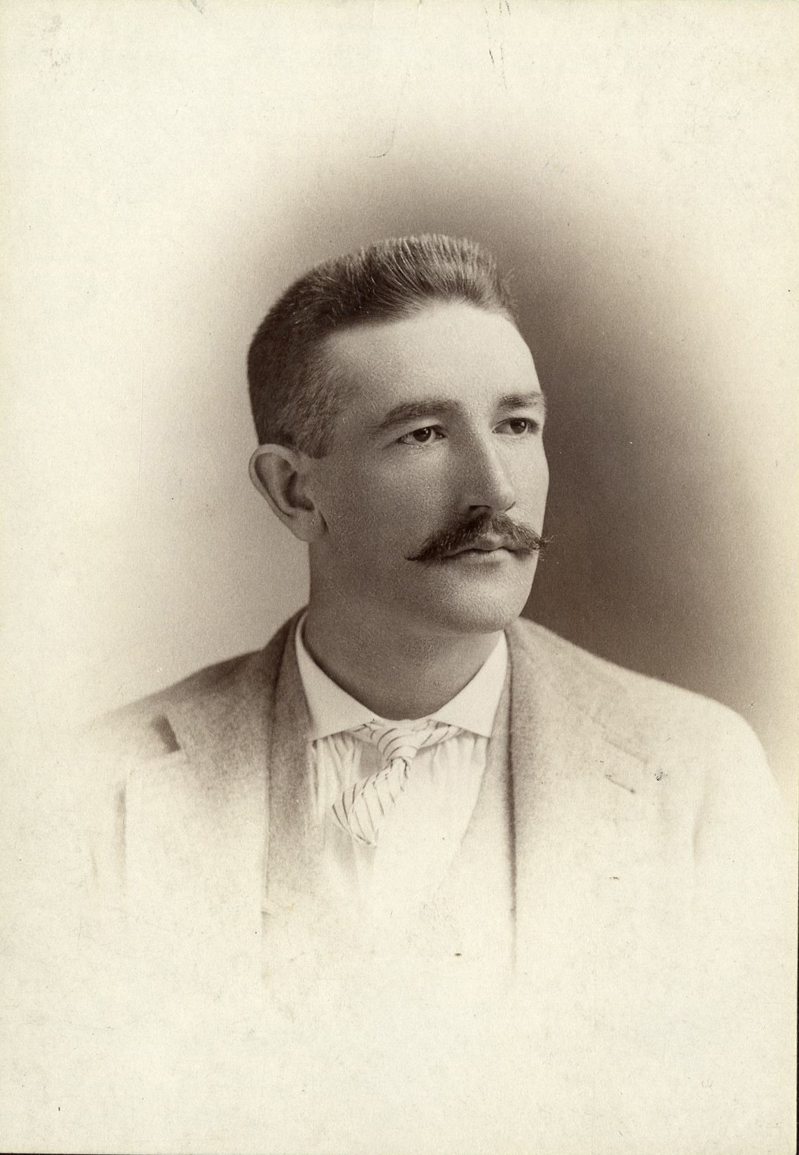
![Homer Davenport (1867-1912)]()
Homer Davenport (1867-1912)
Homer Calvin Davenport was one of the most important and influential po…
-
![Silver Falls State Park]()
Silver Falls State Park
Silver Falls State Park, located about twenty miles southeast of Salem,…
-
![Stu Rasmussen (1948-2021)]()
Stu Rasmussen (1948-2021)
In a state heralded for its tolerance, Stu Rasmussen stood out. The cha…
-
![Timothy Woodbridge Davenport (1826-1911)]()
Timothy Woodbridge Davenport (1826-1911)
Timothy Woodbridge “T. W.” Davenport, known as the Sage of Silverton, w…

Related Historical Records
Map This on the Oregon History WayFinder
The Oregon History Wayfinder is an interactive map that identifies significant places, people, and events in Oregon history.
Further Reading
Austin, Ed. The Oregonian Railway. Charleston, S.C.: Arcadia Publishing, 2014
Brand, Patricia. "History of Freethought in Oregon." Oregon Historical Quarterly (Summer 1986).
Brown, E.J. “Pioneers of Silverton.” The Silverton-Appeal, April 16 1909: 1.
Clark, Robert c. History of the Willamette Valley, Oregon. Chicago, IL: Clarke, 1927.
Davenport, Homer Calvin. The Country Boy. New York City. G.W. Dillingham Co. 1910
Davenport, Timothy Woodbridge. Silverton, Oregon: Marion County Surveyor’s Plat. Map. [Salem]: Marion County Surveyor, 1885.
Down, Robert H. A History of the Silverton Country. Portland: Berncliff, 1926
Drake, June D. “Silverton’s Start.” Silverton Centennial Program Guide, Silverton Appeal-Tribune. August, 1954
Drake, June D. “Big Mill is Now Only Memory of Bygone Day.” Silverton Appeal Tribune 15 May 1959: 3.
“Entire Block is Wiped Out at Silverton.” The Oregon Statesman [Salem, OR] 24 Apr. 1935: 1.
Klamath Trail, 19th Century. (2012). In Oregon Historic Trail Fund Website. Retrieved from http://www.oregonhistorictrailsfund.org/trails/klamath-trail-19th-century/
McEachern, Philip Duncan. Silverton: The Morphology of an Oregon Town. Graduate Thesis, Department of Geography of University of Oregon. 1990
“Silverton Loses College: Liberal University to Move to Kansas City.” The Oregonian [Portland, OR] 11 Nov. 1902: 4
Territory of Oregon Donation Land Claim Survey: Township No.7 South Range No. 1 West Willamette Meridian. Map. Salem: Marion County Surveyors Office, c. 1850.