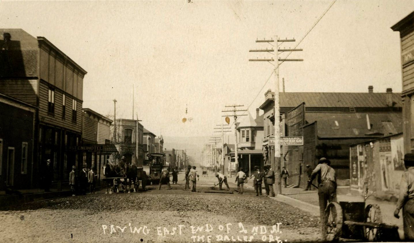
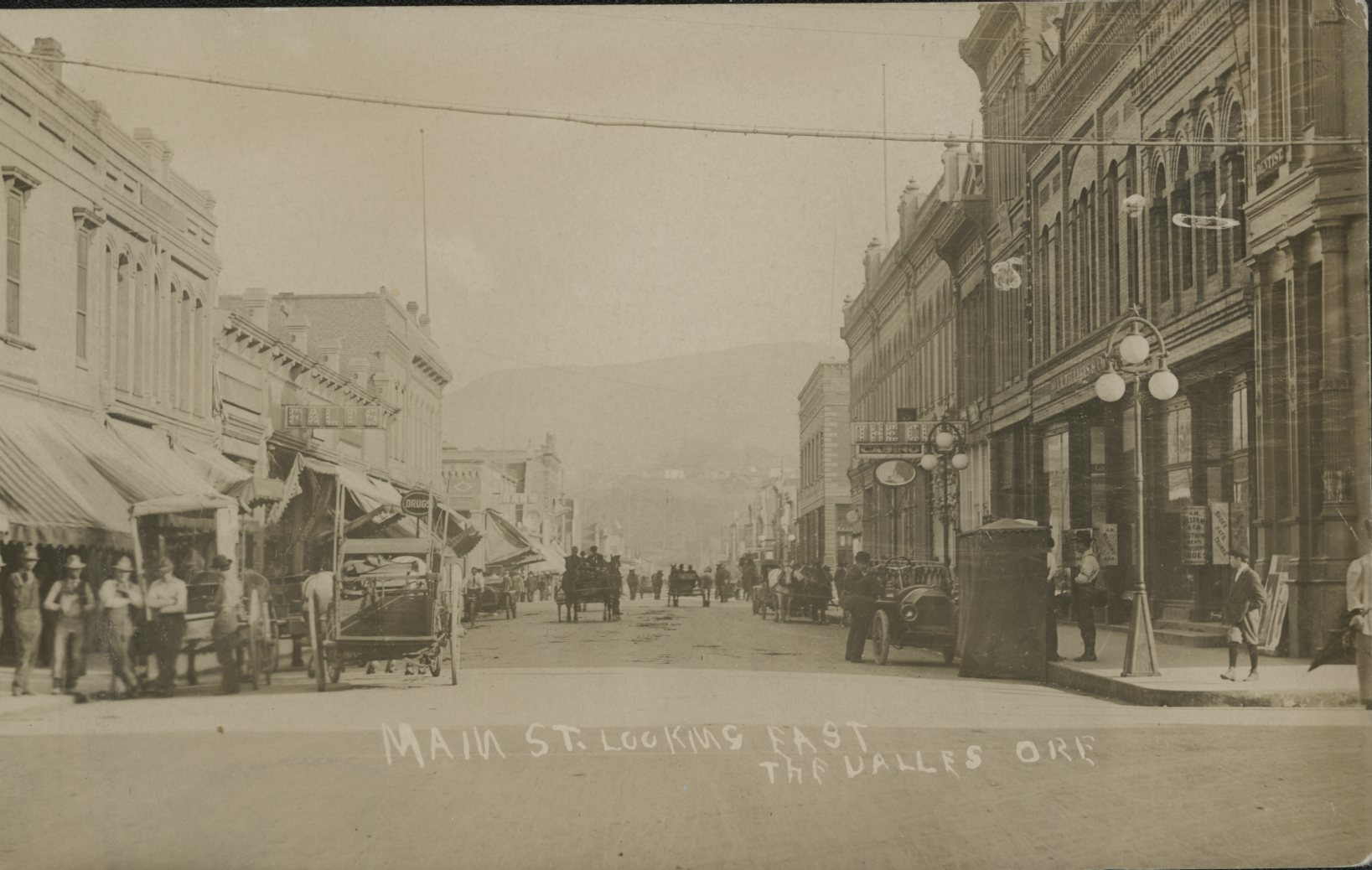
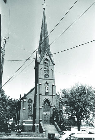
The Dalles is one of the oldest permanently occupied places in Oregon, significant to Native people for over ten millennia and to Euro-American settlers since the 1830s. The city, the largest in Wasco County, is located on a bend of the Columbia River at the east end of the Columbia River Gorge National Scenic Area. As the center of navigation on the Mid-Columbia River, The Dalles is the county seat and was known as the Gateway to the Inland Empire, a jumping-off spot for pioneers, soldiers, gold miners, and adventurers.
For more than ten thousand years before Euro-Americans arrived in the Pacific Northwest, Native people gathered on the banks of the Columbia River to fish and trade. During the summer and fall fish seasons, the population of the area swelled dramatically as people from other bands gathered there for trade and interaction. The Wasq'ó-pam (Wasco), the People of the Horn-bowl, lived in the area; their descendants are now members of the Confederated Tribes of Warm Springs. The area around The Dalles—including Horsethief Lake, Wakemap Mound, Atlatl Valley, and Roadcut—is one of the most significant archaeological regions in the Pacific Northwest.
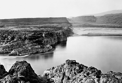
Located between Mount Hood and Mount Adams on the south bank of the Columbia River, The Dalles was settled at the foot of a series of dangerous rapids. Meriwether Lewis and William Clark noted the rapids in their journals as they passed through the area on their way to the Pacific Ocean in October 1805 and on their return in April 1806. The site of the Expedition’s Rock Fort Camp in present-day The Dalles, overlooking the Columbia River, is on the National Register of Historic Places.
The word dalles was commonly used by fur traders to refer to areas where a river flows through narrow, rocky channels, and French Canadian fur traders of the Hudson’s Bay Company called the great rapids at The Dalles Les Grandes Dalles de la Columbia. Fur trader Gabriel Franchère described the rapids in 1814 as "a channel cut by nature through the rocks, which are here almost perpendicular: the channel is from 150 to 300 feet wide, and about two miles long. The whole body of the river rushes through it, with great violence, and renders navigation impracticable."
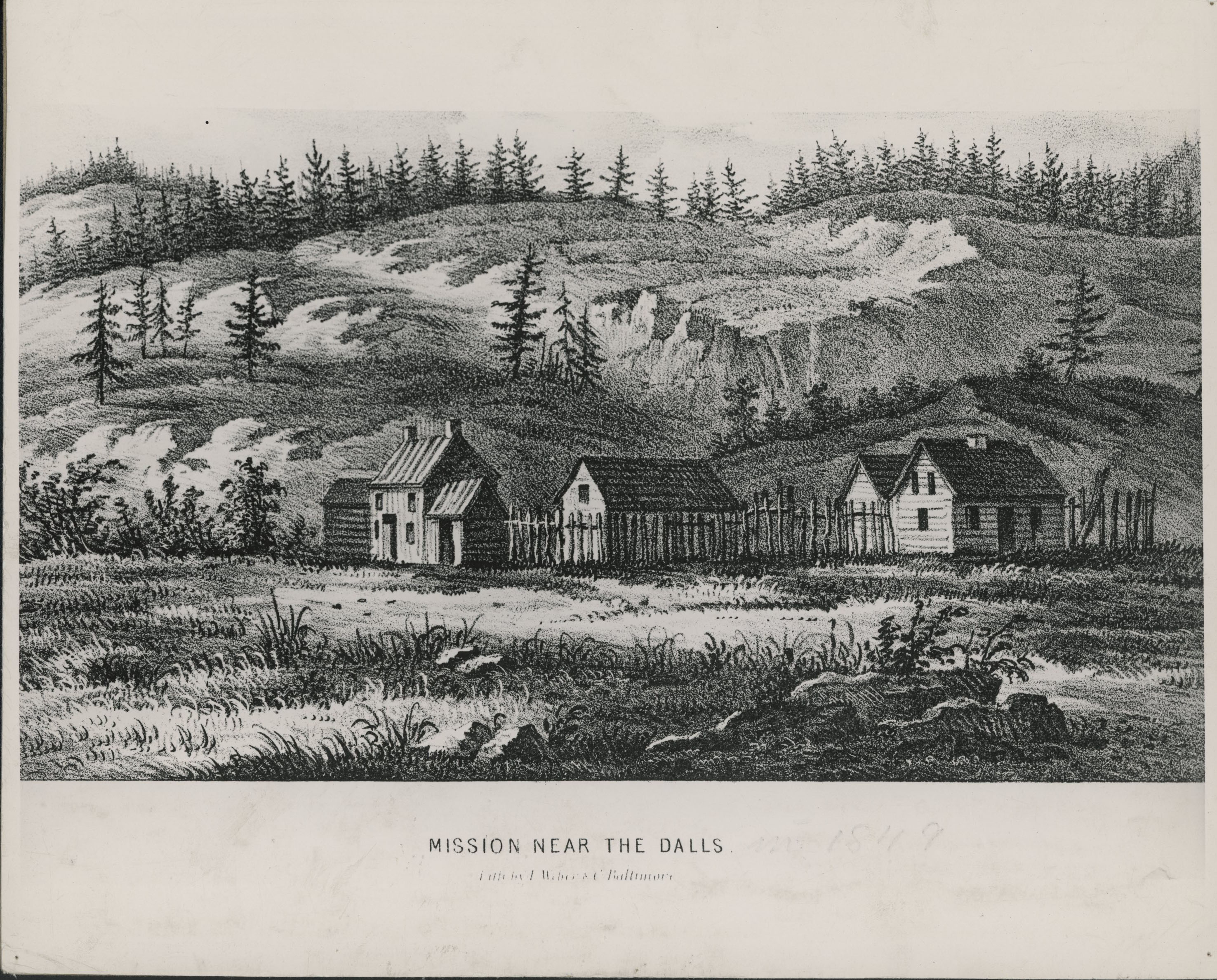
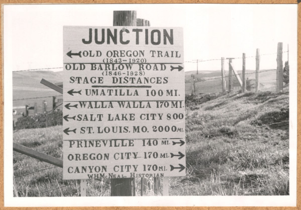
American missionaries Daniel Lee and Henry Perkins established Wascopam Mission on March 21, 1838. By 1841, the mission had become an important stop for emigrants on the Oregon Trail, who built rafts or contracted boatmen to ferry them downriver to Fort Vancouver. In 1845, the Barlow Road offered an alternative route west around Mount Hood. In 1906, Ezra Meeker dedicated a marker designating The Dalles as the End of the Oregon Trail; it is now in The Dalles City Park.
The U.S. government established Fort Dalles in 1850 to protect Americans traveling on the Oregon Trail. The discovery of gold in Oregon and eastern Washington in the early 1850s brought gold miners to the area and made The Dalles an important link between mining regions and Portland. Steamboats took miners and supplies upriver from The Dalles and brought gold downriver, while passengers, manufactured goods, and materiel came upriver from Portland.
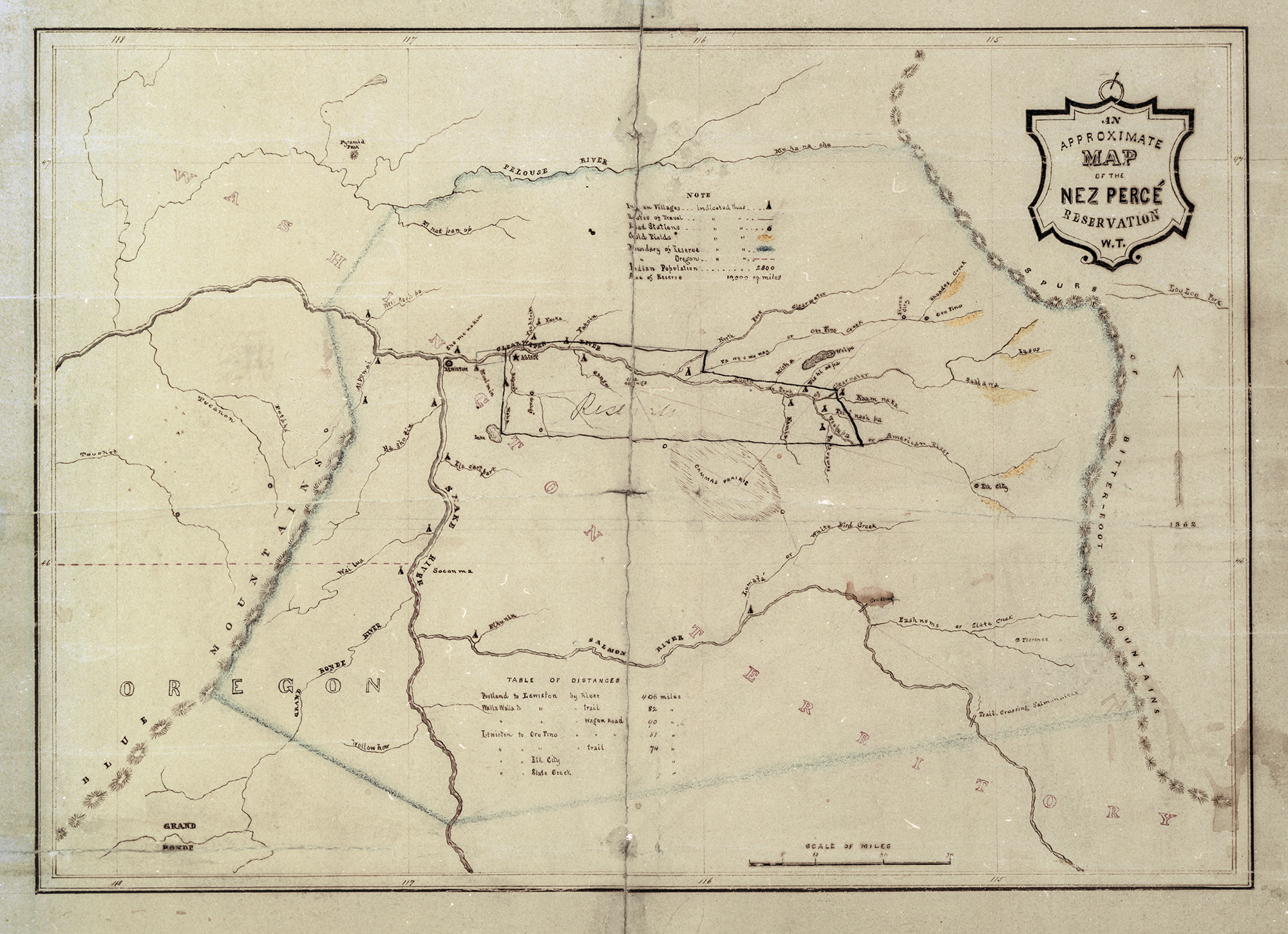
In 1855, the territorial and U.S. governments forced area tribes to sign treaties, which ceded their lands and removed them to reservations. After the treaties were in place, increasing tensions ignited the Yakama War, and Fort Dalles became the central military headquarters for dispatching federal troops to battle areas. By 1857, the war front had moved east, and Fort Dalles was abandoned. The 1856 Surgeon's Quarters of the territorial fort, on the National Register of Historic Places, is the home of the Fort Dalles Museum, which opened in 1905 and is one of the oldest history museums in Oregon.
Dalles City was designated the county seat when Wasco County was created on January 11, 1854. The original Wasco County Courthouse, built in 1859, was the first territorial courthouse west of the Rockies. One of the last surviving territorial courthouses, the building is a museum and is on the National Register of Historic Places. The town was incorporated as Dalles City on January 26, 1857. The town changed its name to The Dalles on March 22, 1860, and the name City of The Dalles was officially adopted in 1966.
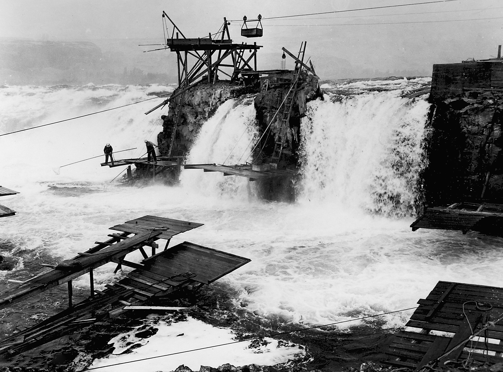
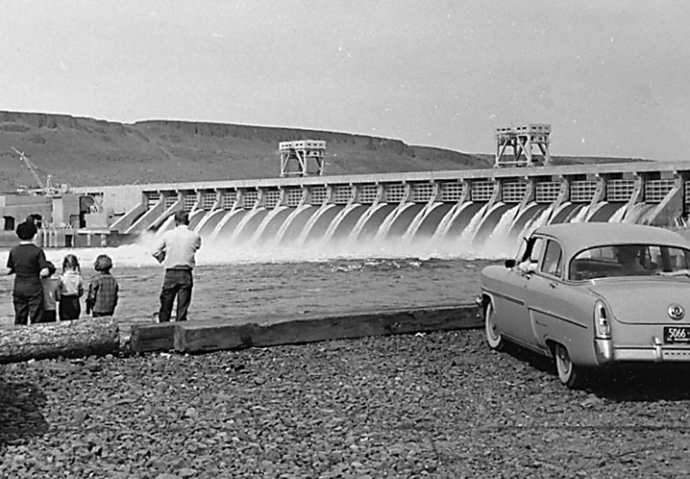
The Dalles, which has two historic districts with over seventy properties on the National Register of Historic Places, remains a trading hub for the Mid-Columbia River. The Dalles Lock and Dam, one of the ten largest hydropower dams in the nation, provides a reliable water source for navigation, irrigation, and seasonal flood mitigation. When the dam went into operation on March 10, 1957, the twenty-four-mile-long backwater lake that formed behind the dam submerged the rapids and Celilo Falls, an ancestral fishery that had been used by Native people for millennia.
Notable Oregonians had roots in The Dalles, including the first Oregon State geologist, Thomas Condon, who came to The Dalles in 1862 as a pastor for the Congregational Church. In 1882, Zenas Ferry Moody was elected governor of Oregon; his son Malcolm Moody was elected mayor of Dalles City in 1889 and served in the U.S. Congress from 1899 to 1903. Writer Harold L. Davis lived in The Dalles from 1908 until 1928. His years in eastern Oregon became the grist for his novel Honey in the Horn, which won the Pulitzer Prize in 1936.
The Northwest Aluminum made its mark on the Mid-Columbia with the construction of the Harvey Aluminum smelter, which began operations in 1958. Martin Marietta Corporation acquired the facilities in 1969 but began to curtail production in 1984, citing a drop in the world market price of aluminum and high power rates. In 1986, Northwest Aluminum took over operations, but the smelter closed again in 2000. While bringing a huge boon to the economy, the aluminum industry also had an environmental impact, including damage to cherry crops from fluoride emissions. The smelter was listed as a Superfund site in 1987 due to toxins from the spent pot liners and waste. The Environmental Protection Agency began a cleanup of the site in 1989; it was deleted from the EPA’s National Priorities List in 1996.
During the 1980s, the Bhagwan Shree Rajneesh, who had purchased the Big Muddy Ranch in south Wasco County, came up against county land use laws and in 1984 plotted to take control of the county at the polls. The Rajneeshees poisoned restaurant salad bars in The Dalles with salmonella, which affected 750 people. It was the first confirmed instance of chemical or biological terrorism in the United States.
The Dalles had a population of about 16,000 in 2020, with almost 20 percent of residents Hispanic or Latino. The city's top employers are the Mid Columbia Medical Center, School District #21, the Oregon Cherry Growers, and the Army Corps of Engineers. Columbia Gorge Community College is a national leader through its Renewable Energy Technology program, and Google located a data storage facility in The Dalles in 2006, taking advantage of inexpensive hydroelectric power and the city’s fiber-optic network. Orchard View Farms is the largest cherry grower in the state, and vineyards flourish in the area, with The Pines growing grapes from vines planted over a hundred years ago.
-
![]()
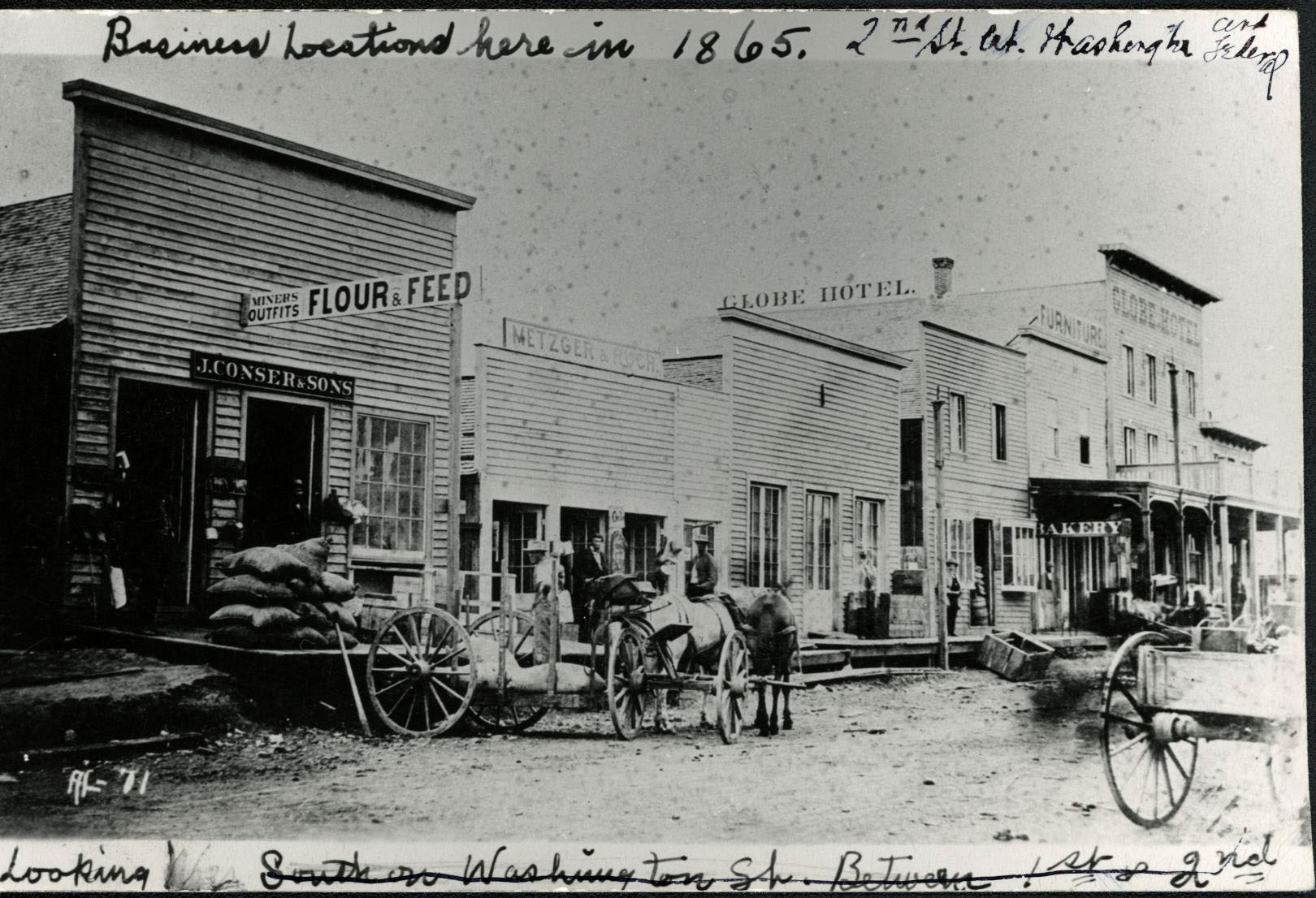
The Dalles, 1865.
Courtesy Oregon Hist. Soc. Research Lib., 5345
-
![]()
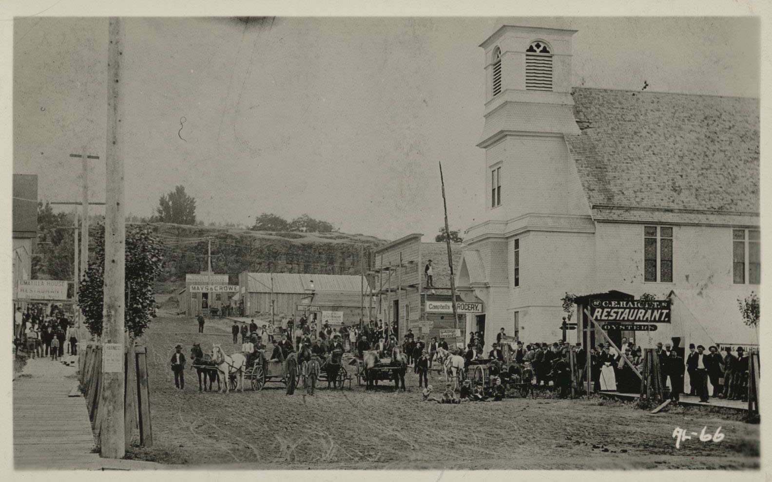
An early view of The Dalles.
Courtesy Oregon Hist. Soc. Research Lib., photo file 1037B
-
![]()
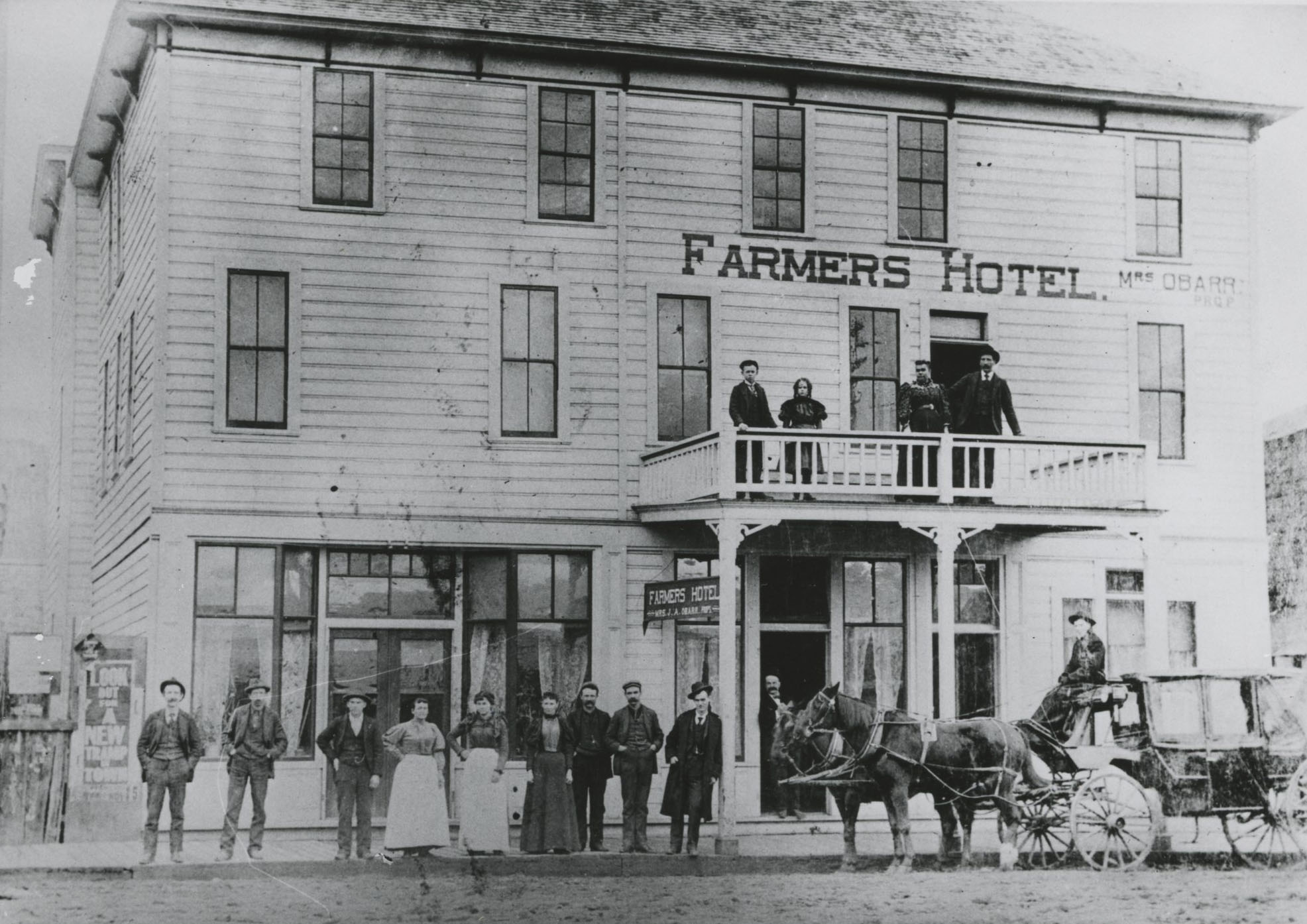
Farmers Hotel, The Dalles.
Courtesy Oregon Hist. Soc. Research Lib., 11967
-
![]()
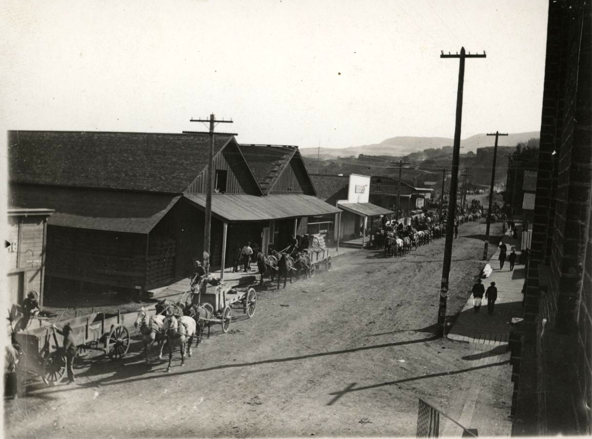
An early view of The Dalles.
Courtesy Oregon Hist. Soc. Research Lib., 43468
-
![]()
The Dalles Mission, 1849.
Courtesy Oregon Hist. Soc. Research Lib., Orhi633
-
![]()
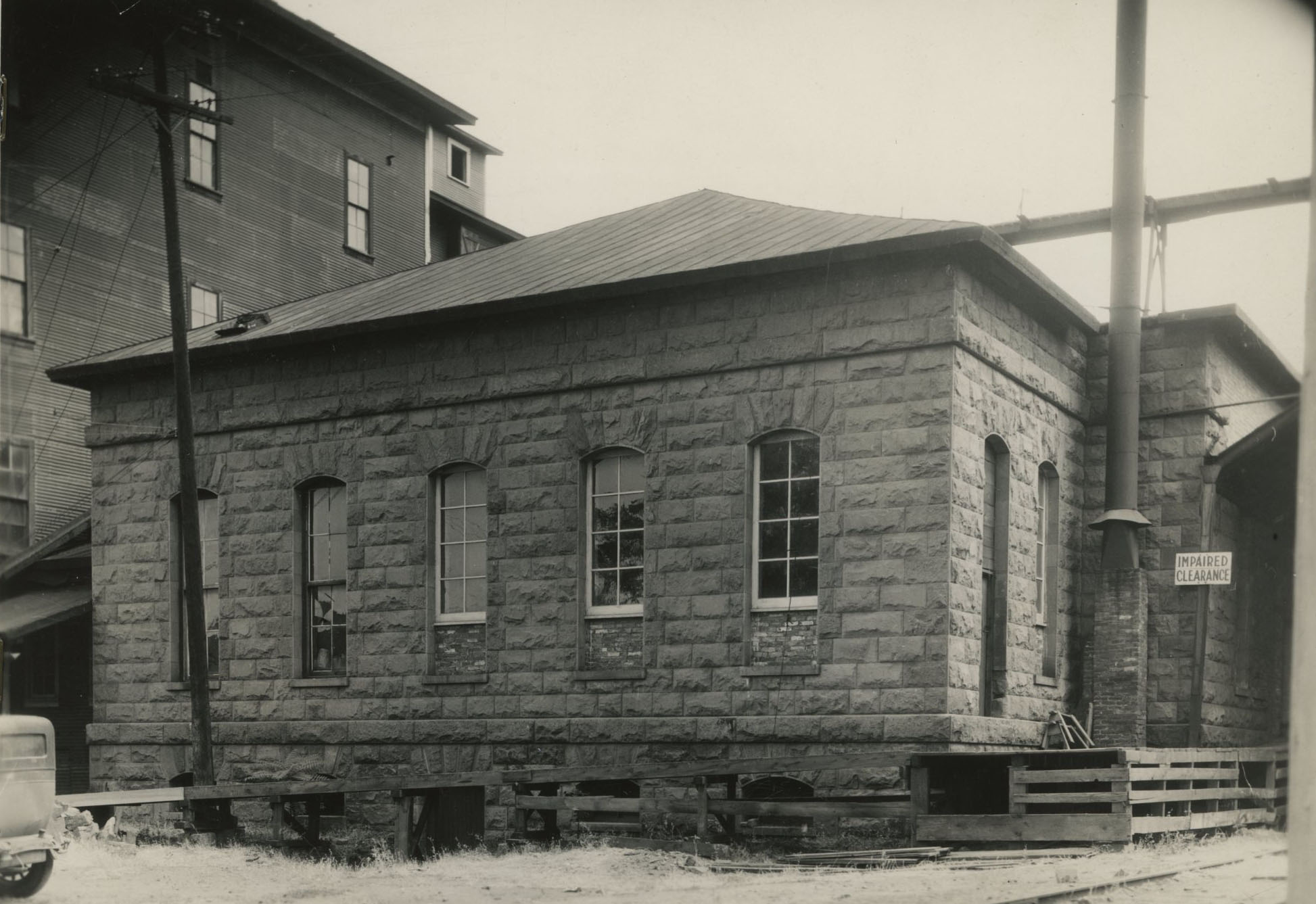
U.S. Mint in 1939, built in 1868 (torn down in 1946), The Dalles.
Courtesy Oregon Hist. Soc. Research Lib., 5348
-
![]()
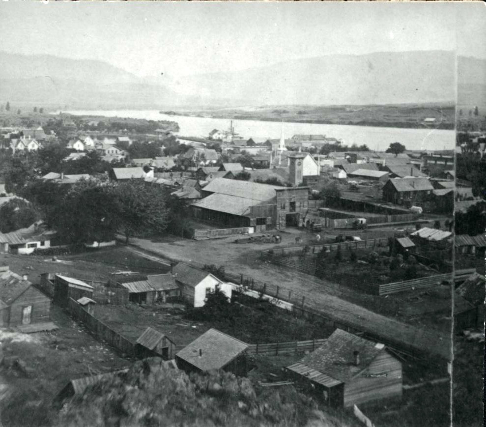
Stereo view of The Dalles, c.1875.
Courtesy Oregon Hist. Soc. Research Lib., 016043
-
![]()
4th of July parade, 1877; 2nd and Washington street, The Dalles..
Courtesy Oregon Hist. Soc. Research Lib., Orhi365
-
![The Dalles, 1882 (Carleton Watkins, photographer)]()
The Dalles, 1882 (Carleton Watkins, photographer).
The Dalles, 1882 (Carleton Watkins, photographer) Courtesy Oreg. Hist. Soc. Research Lib., OrHi21650
-
![]()
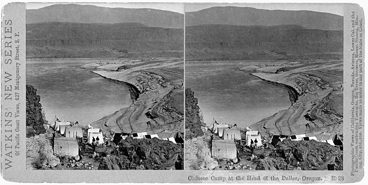
"Chinese Camp at the Head of The Dalles," 1882 (Carleton Watkins, photographer).
Courtesy Oreg. Hist. Soc. Research Lib., bb003883
-
![]()
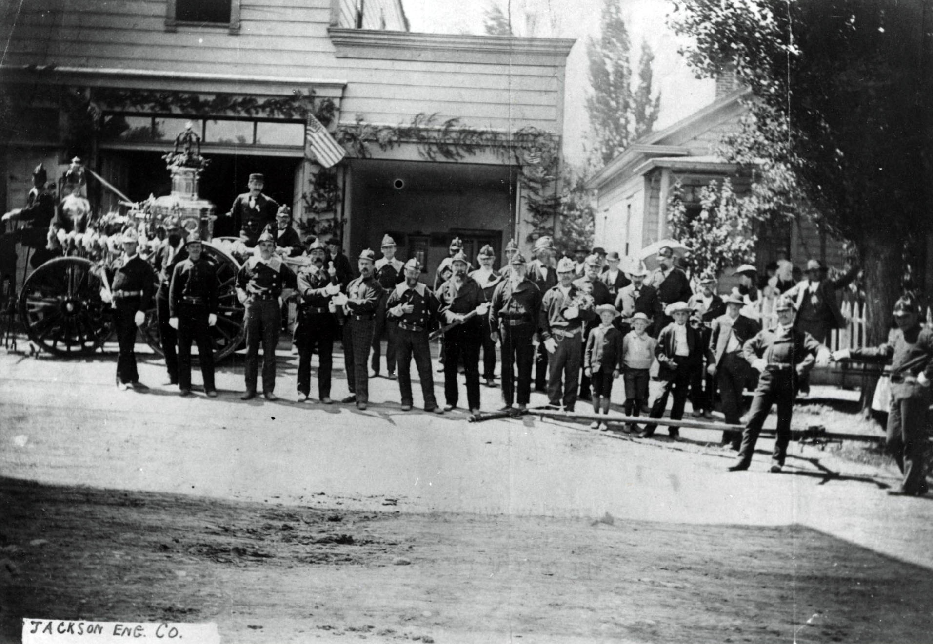
Jackson Engine Co., on 3rd St., The Dalles, prior to 1891 fire.
Courtesy Oregon Hist. Soc. Research Lib., Orhi91783
-
![]()
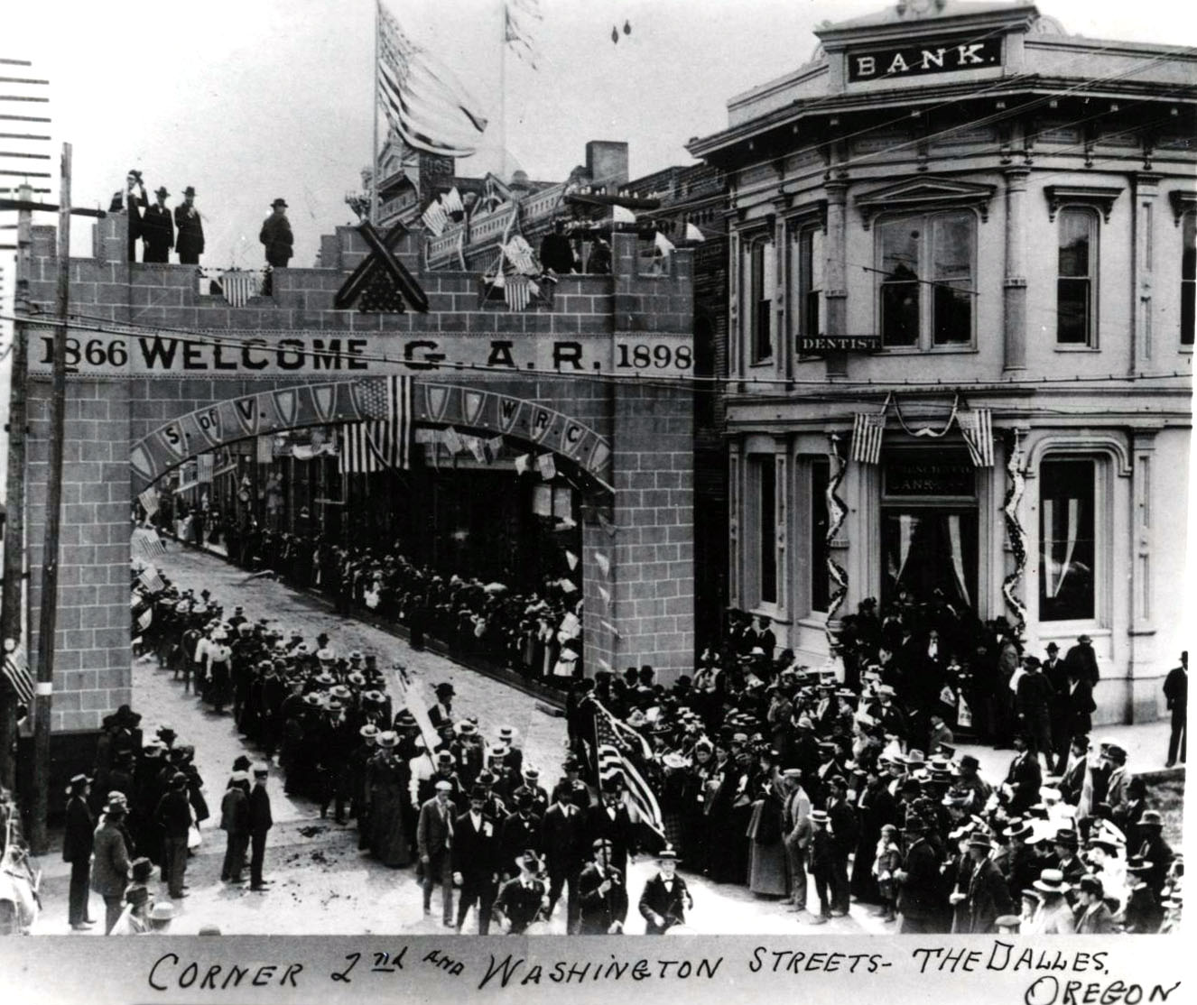
Grand Army of the Republic parade, The Dalles, 1898.
Courtesy Oregon Hist. Soc. Research Lib., 35099
-
![]()
The Dalles, 1900.
Courtesy Oregon Hist. Soc. Research Lib., 58703
-
![]()
The Dalles, c. 1908.
Courtesy Oregon Hist. Soc. Research Lib., Orhi88741
-
![]()
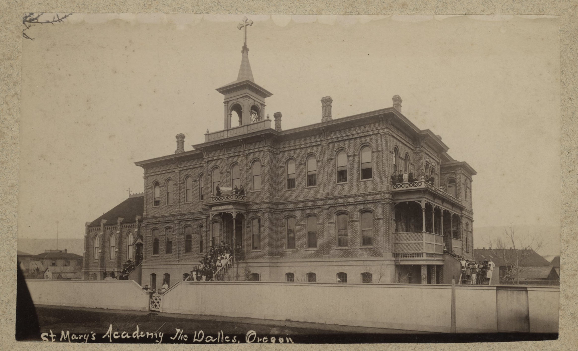
St. Mary's school ,The Dalles.
Courtesy Oregon Hist. Soc. Research Lib., Orhi51548
-
![]()
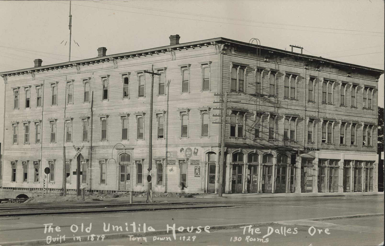
Umatilla House, The Dalles.
Courtesy Oregon Hist. Soc. Research Lib., photo file 1037A
-
![]()
Umatilla House barroom, The Dalles.
Courtesy Oregon Hist. Soc. Research Lib., 25156
-
![]()
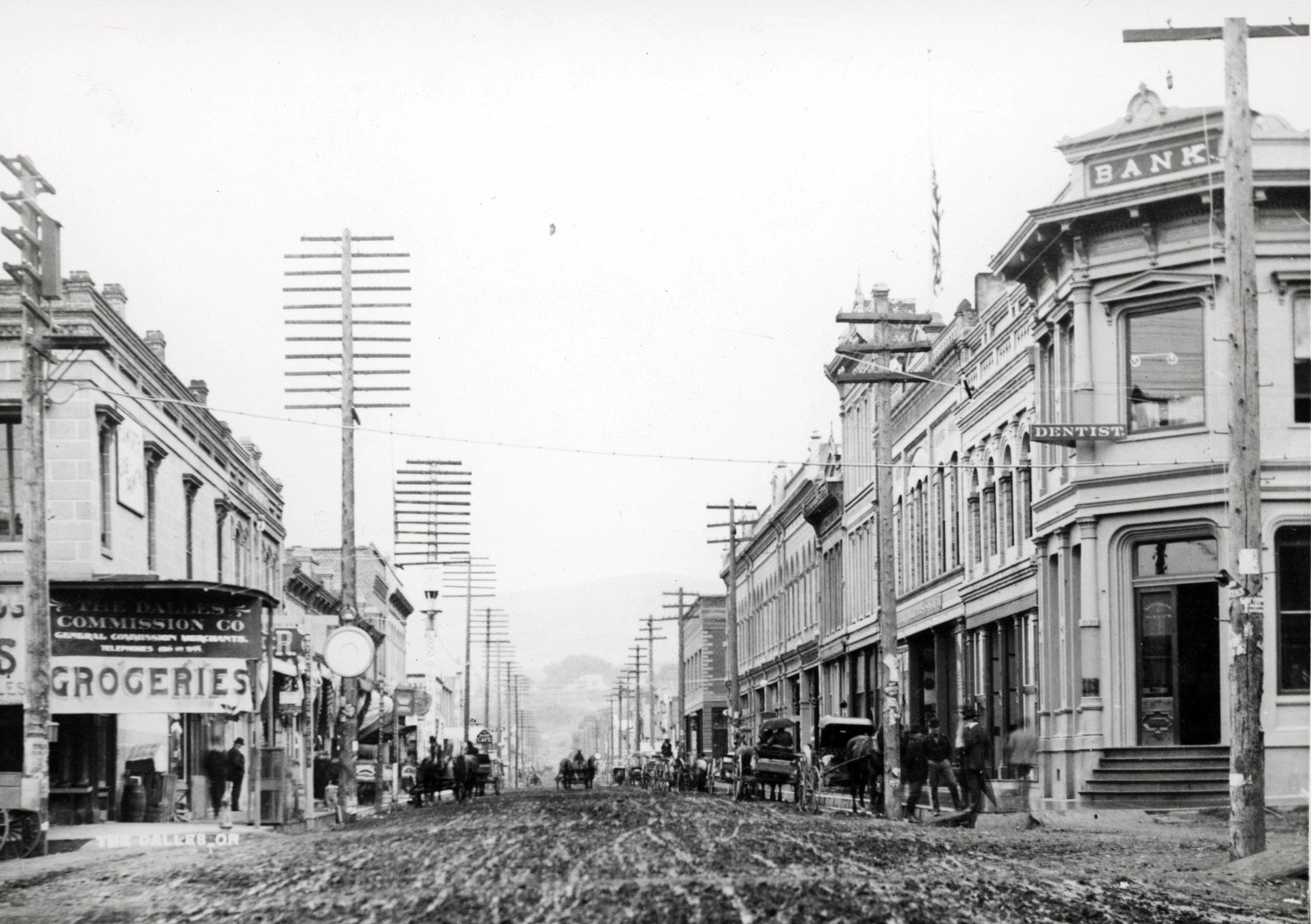
2nd and Washington, The Dalles.
Courtesy Oregon Hist. Soc. Research Lib., Acc7669
-
![]()
2nd and Federal, The Dalles.
Courtesy Oregon Hist. Soc. Research Lib., 11968
-
![]()
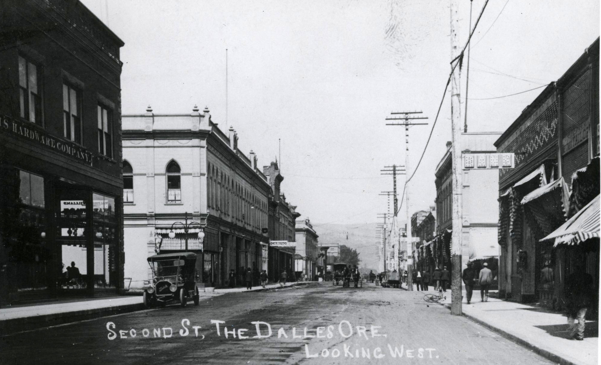
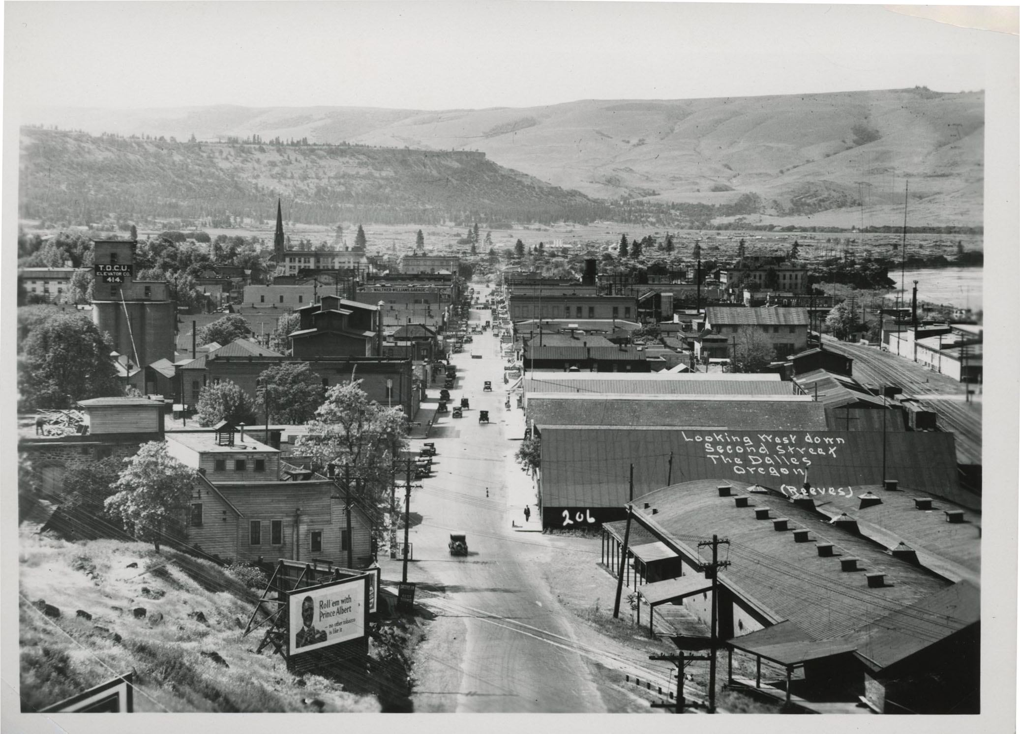
2nd Street, The Dalles, c. 1923.
Courtesy Oregon Hist. Soc. Research Lib., 019813
-
![]()
Wasco County Courthouse, The Dalles.
Courtesy Oregon Hist. Soc. Research Lib., photo file 1037A
-
![]()
The Dalles, c. 1920.
Courtesy Oregon Hist. Soc. Research Lib., 15060
-
![]()
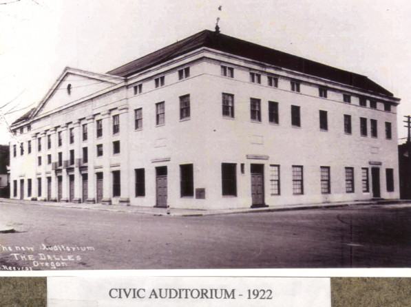
The Dalles Civic Auditorium and Veterans Memorial, 1922.
Courtesy Columbia Gorge Discovery Center Photo Archive, Oregon State University. "WCPA 250-4" Oregon Digital -
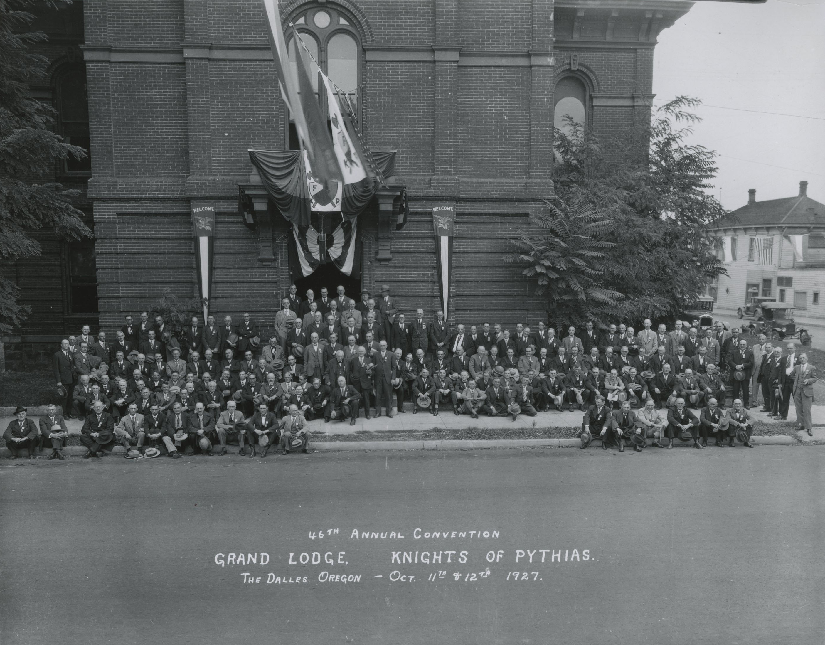
![]()
Knights of Pythias, The Dalles, 1927.
Courtesy Oregon Hist. Soc. Research Lib., Orhi6122
-
![]()
First U.S. post office in The Dalles, photographed in 1939.
Courtesy Oregon Hist. Soc. Research Lib., Orhi89930
-
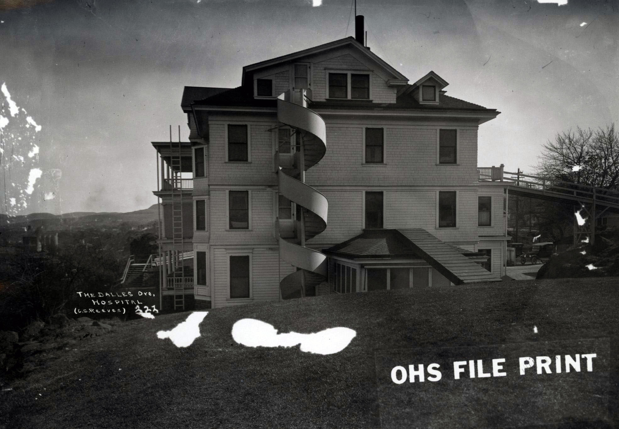
![]()
The Dalles hospital.
Courtesy Oregon Hist. Soc. Research Lib., 15091
-
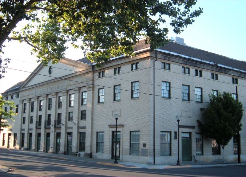
![The Dalles Civic Auditorium and Veterans Memorial]()
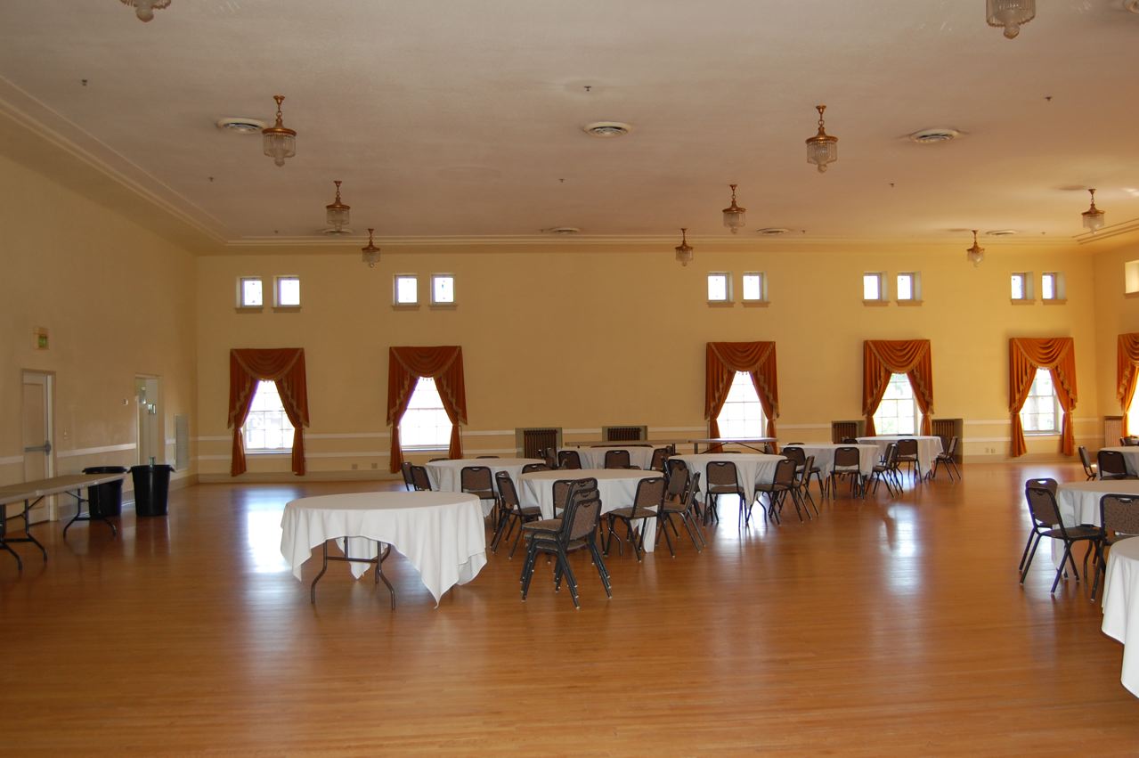
The Dalles Civic Auditorium and Veterans Memorial.
The Dalles Civic Auditorium and Veterans Memorial Courtesy Joe Fitzgibbon
-
![]()
Carnegie Library, The Dalles, 1978.
Courtesy Building Oregon, University of Oregon. "Carnegie Library (The Dalles, Oregon)" Oregon Digital
Related Entries
-
![Barlow Road]()
Barlow Road
The Barlow Road is a historic wagon road that created a new route on th…
-
Celilo Falls
Celilo Falls (also known as Horseshoe Falls) was located on the mid-Col…
-
![Craig Lesley (1945-)]()
Craig Lesley (1945-)
In both his fiction and nonfiction, writer and teacher Craig Lesley spe…
-
![Department of Environmental Quality]()
Department of Environmental Quality
The Oregon Department of Environmental Quality (DEQ) administers and en…
-
![Fort Dalles Museum]()
Fort Dalles Museum
Fort Dalles Museum sits on a bluff in a residential neighborhood in The…
-
![Harold Lenoir Davis (1894-1960)]()
Harold Lenoir Davis (1894-1960)
Born and raised in rural and small-town Oregon, Harold Lenoir Davis was…
-
![Native American Treaties, Northeastern Oregon]()
Native American Treaties, Northeastern Oregon
After American immigrants arrived in the Oregon Territory in the 1840s,…
-
![Old St. Peter's Landmark]()
Old St. Peter's Landmark
Old St. Peter’s Landmark, a former Roman Catholic church located at the…
-
Rajneeshees
Bhagwan Shree Rajneesh, a spiritual teacher who developed a substantial…
-
![Seufert Brothers Cannery]()
Seufert Brothers Cannery
Seufert Brothers Company was the leading salmon packer on the Middle Co…
-
![The Dalles Civic Auditorium and Veterans Memorial]()
The Dalles Civic Auditorium and Veterans Memorial
On April 7, 1922, four years after the armistice ended World War I, an …
-
![The Dalles Dam]()
The Dalles Dam
The United States Army Corps of Engineers constructed The Dalles Dam be…
-
![U.S. Army Corps of Engineers]()
U.S. Army Corps of Engineers
The U.S. Army Corps of Engineers, a hybrid military and civilian federa…
-
![Wascopam Mission]()
Wascopam Mission
Wascopam Mission, which operated at The Dalles from 1838 to 1847, was t…
Related Historical Records
Map This on the Oregon History WayFinder
The Oregon History Wayfinder is an interactive map that identifies significant places, people, and events in Oregon history.
Further Reading
The Laws of the Legislative Assembly of the Territory of Oregon, Enacted During The Eighth Regular Session Thereof; Begun December 1, 1856, Concluded January 29, 1857.
McArthur, Lewis A., and Lewis L. McArthur. Oregon Geographic Names, Seventh Edition. Portland: Oregon Historical Society Press, 2003.
Clark, William. Journals of Lewis & Clark, Vol. 3, and Vol. 4. American Journeys.
Rock Fort Campsite, National Register of Historic Places Nomination form, October 3, 1979.
Oregon Parks & Recreation Department: Oregon Heritage: State Historic Preservation Office, "Historic Places, Historic Sites Database", http://heritagedata.prd.state.or.us/historic/
Boyd, Robert T. People of The Dalles: The Indians of Wascopam Mission. Lincoln: University of Nebraska Press, 1996.
Meeker, Ezra. Personal Experiences on the Oregon Trail Sixty Years Ago. Saint Louis, MO.: McAdoo Printing Co., 1912.
Glassley, Ray H. Indian Wars of the Pacific Northwest. Portland, Ore.: Binfords & Mort, 1953.
Knuth, Priscilla. Picturesque Frontier: The Army's Fort Dalles. Portland: Oregon Historical Society Press, 1987.
Clark, Robert D. "The Odyssey of Thomas Condon." Portland: Oregon Historical Press, 1989.
"Malcolm A. Moody House." National Register of Historic Places, Inventory Nomination Form.
Zaitz, Les. "Rajneesh: An Oregonian Special Report." Oregonian, April 14, 2011.
Former Martin-Marietta Aluminum Reduction Facility Superfund Site, United States Environmental Protection Agency, Region 10: the Pacific Northwest.
Five-Year Review Report, Fourth Five-Year Review Report for Lockheed Martin Corporation The Dalles Facility, Formerly Martin Marietta Company Reduction Facility, The Dalles, Wasco County, Oregon, Covering January 2005 through December 2012, dated May 15, 2013.
McDonald, Sophia. "The Oregon Cherry." 1859 Oregon Magazine (July 1, 2011).
Eldridge, Cory. "Enduring Village." The Dalles Chronicle, July 27, 2008, p. A1, A7.

