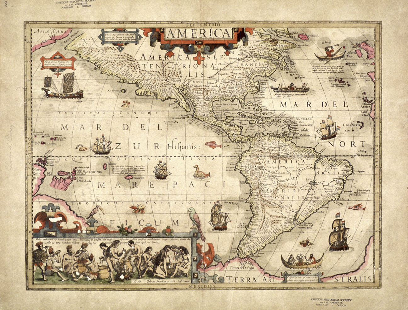
4. Map of the Americas, 1606
This map of the Americas was published in 1606 by Dutch cartographer Jodocus Hondius (1563-1612). It is an excellent example of early seventeenth-century European cartography.
The continental outline of the Americas is depicted relatively accurately in this map and the areas explored by the Spanish are mapped in great detail, but much of the interior of North America is left blank as Europeans had not yet discovered the Mississippi River, the Great Lakes, Hudson Bay, or the Rocky Mountains. The St. Lawrence River is charted, but it is shown originating far to the southwest of its actual source. The northern portion of the continent is obscured by the title cartouche, suggesting that the cartographer was reluctant to speculate about the geography of that unknown portion of the earth's surface.
View source4 of 7