The Burnett Site (35CL96), located on a terrace above the Willamette River in a private residential neighborhood within the City of Lake Oswego, is one of the oldest archaeological sites in the Pacific Northwest, dating back to the transition from the Late Pleistocene to the Early Holocene. Over 7,000 prehistoric artifacts were recovered and analyzed from the site, including various stone tools and debitage (debris from the making of stone tools and weapons).
Robert Burnett first recorded the site on his property in 1987. Initial archaeological excavations by Portland State University from 1987 to 1990 recovered artifacts representative of the Early Archaic period, which began shortly after the end of the last ice age. Recent excavations in a portion of the site, conducted by Archaeological Investigations Northwest Inc. and funded by the Lake Oswego–Tigard Water Partnership, provided additional artifact and data analyses.
The site served as a seasonal hunting camp that was likely occupied and reused over a period of roughly 11,500 years. Hunting equipment armed with stone projectile points was manufactured, used, resharpened, and eventually discarded at the site. Tools used for butchering and processing game animals suggest that the occupants of the site lived at the location for brief periods of time to perform tasks associated with hunting and hide-processing.
The analysis of blood residue trapped in microscopic cracks of stone tools at the site suggest that deer, ducks, and bighorn sheep were butchered at the Burnett Site. Because bighorn sheep prefer dry and open surroundings and are not currently found in the northwest Willamette Valley, the site provides evidence that paleoenvironmental conditions were much different than they are now.
A number of specialized dating techniques were used to establish the age of the site. A charcoal sample produced a radiocarbon date of 7,260–7,160 calibrated calendar years before present (cal BP). Optically stimulated luminescence, a technique that determines the time since now-buried sediment layers containing artifacts were last exposed to sunlight, yielded dates between 13,650 and 2,160 cal BP. Obsidian, a natural volcanic glass shaped into tools by early occupants of the Burnett Site, can also be dated using a technique called obsidian hydration. Freshly made obsidian artifacts absorb water molecules and form a microscopic hydration band, or rind, that thickens over time. By measuring these rinds, the obsidian hydration analysis produced multiple dates that clustered in three ranges between about 10,500 and 2,000 cal BP. The geochemistry of the obsidian artifacts indicates that obsidian was imported from southeast Oregon, as far as 200 miles from the site.
The Burnett site is nearby Oswego Lake, which is located between the traditional territories of the Clackamas Chinook and the Tualatin band of the Kalapuya. Both groups seasonally migrated to the lake to gather roots, to fish, and to hunt waterfowl, and they traveled to nearby Willamette Falls for salmon. Oral tradition refers to the area as a place where “bad” things dwell, and Clackamas Chinook texts describe individuals who gained spirit power from water beings who lived in the lake. Such stories may have been used by the Clackamas Chinook to establish the area surrounding the lake as taboo, thereby creating a buffer between the Clackamas and the nearby Tualatin Kalapuya to the west that would help reduce conflict. Although the Tualatin were connected politically with the Clackamas Chinook, the two groups were linguistically and culturally distinct, increasing the likelihood that tensions might arise through the common use of areas around the lake.
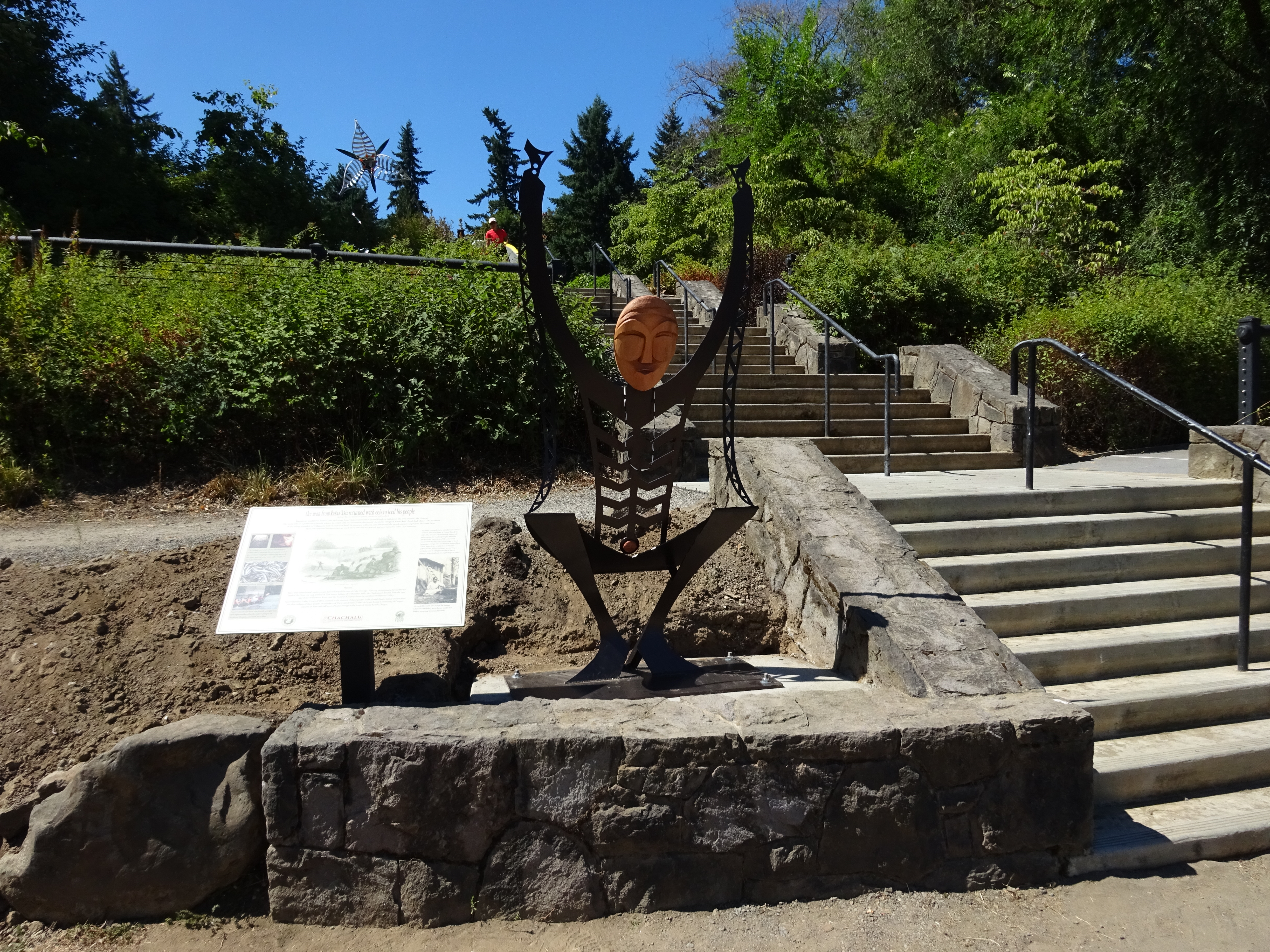
A sculpture commemorating this cultural and tribal legacy of Lake Oswego was installed in George Rogers Park along the Willamette River near the Burnett Site. The Man from Kosh–huk–shix, created by artist Travis Stewart of the Confederated Tribes of Grand Ronde, was inspired by the story of a man who harvested eels from Willamette Falls and taught his village how to cook them to fend off starvation during a brutal winter. The installation was a cooperative effort of the Lake Oswego–Tigard Water Partnership, the Confederated Tribes of Grand Ronde, and the City of Lake Oswego. It is a reminder of the area’s long history of use by Native people.
-
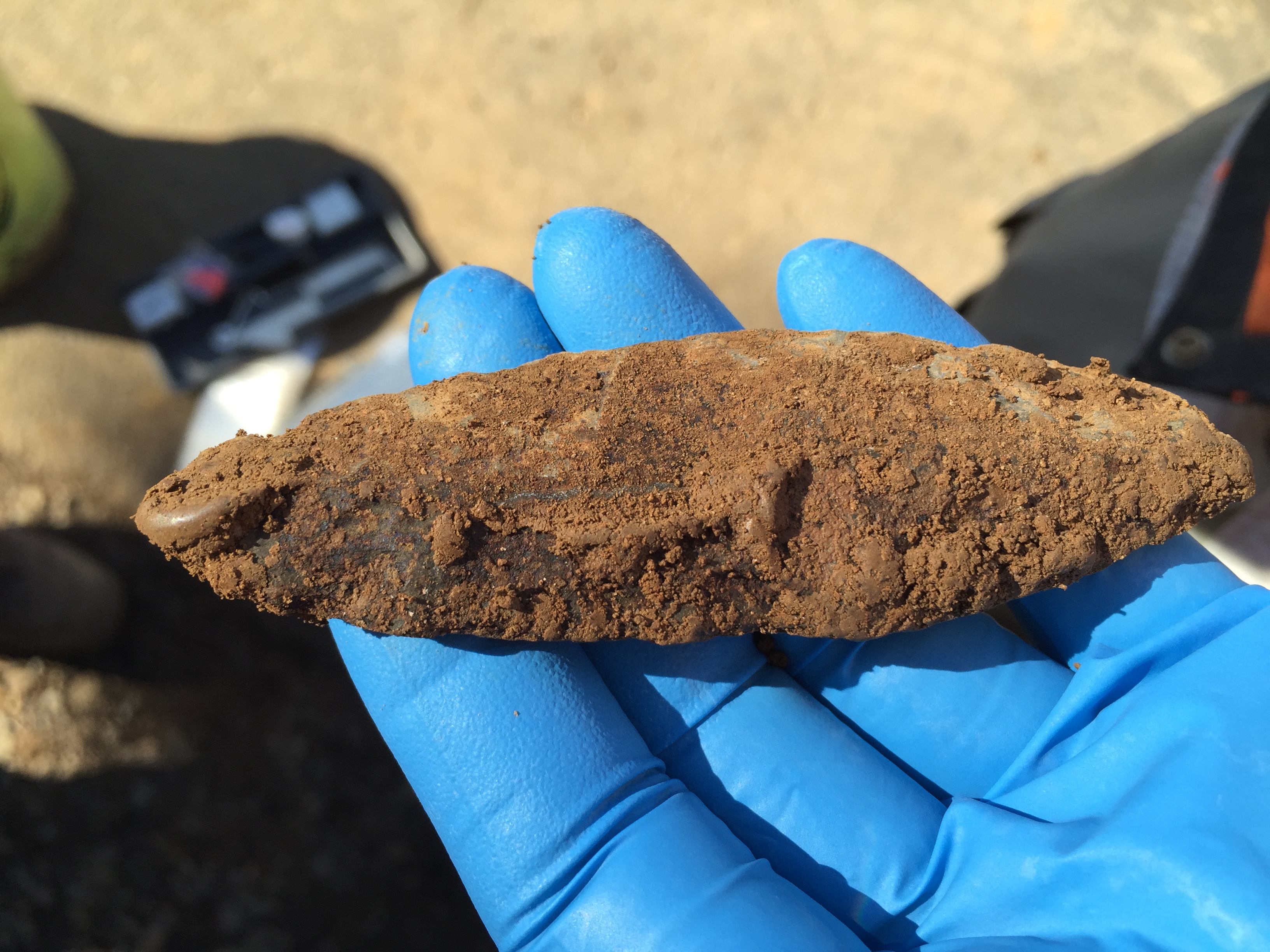
![A lanceolate Cascade-style projectile point recovered during the most recent archaeological investigations at the Burnett Site.]()
Cascade point.
A lanceolate Cascade-style projectile point recovered during the most recent archaeological investigations at the Burnett Site. Courtesy Archaeological Investigations Northwest, Inc.
-
![]()
Rick Atwell conducting archaeological excavations at Robert Burnett's residence in 1987.
Courtesy Robert Burnett
-
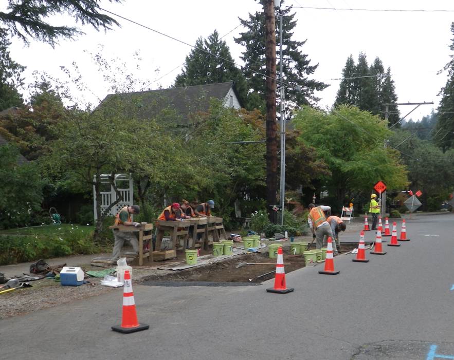
![The most recent archaeological investigations conducted at the Burnett Site.]()
2014 Excavation.
The most recent archaeological investigations conducted at the Burnett Site. Courtesy Archaeological Investigations Northwest, Inc.
-
![]()
Cascade-style lanceolate projectile points recovered during original excavations at the Burnett Site. .
Courtesy Robert Burnett
-
![“The Man from Kosh-huk-shix,” created by artist Travis Stewart of the Confederated Tribes of Grand Ronde.]()
Artwork installed in George Rogers Park .
“The Man from Kosh-huk-shix,” created by artist Travis Stewart of the Confederated Tribes of Grand Ronde. Courtesy of Council Digest: City of Lake Oswego.
Related Entries
-
![Cathlapotle]()
Cathlapotle
Cathlapotle is the archaeological site of a major Chinookan town locate…
-
![Confederated Tribes of Grand Ronde]()
Confederated Tribes of Grand Ronde
The Confederated Tribes of Grand Ronde Community of Oregon is a confede…
-
![Fort Rock Cave]()
Fort Rock Cave
Fort Rock Cave is located in a small volcanic butte approximately half …
-
![Fort Rock Sandals]()
Fort Rock Sandals
Fort Rock sandals are a distinctive type of ancient fiber footwear foun…
-
![Meier Site]()
Meier Site
The Meier site, the subject of an archaeological excavation that docume…
-
![Tualatin peoples]()
Tualatin peoples
Tualatin (properly pronounced 'twälə.tun in English) was the name of a …
Map This on the Oregon History WayFinder
The Oregon History Wayfinder is an interactive map that identifies significant places, people, and events in Oregon history.
Further Reading
Bajdek, Brennan P., Eva L. Hulse, Jason A. Cowan, Andrea Blaser, and Terry L. Ozbun. Archaeological Data Recovery at the Burnett Site (35CL96) for the Lake Oswego - Tigard Water Partnership Project, Lake Oswego, Oregon. Report No. 3563. Portland, Ore.: Archaeological Investigations Northwest, Inc., 2016.
Bajdek, Brennan P., Terry L. Ozbun, and Andrea K. Blaser. Archaeological Testing and Evaluation of Site 35CL96 along the Revised Finished Water Pipeline Alignment for the Lake Oswego - Tigard Water Partnership Project, Lake Oswego, Oregon. Report No. 3266. Portland, Ore.: Archaeological Investigations Northwest, Inc., 2014.
Burnett, Robert M. The Burnett Site: A Cascade Phase Camp on the Lower Willamette River. Unpublished Master’s thesis. Portland, Ore.: Portland State University, 1991.
Burnett, Robert M. "Obsidian Hydration Analysis of Artifacts from Site 35CL96, A Cascade Phase Camp on the Lower Willamette River." Current Archaeological Happenings in Oregon 20.3 (1995), 3-7.
Thorsgard, Eirik. Historical and Ethnographic Information about the Lake Oswego Area. Grand Ronde: Confederated Tribes of the Grand Ronde Community of Oregon, 2011.
Walsh, Megan K., Christopher A. Pearl, Cathy Whitlock, Patrick J. Bartlein, and Marc A. Worona. "An 11,000-year-long record of fire and vegetation history at Beaver Lake, Oregon, central Willamette Valley." Quaternary Science Reviews 29 (2010): 1093-1106.

