The Irvington neighborhood in northeast Portland began as an exclusive suburb planned by visionary developers many years before the city adopted zoning rules. The neighborhood—generally bounded by Northeast 7th, Fremont, Northeast 24th, and Broadway—is primarily a residential district, characterized by Queen Anne, Period Revival Bungalow/Craftsman, and Prairie School architectural styles built primarily between 1900 and the 1930s.
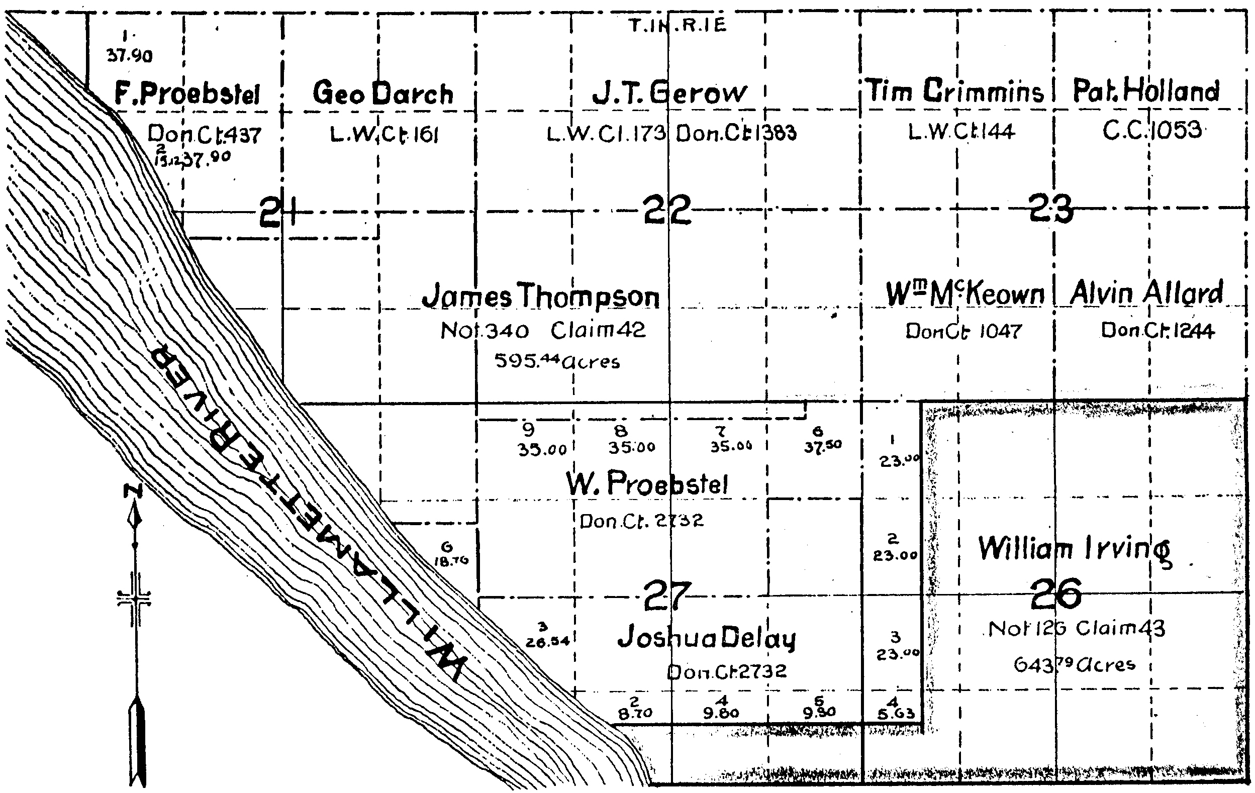
The neighborhood was carved out of a land claim settled in 1851 by riverboat captain William Irving and his wife Elizabeth, who built a home near the river at the end of the "panhandle" of the property. In 1859, the Irvings moved to British Columbia and appointed another boat captain and Elizabeth Irving’s brother-in-law, George Shaver, to manage their property.
In 1872, William Irving died from an illness, and Elizabeth Irving returned to Portland in 1882 with her youngest daughter, Lizzie, who had married Ernest Spencer, another riverboat captain. In 1884, they built a new home on North Broadway. In about 1911, during construction of the Broadway Bridge over the Willamette River, the house was moved into the present Irvington neighborhood.
Elizabeth Irving had also returned to Portland to take care of business by subdividing and selling some of the land. In the 1880s, the economy was booming after years of recession. Irving met with Portland developers David P. Thompson, John Brazee, and Ellis Hughes and sold half of her interest in a large portion of her property inland from the river. In October 1887, the plat (subdivision) of Irvington was filed with 129 rectangular blocks.
In November 1890, limited streetcar service became available connecting the area to downtown Portland, and lot sales were first opened in the southwest portion of what was known as West Irvington. In July 1891, a larger portion of Irvington was opened for lot sales east of Northeast 14th and north to Northeast Thompson. These sales contained deeded building restrictions designed to target the higher-classed residential market, one of the earliest known covenants in the Portland area. Building activity was steady due to improved streetcar service, but it was then crimped by the 1893 Depression.
After 1900, the Irvington neighborhood boomed with new activity, as more blocks were opened up to the north. The successful 1905 Lewis and Clark Centennial Exposition caused an explosion of new home construction that lasted through 1913. Soon the recession associated with World War I and competing subdivisions on the east side—such as Alameda, Laurelhurst, and Eastmoreland—put a damper on rising lot prices and the building of large homes in Irvington.
During the 1920s and 1930s, Irvington was still a desirable place to live, but new homes were generally middle-class as Portland grew farther to the east. During the 1940s, a housing shortage caused by the influx of people to work in the shipyards and other war-related industries led to the conversion of many large homes into multi-family use. During the 1960s and 1970s, the neighborhood was said to be in decline as property values remained flat or fell and homes went into disrepair. In the southern part of the neighborhood, some houses were replaced by modern apartment buildings. A grassroots movement developed during this time, and residents took action to protect the neighborhood.
The 1979-1982 recession halted higher-density redevelopment, and low-interest loans encouraged restorations. Also part of the perception of decline was the arrival of middle-class African Americans, which created an integrated neighborhood. Irvington participated in the Model Cities program from 1969 into the 1970s.
In 1992, the city designated Irvington a local historic district. An influx of new restoration-minded people moved into the neighborhood, which gave a strong boost to home values. Some gentrification did take place but not at a level that threatened historic homes with replacement by high-end, high-density housing. The neighborhood reverted to a more white ethnic makeup during the 2000s, as many African American families cashed out their equity and relocated to outer neighborhoods.
In May, 2010, the Irvington Community Association completed its application to place the neighborhood on the National Register of Historic Places. The neighborhood's significance includes its period architecture as well as its being an example of an intact, early twentieth-century "streetcar suburb."
-
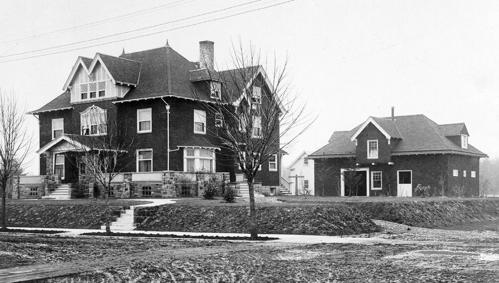
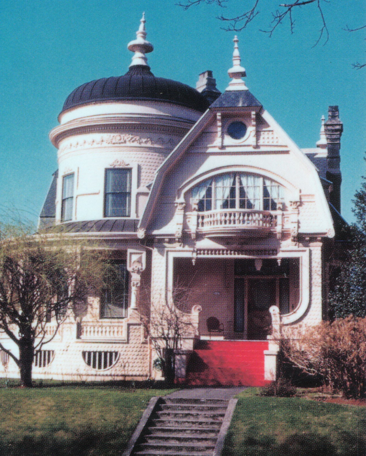
Irvington, Portland, 2323 Tillamook.
Doernbacher House at 2323 NE Tillamook St. in the 1900s (built 1903). Courtesy Walter Poida
-
Irvington, Portland, plat map, 1887.
Irvington plat map, recorded Oct. 24, 1887. Courtesy Roy Roos
-
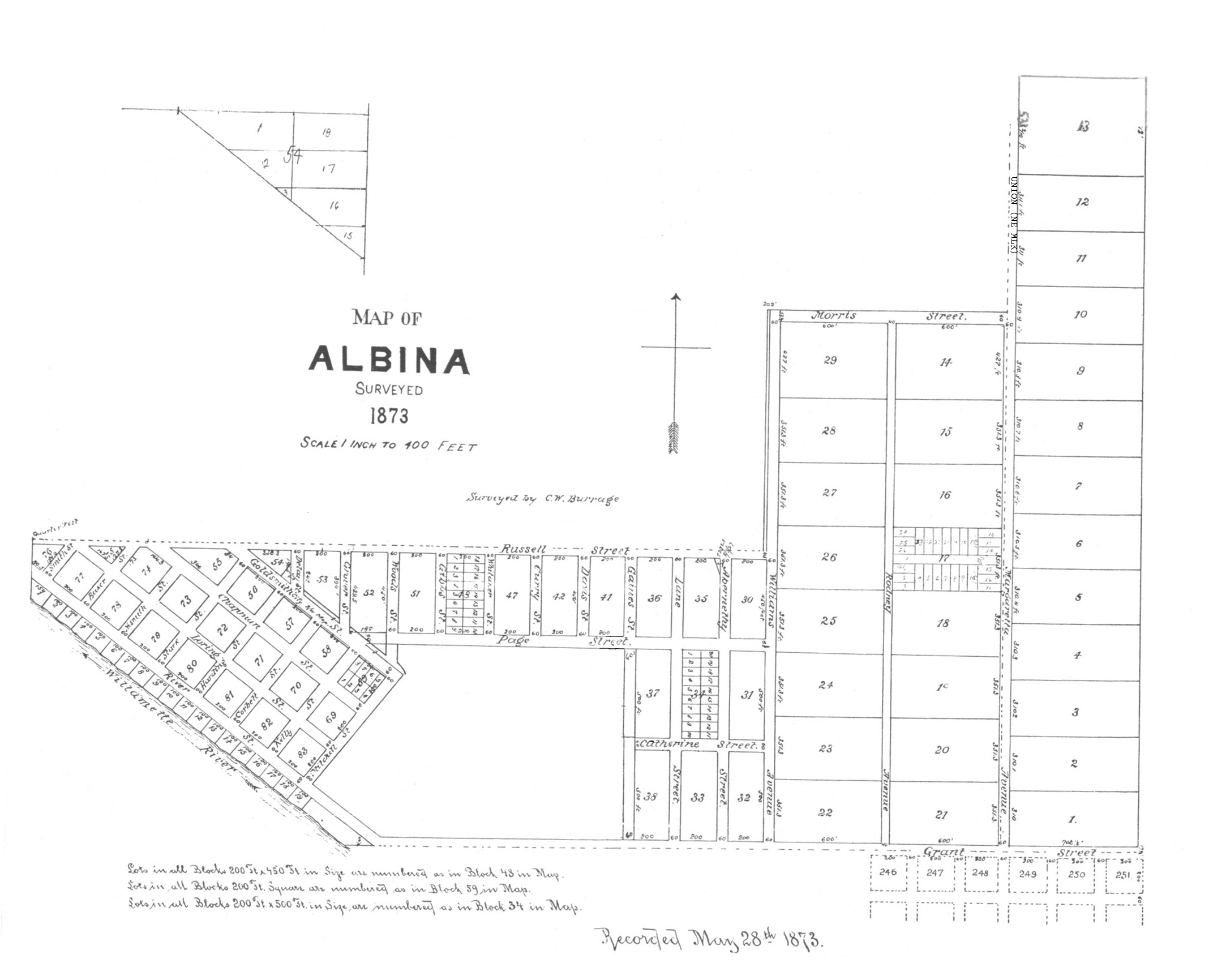
Irvington, Portland, Donation Land Claim map.
Irvington area Donation Land Claim map. Courtesy Roy Roos
-
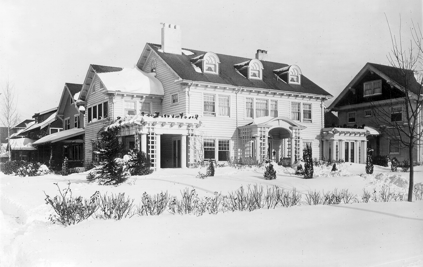
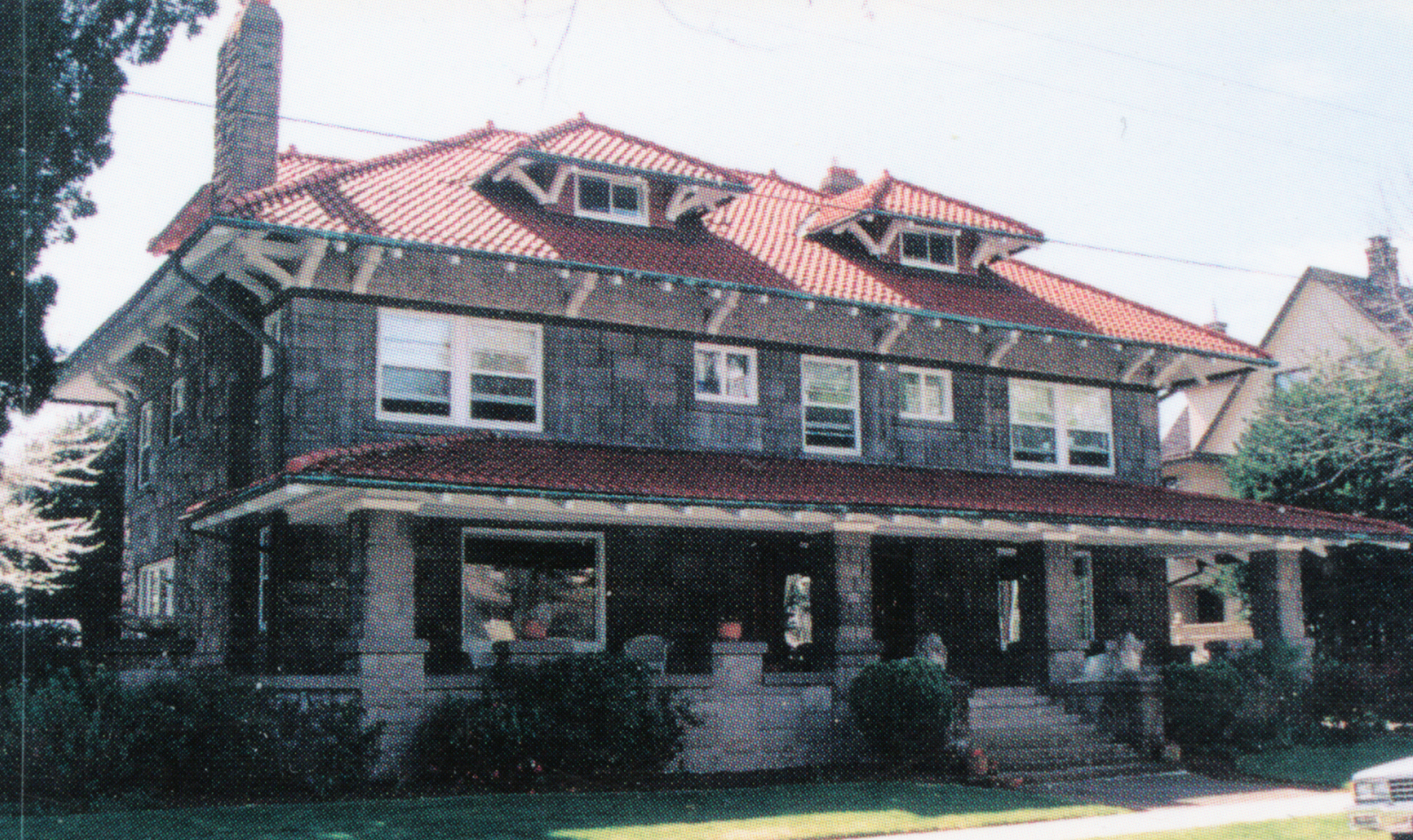
Irvington, Portland, 1511 Knott.
F. A. Seufert House at 1511 Knott St. in 1916 (built 1912-1913). Courtesy Mary Anne Stowell
-
![John E. Povey House at 1312 NE Tillamook St. in 1996 (built 1891).]()
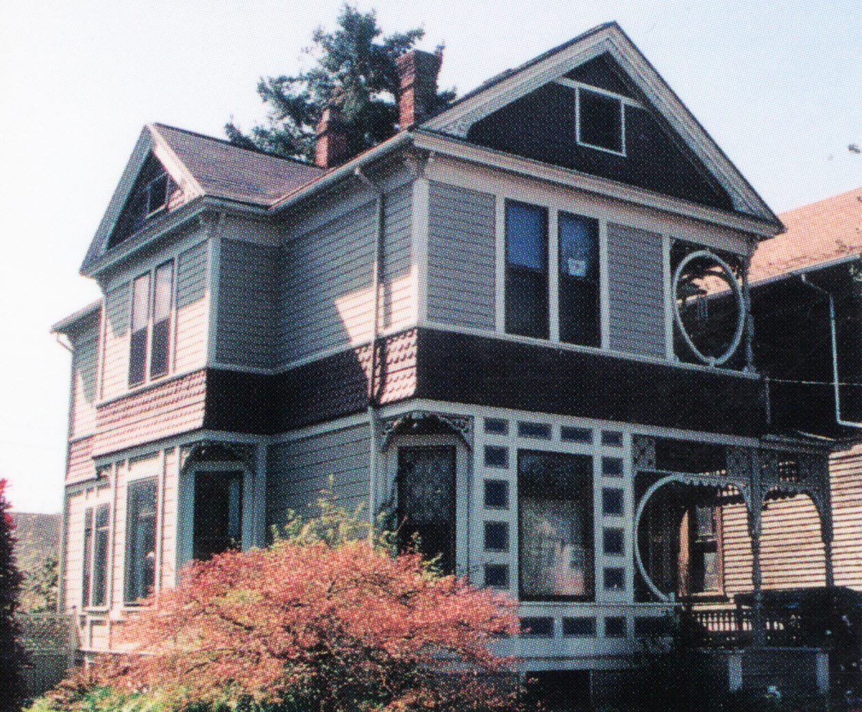
Irvington, Portland, 1312 NE Tillamook.
John E. Povey House at 1312 NE Tillamook St. in 1996 (built 1891). Photo Roy Roos
-
![2117 NE 15th St. in the 1940s (built 1898).]()
Irvington, Portland, 2117 NE 15th (built 1898).
2117 NE 15th St. in the 1940s (built 1898). Photo George McMath, courtesy Roy Roos
-
![2330 NE Thompson St. (built 1910).]()
Irvington, Portland, 2330 NE Thompson (1910).
2330 NE Thompson St. (built 1910). Courtesy Roy Roos
Related Entries
-
Albina area (Portland)
By the late 1880s, Albina, located across the Willamette River from Por…
-
![Ladd's Addition]()
Ladd's Addition
Ladd's Addition is a streetcar-era neighborhood in southeast Portland w…
-
![Laurelhurst]()
Laurelhurst
The Laurelhurst neighborhood in Portland is an historic twentieth-centu…
Map This on the Oregon History WayFinder
The Oregon History Wayfinder is an interactive map that identifies significant places, people, and events in Oregon history.
Further Reading
Labbe, John T. Fares Please! Those Portland Trolley Years. Caldwell, Id.: Caxton Printers, 1982.
Miller, Archie and Valerie Francis. Irving House: A Family History. New Westminster, BC.: Archie & Valerie Francis Miller, 1988.
Oregon Parks & Recreation. "Irvington Historic District Nomination."
Roos, Roy E. The History & Development of Portland's Irvington Neighborhood. Portland, Ore.: Roy E. Roos, 1997.

