The Expedition
No exploration of the Oregon Country has greater historical significance than the Voyage of Discovery led by Meriwether Lewis and William Clark. Historians and geographers judge the Lewis and Clark Expedition, which brought more than thirty overland travelers into the Columbia River Basin in 1805-1806, as the most successful North American land exploration in U.S. history. Officially called the Corps of Volunteers for North West Discovery, the Expedition was carried out under the auspices of the U.S. Department of War, with presidential and congressional authorization.
The expeditionary force left the Mississippi River Valley in spring 1804, traveling up the Missouri River to the Continental Divide, then down the Snake and Columbia Rivers west to the Pacific Ocean, and returning east on the Columbia, Yellowstone, and Missouri Rivers to St. Louis in September 1806. The explorers traveled more than eight thousand miles, by water and land, in boats, on horseback, and by foot. The journey took just over twenty-eight months, and only one member of the Corps died, the result of disease. They met hundreds of Native people from dozens of groups along the exploration route, mostly under friendly or conciliatory conditions, but not without conflict. They also cataloged hundreds of new plant and animal species unknown to science of the day. The origins and ambitions of the Expedition reached back more than two decades before the explorers crossed the Continental Divide in August 1805; but the nine months the Corps of Discovery spent in Oregon Country left a lasting imprint on the region, while their reports described it for the larger world.
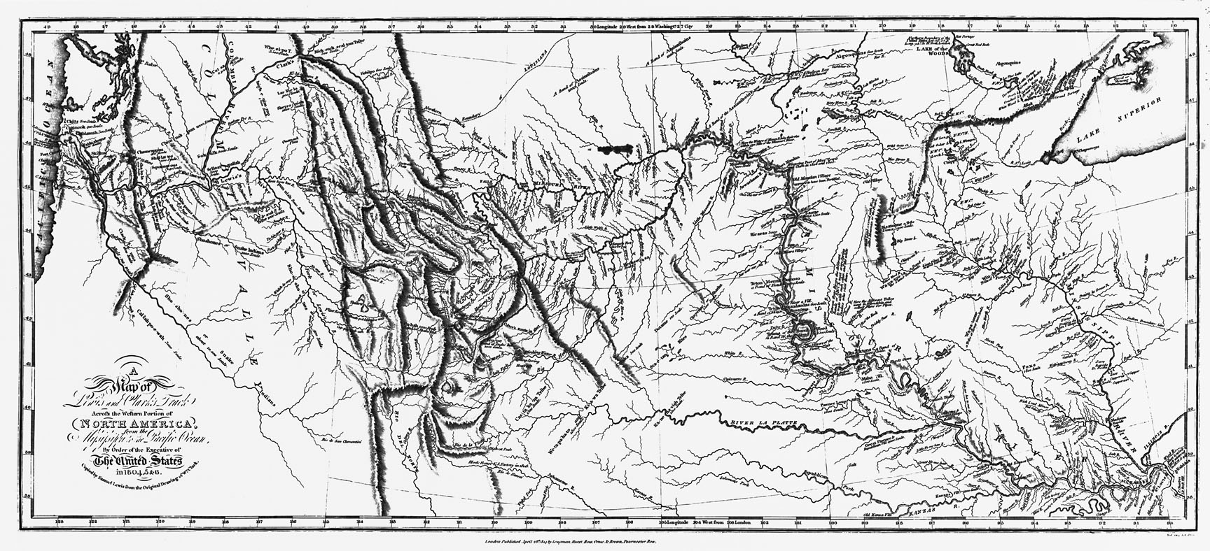
The principal legacy of the Lewis and Clark Expedition is the accounts of the journey recorded in the Journals written by the Captains and five other members of the Corps. The maps, principally the work of William Clark, provided the first detailed topographic representations of the interior landscapes of the Oregon Country. The Expedition also represented an international claim for the United States on the northern Pacific region west of the Continental Divide, a claim the nation used in negotiations over hegemony in the Pacific Northwest during the mid-nineteenth century.
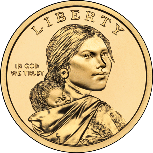
Perhaps most important, the interactions between members of the Corps and Indigenous people left legacies that influenced subsequent relations between Natives and non-Natives in the Pacific Northwest. The presence of a Native woman among the expeditionary force—Sacagawea—made her one of the most recognized female historical figures in Oregon and U.S. history. For these and other reasons, the Corps of Discovery is one of the most important episodes in the history of Oregon.
Origins of the Expedition
More than any other person, President Thomas Jefferson was responsible for the Lewis and Clark Expedition. Beginning in the early 1780s, Jefferson imagined a scientific exploration of the interior of North America that would catalog flora and fauna and thoroughly map the vast reaches between the Mississippi River and the Pacific Ocean. He offered some hints at his intentions in Notes on the State of Virginia (1784), his extended work on North American environment and culture that highlighted how little was known about the continent.
Jefferson embraced Enlightenment-era science, especially the documentation of nature based on empirical investigation. Reflecting that interest, his library at Monticello included hundreds of volumes, maps, and scientific reports on North American subjects, places, and discovered species. During the 1780s and 1790s, he approached American military hero George Rogers Clark and French scientist Andre Michaux to undertake a scientific expedition across the continent, and he offered to finance adventurer John Ledyard’s proposal to cross North America from west to east. These plans did not mature; but once Jefferson became president in March 1801, he had the power of his office to propel his beloved project forward.
Jefferson had especial fascination with the Trans-Appalachian and Trans-Mississippi regions, where he expected scientific discoveries to advance human knowledge. In addition, he worried that other nations might control the vast Trans-Mississippi region and compromise U.S. political and economic security. He had long feared that Great Britain would try to colonize the Pacific Northwest, and his geopolitical concerns increased in the summer of 1802 when he read Voyages from Montreal, a report of Alexander Mackenzie’s transcontinental journey across Canada to the Pacific Ocean in 1792-1793.
In late 1802, Jefferson decided to mount an expedition to the Pacific Ocean. He assigned his private secretary Meriwether Lewis, a bright student of science and a military veteran, the task of preparing plans for the exploration. While Jefferson assured Spain, France, and Great Britain that the expedition was largely for science and the “advancement of geography,” Lewis began a concentrated study of western geography; empirical scientific methodologies; professional medicine; the quadrant, theodolite, and other scientific instruments; and mathematical calculations. Jefferson sent a secret letter to Congress in January 1803, requesting $2,500 in financial support and authorization for an expeditionary force to explore the Trans-Mississippi West. Secrecy was necessary to avoid conflict with European nations that claimed lands in the region the expeditionary force would cross. Once he secured approval from Congress, Jefferson sent Lewis in spring 1803 to meet with scientists and specialists in armaments and materials, using his contacts in the American Philosophical Society in Philadelphia.
By June 1803, Jefferson had outlined a lengthy letter of instruction to Lewis. One month later, the president received word of the successful treaty negotiations in Paris, where France agreed to cede Louisiana to the United States. The so-called Louisiana Purchase did not prompt the Expedition, but it altered how the Corps of Discovery dealt with Natives and other non-Americans in the vast region. Jefferson wrote a second letter of instruction to Lewis in November 1803, advising that the Expedition wait until spring 1804 to ascend the Missouri, allowing for the transfer of Louisiana to the United States and to avoid winter travel.
Up the Missouri River
In July 1803, Lewis chose William Clark, younger brother of Revolutionary War hero George Rogers Clark, as his co-leader. The two men gathered materials and advertised for experienced frontiersmen to join the Expedition. By late 1803, they had enlisted forty-three men—some with experience on the Missouri—and had organized them in five platoons. In December, they established a cantonment, Camp Dubois, across from the mouth of the Missouri River, about eighteen miles from St. Louis.
St. Louis, the principal trading location of the lower Missouri River region, had a population of about a thousand people in 1803-1804. Lewis and Clark spent several weeks in the town gathering information from traders about the Missouri River and Native villages upriver. At 2,723 miles in length, the Missouri is the longest tributary river in North America and was home to dozens of Native groups and hundreds of villages in 1804. French and Spanish traders had long developed relationships with Native groups on the lower river—the Osage, Missouri, Kansa, Pawnee, Oto, and Omaha—while British traders had traded upriver with Arikara, Hidatsa, and Mandan villages for more than two decades. The Captains quizzed traders about conditions, as Clark put it, “so as we may make just Calculations, before we set out.”
The Corps left Camp Dubois on May 14, 1804, with a detailed map in hand of the river to the Mandan villages near present-day Bismarck, North Dakota. They traveled upriver in two large canoes and a 55-foot keelboat that had 16 sweep oars, a single mast, and 12-ton capacity. They poled the keelboat and paddled the canoes laboriously up the Missouri, encountering Natives in a large council held on July 30 at Council Bluff, just north of present-day Omaha, Nebraska. Lewis greeted Natives at Council Bluff and at other like gatherings on the Missouri with ceremony and gifts, emphasizing that the U.S. government had authority over the vast Louisiana Purchase territory. Three weeks later, Sargent Charles Floyd of the Corps became ill and died of a ruptured appendix near present-day Sioux City, Iowa. Floyd was the only Corps member to die during the twenty-eight-month-long Expedition.
In September, Lewis and Clark encountered a group of Teton Sioux who tried to block the Corps’ passage upriver, creating the Expedition’s first diplomatic challenge. The Captains successfully avoided open conflict, and after a tense meeting the Sioux agreed to let them pass. It was the first of many experiences with Native peoples that induced caution from the Expedition leaders.
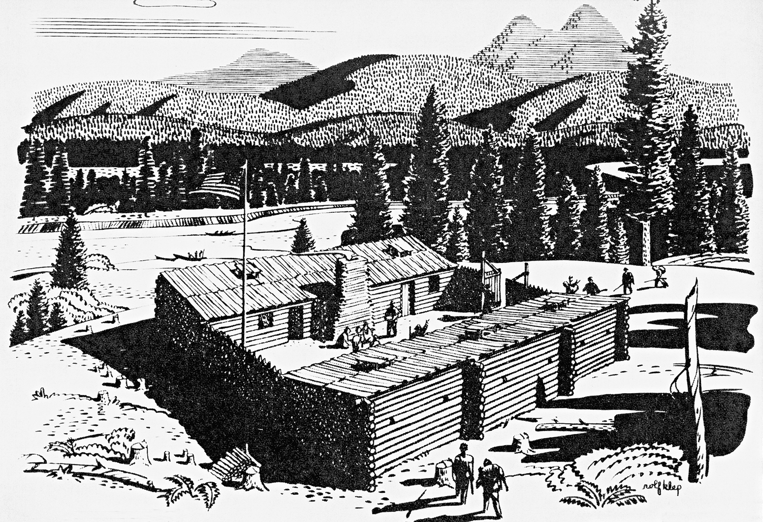
By early November, Lewis and Clark had arrived at Mandan villages on the Knife River, some 1,600 miles upriver from St. Louis. They established the triangular-shaped and palisaded Fort Mandan as their winter quarters, remaining there for five months and interacting with Mandan and Hidatsa people in the region. They enlisted Toussaint Charbonneau as interpreter for the voyage west. Also joining the Corps was Sacagawea, Charbonneau’s Lemhi wife, and their infant son Jean Baptiste.
To the Uncharted West
The Corps left the Knife River villages on April 7, 1805, sending the keelboat and some men downriver to St. Louis. The westward-journeying Expedition included thirty enlisted men and officers, Clark’s personal slave York, Toussaint Charbonneau and Sacagawea (with infant Jean Baptiste), a Mandan guide, and Lewis’s dog Seaman. The Corps had built six dugout canoes from cottonwood trees to augment two larger pirogues, a fleet that Lewis described as “not quite so respectable as those of Columbus or Capt. Cook” but “still viewed by us with as much pleasure.”
Geographical knowledge that the Captains had gleaned from Mandan and Hidatsa informants aided them in their travel through present-day North Dakota and Montana. They did not encounter any Native people for more than a thousand miles of travel on the Missouri, and their journals contain mostly notations on the geography, mineralization, plants, and animals of the region. They recorded tributary streams from the north, including the Milk River, and the major southern tributary to the Missouri, the Yellowstone—which Lewis called “the most eligible site for an establishment” for future commerce. The Corps also marveled at the western high plains environment, especially the abundance of bison herds, the Missouri River landscape, and grizzly bears. In present-day Valley County, Montana, Lewis recorded an encounter with “a monstrous beast” grizzly that he admitted “reather intimidates us all; I must confess that I do not like the gentlemen [bears] and had reather fight two Indians than one bear.”
Mandans had provided general information on some Missouri River landmarks, including a large falls near the western mountains, but few details. When the Corps reached the Marias River, a northern tributary, in June, they had to determine which fork was the Missouri. After several days of exploratory surveys, Lewis concluded that they should follow the southern stream, where they found the Great Falls of the Missouri, a stunning and loud cascade that Lewis described as “the grandest sight I ever beheld.” What he did not immediately perceive was how difficult it would be to portage eighteen miles around the falls, an effort that consumed more than three weeks.
By the end of July, the Corps had passed through the Gates of the Mountains, a narrow limestone canyon north of present-day Helena, Montana, and arrived at the Three Forks of the Missouri. From there, they pursued the Beaverhead River south and west. It was there that Sacagawea recognized Beaverhead Rock, a landmark she remembered from her childhood traveling with her Lemhi family.
On August 12, 1805, the Corps ascended Lemhi Pass to the crest of the Rocky Mountains, where Lewis recorded that he had “accomplished one of those great objects on which my mind has been unalterably fixed for many years.” To the west, however, he saw “immence ranges of high mountains . . . their tops partially covered with snow.” He was looking into the Columbia River Basin and the route to the Pacific Ocean.
On the Columbia
From the moment the Corps headed west from the Continental Divide, they entered territory outside the Louisiana Purchase. The Captains had to address Native people much differently, for the United States did not claim the Columbia River Basin country. Until they encountered Shoshone men and women on the Continental Divide, the Corps had not met Natives since leaving the Mandan Villages. Incredibly, the head of the band was Sacagawea’s brother, Cameahwait, a coincidence that aided the Captains in securing aid and geographical knowledge.
The Corps enlisted a Shoshone guide, who they called Old Toby, to lead them across the Bitterroot Mountains to tributaries of the Columbia River. Old Toby helped them secure horses from Salish groups at Ross’ Hole along the East Fork of the Bitterroot River, south of present-day Missoula, Montana. Salish oral traditions about the meeting with Lewis and Clark include their astonishment at York, Clark’s slave, primarily because of his skin color. That reaction to York was common among Natives who the Corps encountered and has endured in stories among many tribes along the Expedition route.
After resting for a couple of days on Lolo Creek west of present-day Missoula, the Corps began perhaps the most arduous portion of their outward journey—the trek across the Bitterroot Mountains on the Lolo Trail. It took eleven days of heavy slogging, with diminishing food supplies and inclement weather, before they descended the mountains in late September to Weippe Prairie on the Clearwater River. There they met the Nez Perce, whose hospitality revived the physically weakened Corps during their two-week stay.
The Captains made strong connections with Nez Perce and secured their aid in constructing five dugout canoes from ponderosa pine logs to descend the Clearwater, Snake, and Columbia Rivers. With two Nez Perce as guides—Twisted Hair and Teotarsky—the small flotilla descended the Clearwater to the Snake River, where they encountered nearly fifty major rapids and a semi-arid landscape that was unlike anything they had experienced. At the mouth of the Snake, the Corps met Yellepit, a Walla Walla chief, and gave him one of the thirty-two small “peace medals” that the Captains had brought to distribute to friendly headmen.
As the Corps descended the Columbia in October and November 1805, the Captains described Native people in increasingly negative terms, emphasizing the pilfering of items and their physical appearance and dress. But they also noted their extensive caches of dried fish, the unusual reed mat lodges, and their fishing gear. Their Nez Perce guides told the Captains that they had entered a dangerous region and that people who lived below the falls would kill them. They left the Corps to return to their villages on the Clearwater. Lewis and Clark discovered that those who lived in the Columbia River Gorge spoke a different language, but they ignored the Nez Perce warnings and encountered no hostility.
The river overwhelmed the Corps. The rapids at The Dalles greatly impressed Clark, who wrote that “the whole of the current of this great river must at all stages pass thro’ this narrow chanel of 45 yards wide.” The Corps labored down the river, portaging around Celilo Falls with Native help. By early November, they had descended below the Cascades rapids, where Clark noted evidence of a tidal effect in the river near present-day Beacon Rock. On the southern bank they found extensive sand deposits at the mouth of what they called the Quicksand River (the present-day Sandy River). From that point on, they could use Lieutenant William Broughton’s 1792 map as a guide.
Their journal entries increasingly included complaints about the weather. During one six-day period on the lower Columbia near the north end of the present-day Astoria-Megler Bridge, the Corps had to hunker down on the riverbank in incessant rain, trapped in a place that Clark called the “dismal nitch.”
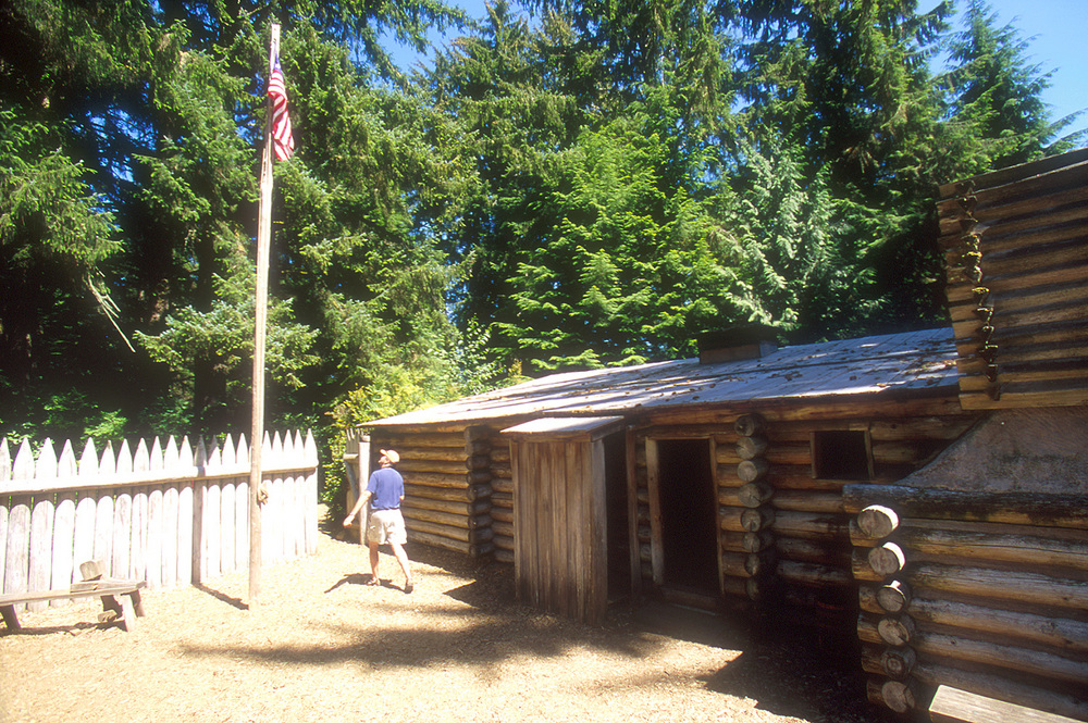
The Corps greatly anticipated arriving at the Pacific Ocean, so much so that on November 7 Clark incorrectly exclaimed “Ocian in view! O! the joy.” What he actually saw was the expansive Baker Bay, a nearly ten-mile-wide expanse of the Columbia’s estuary. By November 18, the expeditionary force had reached the Pacific. By polling Corps members, they decided to stay the winter on the south side of the river. In early December, they built a sturdy stockade, named Fort Clatsop, on the present-day Lewis and Clark River southwest of present-day Astoria. Lewis and Clark had hoped to find seafarers at the mouth of the Columbia, but no ships entered the river during their stay on the coast.
Pacific Coast Winter
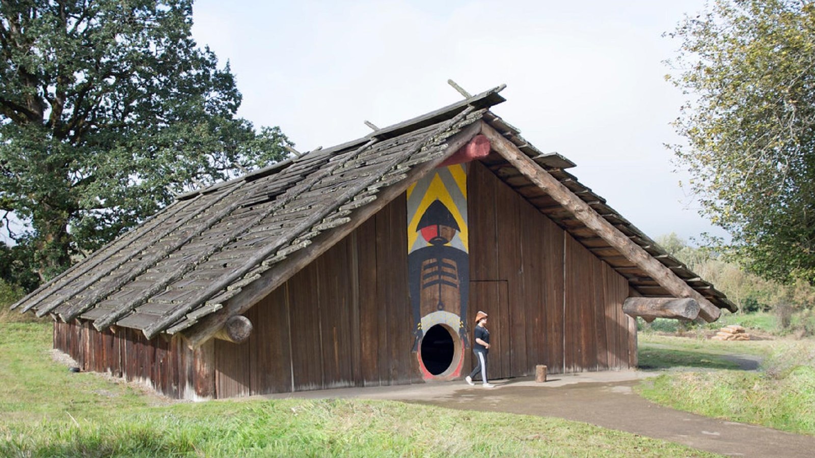
Fort Clatsop, a 50-by-50-foot structure built from locally harvested timbers, was home to the Corps from December 7, 1805, to March 23, 1806. Built in the homeland of the Clatsop people, the fort drew sufficient attention from residents on both sides of the Columbia River that the Captains instituted security precautions to limit encounters between Corps members and Natives. The restrictions reflected significant tensions between the Corps and lower Columbia River people, who the Captains saw as difficult in trade and generally not interested in friendly relations, as the Mandan had been. Coboway, chief of the Clatsop, and Concomly, chief of the Chinook, had long traded with EuroAmerican mariners and had only marginal interest in the Corps’ meager trade items. Chinook and Clatsop people had little to gain in trade with the Corps, and their middleman role in trade between coastal and interior Native groups gave them considerable power.
Lewis and Clark spent the winter compiling their notes and maps from the journey west of Fort Mandan, taking care to make drawings of people, flora, fauna, and landscapes. They also compiled an “Estimate of Western Indians,” which matched a similar document they had completed at Fort Mandan. Their journal entries from that winter are peppered with criticism of the people and conditions at the coast. Lewis became more critical of Natives, writing a rant in February 1806 that proclaimed “the treachery of the aborigenes of America.” In one of many journal entries complaining about the weather, Clark exclaimed: “The winds violent. Trees falling in every derection, whorl winds, with gusts of rain Hail & Thunder, this kind of weather lasted all day. Certainly one of the worst days that ever was!”
During much of the Fort Clatsop winter, the Corps prepared gear and clothing for the return journey, hunted elk in the Coast Range, and tended a salt-boiling station on the coast. The Captains gathered considerable information about the flora and fauna on the lower Columbia, and they commented in journal entries about the Natives’ impressive seaworthy canoes and their seamanship. Nonetheless, the Captains were eager to head upriver. Their impatience with Clatsops who would not sell them a canoe led them to steal one of the great canoes they had lauded, breaking one of their fundamental rules to not transgress Natives. The Captains turned over Fort Clatsop to Coboway on March 22, 1806, and pushed off upriver the next day, commenting that they had lived at Fort Clatsop “as well as we had any right to expect.”
Homeward
Lewis and Clark and the members of the Corps focused on arriving at the Nez Perce camps as speedily as possible. They dallied only to explore the Willamette River, which they called the Multnomah, a major tributary they had missed on their 1805 descent. Clark had time only to travel up the Willamette to near the present-day site of the St. Johns Bridge.
Once back on the Columbia and in the Gorge, the Captains tried to bargain for horses to hasten their journey. The spring freshet on the river offered the Corps a much different river, one very difficult to navigate against a strong current. At The Dalles, Lewis became agitated with what he perceived to be Native intransigence and erupted over thievery. On April 21, he wrote: “I now informed the Indians that I would shoot the first of them that attempted to steal an article from us.” Despite the friction, Clark succeeded in bargaining for twelve horses by the time they had crossed the Columbia near the mouth of the Deschutes River.
By April 27, the Corps had reunited with Yellepit near the mouth of the Snake River, where they traded for more horses and made their way cross-country to the Nez Perce camps and a reuniting with Teotarsky. The Captains learned that snow blocked passage over the Bitterroot Mountains, so they spent more than a month with the Nez Perce, developing the strongest relationship with Natives during the entire Expedition. Part of that relationship was the result of Clark’s ministering to illnesses among the Nez Perce with his medicine kit.
The Corps struggled back over the Lolo Trail to the Bitterroot Valley by late June, when they rested and decided to split up. One group, headed by Lewis, explored the Marias River to determine if it originated in British Canadian territory, while the second, headed by Clark, proceeded southwest and descended the Yellowstone River. Clark’s group included Sacagawea, who recognized a key geographic landmark that led the group directly to the Yellowstone, near present-day Livingston, Montana. On the descent of the Yellowstone, Clark’s group suffered horse theft by a group of Absaroka, but otherwise they traveled without incident. Clark left behind the only physical remnant of the Expedition on the land when he carved his name in a large sandstone formation near present-day Billings, Montana, the so-called Pompey’s Pillar. Clark had given Sacagawea’s child the nickname Pomp, so the carving honored the child as much as Clark.
Lewis and his group had a much different experience. On July 26, in the Marias drainage on Two Medicine Creek, they encountered several Piegan. Offering to camp with them, Lewis believed he was being careful, but an attempted theft of a Corps rifle led to a skirmish that left two Piegan dead and the Corps racing away from the scene to the Missouri River. It was the only armed conflict with Natives during the Expedition.
Clark and Lewis and their entourages reunited at the mouth of the Yellowstone on August 12 for their final descent of the Missouri to the Mandan villages, where they arrived two days later. The Captains took two days to conduct diplomacy with Mandan and Hidatsa chiefs; to say their farewells to Toussaint Charbonneau, Sacagawea, and Baptiste; and to enlist Mandan chief Sheheke and his family to accompany the Corps to St. Louis to visit the United States as ambassadors of the Mandan people. On September 23, the greatest land exploration in the nation’s history concluded when the Corps’ flotilla arrived in St. Louis and sent word by letter of their success.
The Legacy
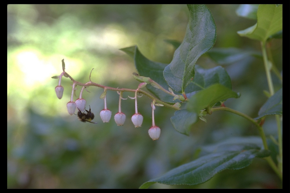
The most important legacy of the Lewis and Clark Expedition is extant in the nearly one million words of description preserved in the journals, the herbarium specimens collected during the Expedition, and the maps created by William Clark. The Captains listed 122 plants and animals new to science, with 65 species located in Oregon Country. Included in those new species are Columbian ground squirrel, white sturgeon, and Oregon pronghorn, along with Western red cedar, salmonberry, and Oregon white oak.
The Expedition also established an American claim to the Oregon Country that added to Robert Gray’s 1792 chart of the Columbia River when the United States and Great Britain negotiated over control of the Pacific Northwest in 1846. The Corps of Discovery was not a direct cause of western settlement or a pathway for the later Oregon Trail. Fur-trade companies based in St. Louis, however, enlisted Corps members to trap the Yellowstone River region and establish outposts as early as 1807.
The manuscript journals from the Expedition are archived at the American Philosophical Society in Philadelphia. The first publication of a travel narrative based on the Expedition was an edited version of a journal (lost to history) kept by Patrick Gass, which appeared in 1807, with six later editions by 1814. The first official publication of Lewis and Clark’s journals came in 1814, edited in two volumes by Nicholas Biddle, with direct aid from William Clark. The first modern edition was the work of Elliott Coues, who published a four-volume rendition of the journals in 1893. In 1904-1905, Reuben Gold Thwaites of the Wisconsin Historical Society published an extensive eight-volume edition of the journals, which remained the standard until Gary E. Moulton at the University of Nebraska created the twelve-volume complete The Journals of the Lewis & Clark Expedition (1983-1999).
The lives of principals in the great exploration varied dramatically. Meriwether Lewis never completed his promised narrative of the Expedition, served briefly as governor of Upper Louisiana Territory, and came under congressional criticism. He committed suicide on the Natchez Trace in October 1809. Some have questioned if Lewis killed himself, but Jefferson left no doubt in his mind, writing in 1813: “Governor Lewis had from early life been subject to hypochondriac affections.”
William Clark lived out his life as a public official as Louisiana Territory superintendent of Indian affairs, governor of Missouri Territory, and finally as federal superintendent of Indian affairs. He lived in St. Louis, where he died in 1838. Sacagawea lived with Charbonneau in St. Louis and at fur forts in the Upper Missouri region, gave birth to a second child, and died in late 1812 of fever at Fort Manuel. Jean Baptiste Charbonneau went to live with Clark in St. Louis in 1809, attended school, traveled to Europe, and worked as a western guide and in gold mining. He died of pneumonia in southeast Oregon in May 1866. York remained Clark’s slave and eventually received his freedom in 1816.
Two material objects from the Lewis and Clark Expedition remain in Oregon. The silver medal given to Yellepit, which was evidently lost or traded, ended up in the collections of the Oregon Historical Society in 1899 after it was discovered on an island in the Columbia in the early 1880s. In 2011, the medal was returned to the Confederated Tribes of the Umatilla Indian Reservation under terms of the Native American Graves Protection and Repatriation Act. The second object is a large military branding iron carrying Lewis’s name, which was used to mark materiel boxes and other items. It was found near The Dalles in the 1890s and is in the collections of the Oregon Historical Society.
The Lewis and Clark Expedition remains one of the foundational stories of Oregon history. Place-names the explorers set down on maps are still used, Sacagawea became one of the most famous women in American history, and modern places and institutions in Oregon are named for the Captains and members of the Corps. Interest in the Expedition waned during the nineteenth century, but was reinvigorated after World War II, when scholars pursued subjects that revealed Native perspectives on the journey, geopolitical consequences, and scientific discoveries made by the explorers. During the 2003-2006 Bicentennial of the Lewis & Clark Expedition, events and commemorations took place from Virginia, across the eleven western states where the Expedition traveled, to the Pacific Coast.
-
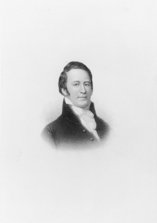
![Captain William Clark, c. 1810]()
Captain William Clark, c. 1810.
Captain William Clark, c. 1810 Courtesy Oreg. Hist. Soc. Research Lib., OrHi97395
-
![Captain Meriwether Lewis, 1807]()
Captain Meriwether Lewis, 1807.
Captain Meriwether Lewis, 1807 Courtesy Oreg. Hist. Soc. Research Lib., by Charles Willson Peale, OrHi9739
-
![Statue of William Clark's slave York, a member of the Lewis and Clark Expedition of 1804-1806. The statue is installed in Louisville, Kentucky.]()
York.
Statue of William Clark's slave York, a member of the Lewis and Clark Expedition of 1804-1806. The statue is installed in Louisville, Kentucky. Fair use
-
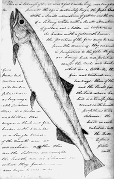
![William Clark's sketch of a white salmon]()
William Clark's sketch of a white salmon.
William Clark's sketch of a white salmon Courtesy Oreg. Hist. Soc. Research Lib., OrHi96344
-
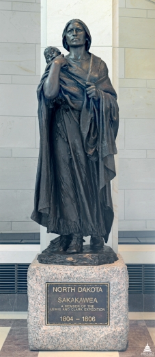
![Statue in the U.S Capitol building, presented by North Dakota]()
Statue in the U.S Capitol building, presented by North Dakota.
Statue in the U.S Capitol building, presented by North Dakota Courtesy U.S. Architect of the Capitol
-
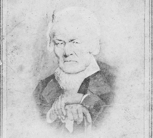
![Patric Gass, c, 1860]()
Patrick Gass, c. 1860.
Patric Gass, c, 1860 Courtesy Oreg. Hist. Soc. Research Lib., OrHi105022
-
![Mural in Capitol rotunda, “Lewis and Clark at Celilo Falls on the Columbia”]()
State Capitol, Lewis .
Mural in Capitol rotunda, “Lewis and Clark at Celilo Falls on the Columbia” Mural by Frank Schwarz, courtesy Oreg. Dept. of Trans., Travel Div., 3295
Related Entries
-
![Cathlapotle]()
Cathlapotle
Cathlapotle is the archaeological site of a major Chinookan town locate…
-
![Concomly (1765?-1830?)]()
Concomly (1765?-1830?)
Of the several Chinook men called Concomly at one time or another, the …
-
Fort Clatsop
Built in 1805 near present-day Astoria, Fort Clatsop was the winter qua…
-
John Colter (ca. 1775-1813)
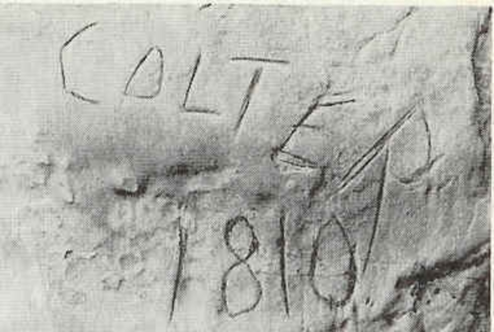
John Colter was a member of the Corps of Discovery, commanded by Meriwe…
-
![Lewis and Clark Bicentennial]()
Lewis and Clark Bicentennial
At least ten years before 2004, the 200th anniversary of Meriwether Lew…
-
![Meriwether Lewis (1774-1809)]()
Meriwether Lewis (1774-1809)
Reflecting on Meriwether Lewis after his death, Thomas Jefferson bemoan…
-
![Patrick Gass (1771-1870)]()
Patrick Gass (1771-1870)
Patrick Gass was one of the early enlistees in the expeditionary force …
-
![Sacagawea]()
Sacagawea
Sacagawea was a member of the Agaideka (Lemhi) Shoshone, who lived in t…
-
![Salal]()
Salal
Both Meriwether Lewis and William Clark wrote about salal (Gaultheria s…
-
![William Clark (1770-1838)]()
William Clark (1770-1838)
William Clark is indelibly connected to Oregon in many ways, some obvio…
-
![York (ca. 1770–?)]()
York (ca. 1770–?)
York was William Clark's slave and an integral member of the Lewis and …
Related Historical Records
Map This on the Oregon History WayFinder
The Oregon History Wayfinder is an interactive map that identifies significant places, people, and events in Oregon history.
Further Reading
Donald Jackson, ed. Letters of the Lewis and Clark Expedition, 2 vols., 2d ed. Urbana: Universityof Illinois Press, 1978.
Gary E. Moulton, ed. An American Epic of Discovery: The Lewis and Clark Journals. Lincoln: University of Nebraska Press, 2003.
James P. Ronda. Jefferson’s West: A Journey with Lewis and Clark. Monticello, VA: Thomas Jefferson Foundation, 2000.
James P. Ronda. Lewis and Clark Among the Indians. Lincoln: University of Nebraska Press, 1984.
Jon Meacham, Thomas Jefferson: The Art of Power. New York: Random House, 2012.
Richard Engeman. “Research Files: The Jefferson Peace Medal: Provenance and the Collections of the Oregon Historical Society.“ Oregon Historical Quarterly (Summer 2006): 290-98.
William L. Lang and Carl Abbott. Two Centuries of Lewis and Clark: Reflections on the Voyage of Discovery. Portland: Oregon Historical Society Press, 2004.

