Located on the Multnomah Channel twenty miles northwest of Portland, Scappoose is one of seven incorporated cities in Columbia County. The Multnomah Channel flows north a mile east of the city, and its opposite shore embraces the west side of Sauvie Island. Before incorporation in 1921 defined the city’s boundary, Scappoose was described as “all the territory from Scappoose Bay to Rocky Point,” a distance of twelve to fifteen miles. As Portland grew and became a center of commerce in the Pacific Northwest, locals decided to promote the town as a suburb to share in the larger city’s prosperity. That ambition continued well into the twentieth century, and Scappoose, with a 2020 population of 8,010, is now a net exporter of workers to the Portland metropolitan area.
The name Scappoose is derived from Skáppus (also sqə́pus), a Chinookan village on the west side of the Multnomah Channel. The village was a Native trading site that early resettlers described as the Scappoose Plains, a thousand acres of land in the Wapato Valley surrounded by 6,000 acres of wetlands. Chinookan Chief Kiesno (Cassino) was the valley’s principal Indian leader from 1811 to 1847. His village, Gatlakmap, was near Skáppus, but farther south along present-day Scappoose Bay.
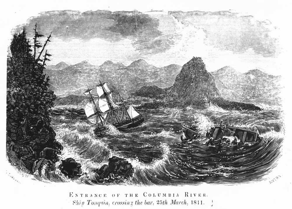
In 1832, fur trader Thomas McKay took a leave from the Hudson’s Bay Company and began farming on the Scappoose Plains opposite the lower end of Wapato (Sauvie) Island. McKay’s stepfather was John McLoughlin, HBC chief factor at Fort Vancouver. His mother was Marguerite Waddens McKay, whose husband (and Thomas’s father), Alexander McKay, was killed in the merchant-ship Tonquin disaster near Nootka Sound in 1811. Thomas McKay is buried on his Scappoose farm.
In the mid-nineteenth century, EuroAmerican resettlers chose the area for its rich alluvial soil, access to deep water, and plentiful fish and game. Dairy farming, logging, sawmills, and fishing were the leading industries in the nineteenth and early twentieth centuries. Before the arrival of the Northern Pacific Railroad in 1883, the primary means of transportation for people and commodities was steamboats and wagons. Guided by an ancient Indian trail, those who built the St. Helens–Hillsborough Territorial Road in the early 1850s provided an important trade route through Scappoose and over the hills to the Tualatin and Willamette Valleys.
The railroad quickly became the favored means of conveyance and inspired the growth of businesses near a train station in what would become downtown Scappoose. Trains and steamships on the Multnomah Channel made regular stops to pick up dairy and timber products, including huge quantities of cordwood cut in the hills and valleys west of Scappoose.
With a population of 151 people, Scappoose was incorporated in July 1921, with James Grant Watts as the first mayor. Watts, who was born in Scappoose in 1864, taught school and managed a store and post office; he also was elected Columbia County’s first school superintendent and served as county clerk. Grant Watts Elementary School in Scappoose bears his name.
In 1927, the Scappoose Drainage District built a levee along the west side of Multnomah Channel, which drained wetlands and opened up thousands of acres to agriculture. Part of this area is now within the northeast city limits, including the Scappoose Airport (1926), located within the 196-acre Scappoose Industrial Airpark.
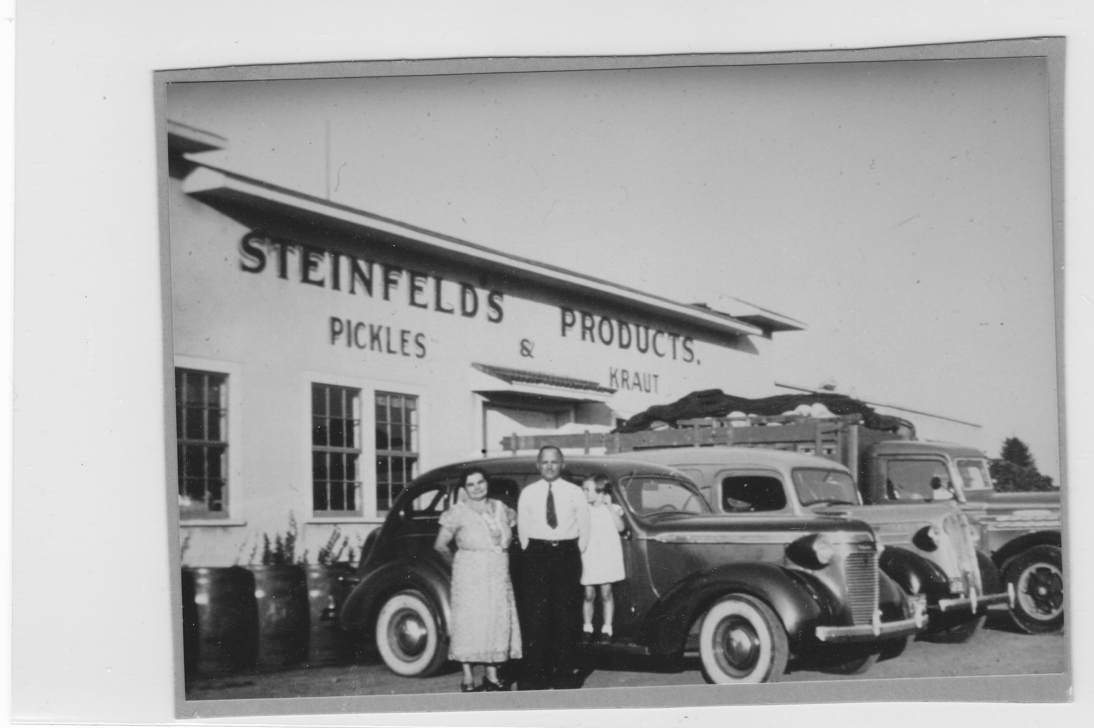
Between 1930 and 1950, the city’s population increased from 248 to 659. Two of the largest employers were the West Coast Shoe Company (Wesco) and the Peterson & Dering nursery, which together employed more than a hundred people by 1950. In 1990, when the town’s population was 3,575, the largest businesses were Steinfelds Products, Wesco, OS Systems, and Thriftway grocery. In the summer of 2016, Cascade Inc. began construction on a 600,000-square-foot paper conversion and packaging plant. Also that year, the Oregon legislature approved $7.5 million for the Oregon Manufacturing Innovation Center, a workforce training facility.
Scappoose High School has had several winning sport teams, most recently taking the 2015 4A state championships in girls soccer (the second time in three years) and boys basketball. Beginning in 2000, the boys 3A football team won three state championships in a row. Two graduates, quarterback Derek Anderson and linesman David Mayo, were on the roster for the Carolina Panthers in the 2015 Super Bowl.
Michael Curry, who is internationally recognized for his theatrical puppetry designs, works in rural Scappoose, where he employs as many as fifty people at his “imagination” workspace. Curry and his team have produced characters for Disney Productions, the Olympics, Cirque du Soleil, Broadway productions, Super Bowls, and the Oregon Symphony.
Scappoose Bay, which is popular with kayakers, is an important wildlife habitat and stopover for birds on the Pacific Flyway. At the north end of Scappoose is the over twenty-mile-long Crown-Zellerbach Trail for hikers, cyclists, and horseback riders. Established in 1964 on an old rail line (later converted to a logging road by Crown Zellerbach Corporation), the trail heads west from Scappoose toward Vernonia; it is maintained by Columbia County.
The Scappoose Peace Candle of the World on Highway 30 welcomes visitors to the town. Darrel and Mona Brock of Western Candles Ltd. built the candle in 1971, covering a 50-foot-high silo in wax and outfitting it with a wick. The candle, which is maintained by private owners, is now topped by a neon flame.
-
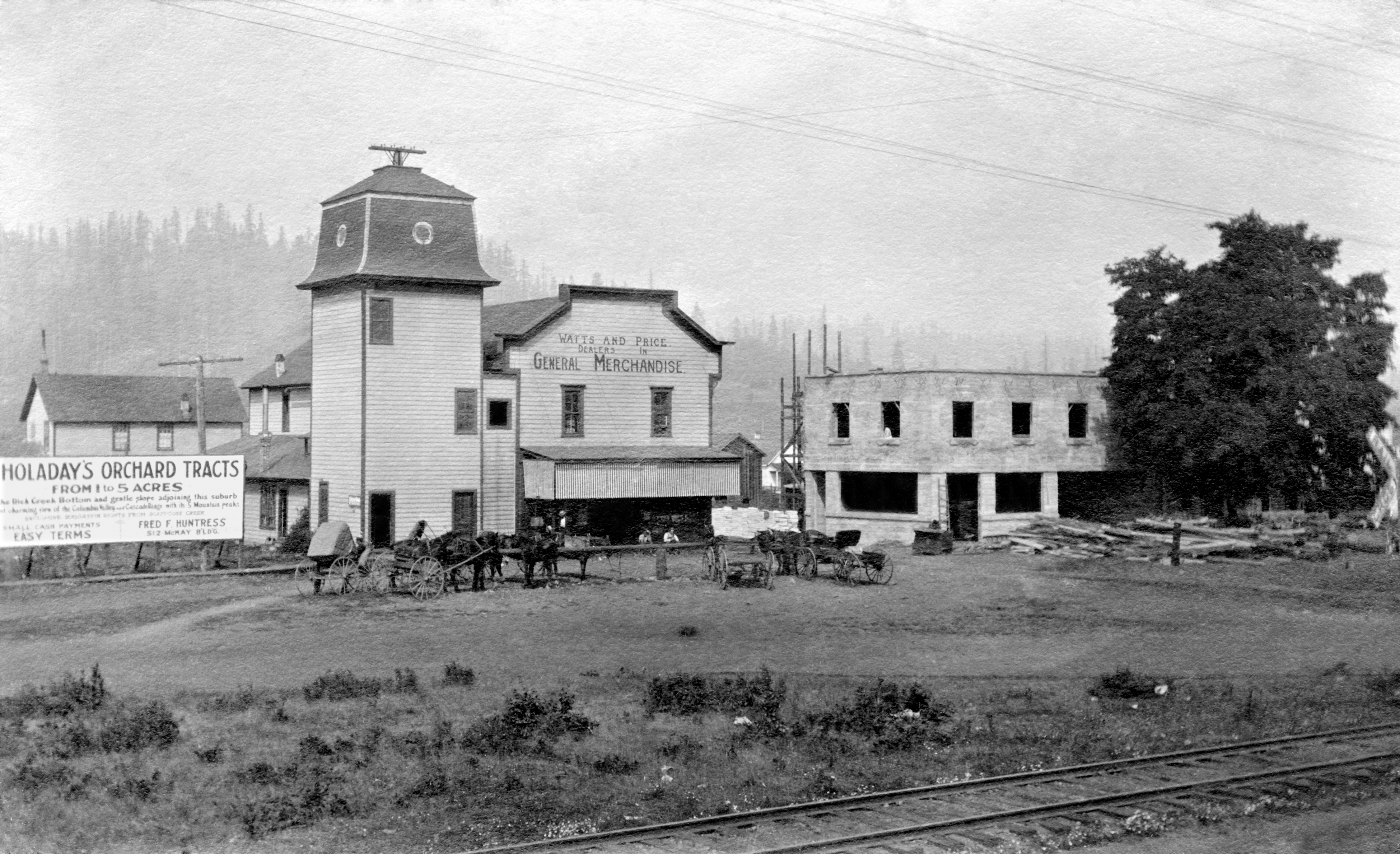
![]()
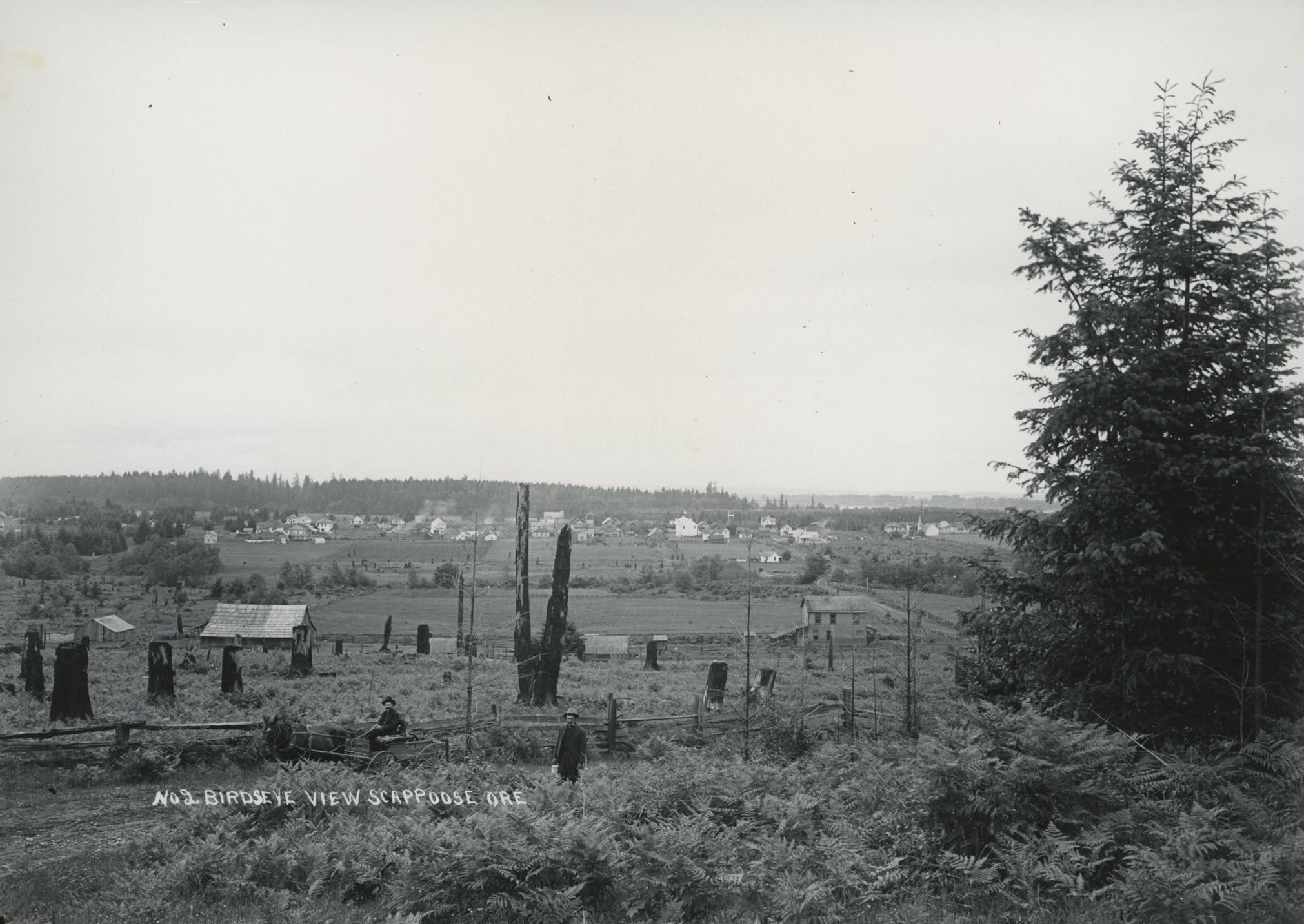
Early photograph of Scappoose.
Courtesy Oregon Hist. Soc. Research Lib., 18108
-
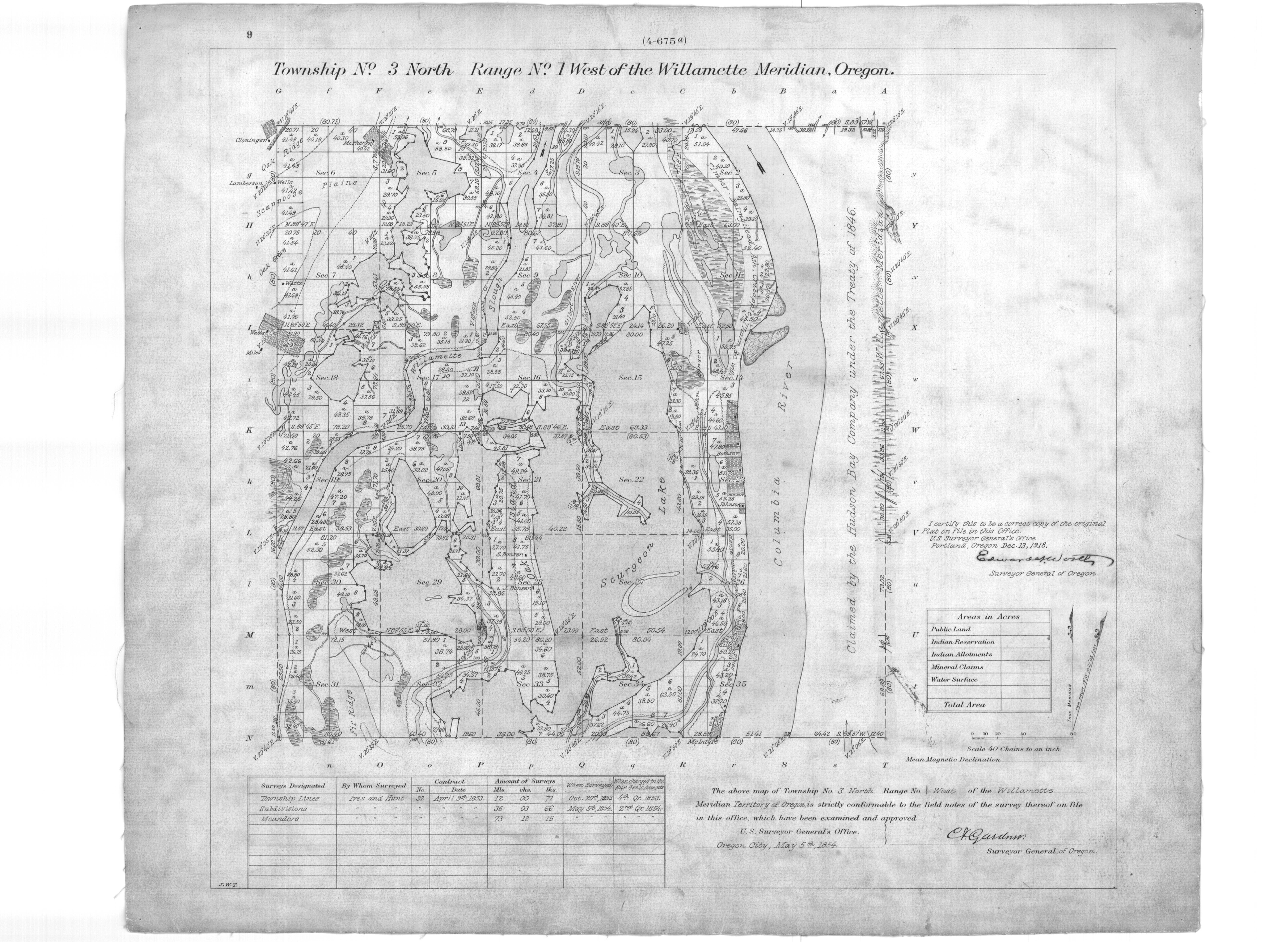
![]()
Map of Scappoose plains (upper left corner), 1854.
Public Domain
-
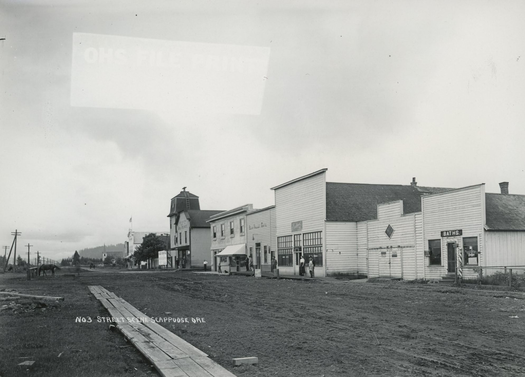
![]()
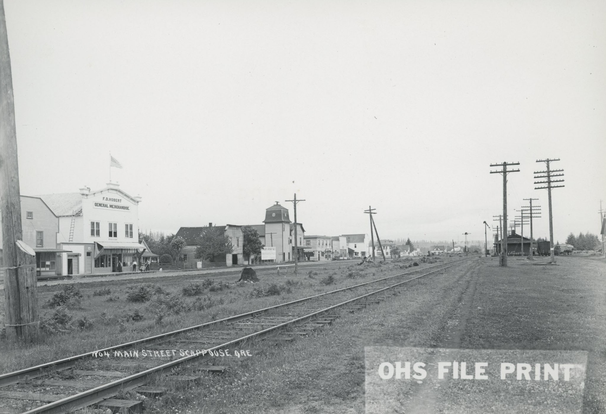
Main Street, Scappoose, 1912.
Courtesy Scappoose Historical Society
-
![]()
Early photograph of Scappoose.
Courtesy Oregon Hist. Soc. Research Lib., 18110
-
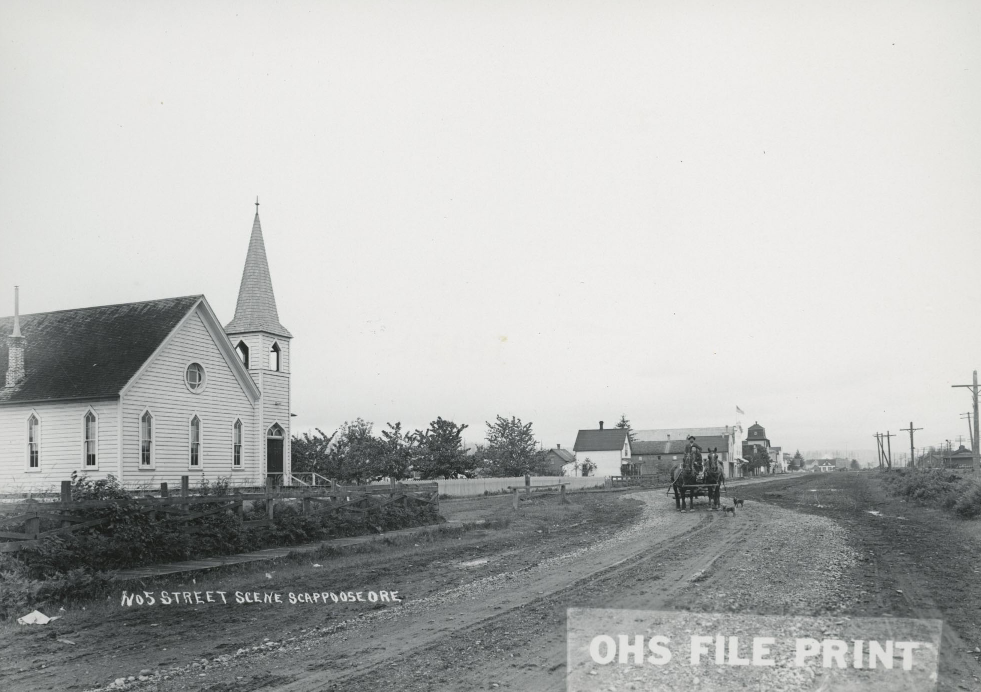
![]()
Main St., Scappoose.
Courtesy Oregon Hist. Soc. Research Lib., 18109
-
![]()
Spokane, Portland and Seattle Railway depot, Scappoose.
Courtesy Oregon Hist. Soc. Research Lib., 18112
-
![]()
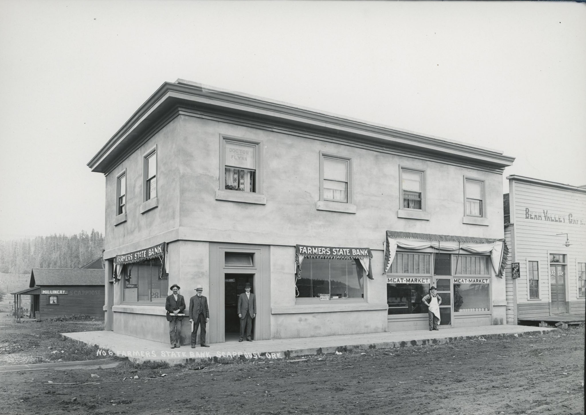
Farmers State Bank, Scappoose.
Courtesy Oregon Hist. Soc. Research Lib., 18111
-
![]()
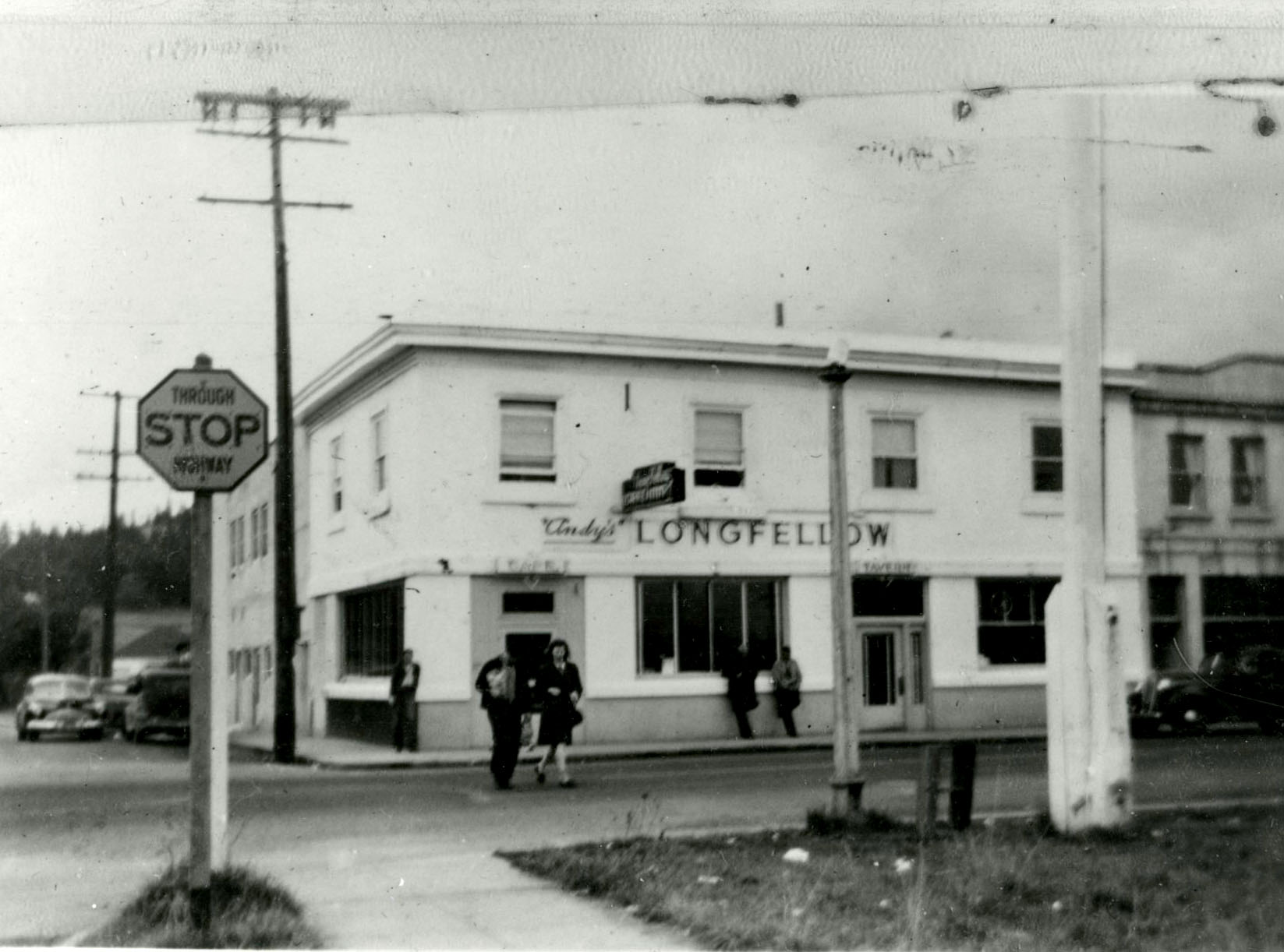
Andy's Longfellow Building, First St., Scappoose.
Courtesy Oregon Hist. Soc. Research Lib., Orhi086751
-
![]()
Scappoose, Oregon.
Courtesy Oregon Hist. Soc. Research Lib., 18106
-
![]()
Scappoose, Oregon.
Courtesy Oregon Hist. Soc. Research Lib., 18107
-
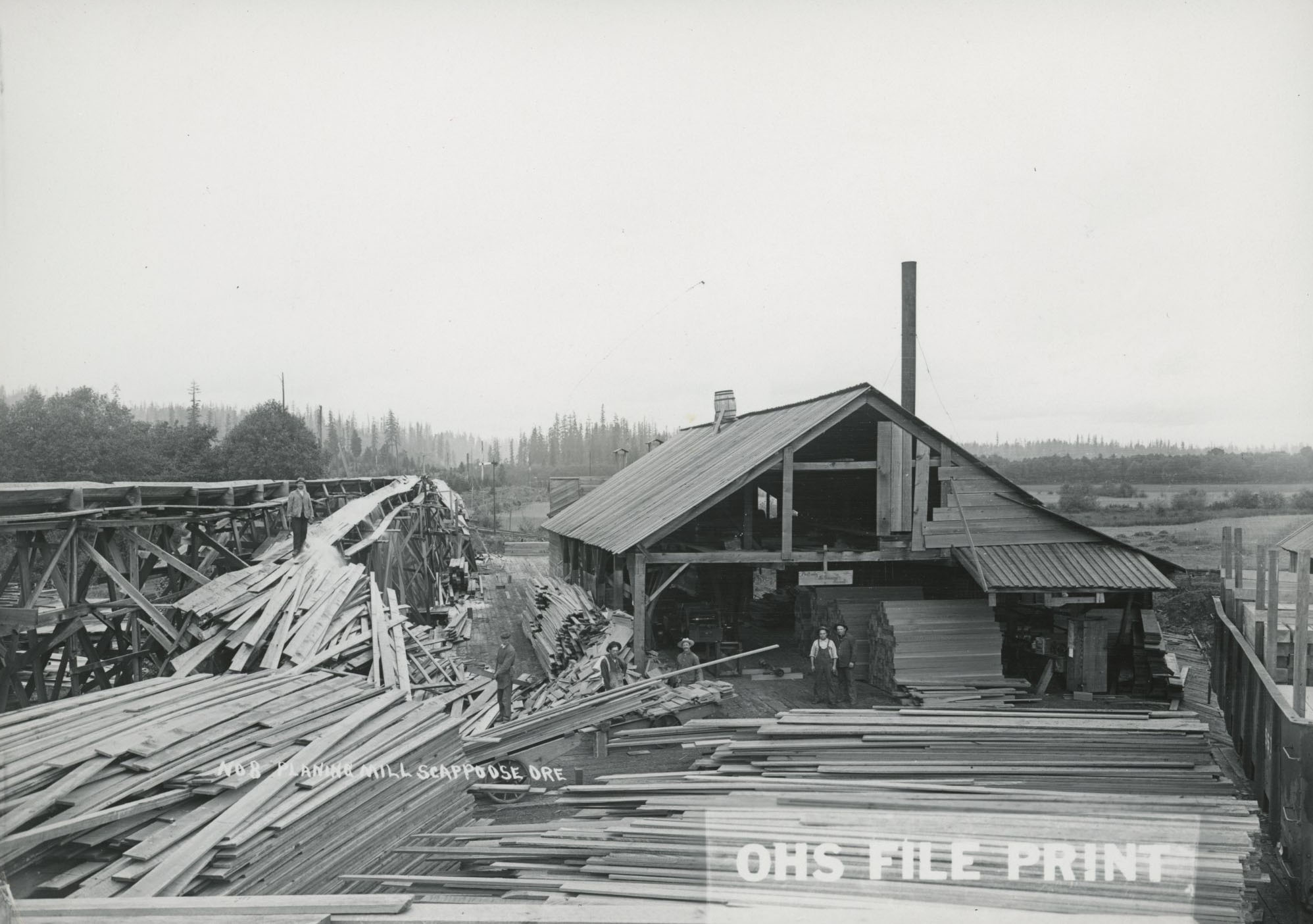
![]()
Planing Mill, Scappoose.
Courtesy Oregon Hist. Soc. Research Lib., 18113
-
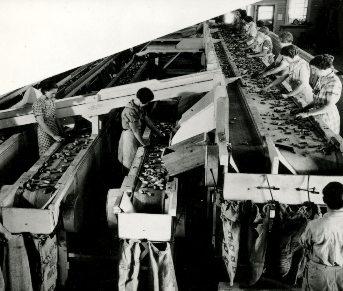
![]()
Women sorting cucumbers for pickles, California Conserving Co., Scappoose, 1936.
Courtesy Oregon Hist. Soc. Research Lib., 023594
-
![]()
Steinfeld's Products in Scappoose.
Courtesy Scappoose Historical Society
-
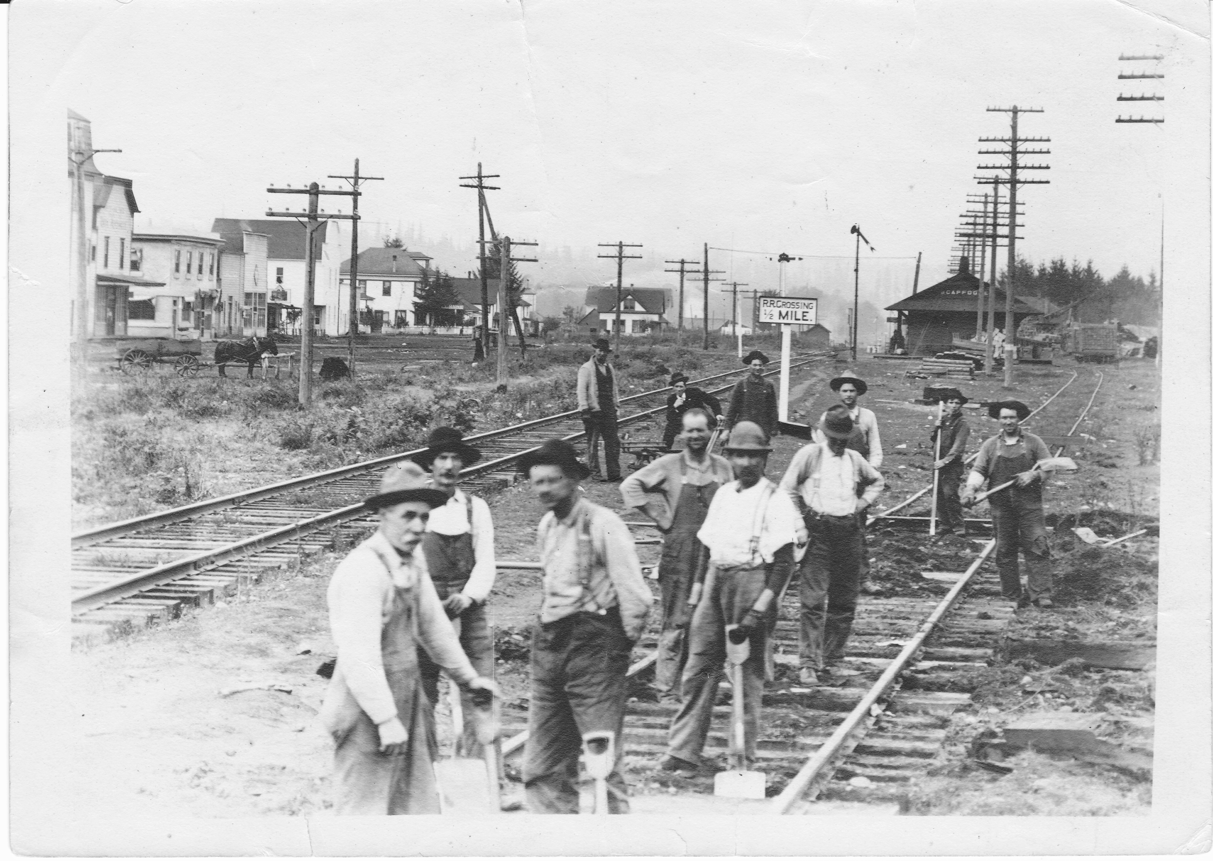
![]()
Men working on railroad tracks at the Scappoose business district, c. 1920.
Courtesy Scappoose Historical Society
-
![]()
Treehouse, Scappoose.
Courtesy Oregon Hist. Soc. Research Lib., 18115


Related Entries
-
![Kiesno (Chief Cassino) (1779?-1848)]()
Kiesno (Chief Cassino) (1779?-1848)
Chief Kiesno (his name has also been spelled Keasno, Casino, Kiyasnu, Q…
-
![Multnomah (Sauvie Island Indian Village)]()
Multnomah (Sauvie Island Indian Village)
"Multnomah" is a word familiar to Oregonians as the name of a county an…
-
![Portland]()
Portland
Portland, with a 2020 population of 652,503 within its city limits and …
-
![Portland Basin Chinookan Villages in the early 1800s]()
Portland Basin Chinookan Villages in the early 1800s
During the early nineteenth century, upwards of thirty Native American …
-
![Scappoose Peace Candle of the World]()
Scappoose Peace Candle of the World
The Peace Candle of the World is a distinctive landmark on Highway 30, …
-
![Thomas McKay (1797-1849/1850?)]()
Thomas McKay (1797-1849/1850?)
Thomas McKay (pronounced “Mac-eye”) was a Hudson’s Bay Company fur trap…
-
![Willamette River]()
Willamette River
The Willamette River and its extensive drainage basin lie in the greate…

Related Historical Records
Map This on the Oregon History WayFinder
The Oregon History Wayfinder is an interactive map that identifies significant places, people, and events in Oregon history.
Further Reading
"Scappoose History Not Blotted By Progress of Community." Scappoose Register, March 2, 1928.
Watts, James Loring. History of Scappoose. Edited by Irene L. Watts and Mrs. James Loring Watts. Scappoose, Ore.: Scappoose Historical Society, 2004.
Zenk, Henry. "Notes on Native American Place-Names of the Willamette Valley Region." Oregon Historical Quarterly 109.1 (Spring, 2008).