The Willamette River, in its natural state, has been subject to annual flooding, at times severe. Draining an area of over 11,200 square miles, the river supplies water for agricultural, industrial, municipal, and domestic purposes in the Willamette Valley. Between November and February, heavy rains often fall on the deep snow in the Cascade Range.
In the 1890s, when the rains were accompanied by a sharp temperature rise and heavy precipitation in the valley, the Willamette River could experience major floods. The flood of June 1894 was one of the worst such high-water events of the nineteenth century in Oregon. The effects of the high water on the Willamette were hightened by similar flooding on the Columbia River at the same time.
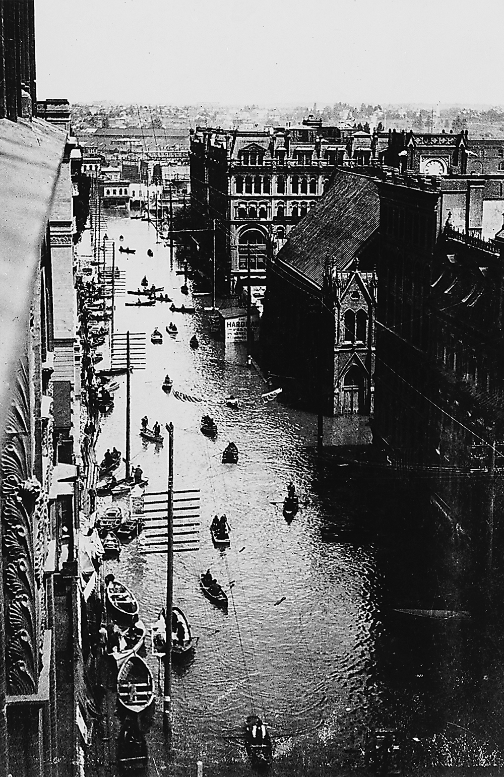
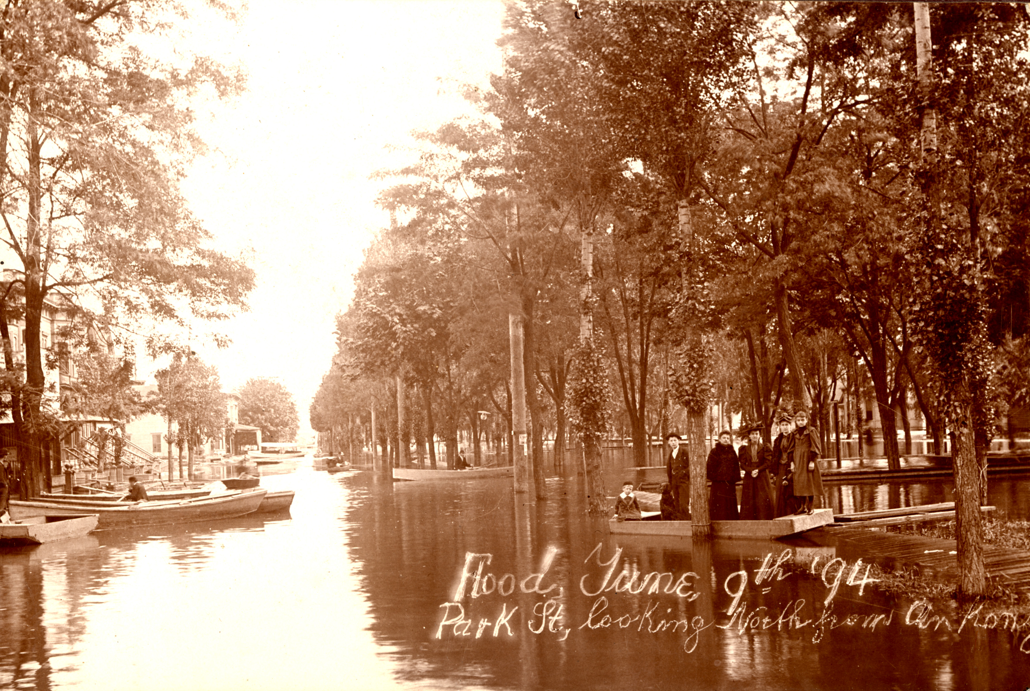
That year, floodwaters inundated agricultural land, eroding soils, killing livestock, and damaging farm buildings. The rampaging Willamette flooded towns along its banks, destroying mills, docks, warehouses, and transportation facilities. At Portland, the river reached a high-water mark of 33.5 feet, the worst flood ever recorded in the city. Surging high water covered 250 square blocks and knocked out public utilities, warehouses, and docks. Two drawbridges were stuck open, limiting travel between the east and west sections of the city. Businesses sold merchandise from their second-floor windows or operated from boats floating on city streets.
With more than a hundred miles of track washed out, the Union Pacific Railroad suspended service to the city. The aftermath of the flood was nearly as unpleasant as the flood itself, requiring a major cleanup of dead animals, rotted fish, and sewage.
-
Willamette flood, 1894, OrHi 3845.
3rd St., Portland, between Washington and Burnside during 1894 Willamette River flood, June 1894. Oreg. Hist. Soc. Research Libr., OrHi 3845
-
![Park St., north from Ankeny, in Portland's North Park Blocks during flood, June 9, 1894.]()
Park Blocks, North, Portland, during flood, Jun 6 1894.
Park St., north from Ankeny, in Portland's North Park Blocks during flood, June 9, 1894. Courtesy City of Portland, Oreg., Archives and Records Ctr., AP 7169
Related Entries
-
Willamette River
The Willamette River and its extensive drainage basin lie in the greate…
-
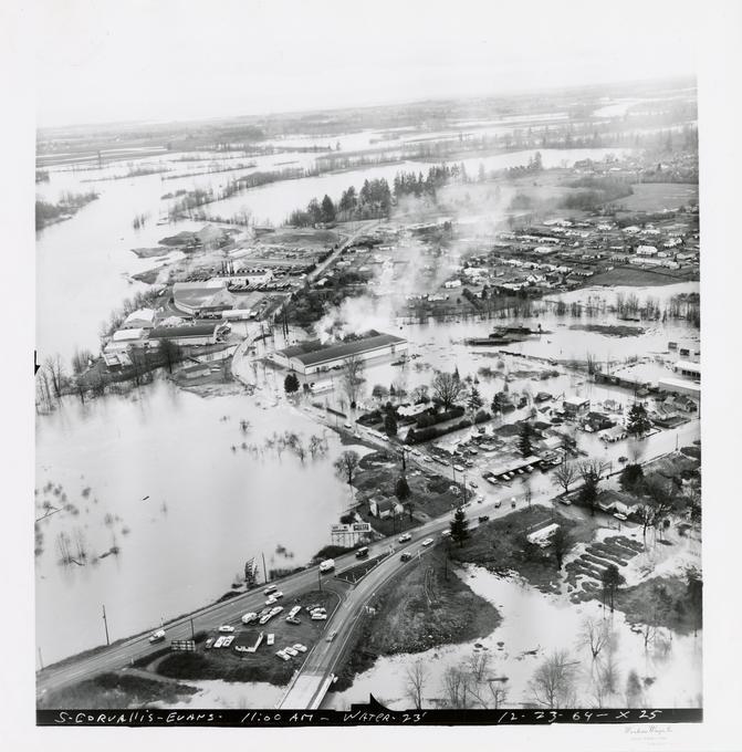
![Willamette River flood of 1964]()
Willamette River flood of 1964
The Willamette River, in its natural state, was subject to annual flood…
-
![Willamette River flood of 1996]()
Willamette River flood of 1996
In 1996, as part of a larger pattern of winter flooding in the Pacific …
Related Historical Records
Map This on the Oregon History WayFinder
The Oregon History Wayfinder is an interactive map that identifies significant places, people, and events in Oregon history.
Further Reading
MacColl, E. Kimbark. The Shaping of a City. Portland, Ore.: The Georgian Press Co., 1976.
Willingham, William F. Army Engineers and the Development of Oregon. Washington, D.C.: Government Printing Office, 1983.


