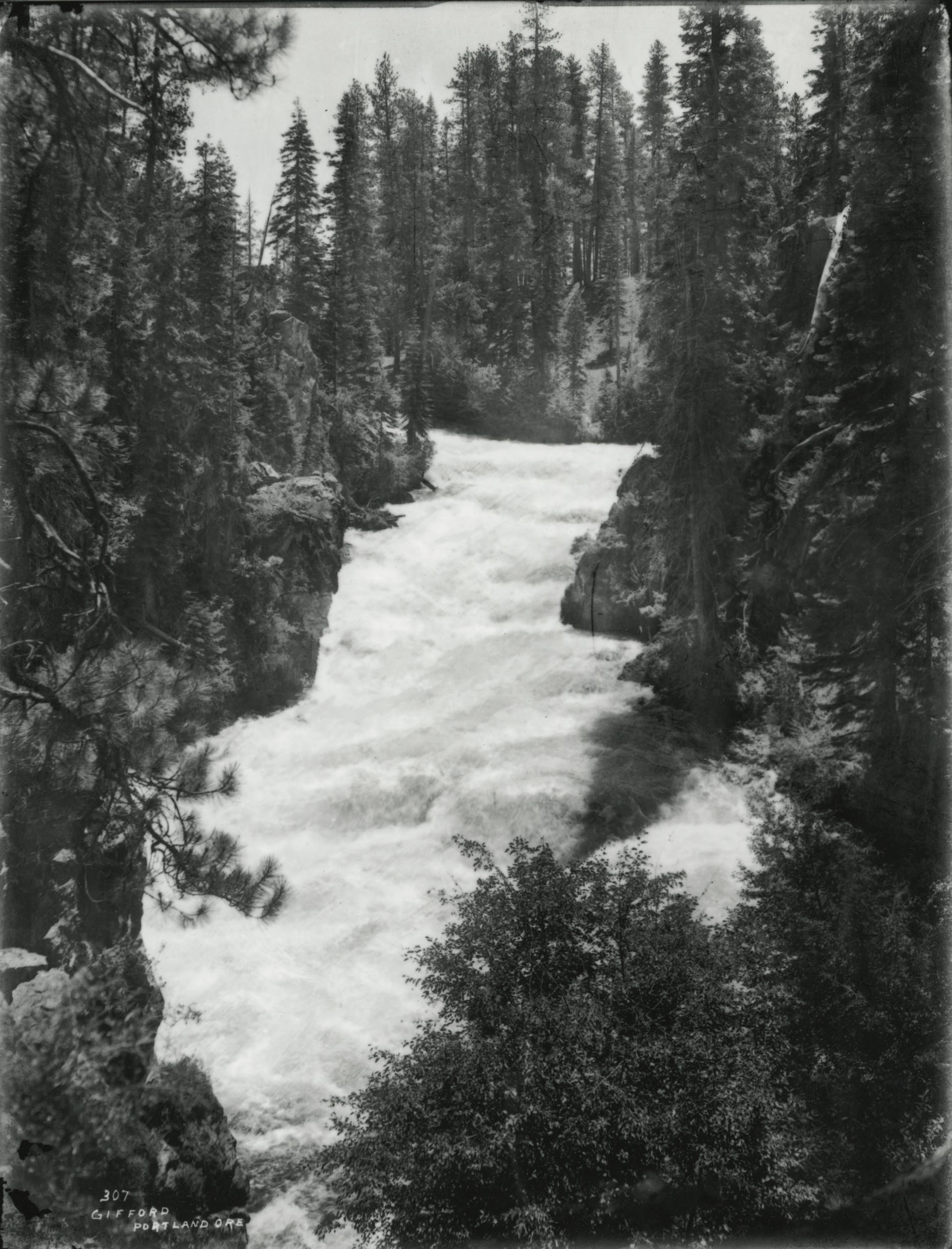
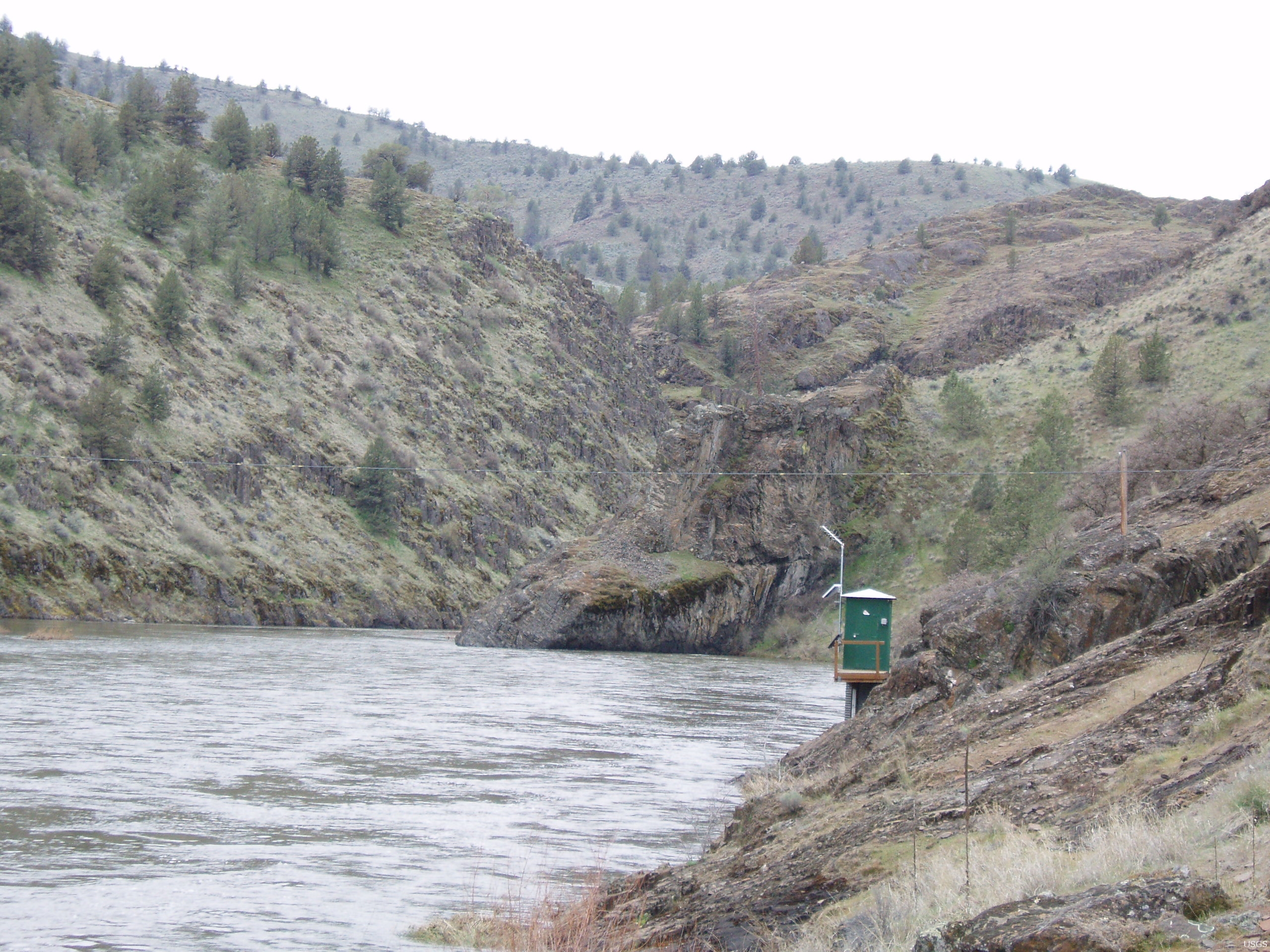
From its headwaters in the fir and ponderosa pine forests of Grant and Harney Counties, the South Fork John Day River flows northward for about sixty miles to the river’s main stem near Dayville, carving a corridor through the rocky basalt, rangeland, and western juniper woodland of the far south Columbia Plateau in central Oregon. With the majority of its length designated an Oregon scenic waterway and a national wild and scenic river, the South Fork provides important habitat for fish and wildlife, including summer steelhead and bighorn sheep, and serves as a gateway to recreational activities managed by state and federal agencies.
The South Fork watershed is nearly 390,000 acres, including the basin of its tributary, Murderers Creek. At the river’s mouth, at an elevation of 2,369 feet, the South Fork’s discharge ranges annually from 90 to 270 cubic feet per second. Discharge varies seasonally as well, with the highest rates—typically from 400 to 500 cubic feet per second—occurring in April and May, owing to snowmelt from the river’s headwaters at 5,400 to 5,600 feet altitude.
At the boundary of the Malheur National Forest just below Donivan Creek, the South Fork becomes a national wild and scenic river for 47 miles. It is classified as a recreational wild and scenic river, due in part to its adjacent South Fork Road, 50 miles of which is nationally designated as the South Fork John Day Back Country Byway. Scenic highlights include Izee Falls, the narrow basalt canyon corridor near Black Canyon Creek, and the historic riparian ranches on the lower river.
The water quality of the South Fork, along with the river’s main stem, suffers due to high water temperatures, high pH, and dissolved oxygen levels; but the South Fork nevertheless hosts nonnative game fish, native and hatchery redband trout, and an estimated 7 percent of the summer steelhead population in the John Day River system. When high water levels occur, adult spring chinook salmon spawn in sections of the river between Murderers Creek and Izee Falls, and juveniles migrate out of the main river to feed on the river’s insects.
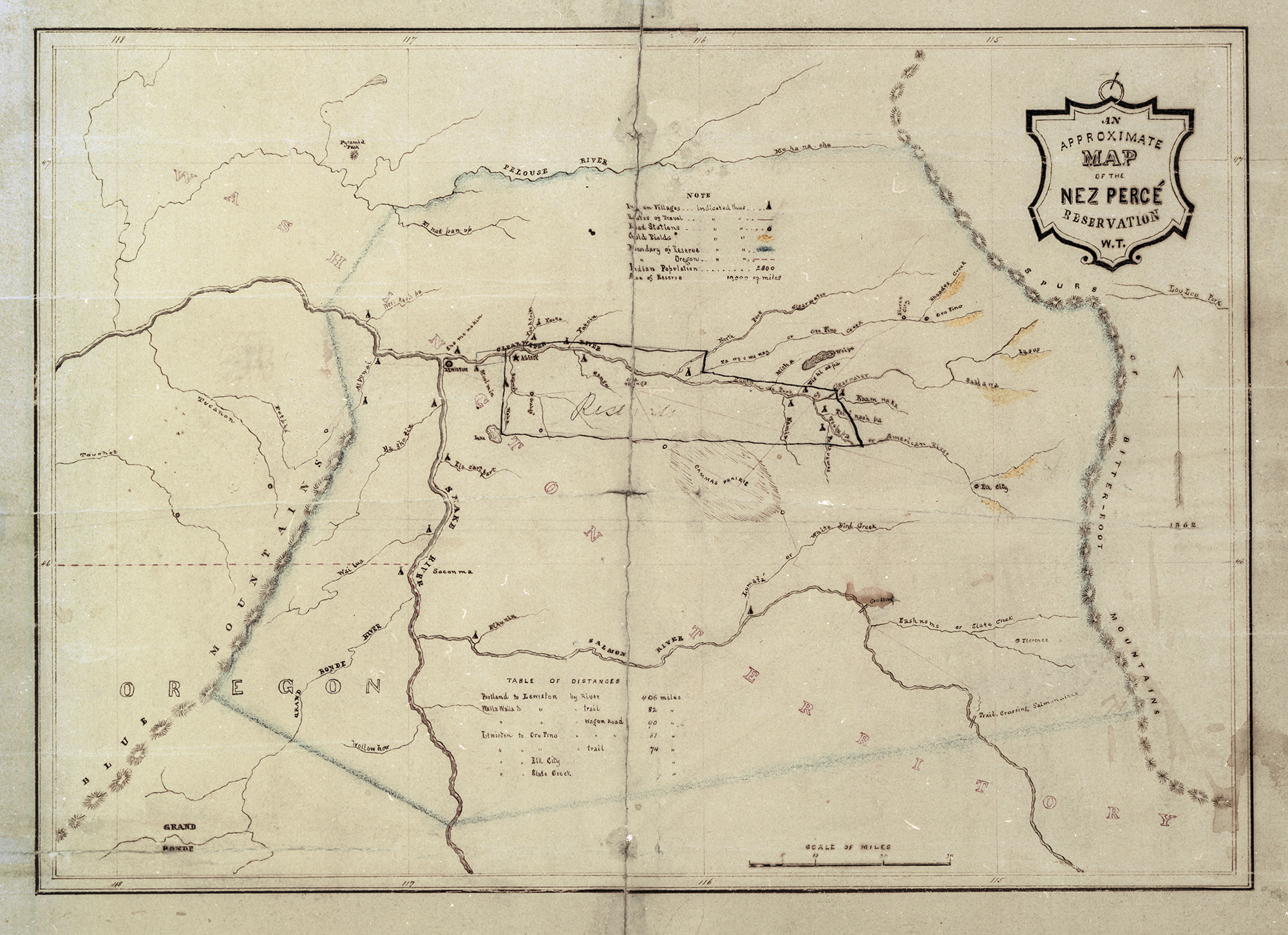
Tribal histories and the archaeological record indicate that the corridor has long been important to Native peoples and their ancestors, including Columbia Plateau and Northern Paiute Indians. The John Day River’s watershed is within the ceded boundaries of the Confederated Tribes of the Umatilla Reservation, and the South Fork watershed is included in the traditional territory of the Burns Paiute Tribe, who have a long tradition of using the river corridor for fishing, hunting, and berry picking.
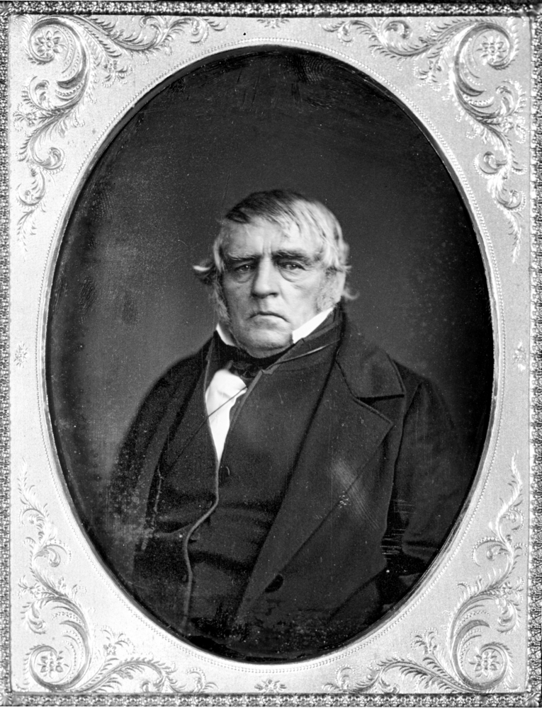
Like the John Day River, the South Fork is named for John Day, a member of the Pacific Fur Company’s overland expedition to Astoria in 1812. Later fur-trapping expeditions into the Snake Country under the Hudson’s Bay Company, in search of beaver and other fur-bearing animals, explored sections of the South Fork as early as January 1826.
The discovery of gold in the watersheds of the main stem of the John Day and its North Fork brought increased conflict with the Northern Paiutes, and the South Fork corridor factored heavily into the resulting punitive military expeditions known as the Snake Conflict. Volunteers from the First Oregon Cavalry established the temporary Camp Lincoln on the South Fork’s lower reaches in 1864 and used the canyon to access the river’s headwaters, the Harney Valley, and other Northern Paiute strongholds. In 1864, volunteers attacked a party of Northern Paiutes crossing the river near the mouth of Black Canyon Creek; and in 1865, in what became known as Garber’s Fight (after an army sergeant killed there), volunteers attacked a camp on the river near present-day Izee. The killing of a party of miners in the river corridor in the 1860s gave name to Murderers Creek, a South Fork tributary. During this period, resettlers established nearby farms and introduced livestock, beginning the area’s ranching tradition, which is still present today.
In 1972, the Oregon Department of Fish and Wildlife established what is now known as the Phillip W. Schneider Wildlife Area, encompassing nearly 52,000 acres of public land around the river’s lower stretch, to protect and restore winter range habitat for mule deer, control wildlife damage, and protect the river’s riparian zones. The Oregon Wilderness Act of 1984 created the 13,400-acre Black Canyon Wilderness on the river’s west side but did not include a proposed 38,200-acre eastside wilderness at Murderers Creek. The U.S. Bureau of Land Management subsequently established the 9,395-acre Aldrich Mountain Wilderness Study Area parallel to the river’s east side.
In 1988, the Omnibus Oregon Wild and Scenic Rivers Act, sponsored by Oregon Senator Mark O. Hatfield, designated 47 miles of the South Fork as wild and scenic. The same year, the Oregon Rivers Initiative designated a section of the South Fork, from the Post–Paulina Road crossing to the Murderers Creek Wildlife Area, as an Oregon State Scenic Waterway. The BLM is the managing agency for the wild and scenic river, and the BLM, the State of Oregon, and the U.S. Forest Service manage public land adjacent to it.
-
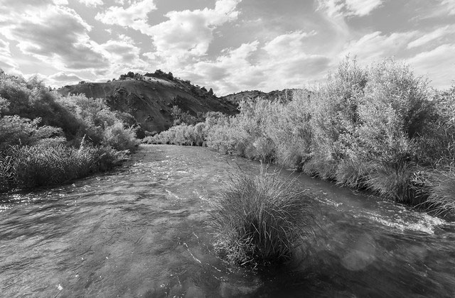
![]()
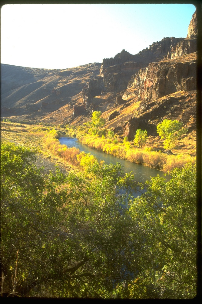
South Fork John Day River, 2017.
Courtesy Bureau of Land Management, photo by Greg Shine
-
![]()
South Fork John Day River, 2017.
Courtesy Bureau of Land Management, photo by Greg Shine
-
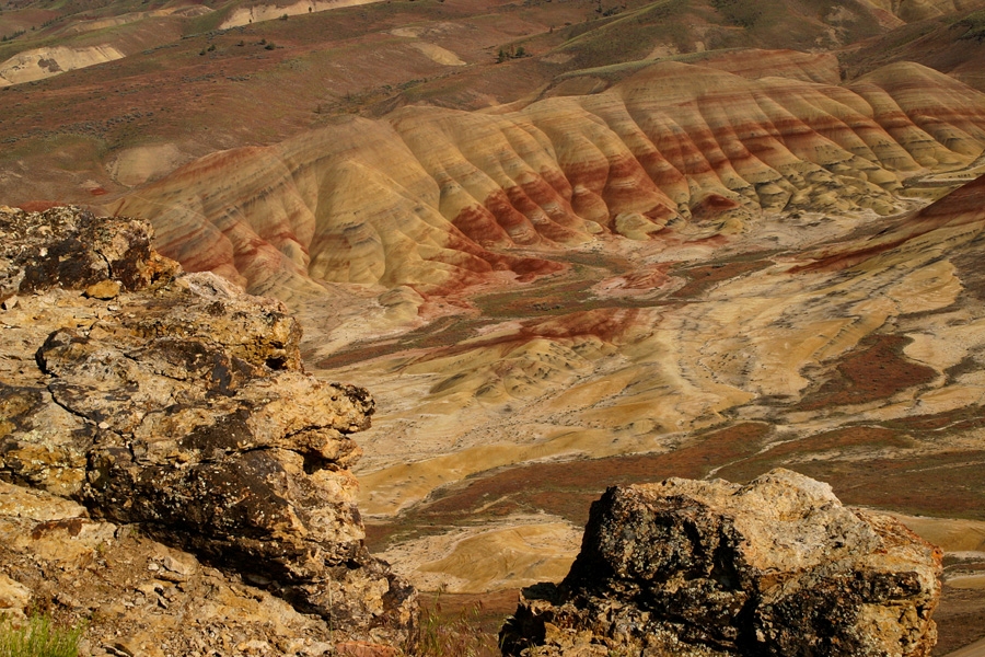
![]()
South Fork John Day River, 2017.
Courtesy Bureau of Land Management, photo by Greg Shine
-
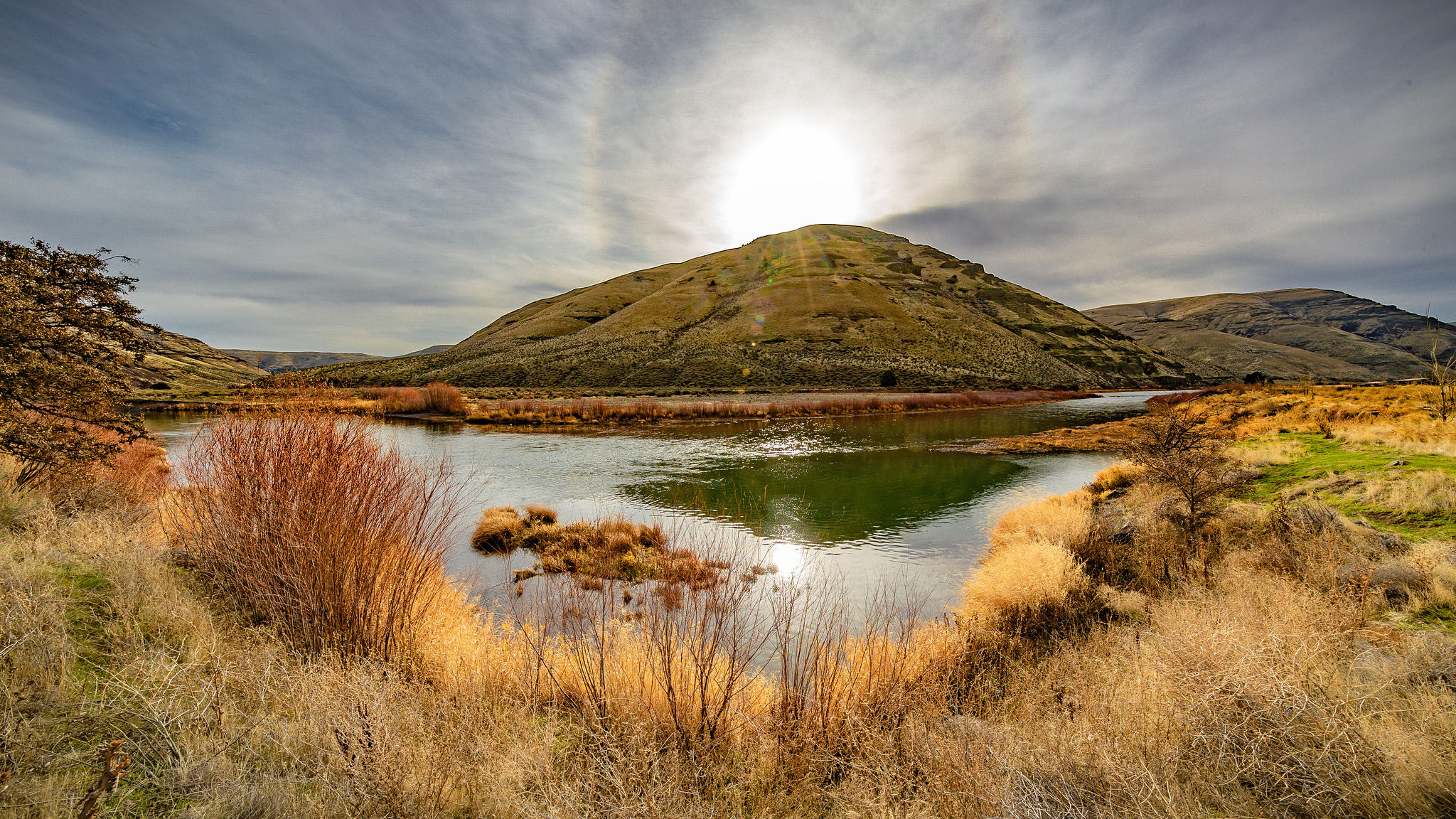
![]()
South Fork John Day River, 2017.
Courtesy Bureau of Land Management, photo by Greg Shine
-
![]()
South Fork John Day River, 2017.
Courtesy Bureau of Land Management, photo by Greg Shine


Related Entries
-
![Fur Trade in Oregon Country]()
Fur Trade in Oregon Country
The fur trade was the earliest and longest-enduring economic enterprise…
-
![John Day Fossil Beds National Monument]()
John Day Fossil Beds National Monument
John Day Fossil Beds National Monument, established in October 1975, sh…
-
![John Day River (north-central Oregon)]()
John Day River (north-central Oregon)
The 281-mile-long John Day River in north-central Oregon is the longest…
-
![National Wild and Scenic Rivers in Oregon]()
National Wild and Scenic Rivers in Oregon
The world's first and most extensive system of protected rivers began w…
-
![Native American Treaties, Northeastern Oregon]()
Native American Treaties, Northeastern Oregon
After American immigrants arrived in the Oregon Territory in the 1840s,…
-
![North Fork John Day River]()
North Fork John Day River
Flowing 113 miles westward from the Blue Mountains, the North Fork John…
-
![Peter Skene Ogden (1790-1854)]()
Peter Skene Ogden (1790-1854)
More than any other figure during the years of the Pacific Northwest's …
-
![U.S. Bureau of Land Management]()
U.S. Bureau of Land Management
The Bureau of Land Management (BLM) administers over 15.7 million acres…
Related Historical Records
Map This on the Oregon History WayFinder
The Oregon History Wayfinder is an interactive map that identifies significant places, people, and events in Oregon history.
Further Reading
Michno, Gregory. The Deadliest Indian War in the West: The Snake Conflict, 1864-1868. Caldwell, Id.: Caxton Press, 2007.
Oregon Department of Fish and Wildlife. Phillip W. Schneider Wildlife Area Management Plan. Salem, Ore.: Oregon Department of Fish and Wildlife, 2006.
Palmer, Tim. Field Guide to Oregon Rivers. Corvallis, Ore.: Oregon State University Press, 2014.
Beckham, Stephen Dow with Florence K. Lentz. Rocks & Hard Places: Historic Resources Study, John Day Fossil Beds National Monument. Seattle: National Park Service, 2006.
U.S. Fish and Wildlife Service. National Wild and Scenic Rivers System, John Day River (South Fork), https://www.rivers.gov/rivers/john-day-sf.php, accessed January 8, 2018.
U.S. Department of Interior, Bureau of Land Management. Record of Decision: John Day River Management Plan, Two Rivers, John Day, and Baker Resource Management Plan Amendments, 2001.