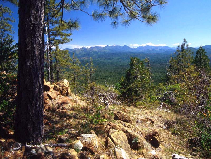
The Bureau of Land Management (BLM) administers over 15.7 million acres of public land in Oregon, equal to about twenty-five percent of the state's total acreage. About 13.5 million acres in the state are in the public domain, while about 2 million acres are the densely forested O&C Lands of western Oregon (former railroad-grant land that was returned to the government by federal court decision in 1913). The diverse domain of the BLM in Oregon extends westward from the Idaho state line, to the sagebrush-dominated rangelands of eastern and central Oregon, to highly productive timberlands in the west, to the scenic rocky stretches of the Pacific coastline. As landlord of such a large area, the BLM plays a substantial role in Oregon’s economy and in its management of natural resources.
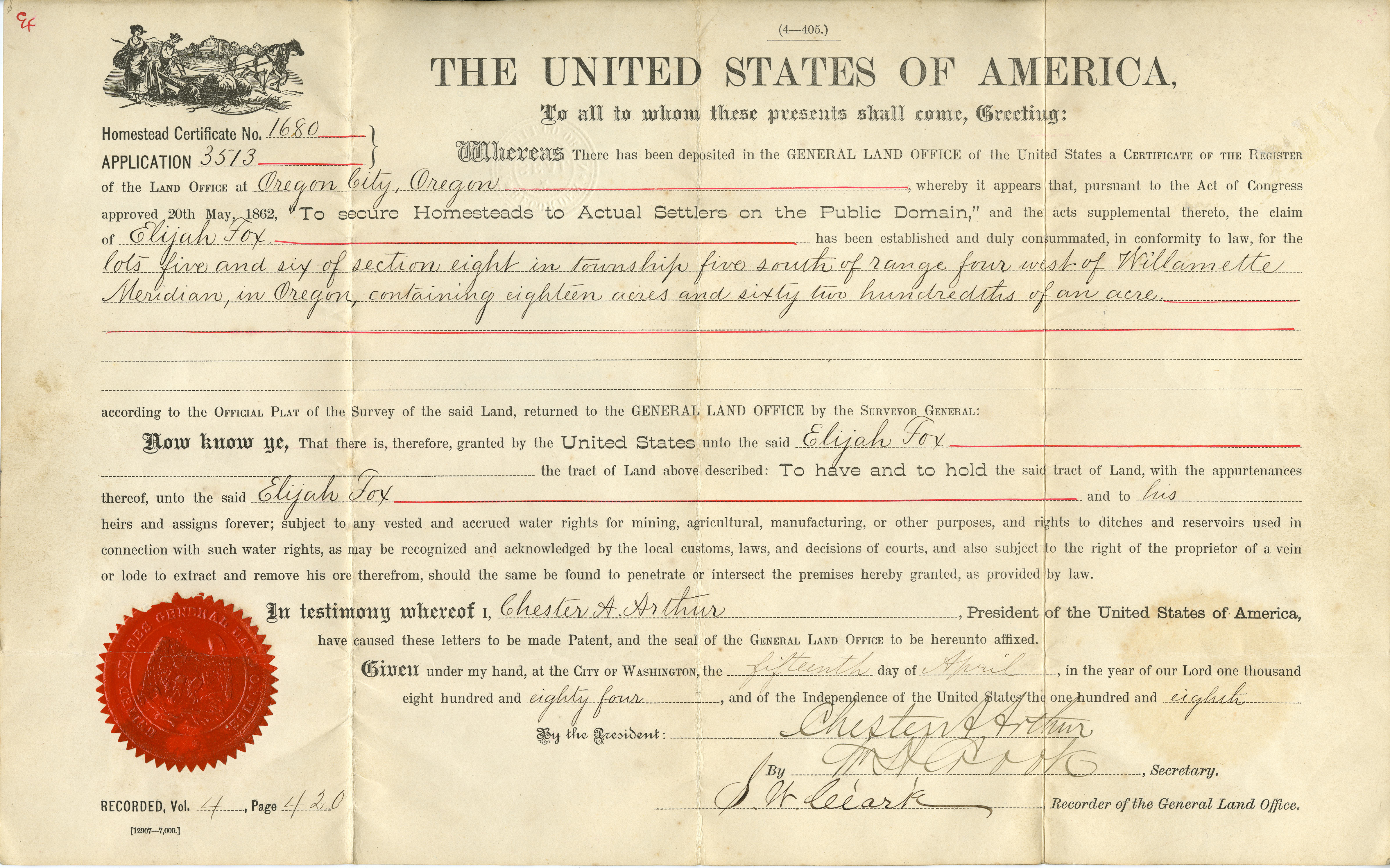
Established in 1946 in the U.S. Department of the Interior, the BLM had its beginnings in laws passed well over a century earlier. The Land Ordinance of 1785 established the nation's public domain from the acquired lands west of the original thirteen states, and the General Land Office (GLO) was created in 1812 to dispose of the public domain by facilitating its conversion into private landholdings through sale, grant, and homestead claim.
In the last half of the nineteenth century and well into the twentieth, the GLO in Oregon not only surveyed the public estate but also transferred ownership of land parcels to thousands of individuals and corporations. With the withdrawal of national forests, national parks, and national wildlife refuges from the public domain, however, Americans began to consider their remaining public lands as a legacy to preserve rather than as real estate to sell or give away. In 1916, the Chamberlain-Ferris Act gave the GLO in Oregon a new and unique role—to administer the sale of timber from the recently revested O&C Lands.
By the time of the Great Depression, public-domain lands consisted largely of remote arid terrain in the western states. The "lands nobody wanted," as they were called, had been heavily used for decades by stockmen as open range. The 1934 Taylor Grazing Act essentially ended the nation's disposal policy of the previous 150 years. Removing the GLO from oversight of many of the grazing areas, the act also established the U.S. Grazing Service to administer federal rangelands organized into grazing districts, including much of the eastern two-thirds of Oregon.
The GLO's remaining responsibilities in Oregon changed dramatically with the O&C Lands Act of 1937, which designated the revested checkerboard as permanent federal forestland. The land was to be managed by foresters of the GLO's new O&C Administration for an ongoing supply of timber to benefit the financially hard-pressed counties in western Oregon. The GLO still conducted cadastral surveys of federal lands and administered mining claims and mineral leases.
After World War II, President Harry S. Truman combined the Grazing Service and the GLO to form the Bureau of Land Management. Because of its emphasis on managing for commodity production (the first campgrounds on O&C Lands were not built until the 1960s), the new agency was referred to by some as the "Bureau of Livestock and Mining." During the 1960s and 1970s, however, the BLM broadened its focus, hired more professional staff, and—with passage of the Federal Land Policy and Management Act (FLPMA) of 1976—finally had a coherent, congressionally mandated mission.
In Oregon, BLM's Vale Project in the 1960s was a national showcase on how to improve grazing lands through scientific classification and range-conservation management. The spotted-owl controversy of the 1980s and the resulting 1994 Northwest Forest Plan transformed the "get out the cut" management of O&C forestlands. In 1986, for example, the BLM harvested well over one-and-a-half billion board feet of timber from its O&C Lands; by 2010, the agency's entire timber harvest for Oregon (that is, both O&C and public domain lands) totaled only 160 million board feet.
In addition to grazing permits and leases totaling over 800,000 AUM's (animal unit months), BLM now administers a dozen congressionally designated wild and scenic rivers, including the Rogue, the John Day, and the Owyhee. It also manages nine wilderness areas in Oregon, fourteen Back Country Byways, and eighteen wild-horse herd-management areas, as well as such places as the 53,000-acre Cascade-Siskiyou National Monument and the 426,000-acre Steens Mountain Cooperative Management and Protection Area.
A decentralized agency, BLM’s activities in Oregon are directed by the State Office, in Portland, which also oversees over 436,000 acres of public domain in the State of Washington. BLM’s district managers—with their Oregon district offices in Salem, Coos Bay Roseburg, Medford, Lakeview, Prineville, Burns, and Vale, and the Washington office in Spokane— wield considerable authority. These managers can, with the legally mandated public review and comment, decide their district’s annual timber harvest levels, grazing numbers, and other resource issues. This is meant to provide for well-balanced decisions based on broad-based local input and influence, while preserving the ultimate authority of an administration elected by the American people at large.
-
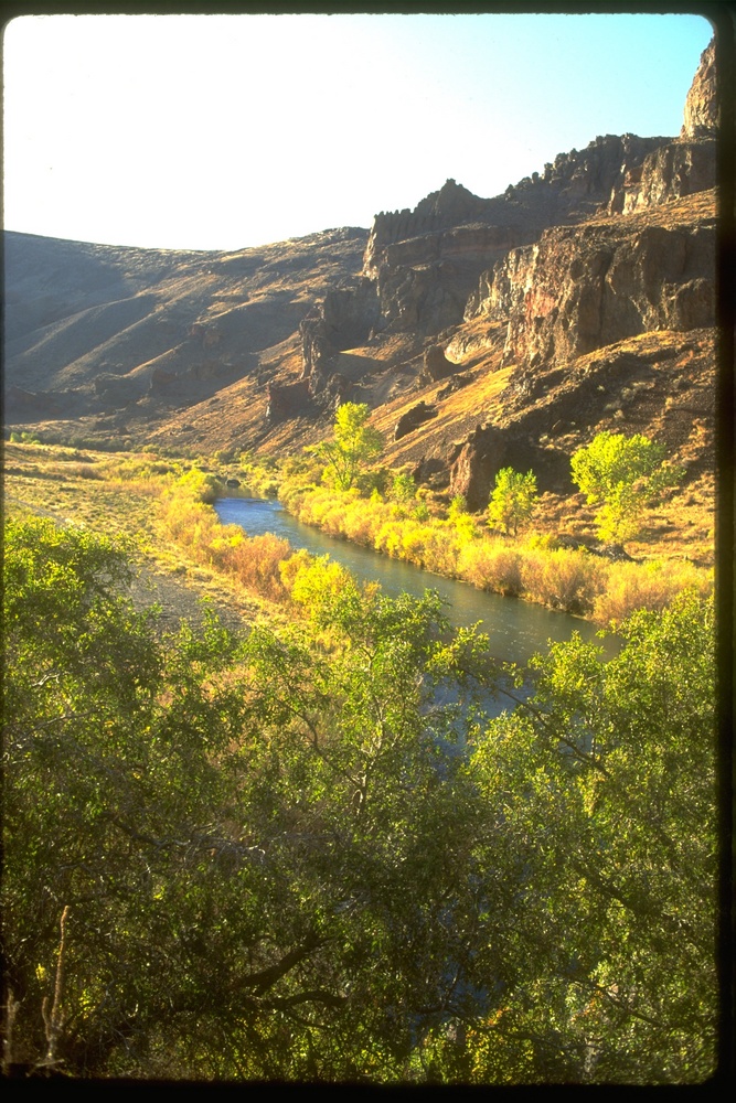
![]()
Owyhee River.
Courtesy Bureau of Land Management
-
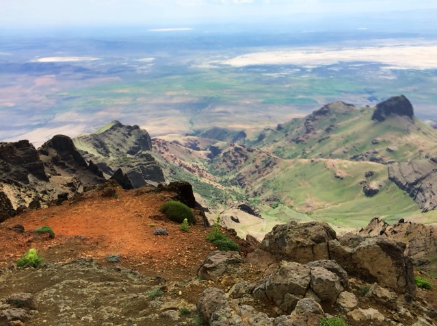
![]()
View from summit of Steens Mountain, looking northeast. Sheepshead Mountains in distance..
Courtesy A.E. Platt
-
![]()
Steens, looking east toward Alford Desert.
Courtesy A.E. Platt
-
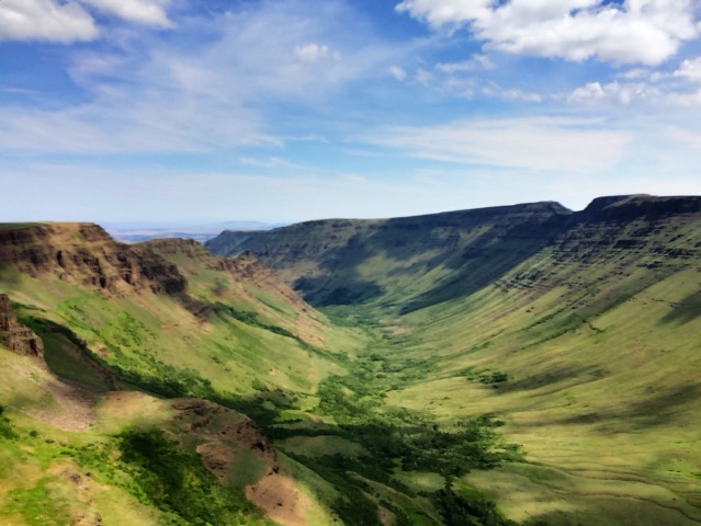
![]()
Kiger Gorge, Steens.
Courtesy A.E. Platt
-
![]()
Steens Mountain.
Courtesy A.E. Platt
-
![]()
Snow-covered Steens.
Courtesy Oregon Hist. Soc. Research Lib., OrHi52458
-
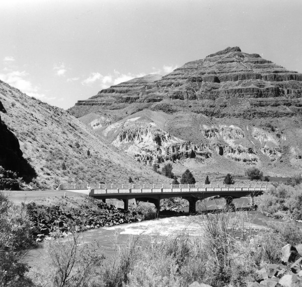
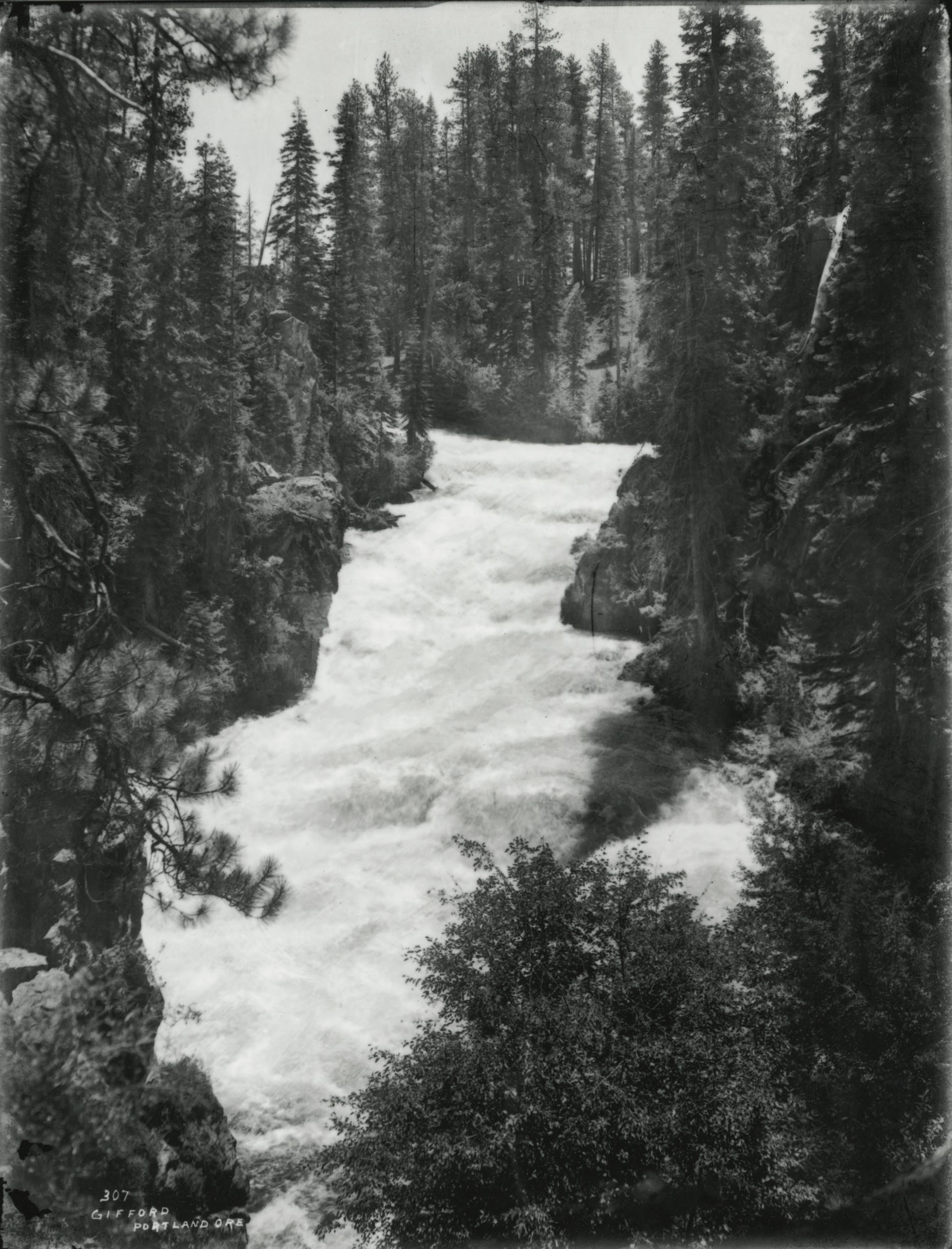
![Bridge over the John Day River, by Wanda Gifford]()
Bridge over the John Day River, by Wanda Gifford.
Bridge over the John Day River, by Wanda Gifford Courtesy Univ. of Oregon Libraries, P218 SG4 0971
-
![Siskiyou National Forest]()
Siskiyou National Forest.
Siskiyou National Forest Courtesy United States Forest Service


Related Entries
-
![National Wild and Scenic Rivers in Oregon]()
National Wild and Scenic Rivers in Oregon
The world's first and most extensive system of protected rivers began w…
-
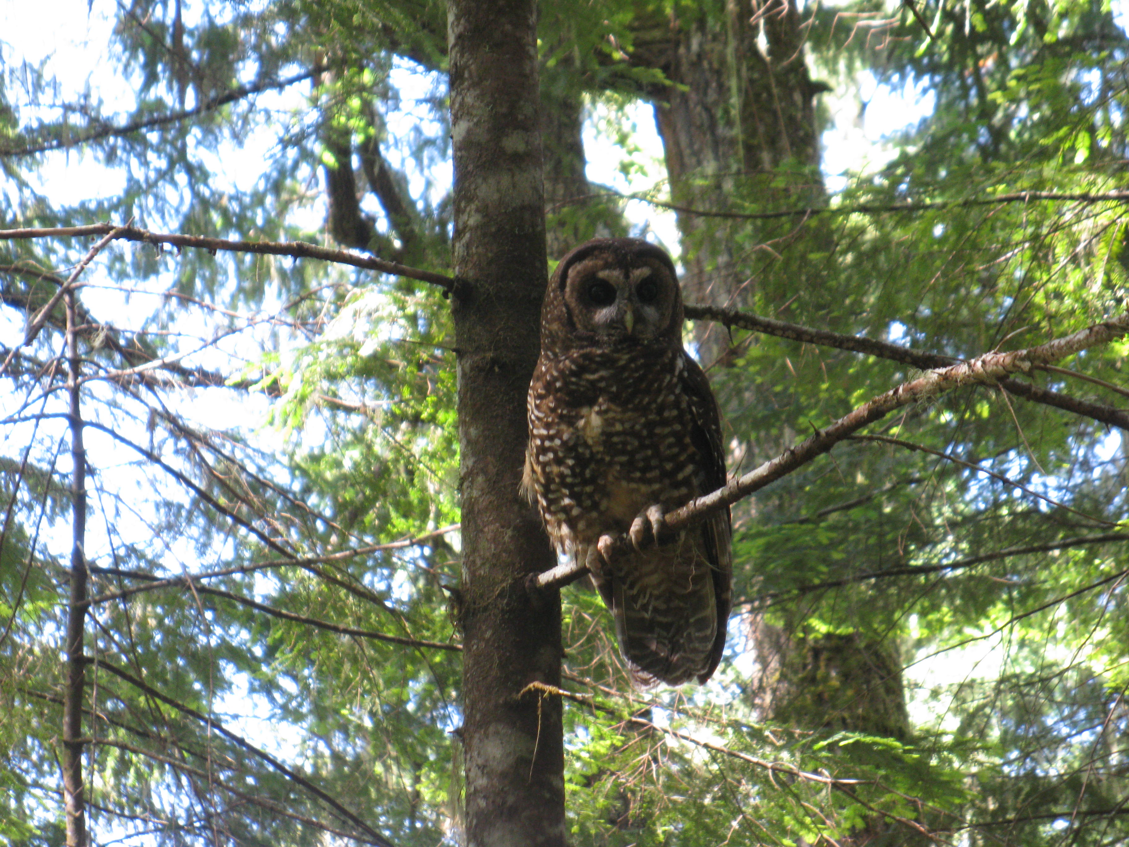
![Northern Spotted Owl]()
Northern Spotted Owl
Natural History The northern spotted owl (Strix occidentalis caurina),…
-
![Oregon and California Lands Act]()
Oregon and California Lands Act
The Oregon and California Lands Act, heralded as a forward-looking cons…
-
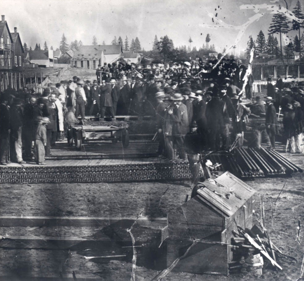
![U.S. General Land Office in Oregon, ca. 1850-1946]()
U.S. General Land Office in Oregon, ca. 1850-1946
With the acquisition of the Oregon Country in 1846, the United States w…
-
![Wild horses in Oregon]()
Wild horses in Oregon
Scientists believe that the ancestors of today's horses evolved in Nort…

Related Historical Records
Map This on the Oregon History WayFinder
The Oregon History Wayfinder is an interactive map that identifies significant places, people, and events in Oregon history.
Further Reading
Clawson, Marion. The Bureau of Land Management. Westport, Ct.: Praeger Publishers, 1971.
Muhn, James and Hanson R. Stuart. Opportunity and Challenge: The Story of BLM. Washington, D.C.: U.S. Bureau of Land Management, 1988.
Richardson, Elmo. BLM's Billion-Dollar Checkerboard: Managing the O&C Lands. Durham, N.C.: Forest History Society, 1980.
Skillen, James R. The Nation's Largest Landlord: the Bureau of Land Management in the American West. Lawrence: University Press of Kansas, 2009.
Vaughan, Champ C. A History of the United States General Land Office in Oregon. Portland: Bureau of Land Management, 2014.