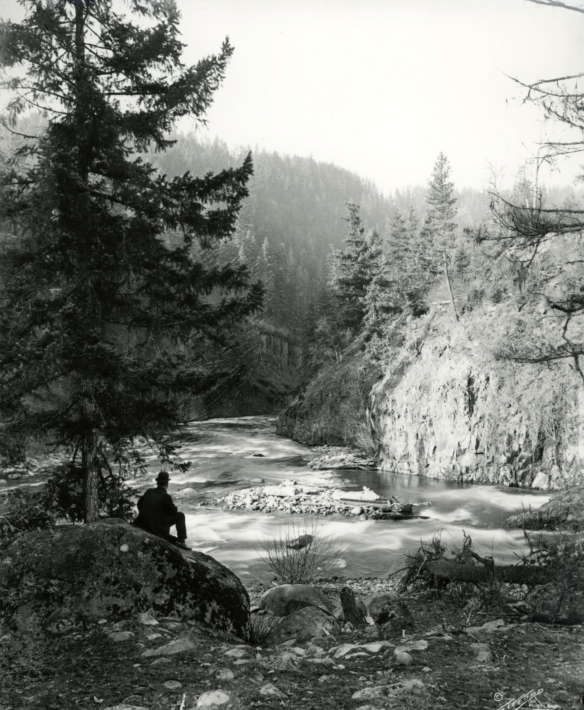
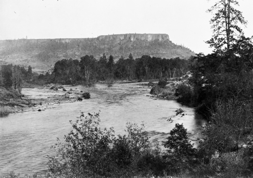
The Table Rocks, two large mesas north of Medford, rise nearly 800 feet from the north side of the Rogue River, opposite where Little Butte Creek and Bear Creek join the river from the south. Lower Table Rock is the downstream, westernmost mesa, while Upper Table Rock is upstream and to the east. Situated between them, and extending to the north, is Sams Valley, named in the 1850s for Takelma chief Toquahear, who was known to the whites as "Sam." At an elevation of just over 2,000 feet, both mesas are horseshoe-shaped. In addition to having a fascinating geological history, the Rocks have also been important in human history.
The base of the mesas is composed of sandstone, conglomerate, and other sediments from ancient rivers, part of the Payne Cliffs Formation that is between 48 and 34 million years old. These sediments have been protected from erosion by the Rocks’ lava cap, formed 7 million years ago when a shield volcano erupted some forty-four miles upstream on the upper Rogue River, near present-day Lost Creek Lake. From there, molten lava flowed down the ancestral Rogue, spreading over what are now parts of the northernmost Rogue Valley. The easternmost exposures of the lava are near Lost Creek Reservoir, and the westernmost outcrop forms Castle Rock, just west of Lower Table Rock.
The Rogue and nearby tributary streams flowed along the edges of the lava flow, where they carved down into the softer underlying rocks, causing the lava-cliff rocks to tumble downhill as large blocks. The Table Rocks are the remnants of a more extensive area of lava, over 90 percent of which is now gone. As the Rogue River meandered through the valley, wearing away the valley floor, it formed what is known as inverted topography—that is, land that was originally low (the lava in the ancestral river channel) became high.
The lava of the Table Rocks is comprised of blocky black andesite with crystals of olivine (green) and augite (black) and with up to 25 percent tabular plagioclase, all embedded in a fine-grained groundmass. The distinctive columns on the edges of the Table Rocks, known as columnar joints, were formed as the lava cooled inward from the top and bottom of the flow. Gas bubbles from the liquid lava escaped toward the top of the flow, which explains why the lava at the top of the Table Rocks has many more holes than are found lower in the flow.
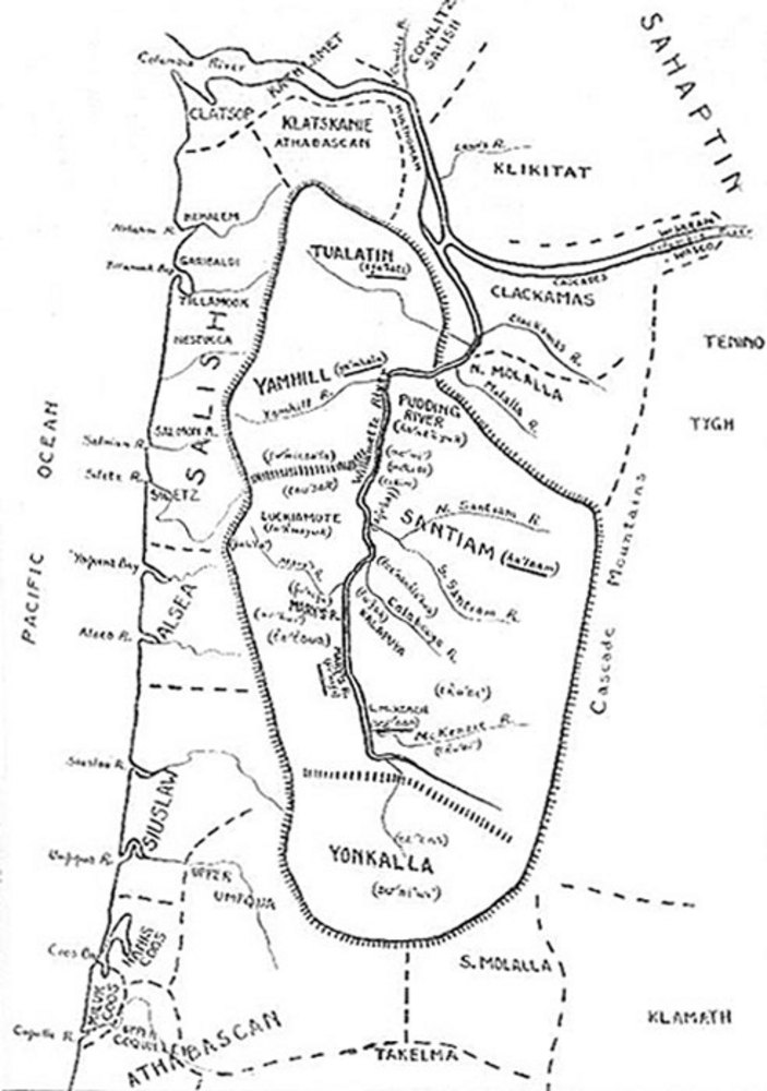
The Takelma Indians called the Table Rocks Ti’tanak (the meaning of which is unknown). A major village, Ti’lomikh, was a short distance downstream from Lower Table Rock, where the river’s rapids made for good salmon harvests. The Takelma dug camas bulbs along Sams Creek, which flows between the Table Rocks, and gathered lomatium, oo-kow, serviceberries, and other plants from the rocky slopes below the cliffs.
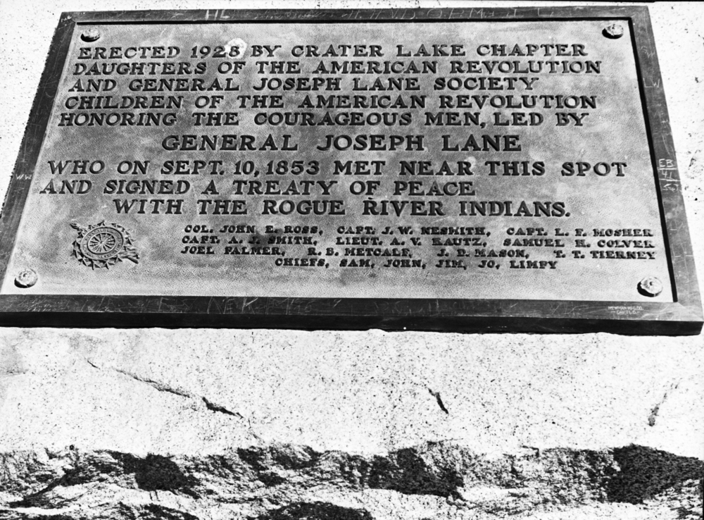
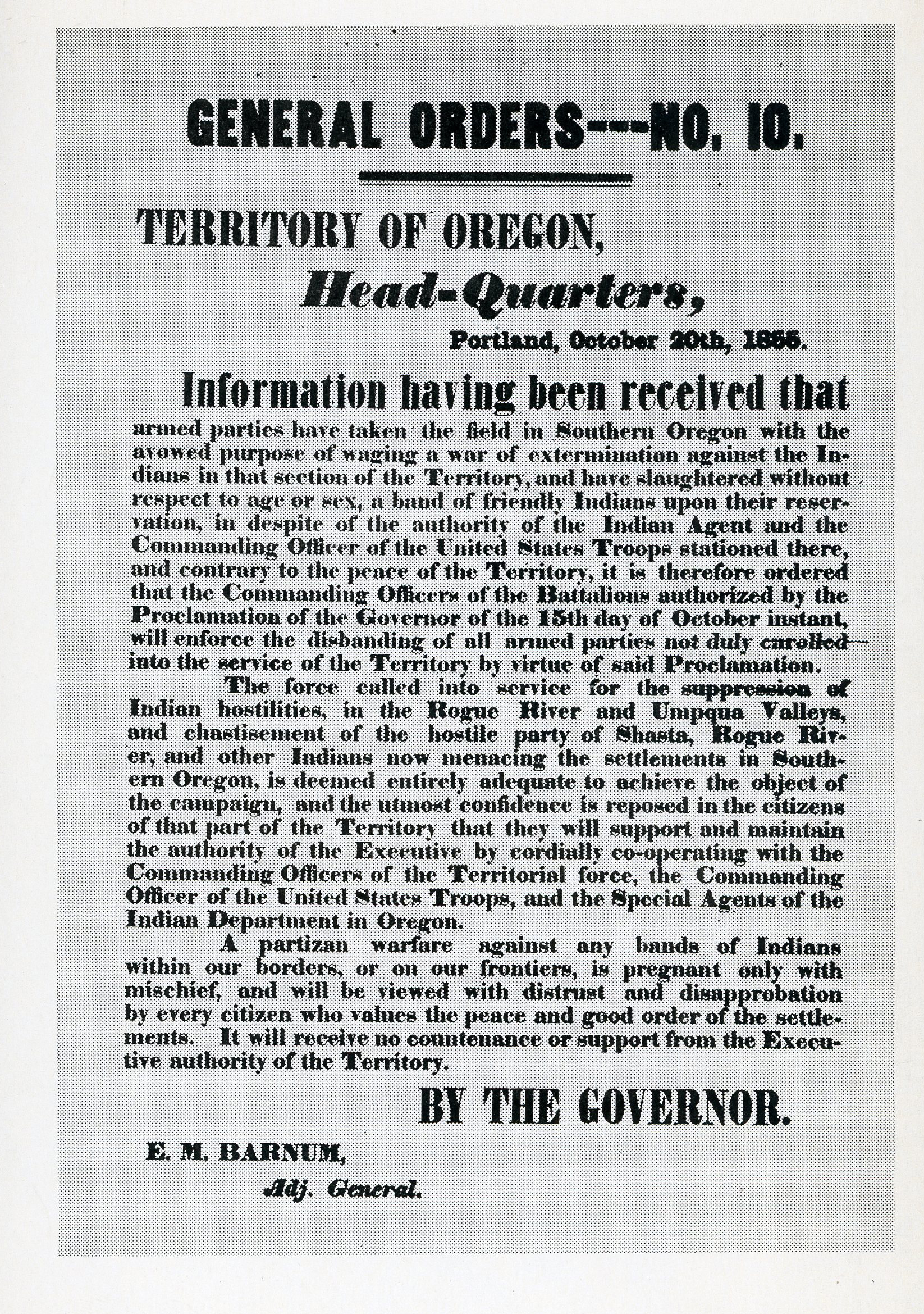
When EuroAmericans passed through the area during the 1830s and 1840s, some of them noted the imposing mesas, which became landmarks along the trail between central California and the Willamette Valley. In the early 1850s, a nearby gold-mining camp took the name Table Rock City (soon changed to Jacksonville). As a result of the 1853 Council of Table Rock, a treaty signed at the east base of Lower Table Rock established the short-lived Table Rock Reservation.
Through the Donation Land Act and other land laws, a large portion of Lower Table Rock came into private ownership. Briefly part of the U.S. Army's Camp White cantonment during World War II, live-fire combat training occurred near the base of Upper Table Rock; concrete pillboxes still remain. And during the 1940s-1960s, Lower Table Rock had a small landing strip for small aircraft. Since the 1980s, virtually all of the Table Rocks is owned by either the Bureau of Land Management or The Nature Conservancy, which developed a trail system and jointly offer guided nature hikes. Each spring, thousands of people participate in these treks, and as many as forty thousand visitors hike through savanna and oak-dominated woodlands to the top of the Rocks each year. The expansive summits of the Rocks, which support few trees, feature vernal pools, where spring moisture supports populations of fairy shrimp and tiny wildflowers, including a species of the dwarf wooly meadowfoam that grows nowhere else.
Erosion due to undercutting and rock fall continues to shape the Table Rocks, and large detached blocks can be seen on the slopes below the cliffs. Over time, more blocks will form along the retreating edges of the Rocks and then slide or tumble toward the valley floor.
-
![]()
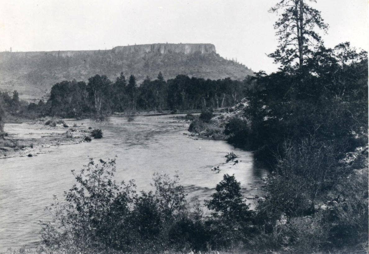
Table Rock, 1887.
Courtesy Oreg. Hist. Soc. Research Library, 003842
-
![]()
-
![]()
-
![]()
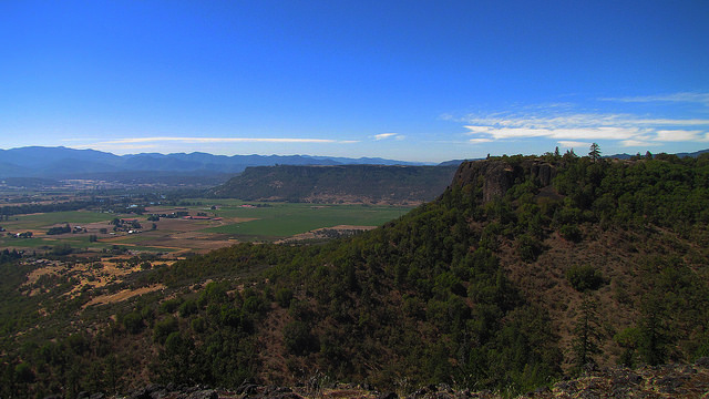
Upper Table Rock.
Courtesy Bureau of Land Management Oregon and Washington -
![]()
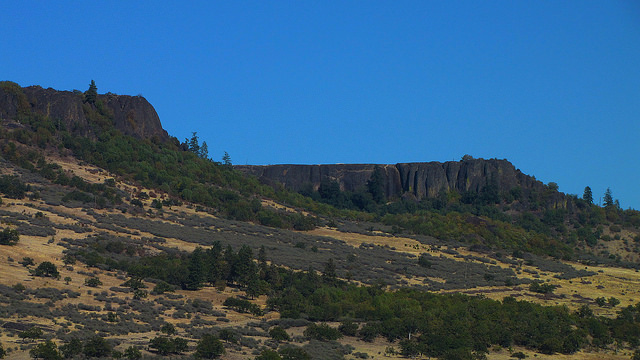
Upper Table Rock.
Courtesy Bureau of Land Management Oregon and Washington

Related Entries
-
![Bear Creek Valley]()
Bear Creek Valley
Oregon has over ninety separate streams named Bear Creek (far more, in …
-
![Camp White]()
Camp White
Camp White, a U.S. Army Cantonment, was built on the Agate Desert, near…
-
![Fort Lane]()
Fort Lane
Fort Lane was a United States military fort constructed following the s…
-
![Kalapuya Treaty of 1855]()
Kalapuya Treaty of 1855
The treaty with the Confederated Bands of Kalapuya (1855) is the only r…
-
![Rogue River]()
Rogue River
The Rogue River, Oregon’s third-longest river (after the Columbia and W…
-
![Rogue River National Forest]()
Rogue River National Forest
For over a century, the Rogue River National Forest has filled an impor…
-
![Rogue River War of 1855-1856]()
Rogue River War of 1855-1856
The final Rogue River War began early on the morning of October 8, 1855…
-
![Table Rock Treaty of 1853]()
Table Rock Treaty of 1853
The Council of Table Rock brought a temporary peace between Indigenous …
Related Historical Records
Map This on the Oregon History WayFinder
The Oregon History Wayfinder is an interactive map that identifies significant places, people, and events in Oregon history.
Further Reading
Miller, Marli B. Roadside Geology of Oregon, Second Edition. Missoula, Mont.: Mountain Press, 2014.
Hladky, F. "Age chemistry, and origin of capping lava at Upper Table Rock and Lower Table Rock, Jackson County, Oregon." Oregon Geology 60.4 (1998): 81-91.