The Tumalo Irrigation District delivers water from Tumalo Creek, supplemented by storage at Crescent Lake, through 140 miles of pipeline, canals, and ditches. Approximately 685 patrons use the water to irrigate more than 7,400 acres west of the Deschutes River. The water rights have priorities of 1900 through 1913.
Sixteen miles from Broken Top Mountain, Tumalo Creek reaches the arid Tumalo area at 3,500 feet elevation, where fine-grained volcanic soils that are low in humus support dryland bunchgrasses, sage, and juniper. Ten to fourteen inches of precipitation fall each year, mostly outside the growing season.
The Carey Act in 1894 opened up the landscape for white settlers, who could claim 160 acres by irrigating at least 20 of them. Settlers first diverted water from Tumalo Creek in 1883, and for a decade they relied on short, private ditches to get water from the creek to their farms.
In 1893, entrepreneurs from Prineville formed the Three Sisters Irrigation Company and announced a plan to irrigate 30,000 acres from Tumalo Creek. By 1900, the acreage had doubled in size and attracted new investors that included principals in the Columbia Southern Railroad, which connected Shaniko with the Oregon Short Line at the Columbia River.
Oregon accepted the Carey Act in 1901 on the condition that private developers front the capital to build, maintain, and operate a diversion, storage, and distribution system, and that they bring enough settlers onto the lands to make the project viable. The developer could retain any profit from selling public land with irrigation water, and settlers assumed a lien to secure payment for the cost of construction and operation. The state, which did not exercise oversight, created the State Land Board (renamed the Desert Land Board in 1909) to administer the act.
During 1902-1905, the land in Tumalo was promoted nationally as “profitable 80-acre homesteads.” In 1904, the developers selected the first lands in Oregon that the Department of the Interior withdrew from the public domain. The system and water supply, however, were grossly inadequate to irrigate the project lands.
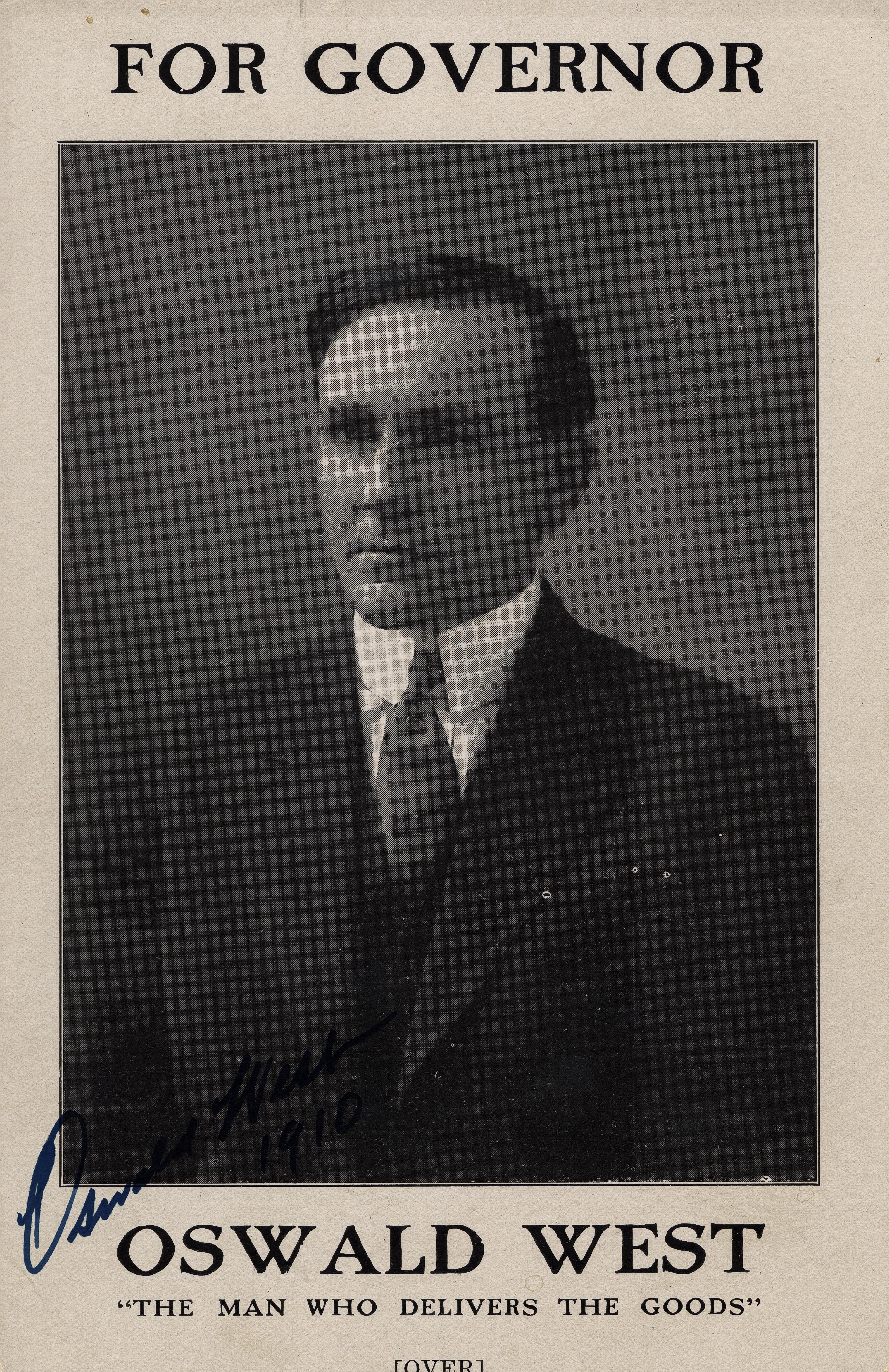
In 1905, Tumalo settlers rallied to convince the state to take responsibility for the project. Oswald West, the state land agent, and John Lewis, Oregon’s first state engineer, began their long involvement with the troubled Tumalo project in 1906.
The settlers persuaded the 1913 legislature to pass the Columbia Southern Act to rebuild the Tumalo project, the first state takeover of a Carey Act project in Oregon. Legislation also provided a mechanism for landowners who shared a water delivery system to form an elected irrigation district to assess their farms for the cost of capital improvements, operation, and maintenance. Sixty-one landowners promptly met in the schoolhouse in Tumalo and voted to form the Tumalo Irrigation District.
The centerpiece of the state reconstruction was a storage reservoir. It failed to hold water. The federal Bureau of Reclamation rebuilt a storage dam at Crescent Lake in 1955 and replaced miles of failing flume and leaky canals with buried pipe in the 1970s. Subdivisions have since transformed the district: the average farm had 120 irrigated acres in 1913, 72 in 1955, 30 in 1972, and holding at 11 irrigated acres from 2012 to 2019.
-
![]()
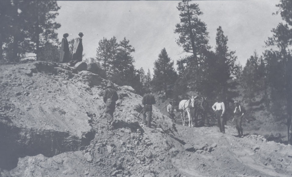
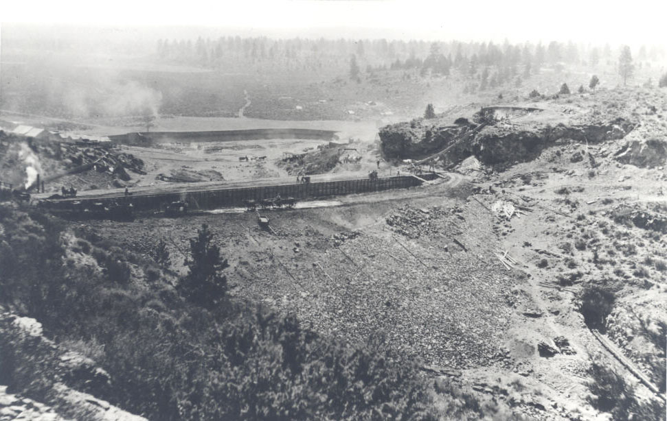
Tumalo crew at work building sections of tumalo feed canal.
Oregon Historical Society Research Library, Tumalo Irrigation Project collection
-
![]()
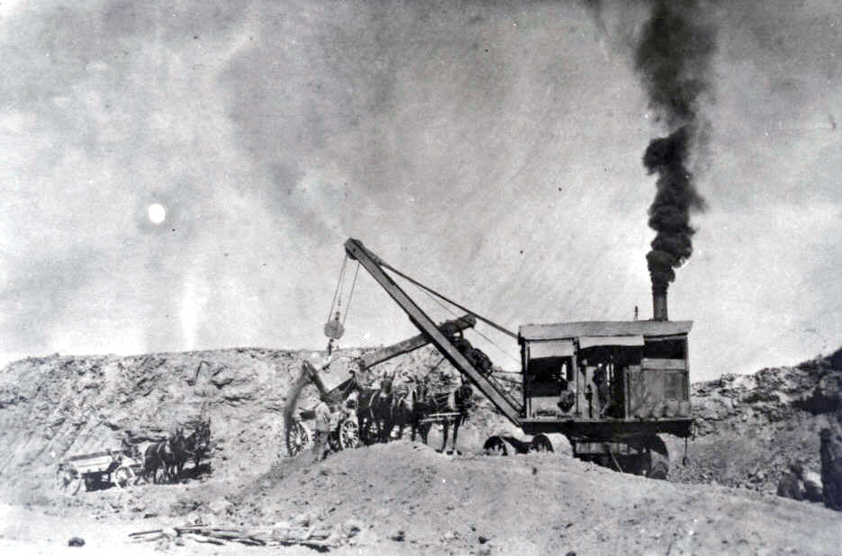
Steamshovel digging fill materials for dam.
Oregon Historical Society Research Library, Tumalo Irrigation Project archives
-
![]()
Tumalo Irrigation District.
Courtesy Tumalo Irrigation District, State of Oregon -
![]()
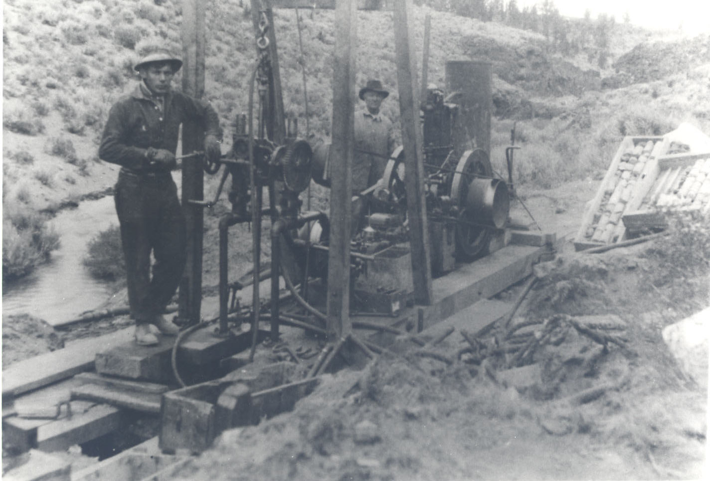
Taking care of samples north of dam site, 1913-1914.
Oregon Historical Society Research Library, State Water Resources Dept. records
-
![]()
Looking over dam and reservoir site, 1914.
Oregon Historical Society Research Library, Tumalo Irrigation Project collection
-
![]()
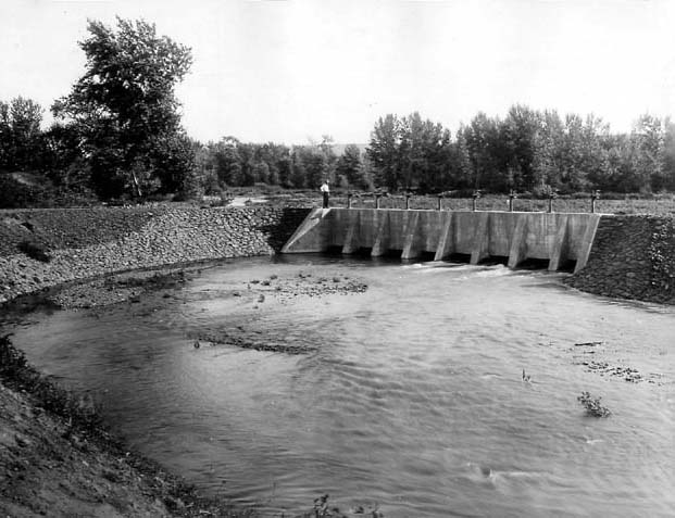
Spillway at the Tumalo Project in Central Oregon.
Oregon Historical Society Research Library, Digital Collections, OrgLot78_B5F4_006

Related Entries
-
![Crooked River Project]()
Crooked River Project
In 1956, with the help of Oregon senators Wayne Morse and Richard Neube…
-
![Hood River Irrigation]()
Hood River Irrigation
Irrigation in the Hood River Valley, about sixty miles east of Portland…
-
![Laidlaw/Tumalo]()
Laidlaw/Tumalo
Laidlaw, now called Tumalo, is an unincorporated town on the Deschutes …
-
![Oswald D. West (1873-1960)]()
Oswald D. West (1873-1960)
Oswald D. West served as Oregon's fourteenth governor, between 1911 and…
-
![U.S. Bureau of Reclamation]()
U.S. Bureau of Reclamation
The U.S. Bureau of Reclamation, in the Department of the Interior, has …


Related Historical Records
Map This on the Oregon History WayFinder
The Oregon History Wayfinder is an interactive map that identifies significant places, people, and events in Oregon history.
Further Reading
"The History of the Tumalo Irrigation District." Tumalo Irrigation District.
Clark, Keith and Donna Clark. “Pioneers of Deschutes Country.” In Thomas Vaughan, ed., High & Mighty: Select Sketches about the Deschutes Country. 51-53, 92. Portland: Oregon Historical Society, 1981.
Winch, Martin T. “Tumalo—Thirsty Land.” A compilation of six articles originally published in the Oregon Historical Quarterly. Also available in hardcover and JSTOR.